Map of Long Lane
| Postcodes | ||
|---|---|---|
| Icon | Postcodes for Long Lane | |
| Walking Distances | ||
| Distance Info | Green Circle = 10 Minutes Walk (800 metres) | |
About Long Lane
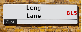
Long Lane is a street located near the town of Westhoughton. It uses the postcode BL5 2BP. The street has a length of approximately 1,307 metres.
Long Lane is located within the Bolton District (B) Council's jurisdiction. They provide various services, like refuse collection, and manage council tax collection. It's situated in the North West region of the UK.
Long Lane has been assigned the Unique Street Reference Number of 3402446 in the National Street Gazetteer.
Long Lane is located within the county of Greater Manchester, situated in the North West region of the UK. It's 175.03 miles North West from central London., 13.05 miles North West from Manchester, 21.33 miles North East from Liverpool and 29.26 miles North East from Chester.

Do you know why this road is called Long Lane?
What's it like to live here?
Ask the community a question about Long Lane.
Do you have any questions, memories to share or know any facts about Long Lane? We'd love to know more.
Also on streetlist.co.uk, can you help?
Swing Swang Lane
28th April 2024
I am trying to find out why the lane is named Swing Swang?
It has been known known this since at least 1905 when hedge making contents used to be held here.
Swing Swang is often used to describe a fairground ride. I remember Swing Boats. Were they a bit like this or is Swing Swang another name for swings?
Swing Swangs are also mentioned in connection to orchards. Or were orchards just good places to have swings?
Estate Agents near Long Lane
| Name | Address | Website |
|---|---|---|
| Seddon Homes | Collingwood Way, Westhoughton, Bolton, BL5 3TT | Visit Website |
| Price and Co | 50 - 52 Chorley Road Westhoughton Bolton BL5 3PR | Visit Website |
| Adore Properties | 87 Church Street, Westhoughton, Bolton, BL5 3RZ | Visit Website |
We have found 1 postcode for Long Lane
Location Details
| Long Lane | |
|---|---|

| |
| Latitude | 53.555849 |
| Longitude | -2.533385 |
| OS Easting (X): | 364669 |
| OS Northing (Y): | 406739 |
| OS Grid Reference: | SD647067 |
Neighbourhood Policing |
| Police Force: Greater Manchester |
 View Neighbourhood Crime and Policing View Neighbourhood Crime and Policing |
| Find a Local Neighbourhood Watch Scheme |
Frequently asked Questions for Long Lane
What Council (Local Authority) is Long Lane in?
Long Lane is located within the local authority area of Bolton Council which is a Metropolitan District.
What Parish Council is Long Lane in?
Long Lane is located within the area of Westhoughton Parish Council.
What Electoral Ward is Long Lane in?
Long Lane is located within the ward of Westhoughton North and Chew Moor.
What County is Long Lane in?
Long Lane is located within the ceremonial county of Greater Manchester.
What Constituency is Long Lane in?
Long Lane is located within the constituency of Bolton West.
What Part of the UK is Long Lane in?
Long Lane is located within the North West (England) region of the United Kingdom.
What County Council area is Long Lane in?
Long Lane is located within the Greater Manchester Council area.
What Police Force area is Long Lane in?
Long Lane is located within the Greater Manchester Police area.
Roads that have a Junction with Long Lane
| Street | Junction Type |
|---|---|
| Great Bank Road | junction |
| James Street | junction |
Sunset and Sunrise times for Long Lane , BL5 2BP
| Sunrise | 05:09 |
|---|---|
| Sunset | 21:03 |
Latest Weather Conditions for Long Lane, BL5 2BP
| Observed at Weather Station: | Rostherne No 2 13 May 2024 at 11:00 (14.94 miles away) |
|---|---|
| Current Weather: | Partly cloudy (day) |
| Temperature and Humidity: | 16.6°C (69.4%) |
| Wind Direction and Speed: | S (13 mph) |
Population Statistics
| ONS Area Code | E00024227 |
|---|---|
| ONS Area Name | Ageing Rural Flat Tenants |
| Average Age | 39.13 |
| Area Population | 1802.00 |
| Male Population | 890.00 (49%) |
| Female Population | 912.00 (51%) |
| Benefit Claimants | 26 (1%) |
| LSOA Code: | E01004776 |
|---|---|
| LSOA Name: | Bolton 031A |
| SOA Code: | 5b |
| SOA Name: | |
| MSOA Code: | E02001014 |
| MSOA Name: | Bolton 031 |
Nearest Supermarkets
| Sainsburys Westhoughton |
|---|
| Cricketers Way, Westhoughton, Bolton, England, BL5 3ZS |
| 01942 507850 |
| Distance: 0.75 Miles |
| Directions from Long Lane to Sainsburys Westhoughton |
| Tesco Westhoughton Express |
|---|
| Manchester Rd, Westhoughton, Bolton, BL5 3JS |
| 0345 674 6531 |
| Distance: 1.03 Miles |
| Directions from Long Lane to Tesco Westhoughton Express |
| Tesco Bolton Horwich Extra |
|---|
| Mansell Way, Horwich, Bolton, BL6 6JS |
| 0345 677 9372 |
| Distance: 1.77 Miles |
| Directions from Long Lane to Tesco Bolton Horwich Extra |
| Asda Horwich |
|---|
| 43-53 The Linkway Middlebrook Retail Park, Horwich, BL6 6JA |
| 01204 699337 |
| Distance: 1.98 Miles |
| Directions from Long Lane to Asda Horwich |
Telephone Information
| Area Code |
|---|
| Area Code: 01942 - Wigan |
| Area Code: 01204 - Bolton |
| Area Code: 01257 - Coppull |
Broadband Information
| Speed | Average Speed | Median Speed | Maximum Speed | Next-generation access (NGA) | Number of Connections |
|---|---|---|---|---|---|
| Greater than 2 Mbps | 7 | 7 | 8.7 | Y | 3 |
Local Government
| Local Council Details |
|---|
| Within the area of Bolton |
| Visit the Council's Website |
| Town Hall, Victoria Square, Bolton, Lancashire &BL1 1RU |
| Send email |
| Telephone Number: 01204 333 333 |
| Local Member of Parliament |
|---|
| Within the Westminster Parliamentary Constituency of Bolton West |
| The Member of Parliament is Chris Green |
| Details for the MP Chris Green on parliament.uk |
| Details for the MP Chris Green on theyworkforyou.com |
| In the 2019 General Election Chris Green won with a majority of 8,855 the result was Con hold. The total electorate was 73,191 |
| Wards, Parish Councils and County Councils |
|---|
| Ward: Westhoughton North and Chew Moor Ward |
| Ceremonial County: Greater Manchester |
Nearest Schools
England Primary Schools
Sacred Heart R.C. Primary School
Address: Sacred Heart R.C. Primary School, Central Drive, Westhoughton, Bolton, Lancashire, BL5 3DU
Distance: 0.53 miles
Contact: 01942634681
The Gates Primary School
Address: The Gates Primary School, Bristle Hall Way, Westhoughton, Bolton, Lancashire, BL5 3QA
Distance: 0.54 miles
Contact: 01942634734
Nearest Hospitals
| Name | Address | Postcode | Distance | Map |
|---|
Nearest Dentists
Dentists near Long Lane
| Name | Address | Postcode | Distance | Map |
|---|
Nearest GP Surgeries
Doctors near Long Lane
KORLIPARA K
Address: WESTHOUGHTON BRANCH SURGERY, 294 CHURCH STREET, WESTHOUGHTON, BOLTON, LANCASHIRE, BL5 3QQ
Distance: 0.40 miles
Contact: tel: 01942 813466
STABLE FOLD SURGERY
Address: 119 CHURCH STREET, WESTHOUGHTON, BOLTON, LANCASHIRE, BL5 3SF
Distance: 0.47 miles
Contact: tel: 01942 813678
PETER HOUSE SURGERY - COVID LOCAL VACCINATION SERVICE 2
Address: PETER HOUSE, CAPTAIN LEES ROAD, WESTHOUGHTON, BOLTON, BL5 3UB
Distance: 1.09 miles
Contact: :
UNSWORTH GROUP PRACTICE
Address: PETER HOUSE, CAPTAIN LEES ROAD, WESTHOUGHTON, BOLTON, LANCASHIRE, BL5 3UB
Distance: 1.09 miles
Contact: tel: 01942 812525
PENNYGATE MEDICAL CENTRE
Address: 109 LADIES LANE, HINDLEY, WIGAN, LANCASHIRE, WN2 2QG
Distance: 2.07 miles
Contact: tel: 01942 807500
BURZA NA
Address: 806 ATHERTON ROAD, HINDLEY GREEN, WIGAN, LANCASHIRE, WN2 4SB
Distance: 2.28 miles
Contact: tel: 01942 255765
Nearest Dispensing Chemists
Pharmacies near Long Lane
| Name | Address | Postcode | Telephone | Map | Distance in Km |
|---|
Nearest Opticians
Opticians near Long Lane
SUSAN HILTON OPTICIANS - MARSDEN STREET
Address: 10 MARSDEN STREET, WESTHOUGHTON, BOLTON, LANCASHIRE, BL5 3AQ
Distance: 0.67 miles
Contact: :
RK EYECARE
Address: 1ST FLOOR, BOLTON ARENA, HORWICH, BOLTON, BL6 6LB
Distance: 1.60 miles
Contact: :
HORWICH EXTRA
Address: MANSELL WAY, HORWICH, BOLTON, LANCASHIRE, BL6 6JS
Distance: 1.77 miles
Contact: :
BOOTS OPTICIANS (HORWICH, BOLTON)
Address: UNIT 2, MIDDLEBROOK RETAIL PARK, HORWICH, BOLTON, LANCASHIRE, BL6 6JA
Distance: 1.91 miles
Contact: :
4652 HORWICH
Address: ASDA STORES LTD, 43-53 THE LINKWAY, HORWICH, BOLTON, LANCASHIRE, BL6 6JA
Distance: 1.91 miles
Contact: :
SPECSAVERS (MIDDLEBROOK RETAIL PK, BOLTON)
Address: 35 THE LINKWAY, MIDDLEBROOK RETAIL PARK, HORWICH, BOLTON, LANCASHIRE, BL6 6JA
Distance: 1.91 miles
Contact: :
Transport
Nearest Rail Stations
Westhoughton Station is 0.39 miles away.
Address: Westhoughton station, Church Street, Westhoughton, Greater Manchester, BL5 3LE
Westhoughton is situated on the Manchester to Preston line and is managed by Northern.
Westhoughton Station is an unstaffed station.
Daisy Hill Station is 1.34 miles away.
Address: Daisy Hill station, Leigh Road, Daisy Hill, Lancashire, BL5 2JQ
Daisy Hill is situated on the Manchester Southport Line and is managed by Northern.
Daisy Hill Station is staffed on a full time basis.