Map of Punch Lane
| Postcodes | ||
|---|---|---|
| Icon | Postcodes for Punch Lane | |
| Walking Distances | ||
| Distance Info | Green Circle = 10 Minutes Walk (800 metres) | |
About Punch Lane
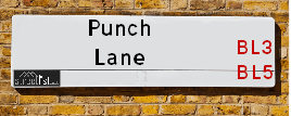
Punch Lane is a street located in the village of Hunger Hill. It uses the postcode BL3 4SE. The street has a length of approximately 611 metres.
Punch Lane is located within the Bolton District (B) Council's jurisdiction. They provide various services, like refuse collection, and manage council tax collection. It's situated in the North West region of the UK.
Punch Lane has been assigned the Unique Street Reference Numbers of 3403233, 3480924 and 3499739 in the National Street Gazetteer.
Punch Lane is located within the county of Greater Manchester, situated in the North West region of the UK. It's 173.73 miles North West from central London., 11.23 miles North West from Manchester, 22.95 miles North East from Liverpool and 30.12 miles North East from Chester.

Do you know why this road is called Punch Lane?
What's it like to live here?
Ask the community a question about Punch Lane.
Do you have any questions, memories to share or know any facts about Punch Lane? We'd love to know more.
Also on streetlist.co.uk, can you help?
Eldroth Road
15th April 2024
I wondered if anyone has any old pictures of Wenning Bank House in the 1940’s and also Lane Side before of the same era .. we visited today with my Mum in law as she used to live at both these properties. Also any photos of the schools around that time .. thank you.
Can You Help?Napps Way
15th April 2024
Why is the road called Napps Way (belonging to Napp, but minus an
apostrophe as is usual with such nomenclature)? Moreover, who or
what is, or was, “Napp” in the respective, possessive case?
Several years ago, I met an elderly man (probably in his late-eighties)
who lives on Bentham Drive, Liverpool 16, and during a conversation
with him whilst in a Northwest Passenger Transport Ambulance on the
way to the former RLUH (Royal Liverpool University Hospital), he told
me that he could remember (when he was a boy, living in Childwall,
Liverpool 16) that, “Where Napps Way is now, during WW2, there was
a two-man gun emplacement on the, then, open land to protect the
railway line passing over Childwall Valley Road - next to the railway
bridge - when suddenly, as they were loading a live “shell” into the gun’s
breach, the aforementioned “shell” accidentally exploded in the gun’s
breach killing both of the two soldiers, that had been manning the gun,
instantly! (Very sad, of course, but could - perhaps - two ghosts relating
to those two, very unfortunately and prematurely-killed soldiers have
haunted that place of their deaths ever since - and have any residents
of Napps Way - formerly and in its latest incarnation - seen two, WW2
(uniformed) soldiers unexpectedly appear in or near their homes?)
Mauritius Road
15th April 2024
Why is Mauritius Road so called, since when and by whom? Does Greenwich have any particular links with Mauritius? Very interested to know. 🤞🏼
Can You Help?Estate Agents near Punch Lane
| Name | Address | Website |
|---|---|---|
| Harrisons Estate Agents | 1 Newbrook Road, Over Hulton, Bolton, BL5 1EL | Visit Website |
| Your Housing Group Ltd - Eldercot Park | Eldercot Road, Daubhill,BL3 4JJ | |
| Northstone | Bolton Road, Westhoughton, BL5 3DN | Visit Website |
We have found 1 postcode for Punch Lane
Location Details
| Punch Lane | |
|---|---|

| |
| Latitude | 53.552947 |
| Longitude | -2.486594 |
| OS Easting (X): | 367766 |
| OS Northing (Y): | 406394 |
| OS Grid Reference: | SD678064 |
Ordnance Survey Maps for Punch Lane
If you purchase a map through the links below, we may earn an affiliate commission.
| Map Series | link | Ordnance Survey |
| Explorer 1:25,000 276 Bolton, Wigan and Warrington | Check Price on Amazon | |
| Landranger 1:50,000 109 Manchester Bolton & Warrington | Check Price on Amazon |
Neighbourhood Policing |
| Police Force: Greater Manchester |
 View Neighbourhood Crime and Policing View Neighbourhood Crime and Policing |
| Find a Local Neighbourhood Watch Scheme |
Frequently asked Questions for Punch Lane
What Council (Local Authority) is Punch Lane in?
Punch Lane is located within the local authority area of Bolton Council which is a Metropolitan District.
What Parish Council is Punch Lane in?
Punch Lane is in an unparished area.
What Electoral Ward is Punch Lane in?
Punch Lane is located within the ward of Westhoughton North and Chew Moor.
What County is Punch Lane in?
Punch Lane is located within the ceremonial county of Greater Manchester.
What Constituency is Punch Lane in?
Punch Lane is located within the constituency of Bolton West.
What Part of the UK is Punch Lane in?
Punch Lane is located within the North West (England) region of the United Kingdom.
What County Council area is Punch Lane in?
Punch Lane is located within the Greater Manchester Council area.
What Police Force area is Punch Lane in?
Punch Lane is located within the Greater Manchester Police area.
Roads that have a Junction with Punch Lane
| Street | Junction Type |
|---|---|
| Manchester Road (A6) | junction |
| Knutshaw Crescent | pseudo node |
Sunset and Sunrise times for Punch Lane , BL3 4SE
| Sunrise | 05:42 |
|---|---|
| Sunset | 20:33 |
Latest Weather Conditions for Punch Lane, BL3 4SE
| Observed at Weather Station: | Rostherne No 2 26 April 2024 at 04:00 (14.04 miles away) |
|---|---|
| Current Weather: | Clear night |
| Temperature and Humidity: | 0.4°C (95.1%) |
| Wind Direction and Speed: | N (3 mph) |
Population Statistics
| ONS Area Code | E00024765 |
|---|---|
| ONS Area Name | Multi-Ethnic Suburbia |
| Average Age | 39.55 |
| Area Population | 1539.00 |
| Male Population | 757.00 (49%) |
| Female Population | 782.00 (51%) |
| Benefit Claimants | 17 (1%) |
| LSOA Code: | E01004899 |
|---|---|
| LSOA Name: | Bolton 030C |
| SOA Code: | 3b |
| SOA Name: | |
| MSOA Code: | E02001013 |
| MSOA Name: | Bolton 030 |
Nearest Supermarkets
| Tesco Westhoughton Express |
|---|
| Manchester Rd, Westhoughton, Bolton, BL5 3JS |
| 0345 674 6531 |
| Distance: 0.9 Miles |
| Directions from Punch Lane to Tesco Westhoughton Express |
| Asda Daubhill |
|---|
| St Helens Road, Daubhill, Bolton, BL3 4EB |
| 01204 512300 |
| Distance: 1.48 Miles |
| Directions from Punch Lane to Asda Daubhill |
| Sainsburys Westhoughton |
|---|
| Cricketers Way, Westhoughton, Bolton, England, BL5 3ZS |
| 01942 507850 |
| Distance: 1.63 Miles |
| Directions from Punch Lane to Sainsburys Westhoughton |
| Asda Atherton |
|---|
| Bolton Road, Atherton, Manchester, M46 9JZ |
| 01942 751710 |
| Distance: 1.84 Miles |
| Directions from Punch Lane to Asda Atherton |
Telephone Information
| Area Code |
|---|
| Area Code: 01204 - Bolton |
| Area Code: 01942 - Wigan |
| Area Code: 01257 - Coppull |
Broadband Information
| Speed | Average Speed | Median Speed | Maximum Speed | Next-generation access (NGA) | Number of Connections |
|---|---|---|---|---|---|
| Less than 2 Mbps | 15.7 | 15.8 | >=30 | Y | 5 |
Local Government
| Local Council Details |
|---|
| Within the area of Bolton |
| Visit the Council's Website |
| Town Hall, Victoria Square, Bolton, Lancashire &BL1 1RU |
| Send email |
| Telephone Number: 01204 333 333 |
| Local Member of Parliament |
|---|
| Within the Westminster Parliamentary Constituency of Bolton West |
| The Member of Parliament is Chris Green |
| Details for the MP Chris Green on parliament.uk |
| Details for the MP Chris Green on theyworkforyou.com |
| In the 2019 General Election Chris Green won with a majority of 8,855 the result was Con hold. The total electorate was 73,191 |
| Wards, Parish Councils and County Councils |
|---|
| Ward: Westhoughton North and Chew Moor Ward |
| Ceremonial County: Greater Manchester |
Nearest Schools
England Primary Schools
Wharton Primary School
Address: Wharton Primary School, Rothwell Lane, Little Hulton, Worsley, Salford, Greater Manchester, M38 9XA
Distance: 2.35 miles
Contact: 01617904473
Haslam Park Primary School
Address: Haslam Park Primary School, Wigan Road, Bolton, Lancashire, BL3 5QL
Distance: 1.68 miles
Contact: 01204333393
St Mary's CofE Primary School, Deane
Address: St Mary's CofE Primary School, Deane, Edale Road, Deane, St Mary's CE Primary School, Bolton, Lancashire, BL3 4QP
Distance: 1.15 miles
Contact: 01204333494
St Andrew's CofE Primary School, Over Hulton
Address: St Andrew's CofE Primary School, Over Hulton, Crescent Avenue, Over Hulton, Bolton, Lancashire, BL5 1EN
Distance: 0.89 miles
Contact: 01204332606
St Bernard's RC Primary School, Bolton
Address: St Bernard's RC Primary School, Bolton, Wendover Drive, Ladybridge, Bolton, Lancashire, BL3 4RX
Distance: 1.21 miles
Contact: 01204652147
Beaumont Primary School
Address: Beaumont Primary School, Wendover Drive, Ladybridge, Beaumont Primary School, Wendover Drive, BOLTON, Lancashire, BL3 4RX
Distance: 1.21 miles
Contact: 01204652149
St Thomas CofE Primary School
Address: St Thomas CofE Primary School, Molyneux Road, Westhoughton, Bolton, Lancashire, BL5 3HP
Distance: 0.78 miles
Contact: 01942634666
Sacred Heart R.C. Primary School
Address: Sacred Heart R.C. Primary School, Central Drive, Westhoughton, Bolton, Lancashire, BL5 3DU
Distance: 1.45 miles
Contact: 01942634681
The Gates Primary School
Address: The Gates Primary School, Bristle Hall Way, Westhoughton, Bolton, Lancashire, BL5 3QA
Distance: 1.46 miles
Contact: 01942634734
England Secondary Schools
Westhoughton High School
Address: Westhoughton High School, Bolton Road, Westhoughton, Bolton, Lancashire, BL5 3BZ
Distance: 1.29 miles
Contact: 01942814122
Nearest Hospitals
| Name | Address | Postcode | Distance | Map |
|---|
Nearest Dentists
Dentists near Punch Lane
| Name | Address | Postcode | Distance | Map |
|---|
Nearest GP Surgeries
Doctors near Punch Lane
PETER HOUSE SURGERY - COVID LOCAL VACCINATION SERVICE 2
Address: PETER HOUSE, CAPTAIN LEES ROAD, WESTHOUGHTON, BOLTON, BL5 3UB
Distance: 0.92 miles
Contact: :
UNSWORTH GROUP PRACTICE
Address: PETER HOUSE, CAPTAIN LEES ROAD, WESTHOUGHTON, BOLTON, LANCASHIRE, BL5 3UB
Distance: 0.92 miles
Contact: tel: 01942 812525
ST HELENS ROAD PRACTICE
Address: GARNET FOLD PRACTICE, 374-376 ST. HELENS ROAD, BOLTON, LANCASHIRE, BL3 3RR
Distance: 1.27 miles
Contact: tel: 01204 665588
BOLTON COMMUNITY PRACTICE CIC - LADYBRIDGE SURGERY
Address: LADYBRIDGE SURGERY, 10-12 BROADGATE, BOLTON, LANCASHIRE, BL3 4PZ
Distance: 1.27 miles
Contact: :
DEANE CLINIC 1
Address: HORSFIELD STREET, DEANE, BOLTON, LANCASHIRE, BL3 4LU
Distance: 1.37 miles
Contact: tel: 01204 64089
STABLE FOLD SURGERY
Address: 119 CHURCH STREET, WESTHOUGHTON, BOLTON, LANCASHIRE, BL5 3SF
Distance: 1.51 miles
Contact: tel: 01942 813678
Nearest Dispensing Chemists
Pharmacies near Punch Lane
| Name | Address | Postcode | Telephone | Map | Distance in Km |
|---|
Nearest Opticians
Opticians near Punch Lane
SUSAN HILTON OPTICIANS - MARSDEN STREET
Address: 10 MARSDEN STREET, WESTHOUGHTON, BOLTON, LANCASHIRE, BL5 3AQ
Distance: 1.52 miles
Contact: :
CLEAR VISION
Address: 22 ST. HELENS ROAD, BOLTON, BL3 3NH
Distance: 1.87 miles
Contact: :
EYESITE EXPRESS (BOLTON)
Address: 22 ST. HELENS ROAD, BOLTON, LANCASHIRE, BL3 3NH
Distance: 1.87 miles
Contact: :
J.W CALDICOTT OPTICIANS
Address: 50 ST. HELENS ROAD, BOLTON, LANCASHIRE, BL3 3NH
Distance: 1.87 miles
Contact: :
EYE ZONE
Address: 378 DERBY STREET, BOLTON, LANCASHIRE, BL3 6LS
Distance: 1.97 miles
Contact: :
HEPWORTH & HALL OPTICIANS (ATHERTON)
Address: 15 CHURCH STREET, ATHERTON, MANCHESTER, GREATER MANCHESTER, M46 9DE
Distance: 1.99 miles
Contact: :
Transport
Nearest Rail Stations
Hag Fold Station is 1.36 miles away.
Address: Hag Fold station, Spa Road, Hag Fold, Greater Manchester, M46 9WX
Hag Fold is situated on the Manchester Southport Line and is managed by Northern.
Hag Fold Station is staffed on a part time basis.
Lostock Station is 1.42 miles away.
Address: Lostock station, Rumworth Road, Lostock, Greater Manchester, BL6 4JP
Lostock is situated on the Manchester to Preston line and is managed by Northern.
Lostock Station is staffed on a full time basis.