BL7 0HQ is a postal code used within the United Kingdom for delivering mail.
Postcodes are made up of two parts. The part before the space (BL7) is called the outward code. The part after the space (0HQ) is called the inward code. The letters C, I, K, M, O and V are not allowed in the inward code. In addition to the inward and outward code, the postcode can be broken up into four parts:
- Postal Area. In our case BL which means Bolton.
- Postal District. In our case BL7.
- Postal Sector. In our case BL7 9.
- Postcode Unit. The last two letters. In our case HQ.
The regional mail center for the post area BL is the North West Distribution Centre, which is located at Mill Lane, Winwick Quay, WARRINGTON, WA2 8RJ.
The final port of call for any post addressed to the BL7 0HQ postcode is the local delivery office (DO) which is . Here the post will be sorted ready for delivery.
The properties in the BL7 0HQ postcode have the street address of Chapeltown Road
Did you know? According to the 2021 Census, the BL7 0HQ postcode is home to a bustling 24 residents!
It is situated within the post town of BOLTON within the old postal county of Lancashire.
BL7 0HQ is within the town of Bolton.
The BL7 0HQ postcode area is composed of 100% residential properties, 0% commercial properties, and 0% public properties.
According to our data. Most dwellings in BL7 0HQ are houses. Of these houses, most are detached.
Most properties in BL7 0HQ are owned by the occupiers with the rest being unknown tenure.

Interactive Mapping Showing UPRNs within the BL7 0HQ Postcode Boundaries
Use the search box to search for other postcodes or places.
| Property Type | Percentage |
|---|---|
| Residential | 100% |
| Commercial | 0% |
| Public | 0% |
Map Coordinates for BL7 0HQ
| Latitude | 53.630146165 |
|---|---|
| Longitude | -2.40827292126 |

What are the Broadband Speeds like in the BL7 0HQ Postcode?
Download Speeds For BL7 0HQ

| Average Mbps | 49.900 |
|---|---|
| Median Mbps | 40.000 |
| Maximum Mbps | 79.910 |
BL7 0HQ has an average download speed of 49.9 Megabits per second (Mbps).
1,492 other postcode units have the same broadband speed.
26% of postcodes (308,539) have slower broadband speeds.
74% of postcodes (874,610) have faster broadband speeds.
Upload Speeds For BL7 0HQ

| Average Mbps | 13.000 |
|---|---|
| Median Mbps | 10.000 |
| Maximum Mbps | 20.000 |
BL7 0HQ has an average upload speed of 13 Megabits per second (Mbps).
10,716 other postcode units have the same upload speed.
45% of postcodes (535,563) have slower upload speeds.
54% of postcodes (638,362) have faster upload speeds.
Schools within a five minute drive of BL7 0HQ Postcode
England Primary Schools
Eagley Junior School
Address: Eagley Junior School, Off Chapeltown Road, Bromley Cross, Bolton, Lancashire, BL7 9AT
Distance: 0.95 miles
Contact: 01204333708
Turton and Edgworth CofE/Methodist Controlled Primary School
Address: Turton and Edgworth CofE/Methodist Controlled Primary School, Bolton Road, Edgworth, Bolton, Lancashire, BL7 0AH
Distance: 1.03 miles
Contact: 01204852932
Eagley Infant School
Address: Eagley Infant School, Stonesteads Drive, Bromley Cross, Bolton, Lancashire, BL7 9LN
Distance: 0.89 miles
Contact: 01204333650
St John the Evangelist RC Primary School, Bromley Cross, Bolton
Address: St John the Evangelist RC Primary School, Bromley Cross, Bolton, Darwen Road, Bromley Cross, Bolton, Lancashire, BL7 9HT
Distance: 1.12 miles
Contact: 01204333440
England Secondary Schools
Turton School
Address: Turton School, Bromley Cross Road, Bromley Cross, Bolton, Lancashire, BL7 9LT
Distance: 1.13 miles
Contact: 01204333233
Canon Slade School
Address: Canon Slade School, Bradshaw Brow, Bradshaw, Bolton, Lancashire, BL2 3BP
Distance: 1.94 miles
Contact: 01204333343
Canon Slade CofE School
Address: Canon Slade CofE School, Bradshaw Brow, Bolton, Lancashire, BL2 3BP
Distance: 1.94 miles
Contact:
Nearest Dentists
Dentists near BL7 0HQ
BROMLEY CROSS DENTAL PRACTICE
Address: 227 DARWEN ROAD, BROMLEY CROSS, BOLTON, LANCASHIRE, BL7 9BS
Distance: 1.13 miles
Contact: :
DENUVO DENTAL
Address: 143 LEA GATE, HARWOOD, BOLTON, LANCASHIRE, BL2 4BQ
Distance: 1.79 miles
Contact: http: HTTP://WWW.DENUVODENTAL.CO.UK
DENTAL SURGERY
Address: 757 BLACKBURN ROAD, BOLTON, LANCASHIRE, BL1 7JJ
Distance: 1.87 miles
Contact: :
DENTAL SURGERY
Address: 513 TONGE MOOR ROAD, BOLTON, LANCASHIRE, BL2 3BG
Distance: 2.35 miles
Contact: :
DENTAL SURGERY
Address: 274 BLACKBURN ROAD, BOLTON, LANCASHIRE, BL1 8DT
Distance: 2.73 miles
Contact: :
DENTAL SURGERY
Address: 403-405 HALLIWELL ROAD, BOLTON, LANCASHIRE, BL1 8DE
Distance: 2.89 miles
Contact: :
Nearest Chemists
Pharmacies near BL7 0HQ
COHENS CHEMIST
Address: EGERTON/DUNSCAR HLTH CTRE, DARWEN ROAD, BROMLEY CROSS, BOLTON, LANCASHIRE, BL7 9RG
Distance: 1.14 miles
Contact: tel: 01204 302137
GELOO BROTHERS LTD
Address: 365 BOLTON ROAD, TURTON, EDGEWORTH, BOLTON, LANCASHIRE, BL7 0AZ
Distance: 1.31 miles
Contact: tel: 01204 852011
COHENS CHEMIST
Address: 10 THE HILLOCK, HARWOOD, BOLTON, LANCASHIRE, BL2 3HP
Distance: 1.83 miles
Contact: tel: 01204 302694
HARWOOD PHARMACY
Address: HARWOOD MEDICAL CENTRE, HOUGH FOLD WAY, HARWOOD, BOLTON, BL2 3HQ
Distance: 1.85 miles
Contact: tel: 01204 304433
COHENS CHEMIST
Address: 576-578 BLACKBURN ROAD, ASTELY BRIDGE, BOLTON, BL1 7AL
Distance: 2.17 miles
Contact: tel: 01204 301049
COHENS CHEMIST
Address: BOLTON MEDICAL CENTRE, 501 CROMPTON WAY, BOLTON, LANCASHIRE, BL1 8UP
Distance: 2.27 miles
Contact: tel: 01204 600730
Nearest Opticians
Opticians near BL7 0HQ
BROMLEY CROSS OPTICIANS (BOLTON)
Address: 494 DARWEN ROAD, BOLTON, LANCASHIRE, BL7 9DX
Distance: 1.14 miles
Contact: :
HARWOOD EYECARE
Address: 117 LEA GATE, HARWOOD, BOLTON, LANCASHIRE, BL2 4BQ
Distance: 1.79 miles
Contact: :
HARWOOD EYECARE
Address: 117 LEA GATE, BOLTON, BL2 4BQ
Distance: 1.79 miles
Contact: :
HOMEOPTICIANS
Address: 1A CANNING STREET, BOLTON, LANCASHIRE, BL1 8EZ
Distance: 2.74 miles
Contact: :
THE EYEWORKS (BOLTON)
Address: 53 THICKETFORD ROAD, BOLTON, LANCASHIRE, BL2 2LS
Distance: 2.84 miles
Contact: :
EYE PEOPLE OPTICIANS
Address: 179 BLACKBURN ROAD, BOLTON, LANCASHIRE, BL1 8HE
Distance: 2.85 miles
Contact: :
Nearest GP Surgeries
Doctors near BL7 0HQ
EDGWORTH MEDICAL CENTRE
Address: EGERTON & DUNSCAR HEALTH CENTRE, DARWEN ROAD, BROMLEY CROSS, BOLTON, LANCASHIRE, BL7 9RG
Distance: 1.14 miles
Contact: tel: 01204 462233
BROMLEY MEADOWS SURGERY
Address: DARWEN ROAD, BROMLEY CROSS, BOLTON, LANCASHIRE, BL7 9RG
Distance: 1.14 miles
Contact: tel: 01204 463232
UMEBUANI VC
Address: EDGWORTH MEDICAL CENTRE, 354 BOLTON ROAD, EDGWORTH, BOLTON, LANCASHIRE, BL7 0DU
Distance: 1.33 miles
Contact: tel: 01204 852226
MANDALAY MEDICAL CENTRE
Address: 933 BLACKBURN ROAD, SHARPLES, BOLTON, LANCASHIRE, BL1 7LR
Distance: 1.67 miles
Contact: tel: 01204 309206
HARWOOD MEDICAL CENTRE
Address: HOUGH FOLD WAY, HARWOOD, BOLTON, LANCASHIRE, BL2 3HQ
Distance: 1.85 miles
Contact: tel: 01204 300033
CROMPTON VIEW SURGERY
Address: CROMPTON HEALTH CENTRE, 501 CROMPTON WAY, BOLTON, LANCASHIRE, BL1 8UP
Distance: 2.27 miles
Contact: tel: 01204 463090
Motorway Junctions near BL7 0HQ
Train Stations
Motorway Junctions near BL7 0HQ
Distances represent the quickest route by car.
What are the Council Tax Bands for the BL7 0HQ Postcode?
| Council Tax Band | Number of Properties |
|---|---|
| Band F | 3 |
| Band G | 5 |
| Band H | 0 |
What Addresses are in the BL7 0HQ Postcode?
Addresses for Chapeltown Road, Turton, Bolton, which have the BL7 0HQ Postcode
Who are my Elected Representatives in the BL7 0HQ Postcode?
| Westminster Constituency | Rossendale and Darwen Boro Const |
|---|---|
| Member or Parliament | 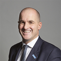 |
| Contact Details | Contact Jake Berry |
| Political Party | Conservative |
What Council is the BL7 0HQ Postcode in?
The Council for this Postcode is Blackburn with Darwen Council, who are a Unitary authority. This means that they are responsible for providing education, libraries and maintaining highways as well as normal council duties such as council tax, rubbish collection, housing, environmental health and planning.
You can visit the website for Blackburn with Darwen at the following link Blackburn with Darwen.How much is the Council Tax?
Blackburn with Darwen Council is responsible for collecting council tax. This will vary depending on which council tax band the property falls within. You can check the council tax band at the gov.uk website.
Once you know the council tax band you can view how much Blackburn with Darwen charge for that band by visiting the The Council Tax section of their website.
Where can I find out where the nearest Library to the BL7 0HQ Postcode is?
Libraries are the responsibility of Blackburn with Darwen council
Visit the link for more information. Please note that some councils outsource library services to private companies and community groups ran by volunteers.
Libraries and reading | Blackburn with Darwen Borough CouncilPostcodes near the BL7 0HQ Postcode
What Popular Supermarkets are near the BL7 0HQ Postcode?
| Supermarket | Distance | Directions |
|---|---|---|
| Morrisons, Gate Fold, BOLTON, BL2 3HN | 2.94 miles | Directions from BL7 0HQ to Morrisons |
| Lidl, Crompton Way, BOLTON, BL1 8TH | 3.52 miles | Directions from BL7 0HQ to Lidl |
| Asda, Moss Bank Way, BOLTON, BL1 8QG | 3.73 miles | Directions from BL7 0HQ to Asda |
| Aldi, Higher Bridge Street, BOLTON, BL1 2HJ | 5.13 miles | Directions from BL7 0HQ to Aldi |
| Aldi, Breightmet Fold Lane, BOLTON, BL2 6PP | 5.56 miles | Directions from BL7 0HQ to Aldi |
What Popular Restaurants are near the BL7 0HQ Postcode?
| Burger King | Distance | Directions |
|---|---|---|
| Unit 6, Trinity Retail Park, Bolton, BL2 1HY | 4.02 miles | Directions from BL7 0HQ to Unit 6, Trinity Retail Park |
| Bury The Rock,the Rock Shopping, Bury, BL9 7XX | 5.35 miles | Directions from BL7 0HQ to Bury The Rock,the Rock Shopping |
| Bridgehall Lane, Bury, BL9 7PJ | 6.23 miles | Directions from BL7 0HQ to Bridgehall Lane |
| Rivington Srvc. Station Southbound, Bolton, BL6 5UZ | 7.05 miles | Directions from BL7 0HQ to Rivington Srvc. Station Southbound |
| Mcdonald's | Distance | Directions |
|---|---|---|
| McDonald's, Waters Meeting Road, BOLTON, BL1 8TT | 2.85 miles | Directions from BL7 0HQ to McDonald's, Waters Meeting Road, BOLTON, BL1 8TT |
| McDonald's, Knowsley Street, BOLTON, BL1 2AQ | 3.59 miles | Directions from BL7 0HQ to McDonald's, Knowsley Street, BOLTON, BL1 2AQ |
| McDonald's, Chorley Old Road, BOLTON, BL1 5SX | 3.99 miles | Directions from BL7 0HQ to McDonald's, Chorley Old Road, BOLTON, BL1 5SX |
| McDonald's, Derby Street, BOLTON, BL3 6HH | 4.20 miles | Directions from BL7 0HQ to McDonald's, Derby Street, BOLTON, BL3 6HH |
| Restaurant | Distance | Directions |
|---|---|---|
| KFC, Waters Meeting Road, BOLTON, BL1 8TT | 2.85 miles | Directions from BL7 0HQ to KFC Bolton - Waters Meeting Road |
| KFC, Derby Street, BOLTON, BL3 6HE | 4.10 miles | Directions from BL7 0HQ to KFC Bolton - Derby Street |
| KFC, Moorgate Retail Park, BURY, BL9 7AQ | 5.45 miles | Directions from BL7 0HQ to KFC Bury - Moorgate Retail Park |
| KFC, The Linkway, Horwich, BOLTON, BL6 6JA | 6.11 miles | Directions from BL7 0HQ to KFC Bolton - The Linkway |
| KFC, Park 66, BURY, BL9 8RZ | 6.64 miles | Directions from BL7 0HQ to KFC Bury - Pilsworth Road |