Map of Eagley Way
| Postcodes | ||
|---|---|---|
| Icon | Postcodes for Eagley Way | |
| Walking Distances | ||
| Distance Info | Green Circle = 10 Minutes Walk (800 metres) | |
About Eagley Way
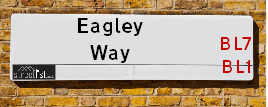
Eagley Way is a street located in the town of Bolton. It uses the postcode BL1 7LW. The street has a length of approximately 465 metres.
Eagley Way is located within the Bolton District (B) Council's jurisdiction. They provide various services, like refuse collection, and manage council tax collection. It's situated in the North West region of the UK.
Eagley Way has been assigned the Unique Street Reference Number of 3401306 and 3480951 in the National Street Gazetteer.
Eagley Way is located within the county of Greater Manchester, situated in the North West region of the UK. It's 175.75 miles North West from central London., 12 miles North West from Manchester, 27.03 miles North East from Liverpool and 33.58 miles South East from Lancaster.

Do you know why this road is called Eagley Way?
What's it like to live here?
Ask the community a question about Eagley Way.
Do you have any questions, memories to share or know any facts about Eagley Way? We'd love to know more.
Also on streetlist.co.uk, can you help?
Swing Swang Lane
28th April 2024
I am trying to find out why the lane is named Swing Swang?
It has been known known this since at least 1905 when hedge making contents used to be held here.
Swing Swang is often used to describe a fairground ride. I remember Swing Boats. Were they a bit like this or is Swing Swang another name for swings?
Swing Swangs are also mentioned in connection to orchards. Or were orchards just good places to have swings?
Estate Agents near Eagley Way
| Name | Address | Website |
|---|---|---|
| Belvoir | 293 Darwen Road Bromley Cross Bolton BL7 9BT | Visit Website |
| Claves | Claves House, 295D Darwen Road, Bromley Cross, Bolton, BL7 9BT | Visit Website |
| Fine & Country | Claves House, 295D Darwen Road, Bromley Cross, Bolton, BL7 9BT | Visit Website |
We have found 1 postcode for Eagley Way
Location Details
| Eagley Way | |
|---|---|

| |
| Latitude | 53.613124 |
| Longitude | -2.429380 |
| OS Easting (X): | 371596 |
| OS Northing (Y): | 413064 |
| OS Grid Reference: | SD716131 |
Neighbourhood Policing |
| Police Force: Greater Manchester |
 View Neighbourhood Crime and Policing View Neighbourhood Crime and Policing |
| Find a Local Neighbourhood Watch Scheme |
Frequently asked Questions for Eagley Way
What Council (Local Authority) is Eagley Way in?
Eagley Way is located within the local authority area of Bolton Council which is a Metropolitan District.
What Parish Council is Eagley Way in?
Eagley Way is in an unparished area.
What Electoral Ward is Eagley Way in?
Eagley Way is located within the ward of Astley Bridge.
What County is Eagley Way in?
Eagley Way is located within the ceremonial county of Greater Manchester.
What Constituency is Eagley Way in?
Eagley Way is located within the constituency of Bolton North East.
What Part of the UK is Eagley Way in?
Eagley Way is located within the North West (England) region of the United Kingdom.
What County Council area is Eagley Way in?
Eagley Way is located within the Greater Manchester Council area.
What Police Force area is Eagley Way in?
Eagley Way is located within the Greater Manchester Police area.
Roads that have a Junction with Eagley Way
| Street | Junction Type |
|---|---|
| Blackburn Road (A666) | junction |
Sunset and Sunrise times for Eagley Way , BL1 7LW
| Sunrise | 05:08 |
|---|---|
| Sunset | 21:03 |
Latest Weather Conditions for Eagley Way, BL1 7LW
| Observed at Weather Station: | Stonyhurst 13 May 2024 at 17:00 (16.44 miles away) |
|---|---|
| Current Weather: | Clear night |
| Temperature and Humidity: | 17.0°C (68.7%) |
| Wind Direction and Speed: | (0 mph) |
Population Statistics
| ONS Area Code | E00024176 |
|---|---|
| ONS Area Name | White Suburban Communities |
| Average Age | 42.34 |
| Area Population | 1641.00 |
| Male Population | 813.00 (50%) |
| Female Population | 828.00 (50%) |
| Benefit Claimants | 6 (0%) |
| LSOA Code: | E01004771 |
|---|---|
| LSOA Name: | Bolton 003C |
| SOA Code: | 8a |
| SOA Name: | |
| MSOA Code: | E02000986 |
| MSOA Name: | Bolton 003 |
Nearest Supermarkets
| Sainsburys Bolton Darwen Road Local |
|---|
| 158 Darwen Road, Bromley Cross, Bolton, England, BL7 9JJ |
| 01204 305739 |
| Distance: 0.49 Miles |
| Directions from Eagley Way to Sainsburys Bolton Darwen Road Local |
| Asda Bolton |
|---|
| Moss Bank Way, Bolton, BL1 8QG |
| 01204 306531 |
| Distance: 0.9 Miles |
| Directions from Eagley Way to Asda Bolton |
| Morrisons Harwood |
|---|
| Lea Gate, Harwood, Bolton BL2 3HN |
| 01204 594158 |
| Distance: 1.46 Miles |
| Directions from Eagley Way to Morrisons Harwood |
| Morrisons Bolton - Atlas Mills |
|---|
| Mornington Road, Bolton BL1 4EU |
| 01204 848687 |
| Distance: 2.09 Miles |
| Directions from Eagley Way to Morrisons Bolton - Atlas Mills |
Telephone Information
| Area Code |
|---|
| Area Code: 01204 - Bolton |
Local Government
| Local Council Details |
|---|
| Within the area of Bolton |
| Visit the Council's Website |
| Town Hall, Victoria Square, Bolton, Lancashire &BL1 1RU |
| Send email |
| Telephone Number: 01204 333 333 |
| Local Member of Parliament |
|---|
| Within the Westminster Parliamentary Constituency of Bolton North East |
| The Member of Parliament is Mark Logan |
| Details for the MP Mark Logan on parliament.uk |
| Details for the MP Mark Logan on theyworkforyou.com |
| In the 2019 General Election Mark Logan won with a majority of 378 the result was Con gain from Lab. The total electorate was 67,564 |
| Wards, Parish Councils and County Councils |
|---|
| Ward: Astley Bridge Ward |
| Ceremonial County: Greater Manchester |
Nearest Schools
England Primary Schools
Castle Hill Primary School
Address: Castle Hill Primary School, Castle Hill Street, Tonge Moor, Bolton, Lancashire, BL2 2JT
Distance: 1.45 miles
Contact: 01204332766
Sharples Primary School
Address: Sharples Primary School, Hugh Lupus Street, Bolton, BL1 8RU
Distance: 0.57 miles
Contact: 01204333077
The Oaks Primary School
Address: The Oaks Primary School, Sharples Hall Drive, Bolton, Lancashire, BL1 7HS
Distance: 0.26 miles
Contact: 01204333171
St John the Evangelist RC Primary School, Bromley Cross, Bolton
Address: St John the Evangelist RC Primary School, Bromley Cross, Bolton, Darwen Road, Bromley Cross, Bolton, Lancashire, BL7 9HT
Distance: 0.34 miles
Contact: 01204333440
High Lawn Primary School
Address: High Lawn Primary School, Holden Avenue, Sharples, Bolton, Lancashire, BL1 7EX
Distance: 0.35 miles
Contact: 01204332728
The Valley Community Primary School
Address: The Valley Community Primary School, Hibbert Street, Off Blackburn Road, Bolton, Lancashire, BL1 8JG
Distance: 1.50 miles
Contact: 01204332684
St Paul's CofE Primary School, Astley Bridge
Address: St Paul's CofE Primary School, Astley Bridge, Newnham Street, Astley Bridge, Bolton, Lancashire, BL1 8QA
Distance: 0.95 miles
Contact: 01204333741
Holy Infant and St Anthony RC Primary School
Address: Holy Infant and St Anthony RC Primary School, Mitre Street, Astley Bridge, Bolton, Lancashire, BL1 6QJ
Distance: 0.79 miles
Contact: 01204333111
Walmsley CofE Primary School
Address: Walmsley CofE Primary School, Blackburn Road, Egerton, Bolton, Lancashire, BL7 9SA
Distance: 0.89 miles
Contact: 01204332650
England Secondary Schools
Sharples School
Address: Sharples School, Hill Cot Road, Sharples, Bolton, Lancashire, BL1 8SN
Distance: 0.46 miles
Contact: 01204333253
Sharples School Science Specialist College
Address: Sharples School Science Specialist College, Hill Cot Road, Sharples, Bolton, Lancashire, BL1 8SN
Distance: 0.46 miles
Contact:
Thornleigh Salesian College
Address: Thornleigh Salesian College, Sharples Park, Astley Bridge, Bolton, Lancashire, BL1 6PQ
Distance: 1.00 miles
Contact: 01204301351
Eden Boys' School Bolton
Address: Eden Boys' School Bolton, Wolfenden Street, Bolton, Greater Manchester, BL1 3QE
Distance: 1.40 miles
Contact: 01204849240
Smithills School
Address: Smithills School, Smithills Dean Road, Smithills School, Bolton, Lancashire, BL1 6JS
Distance: 1.42 miles
Contact: 01204842382
Nearest Hospitals
| Name | Address | Postcode | Distance | Map |
|---|
Nearest Dentists
Dentists near Eagley Way
| Name | Address | Postcode | Distance | Map |
|---|
Nearest GP Surgeries
Doctors near Eagley Way
MANDALAY MEDICAL CENTRE
Address: 933 BLACKBURN ROAD, SHARPLES, BOLTON, LANCASHIRE, BL1 7LR
Distance: 0.21 miles
Contact: tel: 01204 309206
EDGWORTH MEDICAL CENTRE
Address: EGERTON & DUNSCAR HEALTH CENTRE, DARWEN ROAD, BROMLEY CROSS, BOLTON, LANCASHIRE, BL7 9RG
Distance: 0.33 miles
Contact: tel: 01204 462233
BROMLEY MEADOWS SURGERY
Address: DARWEN ROAD, BROMLEY CROSS, BOLTON, LANCASHIRE, BL7 9RG
Distance: 0.33 miles
Contact: tel: 01204 463232
CROMPTON VIEW SURGERY
Address: CROMPTON HEALTH CENTRE, 501 CROMPTON WAY, BOLTON, LANCASHIRE, BL1 8UP
Distance: 1.23 miles
Contact: tel: 01204 463090
THE OAKS FAMILY PRACTICE
Address: 501 CROMPTON WAY, BOLTON, BL1 8UP
Distance: 1.23 miles
Contact: tel: 01204 463111
HARWOOD MEDICAL CENTRE
Address: HOUGH FOLD WAY, HARWOOD, BOLTON, LANCASHIRE, BL2 3HQ
Distance: 1.42 miles
Contact: tel: 01204 300033
Nearest Dispensing Chemists
Pharmacies near Eagley Way
| Name | Address | Postcode | Telephone | Map | Distance in Km |
|---|
Nearest Opticians
Opticians near Eagley Way
BROMLEY CROSS OPTICIANS (BOLTON)
Address: 494 DARWEN ROAD, BOLTON, LANCASHIRE, BL7 9DX
Distance: 0.46 miles
Contact: :
HOMEOPTICIANS
Address: 1A CANNING STREET, BOLTON, LANCASHIRE, BL1 8EZ
Distance: 1.39 miles
Contact: :
UNIVISION EYE CENTRE
Address: 341 HALLIWELL ROAD, BOLTON, LANCASHIRE, BL1 8DF
Distance: 1.45 miles
Contact: :
HARWOOD EYECARE
Address: 117 LEA GATE, HARWOOD, BOLTON, LANCASHIRE, BL2 4BQ
Distance: 1.46 miles
Contact: :
HARWOOD EYECARE
Address: 117 LEA GATE, BOLTON, BL2 4BQ
Distance: 1.46 miles
Contact: :
EYE PEOPLE OPTICIANS
Address: 179 BLACKBURN ROAD, BOLTON, LANCASHIRE, BL1 8HE
Distance: 1.51 miles
Contact: :
Transport
Nearest Rail Stations
Bromley Cross (Lancs) Station is 0.81 miles away.
Address: Bromley Cross station, Chapeltown Road, Bromley Cross, Lancashire, BL7 9AG
Bromley Cross (Lancs) is situated on the Ribble Valley line and is managed by Northern.
Bromley Cross (Lancs) Station is staffed on a part time basis.
Directions from Eagley Way to Bromley Cross (Lancs) Rail Station
Hall-i'-th'-Wood Station is 1.25 miles away.
Address: Hall-i'-th'-Wood station, Crompton Way, Hall-i'-th'-Wood, Lancashire, BL1 8UF
Hall-i'-th'-Wood is situated on the Ribble Valley line and is managed by Northern.
Hall-i'-th'-Wood Station is an unstaffed station.