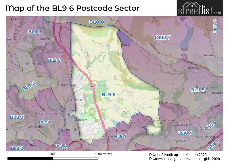
The BL9 6 postcode sector stands on the Greater Manchester and Lancashire border.
Did you know? According to the 2021 Census, the BL9 6 postcode sector is home to a bustling 10,339 residents!
Given that each sector allows for 400 unique postcode combinations. Letters C, I, K, M, O and V are not allowed in the last two letters of a postcode. With 259 postcodes already in use, this leaves 141 units available.
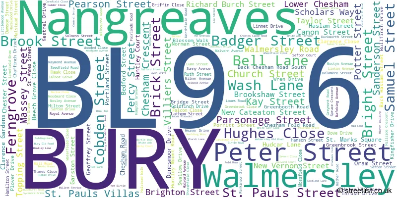
The largest settlements in the BL9 6 postal code are BURY and Nangreaves.
The BL9 6 Postcode shares a border with OL10 4 (HEYWOOD), OL11 5 (ROCHDALE), OL12 7 (ROCHDALE), BL0 0 (Ramsbottom), BL9 5 (BURY, Summerseat, Walmersley) and BL9 7 (BURY, Heap Bridge, Heap).
The sector is within the post town of BURY.
BL9 6 is a postcode sector within the BL9 postcode district which is within the BL Bolton postcode area.
The Royal Mail delivery office for the BL9 6 postal sector is the Bury Delivery Office.
The area of the BL9 6 postcode sector is 5.27 square miles which is 13.65 square kilometres or 3,374.02 square acres.
The BL9 6 postcode sector is crossed by the M66 motorway.
Waterways within the BL9 6 postcode sector include the River Roch.

Map of the BL9 6 Postcode Sector
Explore the BL9 6 postcode sector by using our free interactive map.
| B | L | 9 | - | 6 | X | X |
| B | L | 9 | Space | 6 | Letter | Letter |
Official List of Streets
BURY (171 Streets)
Walmersley (1 Streets)
Nangreaves (1 Streets)
Unofficial Streets or Alternative Spellings
BURY
ARLEY AVENUE BACK WALMERSLEY ROAD WEST BIRCH STREET CATEATON STREET CEDAR STREET CLARENCE GARDENS DEAL STREET EASTHAM AVENUE FERNGROVE EAST INGLEWOOD CLOSE LIME GROVE LIMEFIELD ROAD NEWTON STREET PURDON STREET ROCHDALE OLD ROAD RUSSELL STREET SCHOOL LANE SHAW STREET THE DRIVE WILLOW STREET YORK STREETWalmersley
WALMERSLEY ROADHEYWOOD
GRISTLEHURST LANERamsbottom
BURY OLD ROADWeather Forecast for BL9 6
Press Button to Show Forecast for Walmersley
| Time Period | Icon | Description | Temperature | Rain Probability | Wind |
|---|---|---|---|---|---|
| 09:00 to 12:00 | Cloudy | 8.0°C (feels like 5.0°C) | 5.00% | ENE 9 mph | |
| 12:00 to 15:00 | Cloudy | 9.0°C (feels like 7.0°C) | 9.00% | ENE 9 mph | |
| 15:00 to 18:00 | Overcast | 9.0°C (feels like 6.0°C) | 9.00% | ENE 11 mph | |
| 18:00 to 21:00 | Cloudy | 8.0°C (feels like 6.0°C) | 8.00% | ENE 9 mph | |
| 21:00 to 00:00 | Cloudy | 7.0°C (feels like 4.0°C) | 4.00% | NE 7 mph |
Press Button to Show Forecast for Walmersley
| Time Period | Icon | Description | Temperature | Rain Probability | Wind |
|---|---|---|---|---|---|
| 00:00 to 03:00 | Cloudy | 5.0°C (feels like 3.0°C) | 4.00% | NE 9 mph | |
| 03:00 to 06:00 | Cloudy | 5.0°C (feels like 2.0°C) | 5.00% | NNE 9 mph | |
| 06:00 to 09:00 | Cloudy | 5.0°C (feels like 3.0°C) | 13.00% | N 9 mph | |
| 09:00 to 12:00 | Light rain | 7.0°C (feels like 5.0°C) | 44.00% | NNW 7 mph | |
| 12:00 to 15:00 | Light rain | 9.0°C (feels like 7.0°C) | 46.00% | NW 9 mph | |
| 15:00 to 18:00 | Cloudy | 10.0°C (feels like 7.0°C) | 15.00% | WNW 11 mph | |
| 18:00 to 21:00 | Partly cloudy (day) | 10.0°C (feels like 8.0°C) | 5.00% | W 9 mph | |
| 21:00 to 00:00 | Clear night | 7.0°C (feels like 5.0°C) | 3.00% | SW 7 mph |
Press Button to Show Forecast for Walmersley
| Time Period | Icon | Description | Temperature | Rain Probability | Wind |
|---|---|---|---|---|---|
| 00:00 to 03:00 | Clear night | 6.0°C (feels like 4.0°C) | 1.00% | S 7 mph | |
| 03:00 to 06:00 | Clear night | 4.0°C (feels like 2.0°C) | 3.00% | SSE 7 mph | |
| 06:00 to 09:00 | Partly cloudy (day) | 6.0°C (feels like 3.0°C) | 4.00% | SSE 7 mph | |
| 09:00 to 12:00 | Partly cloudy (day) | 10.0°C (feels like 7.0°C) | 3.00% | S 11 mph | |
| 12:00 to 15:00 | Overcast | 12.0°C (feels like 10.0°C) | 11.00% | S 13 mph | |
| 15:00 to 18:00 | Overcast | 13.0°C (feels like 10.0°C) | 12.00% | S 13 mph | |
| 18:00 to 21:00 | Partly cloudy (day) | 13.0°C (feels like 10.0°C) | 8.00% | S 11 mph | |
| 21:00 to 00:00 | Clear night | 11.0°C (feels like 8.0°C) | 5.00% | SSE 9 mph |
Press Button to Show Forecast for Walmersley
| Time Period | Icon | Description | Temperature | Rain Probability | Wind |
|---|---|---|---|---|---|
| 00:00 to 03:00 | Clear night | 9.0°C (feels like 7.0°C) | 4.00% | SE 9 mph | |
| 03:00 to 06:00 | Partly cloudy (night) | 8.0°C (feels like 6.0°C) | 3.00% | SE 9 mph | |
| 06:00 to 09:00 | Partly cloudy (day) | 9.0°C (feels like 6.0°C) | 3.00% | ESE 9 mph | |
| 09:00 to 12:00 | Sunny day | 12.0°C (feels like 10.0°C) | 4.00% | ESE 11 mph | |
| 12:00 to 15:00 | Cloudy | 15.0°C (feels like 12.0°C) | 9.00% | SE 13 mph | |
| 15:00 to 18:00 | Cloudy | 16.0°C (feels like 13.0°C) | 11.00% | SE 11 mph | |
| 18:00 to 21:00 | Cloudy | 15.0°C (feels like 13.0°C) | 10.00% | ESE 11 mph | |
| 21:00 to 00:00 | Cloudy | 12.0°C (feels like 11.0°C) | 8.00% | E 9 mph |
Schools and Places of Education Within the BL9 6 Postcode Sector
Cambian Chesham House School
Other independent special school
Chesham House, , , BL9 6JD
Head: Miss Caroline Sullivan
Ofsted Rating: Good
Inspection: 2021-10-21 (919 days ago)
Website: Visit Cambian Chesham House School Website
Phone: 01617637072
Number of Pupils: 12
Hoyle Nursery School
Local authority nursery school
Chesham Fold Road, Bury, Lancashire, BL9 6HR
Head: Mrs Rachel O'Neil
Ofsted Rating: Outstanding
Inspection: 2019-10-15 (1656 days ago)
Website: Visit Hoyle Nursery School Website
Phone: 01617616822
Number of Pupils: 96
St Paul's Church of England Primary School, Bury
Voluntary aided school
Porritt Street, Bury, Lancashire, BL9 6LJ
Head: Mrs Joanne Morris
Ofsted Rating: Requires improvement
Inspection: 2023-03-02 (422 days ago)
Website: Visit St Paul's Church of England Primary School, Bury Website
Phone: 01617643788
Number of Pupils: 226
House Prices in the BL9 6 Postcode Sector
| Type of Property | 2018 Average | 2018 Sales | 2017 Average | 2017 Sales | 2016 Average | 2016 Sales | 2015 Average | 2015 Sales |
|---|---|---|---|---|---|---|---|---|
| Detached | £278,600 | 15 | £329,541 | 11 | £231,732 | 17 | £197,625 | 12 |
| Semi-Detached | £144,945 | 42 | £142,788 | 43 | £139,028 | 34 | £118,650 | 33 |
| Terraced | £122,663 | 96 | £118,201 | 97 | £100,540 | 78 | £96,577 | 79 |
| Flats | £113,531 | 16 | £93,000 | 9 | £86,333 | 9 | £106,995 | 10 |
Important Postcodes BL9 6 in the Postcode Sector
BL9 6EP is the postcode for Beech Grove, 174 Chesham Road
BL9 6ER is the postcode for JUNIOR SCHOOL, St. Joseph & St. Bede RC Primary School, Danesmoor Drive, INFANTS SCHOOL, St. Joseph & St. Bede RC Primary School, Danesmoor Drive, and St. Joseph & St. Bede RC Primary School, Danesmoor Drive
BL9 6HR is the postcode for Hoyle Nursery School, Chesham Fold Road
BL9 6JA is the postcode for Huntley Mount Medical Centre, Huntley Mount Road
BL9 6LJ is the postcode for St. Pauls C of E Primary School, Porritt Street
BL9 6NY is the postcode for Bury Metropolitan Borough Council, Seedfield Resource Centre, Parkinson Street
BL9 6PH is the postcode for Chesham Cp School, Talbot Grove
| The BL9 6 Sector is within these Local Authorities |
|
|---|---|
| The BL9 6 Sector is within these Counties |
|
| The BL9 6 Sector is within these Water Company Areas |
|