The BS48 3 postcode sector is within the county of Somerset.
Did you know? According to the 2021 Census, the BS48 3 postcode sector is home to a bustling 5,816 residents!
Given that each sector allows for 400 unique postcode combinations. Letters C, I, K, M, O and V are not allowed in the last two letters of a postcode. With 211 postcodes already in use, this leaves 189 units available.
The largest settlement in the BS48 3 postal code is Backwell followed by Barrow Gurney, and Flax Bourton.
The BS48 3 Postcode shares a border with BS8 3 (BRISTOL, Clifton, Failand), BS40 8 (Winford, Chew Magna, Chew Stoke), BS48 1 (Nailsea, Wraxall, Flax Bourton), BS40 5 (Wrington, Langford, Redhill), BS40 9 (Felton), BS41 8 (Dundry), BS41 9 (Long Ashton), BS48 2 (Nailsea), BS48 4 (Nailsea, Brockley, Backwell) and BS49 4 (Yatton, Claverham, Cleeve).
The sector is within the post town of BRISTOL.
BS48 3 is a postcode sector within the BS48 postcode district which is within the BS Bristol postcode area.
The Royal Mail delivery office for the BS48 3 postal sector is the Nailsea Delivery Office.
The area of the BS48 3 postcode sector is 11.56 square miles which is 29.95 square kilometres or 7,399.67 square acres.
Waterways within the BS48 3 postcode sector include the River Kenn, Yeo River.

Map of the BS48 3 Postcode Sector
Explore the BS48 3 postcode sector by using our free interactive map.
| B | S | 4 | 8 | - | 3 | X | X |
| B | S | 4 | 8 | Space | 3 | Letter | Letter |
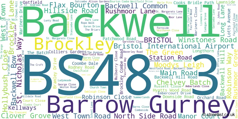
Official List of Streets
Backwell (82 Streets)
Barrow Gurney (17 Streets)
Flax Bourton (12 Streets)
Brockley (3 Streets)
Bristol International Airport (1 Streets)
Unofficial Streets or Alternative Spellings
Winford
BARROW LANEFelton
DIAL LANE NEWDITCH LANEBackwell
CHELVEY ROAD STATION CLOSENailsea
LODGE LANEFlax Bourton
PARSONS MEADRedhill
WINTERS LANEBrockley
ST. NICHOLAS WAYWeather Forecast for BS48 3
Press Button to Show Forecast for Bristol International Airport
| Time Period | Icon | Description | Temperature | Rain Probability | Wind |
|---|---|---|---|---|---|
| 09:00 to 12:00 | Overcast | 6.0°C (feels like 2.0°C) | 16.00% | ENE 11 mph | |
| 12:00 to 15:00 | Cloudy | 8.0°C (feels like 5.0°C) | 8.00% | NE 11 mph | |
| 15:00 to 18:00 | Cloudy | 10.0°C (feels like 7.0°C) | 11.00% | NE 13 mph | |
| 18:00 to 21:00 | Cloudy | 9.0°C (feels like 5.0°C) | 10.00% | NE 13 mph | |
| 21:00 to 00:00 | Overcast | 7.0°C (feels like 4.0°C) | 15.00% | NNE 11 mph |
Press Button to Show Forecast for Bristol International Airport
| Time Period | Icon | Description | Temperature | Rain Probability | Wind |
|---|---|---|---|---|---|
| 00:00 to 03:00 | Cloudy | 6.0°C (feels like 2.0°C) | 45.00% | NNE 11 mph | |
| 03:00 to 06:00 | Light rain | 6.0°C (feels like 2.0°C) | 54.00% | N 13 mph | |
| 06:00 to 09:00 | Light rain | 6.0°C (feels like 2.0°C) | 51.00% | N 11 mph | |
| 09:00 to 12:00 | Light rain | 7.0°C (feels like 3.0°C) | 49.00% | NNW 11 mph | |
| 12:00 to 15:00 | Overcast | 10.0°C (feels like 7.0°C) | 17.00% | NW 11 mph | |
| 15:00 to 18:00 | Cloudy | 11.0°C (feels like 9.0°C) | 10.00% | W 11 mph | |
| 18:00 to 21:00 | Sunny day | 10.0°C (feels like 8.0°C) | 2.00% | W 11 mph | |
| 21:00 to 00:00 | Clear night | 6.0°C (feels like 4.0°C) | 0.00% | WSW 9 mph |
Press Button to Show Forecast for Bristol International Airport
| Time Period | Icon | Description | Temperature | Rain Probability | Wind |
|---|---|---|---|---|---|
| 00:00 to 03:00 | Clear night | 5.0°C (feels like 3.0°C) | 2.00% | SW 7 mph | |
| 03:00 to 06:00 | Clear night | 5.0°C (feels like 2.0°C) | 2.00% | SSW 9 mph | |
| 06:00 to 09:00 | Sunny day | 7.0°C (feels like 4.0°C) | 3.00% | S 9 mph | |
| 09:00 to 12:00 | Cloudy | 10.0°C (feels like 7.0°C) | 5.00% | S 13 mph | |
| 12:00 to 15:00 | Cloudy | 12.0°C (feels like 9.0°C) | 8.00% | S 16 mph | |
| 15:00 to 18:00 | Cloudy | 12.0°C (feels like 9.0°C) | 10.00% | S 16 mph | |
| 18:00 to 21:00 | Partly cloudy (day) | 11.0°C (feels like 9.0°C) | 7.00% | S 13 mph | |
| 21:00 to 00:00 | Partly cloudy (night) | 9.0°C (feels like 6.0°C) | 8.00% | SSE 11 mph |
Press Button to Show Forecast for Bristol International Airport
| Time Period | Icon | Description | Temperature | Rain Probability | Wind |
|---|---|---|---|---|---|
| 00:00 to 03:00 | Cloudy | 9.0°C (feels like 6.0°C) | 11.00% | SSE 11 mph | |
| 03:00 to 06:00 | Partly cloudy (night) | 8.0°C (feels like 5.0°C) | 7.00% | SE 11 mph | |
| 06:00 to 09:00 | Partly cloudy (day) | 8.0°C (feels like 5.0°C) | 9.00% | SE 11 mph | |
| 09:00 to 12:00 | Partly cloudy (day) | 11.0°C (feels like 8.0°C) | 11.00% | SE 13 mph | |
| 12:00 to 15:00 | Partly cloudy (day) | 13.0°C (feels like 10.0°C) | 13.00% | SE 13 mph | |
| 15:00 to 18:00 | Cloudy | 14.0°C (feels like 11.0°C) | 17.00% | SE 13 mph | |
| 18:00 to 21:00 | Partly cloudy (day) | 13.0°C (feels like 10.0°C) | 9.00% | SE 11 mph | |
| 21:00 to 00:00 | Clear night | 10.0°C (feels like 8.0°C) | 6.00% | ESE 9 mph |
Schools and Places of Education Within the BS48 3 Postcode Sector
Backwell School
Academy converter
Station Road, Bristol, , BS48 3BX
Head: Mr Jon Nunes
Ofsted Rating: Good
Inspection: 2020-01-29 (1550 days ago)
Website: Visit Backwell School Website
Phone: 01275463371
Number of Pupils: 1687
West Leigh Infant School
Academy converter
Westfield Drive, Bristol, Somerset, BS48 3NG
Head: Mr Nick Webster
Ofsted Rating: Good
Inspection: 2022-10-19 (556 days ago)
Website: Visit West Leigh Infant School Website
Phone: 01275463274
Number of Pupils: 157

House Prices in the BS48 3 Postcode Sector
| Type of Property | 2018 Average | 2018 Sales | 2017 Average | 2017 Sales | 2016 Average | 2016 Sales | 2015 Average | 2015 Sales |
|---|---|---|---|---|---|---|---|---|
| Detached | £600,443 | 59 | £605,074 | 37 | £596,994 | 64 | £473,829 | 41 |
| Semi-Detached | £420,037 | 20 | £360,262 | 25 | £312,859 | 23 | £338,506 | 27 |
| Terraced | £273,188 | 8 | £344,278 | 9 | £240,898 | 13 | £216,457 | 14 |
| Flats | £0 | 0 | £311,000 | 2 | £0 | 0 | £0 | 0 |
Important Postcodes BS48 3 in the Postcode Sector
BS48 3BX is the postcode for BUSINESS STUDIES, Backwell School, Station Road, SPORTS HALL, Backwell School, Station Road, LOWER SCHOOL BLOCK, Backwell School, Station Road, ART BLOCK, Backwell School, Station Road, MAIN BLOCK, Backwell School, Station Road, QUANTOCK & MENDIP HOUSE, Backwell School, Station Road, SIXTH FORM CENTRE, Backwell School, Station Road, SCIENCE BLOCK, Backwell School, Station Road, COTSWOLDS & SEDGEMOOR HOUSE, Backwell School, Station Road, MATHS BLOCK (ARC), Backwell School, Station Road, THE ARC, Backwell School, Station Road, HISTORY BLOCK, Backwell School, Station Road, and LOWER SCHOOL BLOCK, Backwell Secondary School, Station Road
BS48 3HA is the postcode for Backwell Medical Centre, 15 West Town Road
BS48 3JJ is the postcode for Backwell C of E VC Junior School, Church Lane, Backwell
BS48 3NG is the postcode for West Leigh County Infant School, Westfield Drive, Backwell, and West Leigh County Infant School, Westfield Drive
BS48 3PB is the postcode for Backwell Leisure Centre, Farleigh Road, and Backwell Leisure Centre, Farleigh Road, Backwell
| The BS48 3 Sector is within these Local Authorities |
|
|---|---|
| The BS48 3 Sector is within these Counties |
|
| The BS48 3 Sector is within these Water Company Areas |
|