The CA5 postcode district is a postal district located in the CA Carlisle postcode area with a population of 7,230 residents according to the 2021 England and Wales Census.
The area of the CA5 postcode district is 62.73 square miles which is 162.48 square kilometres or 40,149.23 acres.
Currently, the CA5 district has about 340 postcode units spread across 2 geographic postcode sectors.
Given that each sector allows for 400 unique postcode combinations, the district has a capacity of 800 postcodes. With 340 postcodes already in use, this leaves 460 units available.
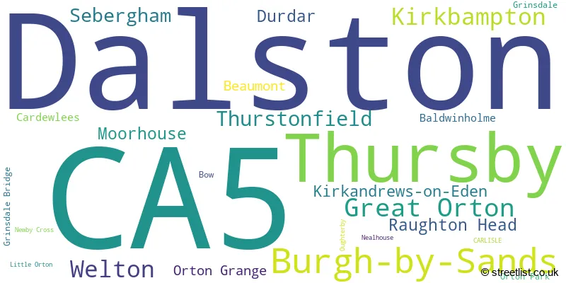
The largest settlement in the CA5 postal code is Dalston followed by Burgh-by-Sands, and Thursby.
The postcode area has a boundary with Solway Firth.
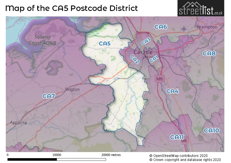
The CA5 Postcode shares a border with CA4 (Scotby, Wetheral, Armathwaite), CA6 (Longtown, Irthington, Kirklinton), CA2 (CARLISLE, Belle Vue), CA3 (CARLISLE, Houghton, Stanwix), CA7 (WIGTON, Aspatria, Silloth) and CA11 (PENRITH, Stainton, Greystoke).
In the CA5 postcode district in Cumbria, the primary settlement is Carlisle. Other significant settlements within this postcode district include Baldwinholme, Beaumont, Bow, Burgh-by-Sands, Cardewlees, Great Orton, Grinsdale, Grinsdale Bridge, Kirkandrews-on-Eden, Kirkbampton, Little Orton, Moorhouse, Nealhouse, Newby Cross, Orton Grange, Orton Park, Oughterby, Thursby, Thurstonfield, Dalston, Durdar, Raughton Head, Sebergham, and Welton. The most significant postal town in the district is Carlisle.
For the district CA5, we have data on 2 postcode sectors. Here's a breakdown: The sector CA5 6, covers Thursby and Burgh-By-Sands and Great Orton in Cumbria. The sector CA5 7, covers Dalston and Welton in Cumbria.

Map of the CA5 Postcode District
Explore the CA5 postcode district by using our free interactive map.
When it comes to local government, postal geography often disregards political borders. However, for a breakdown in the CA5 District: the district mostly encompasses the Cumberland (336 postcodes), and finally, the Westmorland and Furness area (10 postcodes).
Weather Forecast for CA5
Press Button to Show Forecast for Carlisle Racecourse
| Time Period | Icon | Description | Temperature | Rain Probability | Wind |
|---|---|---|---|---|---|
| 09:00 to 12:00 | Sunny day | 8.0°C (feels like 6.0°C) | 1.00% | ENE 4 mph | |
| 12:00 to 15:00 | Cloudy | 10.0°C (feels like 9.0°C) | 5.00% | ENE 7 mph | |
| 15:00 to 18:00 | Cloudy | 11.0°C (feels like 9.0°C) | 7.00% | NNE 7 mph | |
| 18:00 to 21:00 | Partly cloudy (day) | 9.0°C (feels like 8.0°C) | 3.00% | E 7 mph | |
| 21:00 to 00:00 | Clear night | 5.0°C (feels like 3.0°C) | 1.00% | E 4 mph |
Press Button to Show Forecast for Carlisle Racecourse
| Time Period | Icon | Description | Temperature | Rain Probability | Wind |
|---|---|---|---|---|---|
| 00:00 to 03:00 | Clear night | 2.0°C (feels like 0.0°C) | 1.00% | NE 4 mph | |
| 03:00 to 06:00 | Partly cloudy (night) | 2.0°C (feels like 0.0°C) | 1.00% | NNE 4 mph | |
| 06:00 to 09:00 | Partly cloudy (day) | 4.0°C (feels like 2.0°C) | 2.00% | N 4 mph | |
| 09:00 to 12:00 | Cloudy | 8.0°C (feels like 6.0°C) | 5.00% | NNE 9 mph | |
| 12:00 to 15:00 | Cloudy | 10.0°C (feels like 8.0°C) | 8.00% | NNW 9 mph | |
| 15:00 to 18:00 | Cloudy | 11.0°C (feels like 9.0°C) | 8.00% | WNW 9 mph | |
| 18:00 to 21:00 | Partly cloudy (day) | 10.0°C (feels like 8.0°C) | 3.00% | W 11 mph | |
| 21:00 to 00:00 | Clear night | 7.0°C (feels like 4.0°C) | 2.00% | SW 7 mph |
Press Button to Show Forecast for Carlisle Racecourse
| Time Period | Icon | Description | Temperature | Rain Probability | Wind |
|---|---|---|---|---|---|
| 00:00 to 03:00 | Clear night | 6.0°C (feels like 3.0°C) | 2.00% | SSW 7 mph | |
| 03:00 to 06:00 | Cloudy | 6.0°C (feels like 4.0°C) | 9.00% | SSE 7 mph | |
| 06:00 to 09:00 | Partly cloudy (day) | 7.0°C (feels like 4.0°C) | 8.00% | SSE 9 mph | |
| 09:00 to 12:00 | Cloudy | 10.0°C (feels like 8.0°C) | 9.00% | S 13 mph | |
| 12:00 to 15:00 | Light rain shower (day) | 12.0°C (feels like 9.0°C) | 31.00% | S 13 mph | |
| 15:00 to 18:00 | Cloudy | 13.0°C (feels like 10.0°C) | 13.00% | S 13 mph | |
| 18:00 to 21:00 | Cloudy | 12.0°C (feels like 10.0°C) | 12.00% | SSE 11 mph | |
| 21:00 to 00:00 | Cloudy | 10.0°C (feels like 7.0°C) | 11.00% | SE 9 mph |
Press Button to Show Forecast for Carlisle Racecourse
| Time Period | Icon | Description | Temperature | Rain Probability | Wind |
|---|---|---|---|---|---|
| 00:00 to 03:00 | Cloudy | 9.0°C (feels like 7.0°C) | 9.00% | SE 9 mph | |
| 03:00 to 06:00 | Partly cloudy (night) | 8.0°C (feels like 6.0°C) | 5.00% | SE 9 mph | |
| 06:00 to 09:00 | Partly cloudy (day) | 9.0°C (feels like 7.0°C) | 3.00% | ESE 9 mph | |
| 09:00 to 12:00 | Partly cloudy (day) | 13.0°C (feels like 10.0°C) | 2.00% | ESE 11 mph | |
| 12:00 to 15:00 | Partly cloudy (day) | 15.0°C (feels like 12.0°C) | 8.00% | ESE 11 mph | |
| 15:00 to 18:00 | Cloudy | 16.0°C (feels like 13.0°C) | 11.00% | ESE 11 mph | |
| 18:00 to 21:00 | Partly cloudy (day) | 14.0°C (feels like 12.0°C) | 7.00% | ESE 9 mph | |
| 21:00 to 00:00 | Cloudy | 10.0°C (feels like 9.0°C) | 7.00% | ENE 9 mph |
Where is the CA5 Postcode District?
The postcode district for CA5 is located in Carlisle. Carlisle is a district town and is surrounded by several nearby towns. The nearby towns and their distances from Carlisle are as follows: Wigton is located in the South West at a distance of 5.7 miles, Gretna is in the North at a distance of 11.8 miles, Annan is in the North West at a distance of 14.8 miles, Penrith is in the South East at a distance of 15.4 miles, Brampton is in the North East at a distance of 15.8 miles, and Keswick is in the South at a distance of 17.3 miles. Additionally, the distance from Carlisle to London is approximately 260 miles.
The district is within the post town of CARLISLE.
The sector has postcodes within the nation of England.
The CA5 Postcode District is covers the following regions.
- West Cumbria - Cumbria - North West (England)
- East Cumbria - Cumbria - North West (England)
| Postcode Sector | Delivery Office |
|---|---|
| CA5 6 | Carlisle Delivery Office |
| CA5 7 | Carlisle Delivery Office |
| C | A | 5 | - | X | X | X |
| C | A | 5 | Space | Numeric | Letter | Letter |
Current Monthly Rental Prices
| # Bedrooms | Min Price | Max Price | Avg Price |
|---|---|---|---|
| 2 | £525 | £750 | £638 |
| 3 | £750 | £850 | £800 |
Current House Prices
| # Bedrooms | Min Price | Max Price | Avg Price |
|---|---|---|---|
| £980,000 | £1,560,000 | £1,270,000 | |
| 2 | £485,000 | £485,000 | £485,000 |
| 4 | £495,000 | £925,000 | £590,556 |
| 5 | £465,000 | £1,450,000 | £679,375 |
| 6 | £550,000 | £995,000 | £698,000 |
Estate Agents who Operate in the CA5 District
| Logo | Name | Brand Name | Address | Contact Number | Total Properties |
|---|---|---|---|---|---|
 | Carlisle | EDWIN THOMPSON | Fifteen Rosehill Montgomery Way, Rosehill Industrial Estate, Carlisle, CA1 2RW | 01228 587315 | 10 |
 | Carlisle | Hayward Tod Associates | 7 Paternoster Row, Carlisle, CA3 8TT | 01228 810300 | 9 |
 | Riccarton | Davidson & Robertson Limited | The Rural Centre West Mains Ingliston Edinburgh EH28 8LT | 01308 800946 | 7 |
 | North West | eXp UK | 1 Northumberland Avenue, Trafalgar Square, London, WC2N 5BW | 03304 609968 | 7 |
 | Penrith | David Britton Estates | 15, Old London Road Penrith Cumbria CA11 8JJ | 01768 800886 | 7 |
| Type of Property | 2018 Average | 2018 Sales | 2017 Average | 2017 Sales | 2016 Average | 2016 Sales | 2015 Average | 2015 Sales |
|---|---|---|---|---|---|---|---|---|
| Detached | £300,663 | 64 | £271,338 | 70 | £284,657 | 73 | £266,254 | 89 |
| Semi-Detached | £158,215 | 39 | £184,052 | 34 | £167,793 | 41 | £176,472 | 28 |
| Terraced | £169,980 | 25 | £151,120 | 27 | £173,274 | 27 | £126,288 | 16 |
| Flats | £0 | 0 | £143,125 | 6 | £148,543 | 7 | £0 | 0 |