The DA15 7 postcode sector is within the county of Greater London.
Did you know? According to the 2021 Census, the DA15 7 postcode sector is home to a bustling 5,718 residents!
Given that each sector allows for 400 unique postcode combinations. Letters C, I, K, M, O and V are not allowed in the last two letters of a postcode. With 124 postcodes already in use, this leaves 276 units available.
The DA15 7 postal code covers the settlement of SIDCUP .
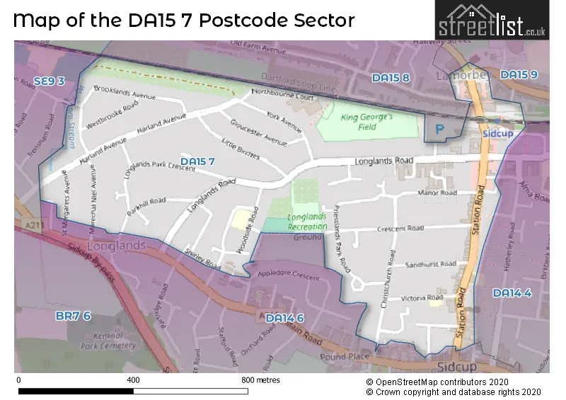
The DA15 7 Postcode shares a border with DA15 8 (SIDCUP ), DA15 9 (SIDCUP ), SE9 3 (ELTHAM , LONDON , NEW ELTHAM ), DA14 4 (SIDCUP ) and DA14 6 (SIDCUP ).
The sector is within the post town of SIDCUP.
DA15 7 is a postcode sector within the DA15 postcode district which is within the DA Dartford postcode area.
The Royal Mail delivery office for the DA15 7 postal sector is the Sidcup Delivery Office.
The area of the DA15 7 postcode sector is 0.39 square miles which is 1.01 square kilometres or 249.14 square acres.
Waterways within the DA15 7 postcode sector include the Wyncham Stream.

Map of the DA15 7 Postcode Sector
Explore the DA15 7 postcode sector by using our free interactive map.
| D | A | 1 | 5 | - | 7 | X | X |
| D | A | 1 | 5 | Space | 7 | Letter | Letter |
Official List of Streets
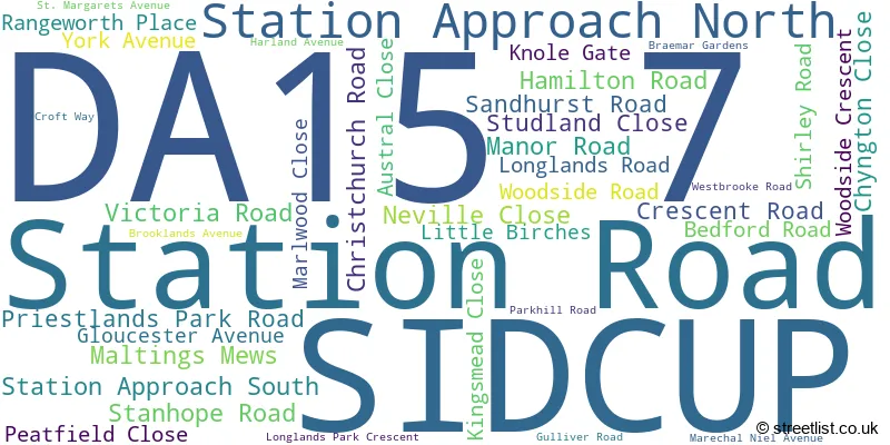
SIDCUP (37 Streets)
Unofficial Streets or Alternative Spellings
SIDCUP
ALMA ROAD APPLEDORE CRESCENT BLENHEIM COURT GREENWOOD CLOSE HATHERLEY CRESCENT JUBILEE WAY LANGFORD PLACE LYDD CLOSE OLD FARM AVENUE SHELBURY CLOSE GRANGE CLOSE HAM SHADES CLOSE LAUREL CLOSE NORTHBOURNE COURT RECREATION ROAD STATION APPROACHBexley
CORNWALLIS AVENUE DULVERTON ROADBEXLEY,
HURST ROADWeather Forecast for DA15 7
Press Button to Show Forecast for Bromley Ski Centre
| Time Period | Icon | Description | Temperature | Rain Probability | Wind |
|---|---|---|---|---|---|
| 15:00 to 18:00 | Partly cloudy (day) | 18.0°C (feels like 18.0°C) | 0.00% | E 4 mph | |
| 18:00 to 21:00 | Sunny day | 18.0°C (feels like 17.0°C) | 1.00% | SE 7 mph | |
| 21:00 to 00:00 | Partly cloudy (night) | 13.0°C (feels like 12.0°C) | 0.00% | SSE 4 mph |
Press Button to Show Forecast for Bromley Ski Centre
| Time Period | Icon | Description | Temperature | Rain Probability | Wind |
|---|---|---|---|---|---|
| 00:00 to 03:00 | Cloudy | 11.0°C (feels like 11.0°C) | 4.00% | S 4 mph | |
| 03:00 to 06:00 | Cloudy | 11.0°C (feels like 10.0°C) | 4.00% | SSW 4 mph | |
| 06:00 to 09:00 | Partly cloudy (day) | 12.0°C (feels like 11.0°C) | 1.00% | S 4 mph | |
| 09:00 to 12:00 | Sunny day | 15.0°C (feels like 15.0°C) | 0.00% | SSW 2 mph | |
| 12:00 to 15:00 | Partly cloudy (day) | 19.0°C (feels like 19.0°C) | 0.00% | ESE 2 mph | |
| 15:00 to 18:00 | Partly cloudy (day) | 21.0°C (feels like 20.0°C) | 1.00% | ENE 4 mph | |
| 18:00 to 21:00 | Partly cloudy (day) | 19.0°C (feels like 18.0°C) | 1.00% | ESE 7 mph | |
| 21:00 to 00:00 | Clear night | 15.0°C (feels like 15.0°C) | 0.00% | S 4 mph |
Press Button to Show Forecast for Bromley Ski Centre
| Time Period | Icon | Description | Temperature | Rain Probability | Wind |
|---|---|---|---|---|---|
| 00:00 to 03:00 | Cloudy | 13.0°C (feels like 13.0°C) | 3.00% | S 2 mph | |
| 03:00 to 06:00 | Cloudy | 12.0°C (feels like 11.0°C) | 4.00% | SE 2 mph | |
| 06:00 to 09:00 | Cloudy | 12.0°C (feels like 12.0°C) | 4.00% | ESE 2 mph | |
| 09:00 to 12:00 | Cloudy | 17.0°C (feels like 17.0°C) | 4.00% | E 4 mph | |
| 12:00 to 15:00 | Cloudy | 20.0°C (feels like 19.0°C) | 4.00% | E 4 mph | |
| 15:00 to 18:00 | Cloudy | 20.0°C (feels like 19.0°C) | 3.00% | E 7 mph | |
| 18:00 to 21:00 | Cloudy | 18.0°C (feels like 17.0°C) | 3.00% | E 7 mph | |
| 21:00 to 00:00 | Cloudy | 15.0°C (feels like 14.0°C) | 3.00% | E 4 mph |
Press Button to Show Forecast for Bromley Ski Centre
| Time Period | Icon | Description | Temperature | Rain Probability | Wind |
|---|---|---|---|---|---|
| 00:00 to 03:00 | Clear night | 12.0°C (feels like 12.0°C) | 0.00% | E 4 mph | |
| 03:00 to 06:00 | Clear night | 11.0°C (feels like 11.0°C) | 0.00% | E 4 mph | |
| 06:00 to 09:00 | Sunny day | 13.0°C (feels like 12.0°C) | 0.00% | E 4 mph | |
| 09:00 to 12:00 | Sunny day | 18.0°C (feels like 18.0°C) | 0.00% | E 4 mph | |
| 12:00 to 15:00 | Partly cloudy (day) | 21.0°C (feels like 20.0°C) | 0.00% | E 7 mph | |
| 15:00 to 18:00 | Partly cloudy (day) | 21.0°C (feels like 19.0°C) | 1.00% | E 9 mph | |
| 18:00 to 21:00 | Sunny day | 19.0°C (feels like 18.0°C) | 1.00% | E 9 mph | |
| 21:00 to 00:00 | Clear night | 15.0°C (feels like 14.0°C) | 0.00% | E 7 mph |
Press Button to Show Forecast for Bromley Ski Centre
| Time Period | Icon | Description | Temperature | Rain Probability | Wind |
|---|---|---|---|---|---|
| 00:00 to 03:00 | Clear night | 14.0°C (feels like 13.0°C) | 0.00% | E 7 mph | |
| 03:00 to 06:00 | Clear night | 13.0°C (feels like 12.0°C) | 1.00% | E 4 mph | |
| 06:00 to 09:00 | Partly cloudy (day) | 14.0°C (feels like 14.0°C) | 1.00% | E 4 mph | |
| 09:00 to 12:00 | Partly cloudy (day) | 19.0°C (feels like 18.0°C) | 1.00% | E 7 mph | |
| 12:00 to 15:00 | Partly cloudy (day) | 21.0°C (feels like 20.0°C) | 3.00% | ESE 9 mph | |
| 15:00 to 18:00 | Partly cloudy (day) | 22.0°C (feels like 20.0°C) | 6.00% | ESE 11 mph | |
| 18:00 to 21:00 | Cloudy | 19.0°C (feels like 18.0°C) | 8.00% | ESE 9 mph | |
| 21:00 to 00:00 | Cloudy | 16.0°C (feels like 15.0°C) | 7.00% | SE 7 mph |
Schools and Places of Education Within the DA15 7 Postcode Sector
Longlands Primary School
Community school
Woodside Road, Sidcup, Kent, DA15 7JG
Head: Miss Janice Owen
Ofsted Rating: Good
Inspection: 2019-03-12 (1884 days ago)
Website: Visit Longlands Primary School Website
Phone: 02083002368
Number of Pupils: 305
House Prices in the DA15 7 Postcode Sector
| Type of Property | 2018 Average | 2018 Sales | 2017 Average | 2017 Sales | 2016 Average | 2016 Sales | 2015 Average | 2015 Sales |
|---|---|---|---|---|---|---|---|---|
| Detached | £667,000 | 5 | £873,000 | 10 | £870,000 | 11 | £809,083 | 15 |
| Semi-Detached | £530,217 | 30 | £525,343 | 36 | £507,536 | 14 | £476,750 | 22 |
| Terraced | £424,028 | 18 | £393,588 | 17 | £412,806 | 18 | £370,303 | 18 |
| Flats | £253,693 | 31 | £262,757 | 33 | £252,284 | 66 | £199,828 | 46 |
Important Postcodes DA15 7 in the Postcode Sector
DA15 7DS is the postcode for Doctors Surgery, 69 Station Road
DA15 7EB is the postcode for Bird College, 27 Station Road
DA15 7EQ is the postcode for Vehicle Registration Office, Sidcup House, 12-20 Station Road
DA15 7ET is the postcode for I L F M, Marlowe House, 109 Station Road, Crown Prosecution Service, 109 Station Road, Marlowe House, Station Road, and 109 Station Road
DA15 7JG is the postcode for Longlands Primary School, Woodside Road
DA15 7JH is the postcode for Wyncham House, 207 Longlands Road
| The DA15 7 Sector is within these Local Authorities |
|
|---|---|
| The DA15 7 Sector is within these Counties |
|
| The DA15 7 Sector is within these Water Company Areas |
|