The DE56 4 postcode sector is within the county of Derbyshire.
Did you know? According to the 2021 Census, the DE56 4 postcode sector is home to a bustling 5,458 residents!
Given that each sector allows for 400 unique postcode combinations. Letters C, I, K, M, O and V are not allowed in the last two letters of a postcode. With 130 postcodes already in use, this leaves 270 units available.
The largest settlements in the DE56 4 postal code are Duffield and Hazelwood.
The DE56 4 Postcode shares a border with DE21 5 (Little Eaton, Breadsall, Horsley), DE22 2 (Allestree, DERBY, Darley Abbey), DE22 5 (Quarndon), DE56 0 (BELPER, Kilburn, Milford) and DE56 2 (BELPER, Ambergate, Heage).
The sector is within the post town of BELPER.
DE56 4 is a postcode sector within the DE5 postcode district which is within the DE Derby postcode area.
The Royal Mail delivery office for the DE56 4 postal sector is the unknown.
The area of the DE56 4 postcode sector is 5.26 square miles which is 13.63 square kilometres or 3,367.28 square acres.
Waterways within the DE56 4 postcode sector include the River Derwent, Ecclesbourne; River Ecclesbourne.

Map of the DE56 4 Postcode Sector
Explore the DE56 4 postcode sector by using our free interactive map.
| D | E | 5 | 6 | - | 4 | X | X |
| D | E | 5 | 6 | Space | 4 | Letter | Letter |
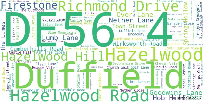
Official List of Streets
Duffield (86 Streets)
Unofficial Streets or Alternative Spellings
Milford
DERBY ROAD BULLPIT LANE CANTERBURY CLOSE CHEVIN BANK DONALD HAWLEY WAY DUCK ISLAND DUFFIELD COURT EATON COURT ECCLESBOURNE COURT FARNAH GREEN ROAD HAZELDENE CLOSE JACKSONS LANE LORD SCARSDALE COURT MAYFAIR COURT MILLCHESTER COURT NORTH LANE SQUIRREL WALK STILES WALK THE ORCHARD VILLAGE COURTDuffield
ORCHARD COTTAGESCowers Lane
WIRKSWORTH ROADQuarndon
BURLEY LANEWeather Forecast for DE56 4
Press Button to Show Forecast for Belper
| Time Period | Icon | Description | Temperature | Rain Probability | Wind |
|---|---|---|---|---|---|
| 09:00 to 12:00 | Heavy rain | 5.0°C (feels like 1.0°C) | 90.00% | NNW 16 mph | |
| 12:00 to 15:00 | Heavy rain | 6.0°C (feels like 2.0°C) | 79.00% | WNW 16 mph | |
| 15:00 to 18:00 | Cloudy | 8.0°C (feels like 4.0°C) | 8.00% | W 16 mph | |
| 18:00 to 21:00 | Partly cloudy (day) | 9.0°C (feels like 6.0°C) | 8.00% | W 11 mph | |
| 21:00 to 00:00 | Clear night | 5.0°C (feels like 3.0°C) | 1.00% | SW 7 mph |
Press Button to Show Forecast for Belper
| Time Period | Icon | Description | Temperature | Rain Probability | Wind |
|---|---|---|---|---|---|
| 00:00 to 03:00 | Clear night | 4.0°C (feels like 2.0°C) | 0.00% | SW 7 mph | |
| 03:00 to 06:00 | Clear night | 4.0°C (feels like 1.0°C) | 2.00% | SSW 7 mph | |
| 06:00 to 09:00 | Partly cloudy (day) | 5.0°C (feels like 2.0°C) | 2.00% | SSW 9 mph | |
| 09:00 to 12:00 | Partly cloudy (day) | 10.0°C (feels like 7.0°C) | 2.00% | S 13 mph | |
| 12:00 to 15:00 | Cloudy | 13.0°C (feels like 10.0°C) | 8.00% | S 16 mph | |
| 15:00 to 18:00 | Partly cloudy (day) | 14.0°C (feels like 11.0°C) | 4.00% | S 16 mph | |
| 18:00 to 21:00 | Partly cloudy (day) | 13.0°C (feels like 10.0°C) | 3.00% | S 13 mph | |
| 21:00 to 00:00 | Partly cloudy (night) | 10.0°C (feels like 8.0°C) | 2.00% | SSE 11 mph |
Press Button to Show Forecast for Belper
| Time Period | Icon | Description | Temperature | Rain Probability | Wind |
|---|---|---|---|---|---|
| 00:00 to 03:00 | Clear night | 8.0°C (feels like 6.0°C) | 1.00% | SSE 9 mph | |
| 03:00 to 06:00 | Clear night | 7.0°C (feels like 5.0°C) | 2.00% | SE 9 mph | |
| 06:00 to 09:00 | Sunny day | 8.0°C (feels like 5.0°C) | 1.00% | ESE 9 mph | |
| 09:00 to 12:00 | Sunny day | 12.0°C (feels like 10.0°C) | 2.00% | ESE 11 mph | |
| 12:00 to 15:00 | Partly cloudy (day) | 15.0°C (feels like 13.0°C) | 5.00% | SE 13 mph | |
| 15:00 to 18:00 | Partly cloudy (day) | 16.0°C (feels like 13.0°C) | 7.00% | SE 11 mph | |
| 18:00 to 21:00 | Sunny day | 15.0°C (feels like 13.0°C) | 8.00% | SE 9 mph | |
| 21:00 to 00:00 | Partly cloudy (night) | 12.0°C (feels like 10.0°C) | 8.00% | ESE 7 mph |
Press Button to Show Forecast for Belper
| Time Period | Icon | Description | Temperature | Rain Probability | Wind |
|---|---|---|---|---|---|
| 00:00 to 03:00 | Cloudy | 10.0°C (feels like 9.0°C) | 14.00% | E 7 mph | |
| 03:00 to 06:00 | Cloudy | 10.0°C (feels like 9.0°C) | 18.00% | ENE 7 mph | |
| 06:00 to 09:00 | Cloudy | 10.0°C (feels like 9.0°C) | 17.00% | ENE 7 mph | |
| 09:00 to 12:00 | Overcast | 12.0°C (feels like 11.0°C) | 18.00% | ENE 7 mph | |
| 12:00 to 15:00 | Light rain shower (day) | 15.0°C (feels like 14.0°C) | 35.00% | E 9 mph | |
| 15:00 to 18:00 | Cloudy | 16.0°C (feels like 15.0°C) | 19.00% | E 9 mph | |
| 18:00 to 21:00 | Cloudy | 15.0°C (feels like 14.0°C) | 17.00% | ENE 9 mph | |
| 21:00 to 00:00 | Cloudy | 12.0°C (feels like 11.0°C) | 13.00% | NE 9 mph |
Schools and Places of Education Within the DE56 4 Postcode Sector
The Ecclesbourne School
Academy converter
Wirksworth Road, Belper, Derbyshire, DE56 4GS
Head: Mr James McNamara
Ofsted Rating: Good
Inspection: 2023-09-20 (221 days ago)
Website: Visit The Ecclesbourne School Website
Phone: 01332840645
Number of Pupils: 1607
William Gilbert Endowed Church of England Primary School
Academy converter
Vicarage Lane, Belper, Derbyshire, DE56 4EB
Head: Mrs Helen Britten
Ofsted Rating: Outstanding
Inspection: 2023-11-15 (165 days ago)
Website: Visit William Gilbert Endowed Church of England Primary School Website
Phone: 01332840395
Number of Pupils: 261

House Prices in the DE56 4 Postcode Sector
| Type of Property | 2018 Average | 2018 Sales | 2017 Average | 2017 Sales | 2016 Average | 2016 Sales | 2015 Average | 2015 Sales |
|---|---|---|---|---|---|---|---|---|
| Detached | £504,521 | 51 | £530,699 | 63 | £453,085 | 55 | £491,649 | 64 |
| Semi-Detached | £285,353 | 17 | £321,654 | 25 | £303,471 | 21 | £300,383 | 27 |
| Terraced | £210,253 | 22 | £206,292 | 12 | £184,568 | 19 | £175,697 | 15 |
| Flats | £168,346 | 14 | £204,600 | 14 | £194,840 | 12 | £172,639 | 18 |
Important Postcodes DE56 4 in the Postcode Sector
DE56 4EB is the postcode for William Gilbert C of E Endowed Primary School, Vicarage Lane, and William Gilbert C of E Endowed Primary School, Vicarage Lane, Duffield
DE56 4FQ is the postcode for Derbyshire Fire & Sescue Service, Fire Station, Derby Road
DE56 4GG is the postcode for Appletree Medical Practice, 47a Town Street
DE56 4GS is the postcode for MAIN BUILDING, The Ecclesbourne School, Wirksworth Road, The Ecclesbourne School, Wirksworth Road, and BLOCK F, The Ecclesbourne School, Wirksworth Road
DE56 4GT is the postcode for Main Building, Duffield Meadows Primary School, Park Road, and Duffield Meadows Primary School, Park Road
| The DE56 4 Sector is within these Local Authorities |
|
|---|---|
| The DE56 4 Sector is within these Counties |
|
| The DE56 4 Sector is within these Water Company Areas |
|