The EH52 postcode district is a postal district located in the EH Edinburgh postcode area with a population of 19,855 residents according to the 2011 Scotland Census.
The area of the EH52 postcode district is 20.07 square miles which is 51.97 square kilometres or 12,842.14 acres.
Currently, the EH52 district has about 537 postcode units spread across 2 geographic postcode sectors.
Given that each sector allows for 400 unique postcode combinations, the district has a capacity of 800 postcodes. With 537 postcodes already in use, this leaves 263 units available.
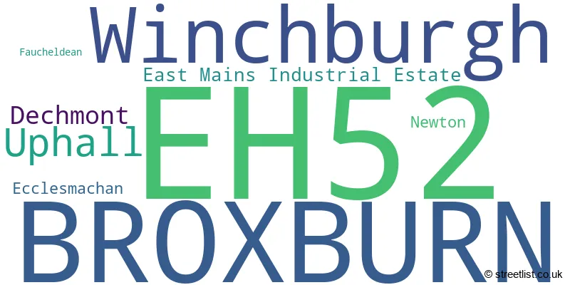
The largest settlement in the EH52 postal code is BROXBURN followed by Winchburgh, and Uphall.
The EH52 Postcode shares a border with EH28 (Ratho, NEWBRIDGE, Ratho Station), EH53 (East Calder, Mid Calder, Pumpherston), EH54 (LIVINGSTON, Deans, Livingston Village), EH48 (BATHGATE, Armadale, Blackridge), EH30 (SOUTH QUEENSFERRY, Dalmeny, Craigiehall), EH29 (KIRKLISTON) and EH49 (LINLITHGOW, Linlithgow Bridge, Bridgend).
The primary settlement of the EH52 postcode district is Broxburn, located in the county of West Lothian, Scotland. Other significant settlements in the district include Uphall, Dechmont, Ecclesmachan, Newton, and Winchburgh. The most significant post town in the district is also Broxburn.
For the district EH52, we have data on 3 postcode sectors. Here's a breakdown: The sector EH52 5, covers Broxburn and Uphall in West Lothian. The sector EH52 6, covers Broxburn and Winchburgh and Uphall in West Lothian. The sector EH52 9 is non-geographic. It's often designated for PO Boxes, large organisations, or special services.

Map of the EH52 Postcode District
Explore the EH52 postcode district by using our free interactive map.

When it comes to local government, postal geography often disregards political borders. However, for a breakdown in the EH52 District: the district mostly encompasses the West Lothian area with a total of 551 postcodes.
Weather Forecast for EH52
Press Button to Show Forecast for Broxburn
| Time Period | Icon | Description | Temperature | Rain Probability | Wind |
|---|---|---|---|---|---|
| 18:00 to 21:00 | Partly cloudy (day) | 8.0°C (feels like 6.0°C) | 2.00% | ENE 7 mph | |
| 21:00 to 00:00 | Clear night | 5.0°C (feels like 4.0°C) | 1.00% | E 4 mph |
Press Button to Show Forecast for Broxburn
| Time Period | Icon | Description | Temperature | Rain Probability | Wind |
|---|---|---|---|---|---|
| 00:00 to 03:00 | Clear night | 3.0°C (feels like 2.0°C) | 0.00% | S 2 mph | |
| 03:00 to 06:00 | Clear night | 2.0°C (feels like 1.0°C) | 0.00% | S 2 mph | |
| 06:00 to 09:00 | Sunny day | 3.0°C (feels like 2.0°C) | 0.00% | WSW 2 mph | |
| 09:00 to 12:00 | Sunny day | 7.0°C (feels like 7.0°C) | 1.00% | E 2 mph | |
| 12:00 to 15:00 | Cloudy | 9.0°C (feels like 7.0°C) | 9.00% | ESE 7 mph | |
| 15:00 to 18:00 | Cloudy | 10.0°C (feels like 8.0°C) | 5.00% | ENE 9 mph | |
| 18:00 to 21:00 | Partly cloudy (day) | 9.0°C (feels like 7.0°C) | 2.00% | ENE 7 mph | |
| 21:00 to 00:00 | Partly cloudy (night) | 6.0°C (feels like 4.0°C) | 1.00% | E 4 mph |
Press Button to Show Forecast for Broxburn
| Time Period | Icon | Description | Temperature | Rain Probability | Wind |
|---|---|---|---|---|---|
| 00:00 to 03:00 | Clear night | 3.0°C (feels like 2.0°C) | 0.00% | ENE 4 mph | |
| 03:00 to 06:00 | Clear night | 1.0°C (feels like 0.0°C) | 1.00% | NNE 4 mph | |
| 06:00 to 09:00 | Partly cloudy (day) | 3.0°C (feels like 2.0°C) | 2.00% | NNW 4 mph | |
| 09:00 to 12:00 | Cloudy | 7.0°C (feels like 5.0°C) | 5.00% | NNE 7 mph | |
| 12:00 to 15:00 | Cloudy | 10.0°C (feels like 8.0°C) | 6.00% | N 7 mph | |
| 15:00 to 18:00 | Overcast | 11.0°C (feels like 10.0°C) | 10.00% | NNW 7 mph | |
| 18:00 to 21:00 | Cloudy | 11.0°C (feels like 9.0°C) | 7.00% | W 7 mph | |
| 21:00 to 00:00 | Clear night | 7.0°C (feels like 5.0°C) | 1.00% | WSW 7 mph |
Press Button to Show Forecast for Broxburn
| Time Period | Icon | Description | Temperature | Rain Probability | Wind |
|---|---|---|---|---|---|
| 00:00 to 03:00 | Clear night | 5.0°C (feels like 3.0°C) | 2.00% | SW 7 mph | |
| 03:00 to 06:00 | Cloudy | 5.0°C (feels like 2.0°C) | 6.00% | SSW 7 mph | |
| 06:00 to 09:00 | Cloudy | 6.0°C (feels like 4.0°C) | 6.00% | S 7 mph | |
| 09:00 to 12:00 | Cloudy | 10.0°C (feels like 8.0°C) | 10.00% | S 9 mph | |
| 12:00 to 15:00 | Cloudy | 12.0°C (feels like 9.0°C) | 12.00% | S 13 mph | |
| 15:00 to 18:00 | Partly cloudy (day) | 13.0°C (feels like 10.0°C) | 7.00% | S 13 mph | |
| 18:00 to 21:00 | Cloudy | 12.0°C (feels like 10.0°C) | 7.00% | S 11 mph | |
| 21:00 to 00:00 | Cloudy | 9.0°C (feels like 7.0°C) | 6.00% | SSE 7 mph |
Press Button to Show Forecast for Broxburn
| Time Period | Icon | Description | Temperature | Rain Probability | Wind |
|---|---|---|---|---|---|
| 00:00 to 03:00 | Partly cloudy (night) | 8.0°C (feels like 6.0°C) | 4.00% | SE 7 mph | |
| 03:00 to 06:00 | Cloudy | 8.0°C (feels like 6.0°C) | 6.00% | SE 7 mph | |
| 06:00 to 09:00 | Partly cloudy (day) | 8.0°C (feels like 6.0°C) | 4.00% | ESE 7 mph | |
| 09:00 to 12:00 | Partly cloudy (day) | 11.0°C (feels like 9.0°C) | 4.00% | ESE 9 mph | |
| 12:00 to 15:00 | Partly cloudy (day) | 13.0°C (feels like 11.0°C) | 9.00% | ESE 11 mph | |
| 15:00 to 18:00 | Cloudy | 12.0°C (feels like 10.0°C) | 15.00% | E 11 mph | |
| 18:00 to 21:00 | Cloudy | 11.0°C (feels like 8.0°C) | 18.00% | E 11 mph | |
| 21:00 to 00:00 | Overcast | 9.0°C (feels like 6.0°C) | 19.00% | ENE 9 mph |
Where is the EH52 Postcode District?
The postcode district EH52 is located in Broxburn, which is a town in Scotland. It is in close proximity to several nearby towns. To the south of Broxburn, there is Newbridge, which is located approximately 2.12 miles away. To the north-east, there is Edinburgh, which is located around 2.77 miles away. Grantown-on-Spey is located to the north, around 3.72 miles away. Linlithgow is situated to the north-west, approximately 4.34 miles away. Kirkliston is to the east, around 4.51 miles away. Clydebank is to the south-west, approximately 5.35 miles away, and Kirknewton is to the south-east, around 5.96 miles away. Additionally, Broxburn is located around 336.14 miles away from the centre of London.
The district is within the post town of BROXBURN.
The sector has postcodes within the nation of Scotland.
The EH52 Postcode District is in the West Lothian region of Eastern Scotland within the Scotland.
| Postcode Sector | Delivery Office |
|---|---|
| EH52 5 | Broxburn Delivery Office |
| EH52 5 | Bathgate Delivery Office |
| EH52 6 | Broxburn Delivery Office |
| EH52 6 | Bathgate Delivery Office |
| E | H | 5 | 2 | - | X | X | X |
| E | H | 5 | 2 | Space | Numeric | Letter | Letter |
Current Monthly Rental Prices
| # Bedrooms | Min Price | Max Price | Avg Price |
|---|---|---|---|
| £1,000 | £1,000 | £1,000 | |
| 1 | £650 | £650 | £650 |
Current House Prices
| # Bedrooms | Min Price | Max Price | Avg Price |
|---|---|---|---|
| £64,000 | £895,000 | £479,500 | |
| 1 | £89,000 | £250,000 | £158,214 |
| 2 | £125,000 | £216,000 | £191,143 |
| 3 | £150,000 | £410,000 | £255,116 |
| 4 | £186,000 | £549,000 | £381,963 |
| 5 | £495,000 | £495,000 | £495,000 |
Estate Agents who Operate in the EH52 District
| Logo | Name | Brand Name | Address | Contact Number | Total Properties |
|---|---|---|---|---|---|
 | Broxburn | KnightBain Estate Agents | 4 Greendykes Road Broxburn EH52 5AG | 01506 379183 | 12 |
 | Edinburgh | Ballantynes | 30 Stafford Street Edinburgh EH3 7BD | 0131 381 0860 | 9 |
 | West Lothian | Remax Property | Fairbairn Road, West Lothian, EH54 6TS | 01506 537260 | 6 |
 | Edinburgh | Avenue Road Estate Agents | 139, Liberton Brae, Edinburgh, EH16 6LD | 03332 420504 | 1 |
 | Riccarton | Davidson & Robertson Limited | The Rural Centre West Mains Ingliston Edinburgh EH28 8LT | 01308 800946 | 1 |