The TA3 5 postcode sector is within the county of Somerset.
Did you know? According to the 2021 Census, the TA3 5 postcode sector is home to a bustling 5,851 residents!
Given that each sector allows for 400 unique postcode combinations. Letters C, I, K, M, O and V are not allowed in the last two letters of a postcode. With 217 postcodes already in use, this leaves 183 units available.
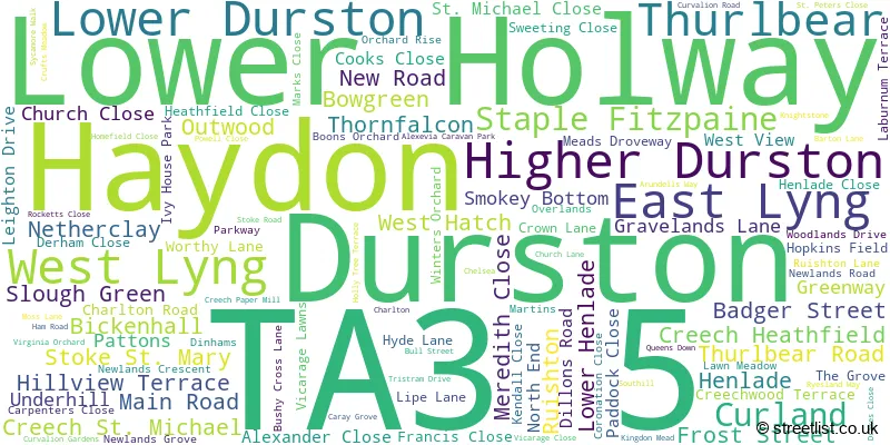
The largest settlement in the TA3 5 postal code is Creech St. Michael followed by Ruishton, and Henlade.
The TA3 5 Postcode shares a border with TA7 0 (Westonzoyland, Middlezoy, North Newton), TA1 2 (TAUNTON), TA1 3 (TAUNTON, Sherford), TA2 8 (TAUNTON, Monkton Heathfield, Bathpool), TA3 6 (North Curry, Stoke St. Gregory, Fivehead), TA3 7 (Trull, Churchinford, Corfe) and TA20 3 (Combe St. Nicholas, Buckland St. Mary, Wadeford).
The sector is within the post town of TAUNTON.
TA3 5 is a postcode sector within the TA3 postcode district which is within the EX Exeter postcode area.
The Royal Mail delivery office for the TA3 5 postal sector is the Taunton Delivery Office.
The area of the TA3 5 postcode sector is 20.26 square miles which is 52.48 square kilometres or 12,967.46 square acres.
The TA3 5 postcode sector is crossed by the M5 motorway.
Waterways within the TA3 5 postcode sector include the Bridgwater and Taunton Canal, River Tone.

Map of the TA3 5 Postcode Sector
Explore the TA3 5 postcode sector by using our free interactive map.
| T | A | 3 | - | 5 | X | X |
| T | A | 3 | Space | 5 | Letter | Letter |
Official List of Streets
Creech St. Michael (34 Streets)
Ruishton (22 Streets)
Thurlbear (4 Streets)
Staple Fitzpaine (5 Streets)
Creech Heathfield (6 Streets)
Stoke St. Mary (3 Streets)
Henlade (8 Streets)
East Lyng (2 Streets)
Unofficial Streets or Alternative Spellings
Staple Fitzpaine
ST. PETERS CLOSENorth Newton
TUCKERTON LANEBathpool
HYDE LANE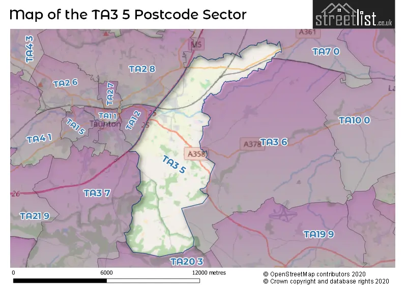
House Prices in the TA3 5 Postcode Sector
| Type of Property | 2018 Average | 2018 Sales | 2017 Average | 2017 Sales | 2016 Average | 2016 Sales | 2015 Average | 2015 Sales |
|---|---|---|---|---|---|---|---|---|
| Detached | £424,898 | 54 | £353,907 | 64 | £331,601 | 81 | £308,984 | 98 |
| Semi-Detached | £224,369 | 29 | £230,850 | 40 | £231,809 | 27 | £229,154 | 26 |
| Terraced | £199,731 | 13 | £174,157 | 7 | £211,509 | 9 | £197,061 | 18 |
| Flats | £0 | 0 | £0 | 0 | £115,500 | 1 | £0 | 0 |
Important Postcodes TA3 5 in the Postcode Sector
TA3 5BW is the postcode for Thurlbear School House, Thurlbear
TA3 5FA is the postcode for Creech Medical Centre, Hyde Lane
TA3 5JZ is the postcode for Ruishton C of E VC Primary School, Newlands Road
TA3 5QQ is the postcode for Creech St. Michael C E V C Primary School, Creech St. Michael, and Creech St Michael Primary School, Hyde Lane, Creech St Michael
TA3 5RJ is the postcode for West Hatch Village Hall, Church Lane, West Hatch
| The TA3 5 Sector is within these Local Authorities |
|
|---|---|
| The TA3 5 Sector is within these Counties |
|
| The TA3 5 Sector is within these Water Company Areas |
|