The GL17 0 postcode sector stands on the Gloucestershire and Herefordshire border.
Did you know? According to the 2021 Census, the GL17 0 postcode sector is home to a bustling 4,862 residents!
Given that each sector allows for 400 unique postcode combinations. Letters C, I, K, M, O and V are not allowed in the last two letters of a postcode. With 268 postcodes already in use, this leaves 132 units available.
The largest settlement in the GL17 0 postal code is MITCHELDEAN followed by LONGHOPE, and May Hill.
The GL17 0 Postcode shares a border with GL14 1 (NEWNHAM, WESTBURY-ON-SEVERN, Elton), GL14 3 (CINDERFORD, Littledean, Whimsey), GL19 3 (Redmarley, Staunton, Hartpury), GL17 9 (DRYBROOK, RUARDEAN, LYDBROOK), GL18 1 (NEWENT, Kilcot, Upleadon), HR9 5 (ROSS-ON-WYE, Walford, Pontshill) and HR9 7 (ROSS-ON-WYE, Lea, Gorsley).
The sector is within the post town of LONGHOPE.
GL17 0 is a postcode sector within the GL17 postcode district which is within the GL Gloucester postcode area.
The Royal Mail delivery office for the GL17 0 postal sector is the Mitcheldean Scale Payment Delivery Office and Longhope (gl) Scale Payment Delivery Office.
The area of the GL17 0 postcode sector is 13.77 square miles which is 35.66 square kilometres or 8,812.83 square acres.
The GL17 0 postcode sector is crossed by the A40 Major A road.

Map of the GL17 0 Postcode Sector
Explore the GL17 0 postcode sector by using our free interactive map.
| G | L | 1 | 7 | - | 0 | X | X |
| G | L | 1 | 7 | Space | 0 | Letter | Letter |
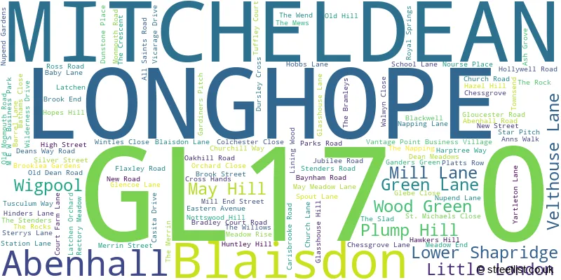
Official List of Streets
MITCHELDEAN (56 Streets)
May Hill (6 Streets)
LONGHOPE (40 Streets)
Blaisdon (2 Streets)
Abenhall (1 Streets)
Unofficial Streets or Alternative Spellings
Huntley
HINDERS LANEMITCHELDEAN
CARISBROOKE ROADHarrow Hill
EASTWOOD ROAD OAKLAND ROADWESTBURY-ON-SEVERN
BLAISDON ROADLittledean
GEORGE LANELea Bailey Hill
WATERY LANEWeather Forecast for GL17 0
Press Button to Show Forecast for Cinderford
| Time Period | Icon | Description | Temperature | Rain Probability | Wind |
|---|---|---|---|---|---|
| 09:00 to 12:00 | Overcast | 5.0°C (feels like 1.0°C) | 52.00% | ENE 11 mph | |
| 12:00 to 15:00 | Overcast | 7.0°C (feels like 3.0°C) | 16.00% | NE 11 mph | |
| 15:00 to 18:00 | Overcast | 8.0°C (feels like 5.0°C) | 17.00% | NE 11 mph | |
| 18:00 to 21:00 | Cloudy | 7.0°C (feels like 4.0°C) | 14.00% | NE 11 mph | |
| 21:00 to 00:00 | Cloudy | 6.0°C (feels like 3.0°C) | 15.00% | NNE 11 mph |
Press Button to Show Forecast for Cinderford
| Time Period | Icon | Description | Temperature | Rain Probability | Wind |
|---|---|---|---|---|---|
| 00:00 to 03:00 | Overcast | 5.0°C (feels like 2.0°C) | 57.00% | NNE 11 mph | |
| 03:00 to 06:00 | Light rain | 5.0°C (feels like 1.0°C) | 57.00% | N 13 mph | |
| 06:00 to 09:00 | Light rain | 4.0°C (feels like 0.0°C) | 55.00% | NNW 11 mph | |
| 09:00 to 12:00 | Heavy rain | 6.0°C (feels like 3.0°C) | 73.00% | NNW 11 mph | |
| 12:00 to 15:00 | Overcast | 9.0°C (feels like 6.0°C) | 20.00% | NW 9 mph | |
| 15:00 to 18:00 | Cloudy | 10.0°C (feels like 8.0°C) | 12.00% | W 9 mph | |
| 18:00 to 21:00 | Cloudy | 10.0°C (feels like 8.0°C) | 8.00% | WSW 9 mph | |
| 21:00 to 00:00 | Clear night | 6.0°C (feels like 3.0°C) | 1.00% | WSW 7 mph |
Press Button to Show Forecast for Cinderford
| Time Period | Icon | Description | Temperature | Rain Probability | Wind |
|---|---|---|---|---|---|
| 00:00 to 03:00 | Clear night | 4.0°C (feels like 1.0°C) | 1.00% | SSW 7 mph | |
| 03:00 to 06:00 | Clear night | 4.0°C (feels like 0.0°C) | 1.00% | S 9 mph | |
| 06:00 to 09:00 | Sunny day | 5.0°C (feels like 2.0°C) | 2.00% | S 11 mph | |
| 09:00 to 12:00 | Cloudy | 10.0°C (feels like 7.0°C) | 6.00% | S 13 mph | |
| 12:00 to 15:00 | Cloudy | 12.0°C (feels like 9.0°C) | 8.00% | S 16 mph | |
| 15:00 to 18:00 | Cloudy | 12.0°C (feels like 9.0°C) | 9.00% | S 16 mph | |
| 18:00 to 21:00 | Partly cloudy (day) | 11.0°C (feels like 8.0°C) | 5.00% | S 13 mph | |
| 21:00 to 00:00 | Partly cloudy (night) | 8.0°C (feels like 5.0°C) | 4.00% | SSE 13 mph |
Press Button to Show Forecast for Cinderford
| Time Period | Icon | Description | Temperature | Rain Probability | Wind |
|---|---|---|---|---|---|
| 00:00 to 03:00 | Cloudy | 7.0°C (feels like 4.0°C) | 8.00% | SE 13 mph | |
| 03:00 to 06:00 | Partly cloudy (night) | 7.0°C (feels like 4.0°C) | 4.00% | SE 11 mph | |
| 06:00 to 09:00 | Partly cloudy (day) | 7.0°C (feels like 4.0°C) | 5.00% | SE 11 mph | |
| 09:00 to 12:00 | Partly cloudy (day) | 11.0°C (feels like 9.0°C) | 8.00% | SE 13 mph | |
| 12:00 to 15:00 | Cloudy | 14.0°C (feels like 11.0°C) | 14.00% | SE 16 mph | |
| 15:00 to 18:00 | Cloudy | 14.0°C (feels like 11.0°C) | 15.00% | SE 13 mph | |
| 18:00 to 21:00 | Cloudy | 13.0°C (feels like 11.0°C) | 11.00% | SE 11 mph | |
| 21:00 to 00:00 | Partly cloudy (night) | 9.0°C (feels like 7.0°C) | 4.00% | SE 9 mph |
Schools and Places of Education Within the GL17 0 Postcode Sector
Dene Magna School
Academy converter
Abenhall Road, Mitcheldean, Gloucestershire, GL17 0DU
Head: Mr Stephen Brady
Ofsted Rating: Outstanding
Inspection: 2012-11-23 (4173 days ago)
Website: Visit Dene Magna School Website
Phone: 01594542370
Number of Pupils: 1030
Hope Brook CofE Primary School
Voluntary controlled school
Church Road, LONGHOPE, Gloucestershire, GL17 0LL
Head: Miss Rosie Marks
Ofsted Rating: Good
Inspection: 2021-07-06 (1026 days ago)
Website: Visit Hope Brook CofE Primary School Website
Phone: 01452830558
Number of Pupils: 112
Mitcheldean Endowed Primary School
Voluntary aided school
Hawker Hill, Mitcheldean, Gloucestershire, GL17 0BS
Head: Mrs Kathryn Oshun
Ofsted Rating: Good
Inspection: 2023-03-23 (401 days ago)
Website: Visit Mitcheldean Endowed Primary School Website
Phone: 01594542240
Number of Pupils: 201

House Prices in the GL17 0 Postcode Sector
| Type of Property | 2018 Average | 2018 Sales | 2017 Average | 2017 Sales | 2016 Average | 2016 Sales | 2015 Average | 2015 Sales |
|---|---|---|---|---|---|---|---|---|
| Detached | £353,842 | 27 | £341,241 | 33 | £275,166 | 45 | £281,023 | 37 |
| Semi-Detached | £160,634 | 26 | £196,181 | 16 | £160,000 | 23 | £142,455 | 20 |
| Terraced | £161,595 | 10 | £229,984 | 22 | £182,718 | 19 | £164,407 | 22 |
| Flats | £152,000 | 1 | £50,000 | 1 | £56,250 | 2 | £45,000 | 1 |
Important Postcodes GL17 0 in the Postcode Sector
GL17 0BS is the postcode for Mitcheldean Endowed Primary School, Hawkers Hill
GL17 0DD is the postcode for Building 6, Vantage Point Business Village, and Gloucestershire College, Cedars Building
GL17 0DU is the postcode for BLOCK 2 MATHS, Dene Magna School, Abenhall, BLOCK 3 SCIENCE, Dene Magna School, Abenhall, Dene Magna School, Abenhall, SPORTS HALL, Dene Magna School, Abenhall, and BLOCK 5 TECHNOLOGY, Dene Magna School, Abenhall
GL17 0LL is the postcode for Hope Brook Primary School, Church Road
| The GL17 0 Sector is within these Local Authorities |
|
|---|---|
| The GL17 0 Sector is within these Counties |
|
| The GL17 0 Sector is within these Water Company Areas |
|