The GU33 6 postcode sector is within the county of Hampshire.
Did you know? According to the 2021 Census, the GU33 6 postcode sector is home to a bustling 1,936 residents!
Given that each sector allows for 400 unique postcode combinations. Letters C, I, K, M, O and V are not allowed in the last two letters of a postcode. With 129 postcodes already in use, this leaves 271 units available.
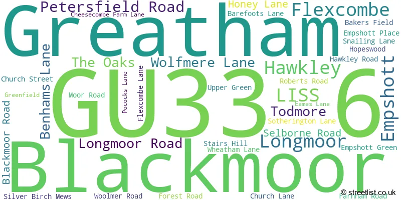
The largest settlement in the GU33 6 postal code is Greatham followed by LISS, and Hawkley.
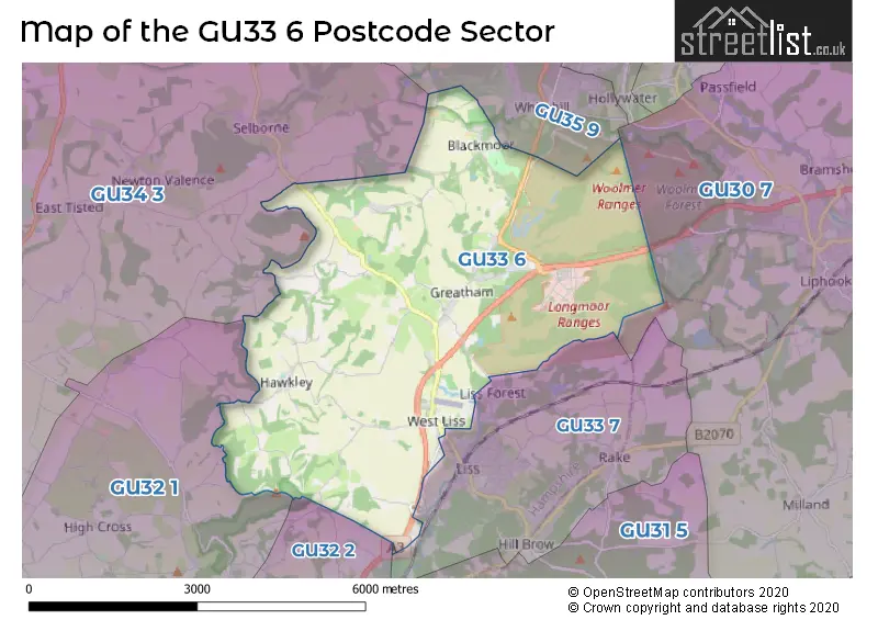
The GU33 6 Postcode shares a border with GU30 7 (LIPHOOK, Passfield, Milland), GU32 1 (East Meon, West Meon, Froxfield), GU34 3 (Selborne, Privett, Lower Farringdon), GU32 2 (PETERSFIELD, Steep, Steep Marsh), GU33 7 (LISS, Hill Brow, Rake) and GU35 9 (Whitehill, Kingsley, BORDON).
The sector is within the post town of LISS.
GU33 6 is a postcode sector within the GU32 postcode district which is within the GU Guildford postcode area.
The Royal Mail delivery office for the GU33 6 postal sector is the unknown.
The area of the GU33 6 postcode sector is 13.27 square miles which is 34.38 square kilometres or 8,495.27 square acres.
The GU33 6 postcode sector is crossed by the A3 Major A road.

Map of the GU33 6 Postcode Sector
Explore the GU33 6 postcode sector by using our free interactive map.
| G | U | 3 | 3 | - | 6 | X | X |
| G | U | 3 | 3 | Space | 6 | Letter | Letter |
Official List of Streets
Greatham (13 Streets)
LISS (5 Streets)
Blackmoor (5 Streets)
Hawkley (6 Streets)
Empshott (3 Streets)
Flexcombe (1 Streets)
Longmoor (1 Streets)
Unofficial Streets or Alternative Spellings
Whitehill
DRIFT ROADLISS
FOREST CORNER STATION ROADSteep
MILL LANESchools and Places of Education Within the GU33 6 Postcode Sector
Greatham Primary School
Community school
Petersfield Road, Liss, Hampshire, GU33 6HA
Head: Miss Jo Goman
Ofsted Rating: Good
Inspection: 2020-01-15 (1590 days ago)
Website: Visit Greatham Primary School Website
Phone: 01420538224
Number of Pupils: 198
St Matthew's Church of England Aided Primary School
Voluntary aided school
Drift Road, Liss, Hampshire, GU33 6BN
Head: Mrs K Pennicotte-Henrie
Ofsted Rating: Good
Inspection: 2023-03-14 (436 days ago)
Website: Visit St Matthew's Church of England Aided Primary School Website
Phone: 01420472844
Number of Pupils: 208
House Prices in the GU33 6 Postcode Sector
| Type of Property | 2018 Average | 2018 Sales | 2017 Average | 2017 Sales | 2016 Average | 2016 Sales | 2015 Average | 2015 Sales |
|---|---|---|---|---|---|---|---|---|
| Detached | £706,167 | 9 | £1,164,750 | 8 | £591,008 | 6 | £820,000 | 11 |
| Semi-Detached | £437,250 | 4 | £497,667 | 6 | £401,500 | 5 | £378,073 | 13 |
| Terraced | £547,500 | 2 | £318,750 | 4 | £364,494 | 8 | £396,000 | 15 |
| Flats | £424,167 | 6 | £682,500 | 2 | £162,667 | 3 | £374,375 | 4 |
Important Postcodes GU33 6 in the Postcode Sector
GU33 6BN is the postcode for St. Matthews C of E Primary School, Blackmoor
GU33 6HA is the postcode for Greatham Primary School, Petersfield Road
| The GU33 6 Sector is within these Local Authorities |
|
|---|---|
| The GU33 6 Sector is within these Counties |
|
| The GU33 6 Sector is within these Water Company Areas |
|