The HU11 4 postcode sector is within the county of East Riding of Yorkshire.
Did you know? According to the 2021 Census, the HU11 4 postcode sector is home to a bustling 8,082 residents!
Given that each sector allows for 400 unique postcode combinations. Letters C, I, K, M, O and V are not allowed in the last two letters of a postcode. With 253 postcodes already in use, this leaves 147 units available.
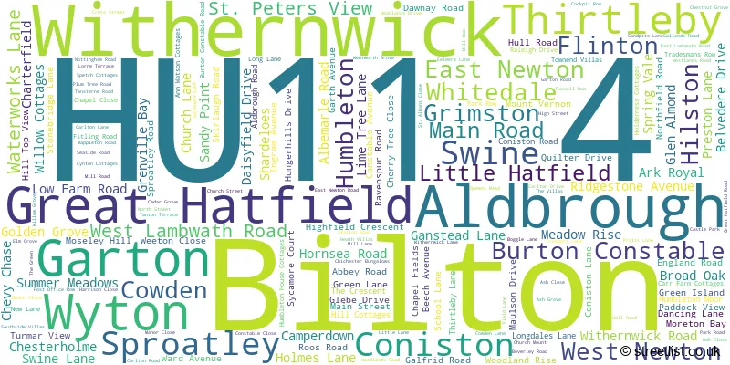
The largest settlement in the HU11 4 postal code is Bilton followed by Aldbrough, and Sproatley.
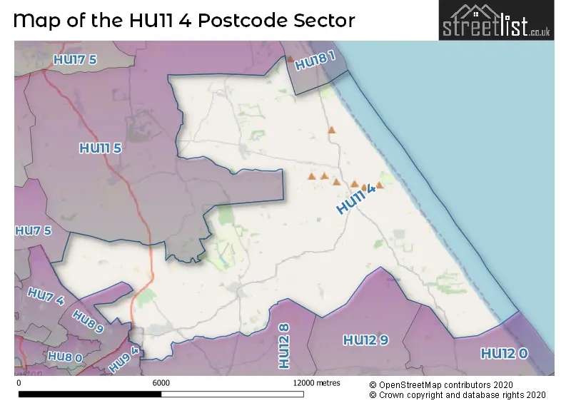
The HU11 4 Postcode shares a border with HU7 4 (Bransholme, Sutton-on-Hull, HULL), HU7 5 (Bransholme, Wawne, Sutton-on-Hull), HU8 9 (HULL), HU9 4 (HULL), HU11 5 (Skirlaugh, Seaton, Long Riston), HU12 0 (Patrington, Tunstall, Easington), HU12 8 (Hedon, Preston, Paull), HU12 9 (Thorngumbald, Keyingham, Burstwick) and HU18 1 (HORNSEA, Rolston, Mappleton).
The sector is within the post town of HULL.
HU11 4 is a postcode sector within the HU1 postcode district which is within the HU Hull postcode area.
The Royal Mail delivery office for the HU11 4 postal sector is the Hull City Delivery Office.
The area of the HU11 4 postcode sector is 40.30 square miles which is 104.37 square kilometres or 25,791.12 square acres.
Waterways within the HU11 4 postcode sector include the Old Fleet, Holderness Drain.

Map of the HU11 4 Postcode Sector
Explore the HU11 4 postcode sector by using our free interactive map.
| H | U | 1 | 1 | - | 4 | X | X |
| H | U | 1 | 1 | Space | 4 | Letter | Letter |
Official List of Streets
Bilton (50 Streets)
Aldbrough (29 Streets)
Flinton (3 Streets)
Withernwick (14 Streets)
Sproatley (27 Streets)
Coniston (8 Streets)
Swine (6 Streets)
Great Hatfield (7 Streets)
Cowden (5 Streets)
Humbleton (5 Streets)
Garton (2 Streets)
Hilston (1 Streets)
Thirtleby (1 Streets)
West Newton (1 Streets)
Unofficial Streets or Alternative Spellings
Roos
HILSTON ROADFitling
HUMBLETON ROADPreston
SPROATLEY ROAD WYTON ROADSkirlaugh
SKIRLAUGH ROADSutton-on-Hull
BRANSHOLME ROADHULL
HOLDERNESS ROAD SHANNON ROAD STANNINGTON DRIVENew Ellerby
LAMBWATH LANESigglesthorne
GREAT HATFIELD ROADOld Ellerby
CRAB TREE LANEWeather Forecast for HU11 4
Press Button to Show Forecast for Hornsea Freeport
| Time Period | Icon | Description | Temperature | Rain Probability | Wind |
|---|---|---|---|---|---|
| 15:00 to 18:00 | Cloudy | 11.0°C (feels like 9.0°C) | 4.00% | NE 16 mph | |
| 18:00 to 21:00 | Partly cloudy (day) | 11.0°C (feels like 8.0°C) | 1.00% | NNE 13 mph | |
| 21:00 to 00:00 | Partly cloudy (night) | 10.0°C (feels like 7.0°C) | 1.00% | N 13 mph |
Press Button to Show Forecast for Hornsea Freeport
| Time Period | Icon | Description | Temperature | Rain Probability | Wind |
|---|---|---|---|---|---|
| 00:00 to 03:00 | Partly cloudy (night) | 10.0°C (feels like 7.0°C) | 1.00% | N 13 mph | |
| 03:00 to 06:00 | Cloudy | 10.0°C (feels like 7.0°C) | 5.00% | N 11 mph | |
| 06:00 to 09:00 | Cloudy | 10.0°C (feels like 8.0°C) | 12.00% | N 9 mph | |
| 09:00 to 12:00 | Heavy rain shower (day) | 11.0°C (feels like 9.0°C) | 54.00% | N 11 mph | |
| 12:00 to 15:00 | Light rain shower (day) | 12.0°C (feels like 10.0°C) | 37.00% | N 11 mph | |
| 15:00 to 18:00 | Cloudy | 12.0°C (feels like 10.0°C) | 17.00% | N 9 mph | |
| 18:00 to 21:00 | Light rain shower (day) | 11.0°C (feels like 9.0°C) | 38.00% | NNW 9 mph | |
| 21:00 to 00:00 | Overcast | 10.0°C (feels like 9.0°C) | 20.00% | NW 7 mph |
Press Button to Show Forecast for Hornsea Freeport
| Time Period | Icon | Description | Temperature | Rain Probability | Wind |
|---|---|---|---|---|---|
| 00:00 to 03:00 | Overcast | 10.0°C (feels like 9.0°C) | 17.00% | WNW 7 mph | |
| 03:00 to 06:00 | Cloudy | 10.0°C (feels like 8.0°C) | 13.00% | WSW 9 mph | |
| 06:00 to 09:00 | Cloudy | 10.0°C (feels like 8.0°C) | 9.00% | WSW 9 mph | |
| 09:00 to 12:00 | Cloudy | 12.0°C (feels like 10.0°C) | 6.00% | SW 11 mph | |
| 12:00 to 15:00 | Cloudy | 14.0°C (feels like 12.0°C) | 7.00% | SW 11 mph | |
| 15:00 to 18:00 | Cloudy | 15.0°C (feels like 13.0°C) | 9.00% | SSW 11 mph | |
| 18:00 to 21:00 | Cloudy | 14.0°C (feels like 12.0°C) | 7.00% | S 9 mph | |
| 21:00 to 00:00 | Cloudy | 11.0°C (feels like 9.0°C) | 8.00% | SSE 9 mph |
Press Button to Show Forecast for Hornsea Freeport
| Time Period | Icon | Description | Temperature | Rain Probability | Wind |
|---|---|---|---|---|---|
| 00:00 to 03:00 | Cloudy | 10.0°C (feels like 9.0°C) | 8.00% | S 9 mph | |
| 03:00 to 06:00 | Partly cloudy (night) | 10.0°C (feels like 8.0°C) | 9.00% | S 9 mph | |
| 06:00 to 09:00 | Partly cloudy (day) | 10.0°C (feels like 9.0°C) | 7.00% | S 7 mph | |
| 09:00 to 12:00 | Cloudy | 12.0°C (feels like 11.0°C) | 8.00% | SSE 9 mph | |
| 12:00 to 15:00 | Cloudy | 14.0°C (feels like 12.0°C) | 8.00% | SE 11 mph | |
| 15:00 to 18:00 | Cloudy | 14.0°C (feels like 12.0°C) | 11.00% | SE 11 mph | |
| 18:00 to 21:00 | Partly cloudy (day) | 13.0°C (feels like 11.0°C) | 6.00% | SE 11 mph | |
| 21:00 to 00:00 | Cloudy | 11.0°C (feels like 9.0°C) | 10.00% | SSE 9 mph |
Schools and Places of Education Within the HU11 4 Postcode Sector
Aldbrough Primary School
Community school
Headlands Road, Hull, , HU11 4RR
Head: Miss Zee Harrison
Ofsted Rating: Good
Inspection: 2022-02-15 (807 days ago)
Website: Visit Aldbrough Primary School Website
Phone: 01964527422
Number of Pupils: 129
Sproatley Endowed Church of England Academy
Academy converter
Balk Lane, Hull, , HU11 4PR
Head: Mrs Vic Tippett
Ofsted Rating: Good
Inspection: 2021-11-04 (910 days ago)
Website: Visit Sproatley Endowed Church of England Academy Website
Phone: 01482811499
Number of Pupils: 119
House Prices in the HU11 4 Postcode Sector
| Type of Property | 2018 Average | 2018 Sales | 2017 Average | 2017 Sales | 2016 Average | 2016 Sales | 2015 Average | 2015 Sales |
|---|---|---|---|---|---|---|---|---|
| Detached | £242,093 | 21 | £243,436 | 48 | £250,427 | 39 | £191,395 | 42 |
| Semi-Detached | £142,040 | 78 | £137,177 | 77 | £127,478 | 66 | £121,822 | 79 |
| Terraced | £116,793 | 21 | £116,894 | 24 | £110,498 | 22 | £102,156 | 16 |
| Flats | £98,500 | 2 | £0 | 0 | £69,000 | 1 | £67,000 | 3 |
Important Postcodes HU11 4 in the Postcode Sector
HU11 4EG is the postcode for Bilton Primary School, School Lane, and BILTON COMMUNITY PRIMARY SCHOOL, LIME TREE LANE
HU11 4PR is the postcode for Sproatley Endowed C of E (VC) School, Balk Lane, Sproatley, and Sproatley Endowed C of E (VC) School, Balk Lane
HU11 4RR is the postcode for Aldbrough Primary School, Headlands Road
| The HU11 4 Sector is within these Local Authorities |
|
|---|---|
| The HU11 4 Sector is within these Counties |
|
| The HU11 4 Sector is within these Water Company Areas |
|