The IP28 6 postcode sector is within the county of Suffolk.
Did you know? According to the 2021 Census, the IP28 6 postcode sector is home to a bustling 5,963 residents!
Given that each sector allows for 400 unique postcode combinations. Letters C, I, K, M, O and V are not allowed in the last two letters of a postcode. With 235 postcodes already in use, this leaves 165 units available.
The largest settlement in the IP28 6 postal code is Risby followed by Barton Mills, and Fornham All Saints.
The IP28 6 Postcode shares a border with IP33 3 (BURY ST. EDMUNDS, Westley), CB8 7 (NEWMARKET, Exning, Kentford), CB8 8 (NEWMARKET, Wickhambrook, Moulton), IP31 1 (Barningham, Bardwell, RAF Honington), IP32 6 (BURY ST. EDMUNDS), IP24 2 (THETFORD, Barnham, Euston), IP24 3 (THETFORD, Elveden), IP27 9 (Lakenheath, RAF Lakenheath, Eriswell), IP28 7 (Mildenhall), IP28 8 (Red Lodge, Beck Row, West Row) and IP29 5 (Barrow, Horringer, Chevington).
The sector is within the post town of BURY ST. EDMUNDS.
IP28 6 is a postcode sector within the IP2 postcode district which is within the IP Ipswich postcode area.
The Royal Mail delivery office for the IP28 6 postal sector is the unknown.
The area of the IP28 6 postcode sector is 56.98 square miles which is 147.58 square kilometres or 36,467.97 square acres.
The IP28 6 postcode sector is crossed by the A11 Major A road.
The IP28 6 postcode sector is crossed by the A14 Major A road.
Waterways within the IP28 6 postcode sector include the River Lark, Cut Off Channel, Lark.

Map of the IP28 6 Postcode Sector
Explore the IP28 6 postcode sector by using our free interactive map.
| I | P | 2 | 8 | - | 6 | X | X |
| I | P | 2 | 8 | Space | 6 | Letter | Letter |
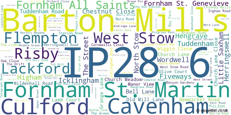
Official List of Streets
Risby (19 Streets)
Fornham All Saints (13 Streets)
Higham (5 Streets)
Tuddenham (10 Streets)
Barton Mills (20 Streets)
Culford (6 Streets)
Fornham St. Martin (13 Streets)
Wordwell (1 Streets)
Flempton (4 Streets)
Icklingham (8 Streets)
Lackford (4 Streets)
West Stow (5 Streets)
Fornham St. Genevieve (4 Streets)
Herringswell (3 Streets)
North Stow (1 Streets)
Little Saxham (1 Streets)
Cavenham (1 Streets)
Unofficial Streets or Alternative Spellings
Fornham St. Martin
THE STREET ANCHOR COURT BAKERS WAY BARWICK AVENUE BURGATE ROAD BURRELL CRESCENT CARGO LANE CHALK LANE CHERRY HILL CHURCH WALK COALPIT LANE COLLIS CLOSE COSSIE CLOSE CROSSES LINK DUNNELL WAY EAST LAKES TRAIL FIVE WAYS ROUNDABOUT FLEMISH AVENUE GODDARD STREET GOLF LINKS ROAD HOPWOODS ROAD KENMARE CLOSE KINGFISHER TRAIL LARK VALLEY PATH MANNOCK DRIVE MERCHANT AVENUE MIDDLEFIED MANOR MYRTLEWOOD ROAD NEW ROAD PAGES LANE PARK FARM DRIVE PETTITS DRIVE PUMPHOUSE ROUTE PURDYS CLOSE QUEEN MARYS AVENUE REDWOOD DRIVE SANDLANDS DRIVE SAYERS BRECK PATH SEVEN TREE ROAD SHAKERS ROAD SHEARING STREET SILK CLOSE SIMPSON WAY SPINNING LANE SUMMER PATH (JUNE-AUGUST) THE MANOR HERRINGSWELL TOLLCOTT DRIVE TRIGG WAY TUDDENHAM LANE VERNA STREET WEAVERS LANE WESTLEY INTERCHANGE WESTON DRIVE WINDELL DRIVE WOODBURN DRIVE WOOL ROAD WORLINGTON ROAD YARN WALKElveden
LONDON ROADGazeley
HIGHAM ROADMildenhall
BURY ROADBURY ST. EDMUNDS
RENDELL CRESCENT WEXFORD WAYBarrow
BURY ROADRed Lodge
CEDAR CLOSEWeather Forecast for IP28 6
Press Button to Show Forecast for Cavenham
| Time Period | Icon | Description | Temperature | Rain Probability | Wind |
|---|---|---|---|---|---|
| 15:00 to 18:00 | Overcast | 10.0°C (feels like 7.0°C) | 13.00% | ENE 11 mph | |
| 18:00 to 21:00 | Overcast | 9.0°C (feels like 6.0°C) | 18.00% | NE 9 mph | |
| 21:00 to 00:00 | Heavy rain | 8.0°C (feels like 5.0°C) | 93.00% | NE 11 mph |
Press Button to Show Forecast for Cavenham
| Time Period | Icon | Description | Temperature | Rain Probability | Wind |
|---|---|---|---|---|---|
| 00:00 to 03:00 | Heavy rain | 8.0°C (feels like 5.0°C) | 92.00% | NE 11 mph | |
| 03:00 to 06:00 | Heavy rain | 9.0°C (feels like 7.0°C) | 93.00% | E 7 mph | |
| 06:00 to 09:00 | Heavy rain shower (day) | 10.0°C (feels like 8.0°C) | 59.00% | SSE 9 mph | |
| 09:00 to 12:00 | Light rain | 11.0°C (feels like 9.0°C) | 55.00% | SSW 13 mph | |
| 12:00 to 15:00 | Heavy rain | 9.0°C (feels like 6.0°C) | 82.00% | WSW 16 mph | |
| 15:00 to 18:00 | Light rain | 8.0°C (feels like 5.0°C) | 55.00% | WSW 16 mph | |
| 18:00 to 21:00 | Cloudy | 9.0°C (feels like 6.0°C) | 11.00% | SW 11 mph | |
| 21:00 to 00:00 | Clear night | 8.0°C (feels like 5.0°C) | 1.00% | SSW 9 mph |
Press Button to Show Forecast for Cavenham
| Time Period | Icon | Description | Temperature | Rain Probability | Wind |
|---|---|---|---|---|---|
| 00:00 to 03:00 | Clear night | 6.0°C (feels like 3.0°C) | 1.00% | SSW 9 mph | |
| 03:00 to 06:00 | Clear night | 5.0°C (feels like 3.0°C) | 0.00% | SSW 7 mph | |
| 06:00 to 09:00 | Sunny day | 7.0°C (feels like 4.0°C) | 0.00% | S 9 mph | |
| 09:00 to 12:00 | Partly cloudy (day) | 12.0°C (feels like 9.0°C) | 0.00% | SSW 11 mph | |
| 12:00 to 15:00 | Cloudy | 14.0°C (feels like 12.0°C) | 5.00% | S 13 mph | |
| 15:00 to 18:00 | Partly cloudy (day) | 15.0°C (feels like 12.0°C) | 3.00% | S 13 mph | |
| 18:00 to 21:00 | Sunny day | 13.0°C (feels like 11.0°C) | 1.00% | S 11 mph | |
| 21:00 to 00:00 | Clear night | 9.0°C (feels like 7.0°C) | 1.00% | SSE 9 mph |
Press Button to Show Forecast for Cavenham
| Time Period | Icon | Description | Temperature | Rain Probability | Wind |
|---|---|---|---|---|---|
| 00:00 to 03:00 | Clear night | 8.0°C (feels like 6.0°C) | 1.00% | SE 7 mph | |
| 03:00 to 06:00 | Partly cloudy (night) | 8.0°C (feels like 6.0°C) | 1.00% | SE 7 mph | |
| 06:00 to 09:00 | Partly cloudy (day) | 10.0°C (feels like 8.0°C) | 2.00% | SE 7 mph | |
| 09:00 to 12:00 | Cloudy | 14.0°C (feels like 12.0°C) | 9.00% | SE 9 mph | |
| 12:00 to 15:00 | Cloudy | 16.0°C (feels like 14.0°C) | 12.00% | SE 11 mph | |
| 15:00 to 18:00 | Cloudy | 16.0°C (feels like 14.0°C) | 10.00% | SE 11 mph | |
| 18:00 to 21:00 | Cloudy | 14.0°C (feels like 13.0°C) | 11.00% | ESE 9 mph | |
| 21:00 to 00:00 | Cloudy | 12.0°C (feels like 11.0°C) | 16.00% | ESE 7 mph |
Press Button to Show Forecast for Cavenham
| Time Period | Icon | Description | Temperature | Rain Probability | Wind |
|---|---|---|---|---|---|
| 00:00 to 03:00 | Cloudy | 11.0°C (feels like 10.0°C) | 15.00% | ESE 7 mph | |
| 03:00 to 06:00 | Partly cloudy (night) | 11.0°C (feels like 10.0°C) | 10.00% | E 4 mph | |
| 06:00 to 09:00 | Cloudy | 11.0°C (feels like 10.0°C) | 10.00% | E 4 mph | |
| 09:00 to 12:00 | Partly cloudy (day) | 15.0°C (feels like 15.0°C) | 9.00% | SE 4 mph | |
| 12:00 to 15:00 | Partly cloudy (day) | 18.0°C (feels like 18.0°C) | 9.00% | ENE 7 mph | |
| 15:00 to 18:00 | Cloudy | 19.0°C (feels like 18.0°C) | 9.00% | NE 9 mph | |
| 18:00 to 21:00 | Cloudy | 16.0°C (feels like 15.0°C) | 6.00% | NNE 7 mph | |
| 21:00 to 00:00 | Cloudy | 12.0°C (feels like 11.0°C) | 7.00% | NE 7 mph |
Schools and Places of Education Within the IP28 6 Postcode Sector
Risby Church of England Voluntary Controlled Primary School
Voluntary controlled school
Aylmer Close, Bury St Edmunds, Suffolk, IP28 6RT
Head: Mrs Soo Miller
Ofsted Rating: Good
Inspection: 2022-11-30 (514 days ago)
Website: Visit Risby Church of England Voluntary Controlled Primary School Website
Phone: 01284810367
Number of Pupils: 207

House Prices in the IP28 6 Postcode Sector
| Type of Property | 2018 Average | 2018 Sales | 2017 Average | 2017 Sales | 2016 Average | 2016 Sales | 2015 Average | 2015 Sales |
|---|---|---|---|---|---|---|---|---|
| Detached | £432,156 | 35 | £440,513 | 59 | £440,029 | 34 | £378,002 | 42 |
| Semi-Detached | £365,733 | 20 | £281,700 | 20 | £291,932 | 22 | £250,277 | 32 |
| Terraced | £267,333 | 6 | £263,614 | 11 | £258,624 | 8 | £196,938 | 8 |
| Flats | £161,500 | 7 | £199,250 | 4 | £200,458 | 6 | £216,929 | 14 |
Important Postcodes IP28 6 in the Postcode Sector
IP28 6RT is the postcode for Risby C E V C P School, Aylmer Close
| The IP28 6 Sector is within these Local Authorities |
|
|---|---|
| The IP28 6 Sector is within these Counties |
|
| The IP28 6 Sector is within these Water Company Areas |
|