The IP32 6 postcode sector is within the county of Suffolk.
Did you know? According to the 2021 Census, the IP32 6 postcode sector is home to a bustling 9,636 residents!
Given that each sector allows for 400 unique postcode combinations. Letters C, I, K, M, O and V are not allowed in the last two letters of a postcode. With 241 postcodes already in use, this leaves 159 units available.
The IP32 6 postal code covers the settlement of BURY ST. EDMUNDS.
The IP32 6 Postcode shares a border with IP33 3 (BURY ST. EDMUNDS, Westley), IP31 1 (Barningham, Bardwell, RAF Honington), IP32 7 (BURY ST. EDMUNDS), IP28 6 (Risby, Barton Mills, Fornham All Saints) and IP33 1 (BURY ST. EDMUNDS).
The sector is within the post town of BURY ST. EDMUNDS.
IP32 6 is a postcode sector within the IP32 postcode district which is within the IP Ipswich postcode area.
The Royal Mail delivery office for the IP32 6 postal sector is the Bury St. Edmunds Delivery Office.
The area of the IP32 6 postcode sector is 1.07 square miles which is 2.78 square kilometres or 687.83 square acres.
The IP32 6 postcode sector is crossed by the A14 Major A road.
Waterways within the IP32 6 postcode sector include the Lark.

Map of the IP32 6 Postcode Sector
Explore the IP32 6 postcode sector by using our free interactive map.
| I | P | 3 | 2 | - | 6 | X | X |
| I | P | 3 | 2 | Space | 6 | Letter | Letter |
Official List of Streets
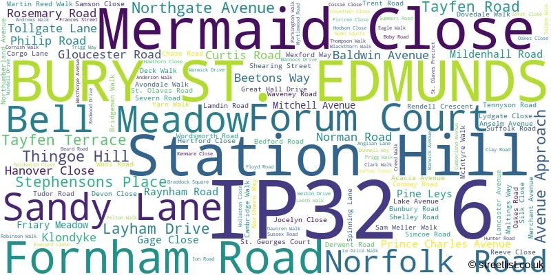
BURY ST. EDMUNDS (148 Streets)
Unofficial Streets or Alternative Spellings
BURY ST. EDMUNDS
IPSWICH STREET OUT NORTHGATE BEETONS LODGE HARLAND COURT HIGHLANDS LARK VALLEY PATH MALTHOUSE BRIDGE MALTHOUSE LANE PEACH MALTINGS RIVERSIDE COURT SANDLANDS DRIVE SOUTH PARADE TAMLYN HOUSE THE FORUM WOODFORD GARDENSFornham St. Martin
THETFORD ROADFornham All Saints
PIGEON LANEWeather Forecast for IP32 6
Press Button to Show Forecast for Bury St. Edmunds
| Time Period | Icon | Description | Temperature | Rain Probability | Wind |
|---|---|---|---|---|---|
| 15:00 to 18:00 | Overcast | 10.0°C (feels like 7.0°C) | 14.00% | NE 11 mph | |
| 18:00 to 21:00 | Overcast | 9.0°C (feels like 6.0°C) | 22.00% | NE 11 mph | |
| 21:00 to 00:00 | Heavy rain | 8.0°C (feels like 5.0°C) | 92.00% | NE 11 mph |
Press Button to Show Forecast for Bury St. Edmunds
| Time Period | Icon | Description | Temperature | Rain Probability | Wind |
|---|---|---|---|---|---|
| 00:00 to 03:00 | Heavy rain | 8.0°C (feels like 6.0°C) | 93.00% | NE 11 mph | |
| 03:00 to 06:00 | Heavy rain | 10.0°C (feels like 8.0°C) | 93.00% | E 7 mph | |
| 06:00 to 09:00 | Heavy rain | 10.0°C (feels like 8.0°C) | 80.00% | S 9 mph | |
| 09:00 to 12:00 | Heavy rain shower (day) | 11.0°C (feels like 8.0°C) | 76.00% | SSW 13 mph | |
| 12:00 to 15:00 | Heavy rain shower (day) | 10.0°C (feels like 7.0°C) | 61.00% | WSW 16 mph | |
| 15:00 to 18:00 | Light rain | 8.0°C (feels like 5.0°C) | 52.00% | WSW 16 mph | |
| 18:00 to 21:00 | Cloudy | 9.0°C (feels like 6.0°C) | 8.00% | SW 11 mph | |
| 21:00 to 00:00 | Clear night | 7.0°C (feels like 5.0°C) | 1.00% | SSW 9 mph |
Press Button to Show Forecast for Bury St. Edmunds
| Time Period | Icon | Description | Temperature | Rain Probability | Wind |
|---|---|---|---|---|---|
| 00:00 to 03:00 | Clear night | 6.0°C (feels like 3.0°C) | 1.00% | SSW 9 mph | |
| 03:00 to 06:00 | Clear night | 5.0°C (feels like 3.0°C) | 0.00% | SSW 7 mph | |
| 06:00 to 09:00 | Sunny day | 6.0°C (feels like 4.0°C) | 0.00% | S 9 mph | |
| 09:00 to 12:00 | Partly cloudy (day) | 12.0°C (feels like 9.0°C) | 0.00% | SSW 11 mph | |
| 12:00 to 15:00 | Cloudy | 14.0°C (feels like 12.0°C) | 5.00% | S 13 mph | |
| 15:00 to 18:00 | Partly cloudy (day) | 15.0°C (feels like 12.0°C) | 3.00% | S 13 mph | |
| 18:00 to 21:00 | Sunny day | 13.0°C (feels like 11.0°C) | 1.00% | SSE 11 mph | |
| 21:00 to 00:00 | Clear night | 9.0°C (feels like 7.0°C) | 1.00% | SSE 7 mph |
Press Button to Show Forecast for Bury St. Edmunds
| Time Period | Icon | Description | Temperature | Rain Probability | Wind |
|---|---|---|---|---|---|
| 00:00 to 03:00 | Partly cloudy (night) | 8.0°C (feels like 6.0°C) | 1.00% | SE 7 mph | |
| 03:00 to 06:00 | Partly cloudy (night) | 7.0°C (feels like 6.0°C) | 1.00% | ESE 7 mph | |
| 06:00 to 09:00 | Partly cloudy (day) | 10.0°C (feels like 8.0°C) | 2.00% | ESE 7 mph | |
| 09:00 to 12:00 | Cloudy | 14.0°C (feels like 12.0°C) | 9.00% | SE 9 mph | |
| 12:00 to 15:00 | Cloudy | 16.0°C (feels like 13.0°C) | 13.00% | SE 11 mph | |
| 15:00 to 18:00 | Cloudy | 16.0°C (feels like 14.0°C) | 9.00% | SE 11 mph | |
| 18:00 to 21:00 | Cloudy | 14.0°C (feels like 13.0°C) | 11.00% | ESE 9 mph | |
| 21:00 to 00:00 | Cloudy | 12.0°C (feels like 10.0°C) | 16.00% | ESE 7 mph |
Press Button to Show Forecast for Bury St. Edmunds
| Time Period | Icon | Description | Temperature | Rain Probability | Wind |
|---|---|---|---|---|---|
| 00:00 to 03:00 | Cloudy | 11.0°C (feels like 10.0°C) | 14.00% | ESE 7 mph | |
| 03:00 to 06:00 | Cloudy | 10.0°C (feels like 9.0°C) | 12.00% | E 4 mph | |
| 06:00 to 09:00 | Cloudy | 11.0°C (feels like 10.0°C) | 10.00% | E 4 mph | |
| 09:00 to 12:00 | Partly cloudy (day) | 15.0°C (feels like 15.0°C) | 9.00% | ESE 7 mph | |
| 12:00 to 15:00 | Cloudy | 18.0°C (feels like 17.0°C) | 12.00% | ENE 7 mph | |
| 15:00 to 18:00 | Cloudy | 19.0°C (feels like 17.0°C) | 9.00% | NE 9 mph | |
| 18:00 to 21:00 | Cloudy | 16.0°C (feels like 15.0°C) | 6.00% | NE 7 mph | |
| 21:00 to 00:00 | Cloudy | 12.0°C (feels like 11.0°C) | 7.00% | NNE 7 mph |
Schools and Places of Education Within the IP32 6 Postcode Sector
Bury St Edmunds County High School
Academy converter
Beetons Way, Bury St Edmunds, Suffolk, IP32 6RF
Head: Ms Sally Kennedy
Ofsted Rating: Good
Inspection: 2022-03-17 (772 days ago)
Website: Visit Bury St Edmunds County High School Website
Phone: 01284754857
Number of Pupils: 659
Howard Community Academy
Academy sponsor led
Beard Road, Bury St Edmunds, Suffolk, IP32 6SA
Head: Mrs Alison Weir
Ofsted Rating: Requires improvement
Inspection: 2023-01-19 (464 days ago)
Website: Visit Howard Community Academy Website
Phone: 01284766278
Number of Pupils: 175
Tollgate Primary School
Academy sponsor led
Tollgate Lane, Bury St Edmunds, Suffolk, IP32 6DG
Head: Miss Hannah Brookman
Ofsted Rating: Good
Inspection: 2023-10-04 (206 days ago)
Website: Visit Tollgate Primary School Website
Phone: 01284752742
Number of Pupils: 383

House Prices in the IP32 6 Postcode Sector
| Type of Property | 2018 Average | 2018 Sales | 2017 Average | 2017 Sales | 2016 Average | 2016 Sales | 2015 Average | 2015 Sales |
|---|---|---|---|---|---|---|---|---|
| Detached | £417,553 | 53 | £405,799 | 5 | £299,357 | 7 | £315,791 | 11 |
| Semi-Detached | £301,267 | 49 | £246,000 | 31 | £243,021 | 26 | £221,355 | 33 |
| Terraced | £226,942 | 57 | £215,358 | 50 | £200,660 | 53 | £182,906 | 58 |
| Flats | £168,364 | 28 | £161,805 | 22 | £143,179 | 28 | £132,078 | 23 |
Important Postcodes IP32 6 in the Postcode Sector
IP32 6AH is the postcode for West Suffolk Contact Centre, 16 Fornham Road, Bury St Edmunds
IP32 6DG is the postcode for Tollgate Primary School, Tollgate Lane, and Tollgate Cp School, Tollgate Lane
IP32 6NU is the postcode for Darbishire House, Lamdin Road
IP32 6RF is the postcode for THE PERFORMING ART BLOCK, Bury St. Edmunds County Upper School, Beetons Way, SCIENCE BLOCK, Bury St. Edmunds County Upper School, Beetons Way, Bury St. Edmunds County Upper School, Beetons Way, DESIGN & TECHNOLOGY BLOCK, Bury St. Edmunds County Upper School, Beetons Way, LIBRARY/HUMANITIES CENTRE, Bury St. Edmunds County Upper School, Beetons Way, MAIN BUILDING, County Upper School, Beetons Way, and SPORTS HALL, Bury St. Edmunds County Upper School, Beetons Way
IP32 6RH is the postcode for NEW TEACHING BLOCK ST BENEDICTS SCHOOL, St. Benedicts Upper School, Beetons Way, St. Benedicts Upper School, Beetons Way, and SCIENCE & TECHNOLOGY, St. Benedicts Upper School, Beetons Way
IP32 6RW is the postcode for Howard Cp School, St. Olaves Road
IP32 6SA is the postcode for SPORTS BARN, Howard Primary School, Beard Road, The Albany Centre, Beard Road, Howard Primary School, Beard Road, and Howard Community Academy, Beard Road
IP32 6SR is the postcode for West Suffolk College Building Services, Unit D, Anglian Lane, West Suffolk College Building Services, Unit C, Anglian Lane, Milburn Centre, Anglian Lane, WEST SUFFOLK COLLEGE, MILBURN CENTRE, ANGLIAN LANE, and West Suffolk College Building Services, Unit B, Anglian Lane
| The IP32 6 Sector is within these Local Authorities |
|
|---|---|
| The IP32 6 Sector is within these Counties |
|
| The IP32 6 Sector is within these Water Company Areas |
|