Given that each sector allows for 400 unique postcode combinations. Letters C, I, K, M, O and V are not allowed in the last two letters of a postcode. With 306 postcodes already in use, this leaves 94 units available.
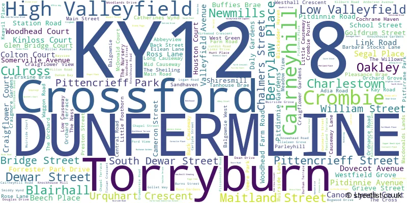
The largest settlement in the KY12 8 postal code is DUNFERMLINE followed by Cairneyhill, and Crossford.
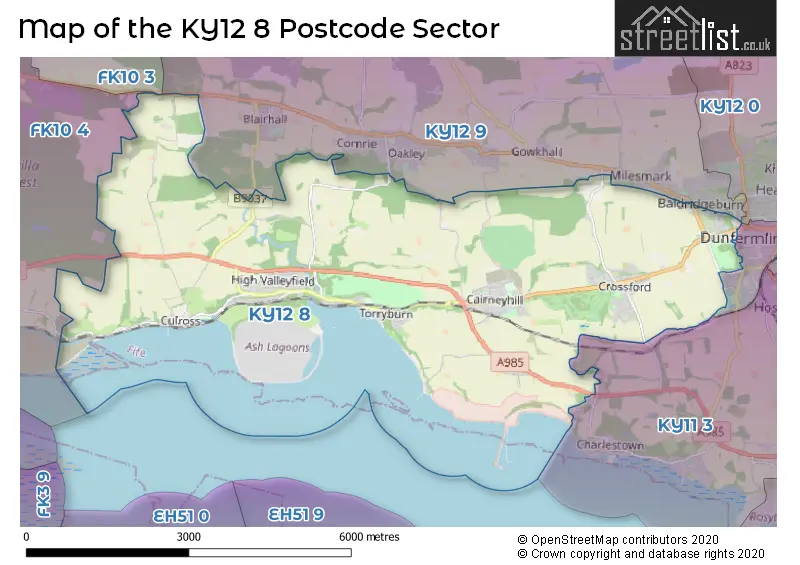
The KY12 8 Postcode shares a border with KY11 3 (DUNFERMLINE, Limekilns, Charlestown), FK10 3 (Sauchie, ALLOA, Fishcross), FK10 4 (Kincardine, CLACKMANNAN, ALLOA), KY12 0 (DUNFERMLINE, Townhill, Kingseat), KY12 7 (DUNFERMLINE) and KY12 9 (DUNFERMLINE, Oakley, Saline).
The sector is within the post town of DUNFERMLINE.
KY12 8 is a postcode sector within the KY1 postcode district which is within the KY Kirkcaldy postcode area.
The Royal Mail delivery office for the KY12 8 postal sector is the unknown.
The area of the KY12 8 postcode sector is 15.45 square miles which is 40.01 square kilometres or 9,887.73 square acres.

Map of the KY12 8 Postcode Sector
Explore the KY12 8 postcode sector by using our free interactive map.
| K | Y | 1 | 2 | - | 8 | X | X |
| K | Y | 1 | 2 | Space | 8 | Letter | Letter |
Official List of Streets
High Valleyfield (20 Streets)
Crossford (47 Streets)
Torryburn (16 Streets)
Culross (21 Streets)
DUNFERMLINE (24 Streets)
Low Valleyfield (4 Streets)
Cairneyhill (39 Streets)
Crombie (9 Streets)
Newmills (8 Streets)
Blairhall (1 Streets)
Charlestown (1 Streets)
Unofficial Streets or Alternative Spellings
DUNFERMLINE
BRUCE STREET CARNEGIE DRIVE MILTON GREEN PHOENIX LANE WINTERTHUR LANE ABBEY VIEW BERRYLAW ROAD BESSIES BAR STEPS BINNIES VENNEL BURNBANK CAIRNEYHILL ROUNDABOUT CAMP ROAD CLINKUM BANK COAL ROAD COLTON TERRACE COMRIE DEAN VIADUCT CRAIGWELL PATH FORTH VIEW COTTAGES GALLOWS LOAN GLEN BRIDGE GLENBRIDGE COURT GRAY CRAIGS LANE GREY CRAIGS HAGGS WYND HANGING GARDENS KEAVIL FARM STEADINGS KIRK STREET LITTLE SANDHAVEN LOGIE ROAD LOGIE ROAD / LADYS LOAN LOVERS LOAN LOW CAUSEWAYSIDE MEADOWEND PITFIRANE PARK ST JOHNS VENNEL STRYND VENNEL THE SHIELING URQUHART CUT WEST FIFE WAY WOODLAND WALKMilesmark
TARGATE ROADOakley
STATION ROADWeather Forecast for KY12 8
Press Button to Show Forecast for Bo'Ness
| Time Period | Icon | Description | Temperature | Rain Probability | Wind |
|---|---|---|---|---|---|
| 03:00 to 06:00 | Partly cloudy (night) | 2.0°C (feels like 0.0°C) | 1.00% | N 4 mph | |
| 06:00 to 09:00 | Cloudy | 3.0°C (feels like 1.0°C) | 4.00% | NNW 4 mph | |
| 09:00 to 12:00 | Cloudy | 6.0°C (feels like 5.0°C) | 5.00% | NNE 4 mph | |
| 12:00 to 15:00 | Cloudy | 8.0°C (feels like 7.0°C) | 8.00% | ENE 4 mph | |
| 15:00 to 18:00 | Cloudy | 8.0°C (feels like 7.0°C) | 10.00% | ESE 4 mph | |
| 18:00 to 21:00 | Partly cloudy (day) | 7.0°C (feels like 6.0°C) | 8.00% | E 4 mph | |
| 21:00 to 00:00 | Partly cloudy (night) | 5.0°C (feels like 3.0°C) | 4.00% | E 4 mph |
Press Button to Show Forecast for Bo'Ness
| Time Period | Icon | Description | Temperature | Rain Probability | Wind |
|---|---|---|---|---|---|
| 00:00 to 03:00 | Partly cloudy (night) | 4.0°C (feels like 2.0°C) | 2.00% | ENE 2 mph | |
| 03:00 to 06:00 | Cloudy | 2.0°C (feels like 1.0°C) | 6.00% | NNE 2 mph | |
| 06:00 to 09:00 | Mist | 3.0°C (feels like 2.0°C) | 14.00% | N 2 mph | |
| 09:00 to 12:00 | Partly cloudy (day) | 7.0°C (feels like 6.0°C) | 6.00% | SE 4 mph | |
| 12:00 to 15:00 | Cloudy | 10.0°C (feels like 8.0°C) | 12.00% | SE 7 mph | |
| 15:00 to 18:00 | Cloudy | 9.0°C (feels like 7.0°C) | 12.00% | SE 9 mph | |
| 18:00 to 21:00 | Partly cloudy (day) | 8.0°C (feels like 7.0°C) | 7.00% | SE 7 mph | |
| 21:00 to 00:00 | Partly cloudy (night) | 5.0°C (feels like 3.0°C) | 6.00% | SE 7 mph |
Press Button to Show Forecast for Bo'Ness
| Time Period | Icon | Description | Temperature | Rain Probability | Wind |
|---|---|---|---|---|---|
| 00:00 to 03:00 | Partly cloudy (night) | 4.0°C (feels like 3.0°C) | 7.00% | ENE 4 mph | |
| 03:00 to 06:00 | Mist | 3.0°C (feels like 1.0°C) | 20.00% | NNE 4 mph | |
| 06:00 to 09:00 | Cloudy | 4.0°C (feels like 2.0°C) | 13.00% | N 7 mph | |
| 09:00 to 12:00 | Partly cloudy (day) | 8.0°C (feels like 6.0°C) | 11.00% | NE 9 mph | |
| 12:00 to 15:00 | Overcast | 10.0°C (feels like 8.0°C) | 17.00% | NE 9 mph | |
| 15:00 to 18:00 | Cloudy | 11.0°C (feels like 9.0°C) | 16.00% | NNW 9 mph | |
| 18:00 to 21:00 | Cloudy | 10.0°C (feels like 8.0°C) | 12.00% | N 9 mph | |
| 21:00 to 00:00 | Partly cloudy (night) | 7.0°C (feels like 5.0°C) | 9.00% | NNW 9 mph |
| The KY12 8 Sector is within these Local Authorities | |
|---|---|
| The KY12 8 Sector is within these Counties | |
| The KY12 8 Sector is within these Water Company Areas |