The L13 4 postcode sector is within the county of Merseyside.
Did you know? According to the 2021 Census, the L13 4 postcode sector is home to a bustling 2,904 residents!
Given that each sector allows for 400 unique postcode combinations. Letters C, I, K, M, O and V are not allowed in the last two letters of a postcode. With 52 postcodes already in use, this leaves 348 units available.
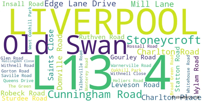
The largest settlement in the L13 4 postal code is LIVERPOOL followed by Old Swan, and Stoneycroft.
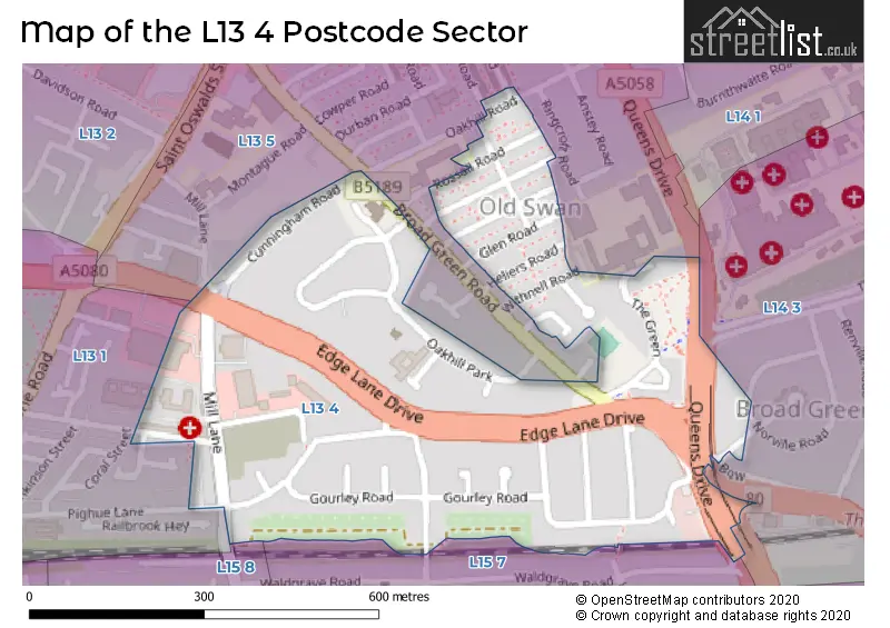
The L13 4 Postcode shares a border with L13 1 (LIVERPOOL, Old Swan, Wavertree), L13 5 (LIVERPOOL, Old Swan, Stoneycroft), L15 7 (LIVERPOOL, Wavertree), L14 3 (LIVERPOOL, Broadgreen, Bowring Park) and L15 8 (LIVERPOOL, Wavertree).
The sector is within the post town of LIVERPOOL.
L13 4 is a postcode sector within the L1 postcode district which is within the L Liverpool postcode area.
The Royal Mail delivery office for the L13 4 postal sector is the Liverpool 1-3.
The area of the L13 4 postcode sector is 0.19 square miles which is 0.49 square kilometres or 121.61 square acres.

Map of the L13 4 Postcode Sector
Explore the L13 4 postcode sector by using our free interactive map.
| L | 1 | 3 | - | 4 | X | X |
| L | 1 | 3 | Space | 4 | Letter | Letter |
Official List of Streets
LIVERPOOL (28 Streets)
Old Swan (3 Streets)
Stoneycroft (1 Streets)
Unofficial Streets or Alternative Spellings
Mossley Hill
QUEENS DRIVELIVERPOOL
BADEN ROAD BINNS ROAD BOWRING PARK ROAD HARMONY WAY LEINSTER ROAD MOWBRAY GROVE NORVILLE ROAD OAK VALE PIGHUE LANE ROCKVILLE ROAD WALDGRAVE ROADOld Swan
OAKHILL ROAD BROADGREEN ROAD QUEENS DRIVE STONEYCROFTWavertree
NORTHWAYWeather Forecast for L13 4
Press Button to Show Forecast for Wavertree
| Time Period | Icon | Description | Temperature | Rain Probability | Wind |
|---|---|---|---|---|---|
| 03:00 to 06:00 | Cloudy | 10.0°C (feels like 7.0°C) | 6.00% | SSE 16 mph | |
| 06:00 to 09:00 | Cloudy | 10.0°C (feels like 6.0°C) | 5.00% | SE 18 mph | |
| 09:00 to 12:00 | Cloudy | 12.0°C (feels like 8.0°C) | 8.00% | SE 18 mph | |
| 12:00 to 15:00 | Cloudy | 14.0°C (feels like 11.0°C) | 9.00% | SSE 18 mph | |
| 15:00 to 18:00 | Cloudy | 15.0°C (feels like 11.0°C) | 15.00% | SSE 16 mph | |
| 18:00 to 21:00 | Light rain shower (day) | 13.0°C (feels like 11.0°C) | 35.00% | SSE 11 mph | |
| 21:00 to 00:00 | Overcast | 11.0°C (feels like 10.0°C) | 16.00% | SE 9 mph |
Press Button to Show Forecast for Wavertree
| Time Period | Icon | Description | Temperature | Rain Probability | Wind |
|---|---|---|---|---|---|
| 00:00 to 03:00 | Cloudy | 10.0°C (feels like 9.0°C) | 7.00% | SE 9 mph | |
| 03:00 to 06:00 | Cloudy | 9.0°C (feels like 7.0°C) | 4.00% | SE 7 mph | |
| 06:00 to 09:00 | Cloudy | 9.0°C (feels like 7.0°C) | 4.00% | SE 7 mph | |
| 09:00 to 12:00 | Cloudy | 11.0°C (feels like 10.0°C) | 5.00% | ESE 7 mph | |
| 12:00 to 15:00 | Cloudy | 14.0°C (feels like 13.0°C) | 8.00% | SE 7 mph | |
| 15:00 to 18:00 | Cloudy | 15.0°C (feels like 14.0°C) | 13.00% | NW 7 mph | |
| 18:00 to 21:00 | Cloudy | 14.0°C (feels like 13.0°C) | 12.00% | WNW 7 mph | |
| 21:00 to 00:00 | Cloudy | 13.0°C (feels like 11.0°C) | 11.00% | NW 7 mph |
Press Button to Show Forecast for Wavertree
| Time Period | Icon | Description | Temperature | Rain Probability | Wind |
|---|---|---|---|---|---|
| 00:00 to 03:00 | Cloudy | 12.0°C (feels like 10.0°C) | 12.00% | NNW 7 mph | |
| 03:00 to 06:00 | Cloudy | 11.0°C (feels like 10.0°C) | 9.00% | NNW 7 mph | |
| 06:00 to 09:00 | Cloudy | 11.0°C (feels like 10.0°C) | 7.00% | N 7 mph | |
| 09:00 to 12:00 | Partly cloudy (day) | 13.0°C (feels like 11.0°C) | 5.00% | N 9 mph | |
| 12:00 to 15:00 | Sunny day | 16.0°C (feels like 14.0°C) | 5.00% | N 9 mph | |
| 15:00 to 18:00 | Sunny day | 17.0°C (feels like 15.0°C) | 3.00% | N 11 mph | |
| 18:00 to 21:00 | Sunny day | 17.0°C (feels like 14.0°C) | 4.00% | N 11 mph | |
| 21:00 to 00:00 | Clear night | 14.0°C (feels like 12.0°C) | 3.00% | NNE 9 mph |
House Prices in the L13 4 Postcode Sector
| Type of Property | 2018 Average | 2018 Sales | 2017 Average | 2017 Sales | 2016 Average | 2016 Sales | 2015 Average | 2015 Sales |
|---|---|---|---|---|---|---|---|---|
| Detached | £0 | 0 | £187,000 | 2 | £0 | 0 | £239,000 | 1 |
| Semi-Detached | £137,833 | 12 | £124,000 | 11 | £131,539 | 19 | £136,500 | 22 |
| Terraced | £101,946 | 27 | £107,044 | 18 | £109,429 | 14 | £104,210 | 15 |
| Flats | £61,920 | 5 | £58,000 | 3 | £67,833 | 3 | £62,645 | 10 |
Important Postcodes L13 4 in the Postcode Sector
L13 4AW is the postcode for WILLIAM HOUSE, Mersey Care NHS Trust, Rathbone Hospital, Mill Lane, AVALON, Mersey Care NHS Trust, Rathbone Hospital, Mill Lane, Mersey Care NHS Trust, Rathbone Hospital, Mill Lane, LOW SECURE UNIT, Mersey Care NHS Trust, Rathbone Hospital, Mill Lane, ELEANOR HOUSE, Mersey Care NHS Trust, Rathbone Hospital, Mill Lane, and REHABILITATION, Mersey Care NHS Trust, Rathbone Hospital, Mill Lane
| The L13 4 Sector is within these Local Authorities |
|
|---|---|
| The L13 4 Sector is within these Counties |
|
| The L13 4 Sector is within these Water Company Areas |
|