The L13 5 postcode sector is within the county of Merseyside.
Did you know? According to the 2021 Census, the L13 5 postcode sector is home to a bustling 4,332 residents!
Given that each sector allows for 400 unique postcode combinations. Letters C, I, K, M, O and V are not allowed in the last two letters of a postcode. With 81 postcodes already in use, this leaves 319 units available.
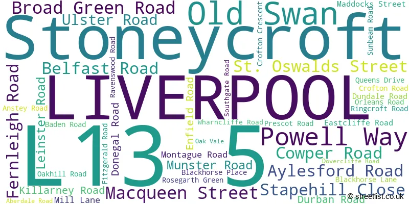
The largest settlement in the L13 5 postal code is LIVERPOOL followed by Old Swan, and Stoneycroft.
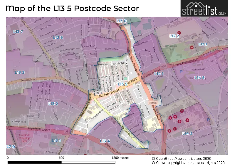
The L13 5 Postcode shares a border with L13 2 (LIVERPOOL, Old Swan, Stanley), L12 2 (West Derby, LIVERPOOL, Sandfield Park), L13 0 (LIVERPOOL, West Derby, Stoneycroft), L13 1 (LIVERPOOL, Old Swan, Wavertree), L13 3 (LIVERPOOL, Old Swan), L14 1 (LIVERPOOL), L13 4 (LIVERPOOL, Old Swan, Stoneycroft), L13 6 (LIVERPOOL, Stoneycroft, Old Swan) and L14 3 (LIVERPOOL, Broadgreen, Bowring Park).
The sector is within the post town of LIVERPOOL.
L13 5 is a postcode sector within the L1 postcode district which is within the L Liverpool postcode area.
The Royal Mail delivery office for the L13 5 postal sector is the Liverpool 1-3.
The area of the L13 5 postcode sector is 0.22 square miles which is 0.57 square kilometres or 141.09 square acres.

Map of the L13 5 Postcode Sector
Explore the L13 5 postcode sector by using our free interactive map.
| L | 1 | 3 | - | 5 | X | X |
| L | 1 | 3 | Space | 5 | Letter | Letter |
Official List of Streets
LIVERPOOL (34 Streets)
Old Swan (4 Streets)
Stoneycroft (2 Streets)
Unofficial Streets or Alternative Spellings
LIVERPOOL
ALDER ROAD BURNTHWAITE ROAD CHILCOTT ROAD CLAYFORD CRESCENT CUNNINGHAM ROAD DAVIDSON ROAD DERBY LANE DORIC ROAD EAST PRESCOT ROAD EDGE LANE DRIVE GLEN ROAD GORTON ROAD HAZLETON ROAD HELIERS ROAD LEXHAM ROAD MONTEREY ROAD OAKHILL PARK PEMBERTON ROAD ROSSALL ROAD SAINTS CLOSE THE BEECHWALK THE GREEN WHITEHOUSE ROAD WITHNELL ROAD WOODHALL ROADMossley Hill
QUEENS DRIVE EAST ROAD QUEENS DRIVE STONEYCROFTOld Swan
SAVILLE ROADWavertree
RATHBONE ROADFairfield
PRESCOT ROADWeather Forecast for L13 5
Press Button to Show Forecast for Knotty Ash
| Time Period | Icon | Description | Temperature | Rain Probability | Wind |
|---|---|---|---|---|---|
| 03:00 to 06:00 | Cloudy | 10.0°C (feels like 7.0°C) | 6.00% | SE 16 mph | |
| 06:00 to 09:00 | Cloudy | 10.0°C (feels like 6.0°C) | 5.00% | SE 16 mph | |
| 09:00 to 12:00 | Cloudy | 12.0°C (feels like 8.0°C) | 8.00% | SE 18 mph | |
| 12:00 to 15:00 | Cloudy | 14.0°C (feels like 11.0°C) | 9.00% | SSE 18 mph | |
| 15:00 to 18:00 | Cloudy | 15.0°C (feels like 12.0°C) | 15.00% | SSE 16 mph | |
| 18:00 to 21:00 | Light rain shower (day) | 13.0°C (feels like 11.0°C) | 35.00% | SSE 11 mph | |
| 21:00 to 00:00 | Cloudy | 11.0°C (feels like 10.0°C) | 16.00% | SE 9 mph |
Press Button to Show Forecast for Knotty Ash
| Time Period | Icon | Description | Temperature | Rain Probability | Wind |
|---|---|---|---|---|---|
| 00:00 to 03:00 | Cloudy | 10.0°C (feels like 9.0°C) | 8.00% | SE 7 mph | |
| 03:00 to 06:00 | Cloudy | 9.0°C (feels like 8.0°C) | 4.00% | SE 7 mph | |
| 06:00 to 09:00 | Cloudy | 9.0°C (feels like 7.0°C) | 4.00% | SE 7 mph | |
| 09:00 to 12:00 | Cloudy | 11.0°C (feels like 10.0°C) | 5.00% | ESE 7 mph | |
| 12:00 to 15:00 | Cloudy | 14.0°C (feels like 13.0°C) | 8.00% | SE 7 mph | |
| 15:00 to 18:00 | Cloudy | 15.0°C (feels like 14.0°C) | 13.00% | SSE 7 mph | |
| 18:00 to 21:00 | Cloudy | 14.0°C (feels like 13.0°C) | 12.00% | WNW 7 mph | |
| 21:00 to 00:00 | Cloudy | 13.0°C (feels like 12.0°C) | 11.00% | NW 7 mph |
Press Button to Show Forecast for Knotty Ash
| Time Period | Icon | Description | Temperature | Rain Probability | Wind |
|---|---|---|---|---|---|
| 00:00 to 03:00 | Cloudy | 12.0°C (feels like 10.0°C) | 12.00% | NNW 7 mph | |
| 03:00 to 06:00 | Cloudy | 11.0°C (feels like 10.0°C) | 9.00% | NNW 7 mph | |
| 06:00 to 09:00 | Cloudy | 11.0°C (feels like 10.0°C) | 7.00% | NNW 7 mph | |
| 09:00 to 12:00 | Partly cloudy (day) | 13.0°C (feels like 11.0°C) | 5.00% | N 9 mph | |
| 12:00 to 15:00 | Sunny day | 16.0°C (feels like 14.0°C) | 5.00% | N 9 mph | |
| 15:00 to 18:00 | Sunny day | 17.0°C (feels like 15.0°C) | 3.00% | N 11 mph | |
| 18:00 to 21:00 | Sunny day | 17.0°C (feels like 14.0°C) | 4.00% | N 11 mph | |
| 21:00 to 00:00 | Clear night | 14.0°C (feels like 12.0°C) | 3.00% | NNE 9 mph |
Schools and Places of Education Within the L13 5 Postcode Sector
Broadgreen Primary
Foundation school
Oakhill Road, Liverpool, Merseyside, L13 5UE
Head: Ms Ann-Marie Moore
Ofsted Rating: Good
Inspection: 2022-09-29 (579 days ago)
Website: Visit Broadgreen Primary Website
Phone: 01512286692
Number of Pupils: 231
St Oswald's Catholic Primary School
Voluntary aided school
Montague Road, Liverpool, Merseyside, L13 5TE
Head: Miss Donna Hay
Ofsted Rating: Good
Inspection: 2018-11-01 (2007 days ago)
Website: Visit St Oswald's Catholic Primary School Website
Phone: 01512288436
Number of Pupils: 633
House Prices in the L13 5 Postcode Sector
| Type of Property | 2018 Average | 2018 Sales | 2017 Average | 2017 Sales | 2016 Average | 2016 Sales | 2015 Average | 2015 Sales |
|---|---|---|---|---|---|---|---|---|
| Detached | £0 | 0 | £180,333 | 3 | £183,333 | 3 | £0 | 0 |
| Semi-Detached | £142,900 | 10 | £140,679 | 7 | £103,429 | 7 | £141,250 | 2 |
| Terraced | £94,576 | 84 | £99,891 | 69 | £81,586 | 61 | £84,005 | 46 |
| Flats | £0 | 0 | £0 | 0 | £0 | 0 | £0 | 0 |
Important Postcodes L13 5 in the Postcode Sector
L13 5SB is the postcode for St. Oswalds Infant School, St. Oswalds Street
L13 5TE is the postcode for St. Oswalds Junior School, Montague Road, St. Oswalds Junior School, Montague Road, Old Swan, St. Oswalds Infant School, Montague Road, and St. Oswalds Infant School, Montague Road, Old Swan
L13 5TF is the postcode for Joseph Lappin Centre, Mill Lane
L13 5UD is the postcode for Old Swan Community Fire Station, Merseyside Fire and Rescue Service, and Old Swan Community Fire Station, Merseyside Fire and Rescue Service, 628 Queens Drive, Stoneycroft
L13 5UE is the postcode for Broadgreen Primary School, Oakhill Road, Old Swan, and Broadgreen Primary School, Oakhill Road
L13 5UQ is the postcode for HIGHFIELD BLOCK, Dixons Broadgreen Academy, Queens Drive, STEPHENSON BLOCK, Dixons Broadgreen Academy, Queens Drive, ADMIN & SIXTH FORM BLOCK, Dixons Broadgreen Academy, Queens Drive, STEPHENSON BLOCK, Broadgreen International School, Queens Drive, ADMIN & SIXTH FORM BLOCK, Broadgreen International School, Queens Drive, and HIGHFIELD BLOCK, Broadgreen International School, Queens Drive
| The L13 5 Sector is within these Local Authorities |
|
|---|---|
| The L13 5 Sector is within these Counties |
|
| The L13 5 Sector is within these Water Company Areas |
|