The L14 6 postcode sector is within the county of Merseyside.
Did you know? According to the 2021 Census, the L14 6 postcode sector is home to a bustling 2,609 residents!
Given that each sector allows for 400 unique postcode combinations. Letters C, I, K, M, O and V are not allowed in the last two letters of a postcode. With 42 postcodes already in use, this leaves 358 units available.
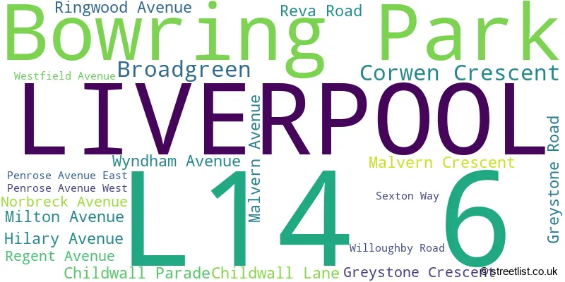
The largest settlement in the L14 6 postal code is LIVERPOOL followed by Broadgreen, and Bowring Park.
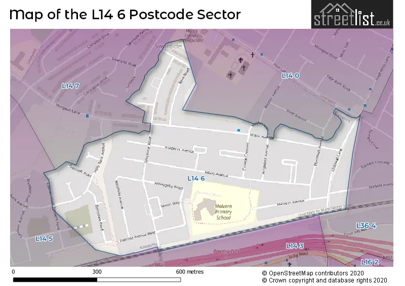
The L14 6 Postcode shares a border with L14 0 (LIVERPOOL, Bowring Park, Knotty Ash), L14 3 (LIVERPOOL, Broadgreen, Bowring Park), L14 5 (LIVERPOOL), L14 7 (LIVERPOOL, Knotty Ash, Dovecot) and L36 4 (LIVERPOOL, Huyton).
The sector is within the post town of LIVERPOOL.
L14 6 is a postcode sector within the L1 postcode district which is within the L Liverpool postcode area.
The Royal Mail delivery office for the L14 6 postal sector is the Liverpool 1-3.
The area of the L14 6 postcode sector is 0.17 square miles which is 0.45 square kilometres or 110.44 square acres.

Map of the L14 6 Postcode Sector
Explore the L14 6 postcode sector by using our free interactive map.
| L | 1 | 4 | - | 6 | X | X |
| L | 1 | 4 | Space | 6 | Letter | Letter |
Official List of Streets
Bowring Park (1 Streets)
LIVERPOOL (15 Streets)
Broadgreen (2 Streets)
Unofficial Streets or Alternative Spellings
Weather Forecast for L14 6
Press Button to Show Forecast for Knotty Ash
| Time Period | Icon | Description | Temperature | Rain Probability | Wind |
|---|---|---|---|---|---|
| 06:00 to 09:00 | Cloudy | 10.0°C (feels like 6.0°C) | 5.00% | SE 16 mph | |
| 09:00 to 12:00 | Cloudy | 12.0°C (feels like 8.0°C) | 8.00% | SE 18 mph | |
| 12:00 to 15:00 | Cloudy | 14.0°C (feels like 11.0°C) | 9.00% | SSE 18 mph | |
| 15:00 to 18:00 | Cloudy | 15.0°C (feels like 12.0°C) | 15.00% | SSE 16 mph | |
| 18:00 to 21:00 | Light rain shower (day) | 13.0°C (feels like 11.0°C) | 35.00% | SSE 11 mph | |
| 21:00 to 00:00 | Cloudy | 11.0°C (feels like 10.0°C) | 16.00% | SE 9 mph |
Press Button to Show Forecast for Knotty Ash
| Time Period | Icon | Description | Temperature | Rain Probability | Wind |
|---|---|---|---|---|---|
| 00:00 to 03:00 | Cloudy | 10.0°C (feels like 9.0°C) | 8.00% | SE 7 mph | |
| 03:00 to 06:00 | Cloudy | 9.0°C (feels like 8.0°C) | 4.00% | SE 7 mph | |
| 06:00 to 09:00 | Cloudy | 9.0°C (feels like 7.0°C) | 4.00% | SE 7 mph | |
| 09:00 to 12:00 | Cloudy | 11.0°C (feels like 10.0°C) | 5.00% | ESE 7 mph | |
| 12:00 to 15:00 | Cloudy | 14.0°C (feels like 13.0°C) | 8.00% | SE 7 mph | |
| 15:00 to 18:00 | Cloudy | 15.0°C (feels like 14.0°C) | 13.00% | SSE 7 mph | |
| 18:00 to 21:00 | Cloudy | 14.0°C (feels like 13.0°C) | 12.00% | WNW 7 mph | |
| 21:00 to 00:00 | Cloudy | 13.0°C (feels like 12.0°C) | 11.00% | NW 7 mph |
Press Button to Show Forecast for Knotty Ash
| Time Period | Icon | Description | Temperature | Rain Probability | Wind |
|---|---|---|---|---|---|
| 00:00 to 03:00 | Cloudy | 12.0°C (feels like 10.0°C) | 12.00% | NNW 7 mph | |
| 03:00 to 06:00 | Cloudy | 11.0°C (feels like 10.0°C) | 9.00% | NNW 7 mph | |
| 06:00 to 09:00 | Cloudy | 11.0°C (feels like 10.0°C) | 7.00% | NNW 7 mph | |
| 09:00 to 12:00 | Partly cloudy (day) | 13.0°C (feels like 11.0°C) | 5.00% | N 9 mph | |
| 12:00 to 15:00 | Sunny day | 16.0°C (feels like 14.0°C) | 5.00% | N 9 mph | |
| 15:00 to 18:00 | Sunny day | 17.0°C (feels like 15.0°C) | 3.00% | N 11 mph | |
| 18:00 to 21:00 | Sunny day | 17.0°C (feels like 14.0°C) | 4.00% | N 11 mph | |
| 21:00 to 00:00 | Clear night | 14.0°C (feels like 12.0°C) | 3.00% | NNE 9 mph |
Schools and Places of Education Within the L14 6 Postcode Sector
Malvern Primary School
Community school
Willoughby Road, Liverpool, Merseyside, L14 6XA
Head: Mr Tony James
Ofsted Rating: Good
Inspection: 2020-02-27 (1524 days ago)
Website: Visit Malvern Primary School Website
Phone: 01514778230
Number of Pupils: 468
House Prices in the L14 6 Postcode Sector
| Type of Property | 2018 Average | 2018 Sales | 2017 Average | 2017 Sales | 2016 Average | 2016 Sales | 2015 Average | 2015 Sales |
|---|---|---|---|---|---|---|---|---|
| Detached | £0 | 0 | £0 | 0 | £0 | 0 | £137,000 | 2 |
| Semi-Detached | £141,728 | 37 | £135,744 | 24 | £129,966 | 31 | £126,425 | 40 |
| Terraced | £113,000 | 5 | £126,988 | 4 | £121,000 | 5 | £118,325 | 6 |
| Flats | £0 | 0 | £0 | 0 | £0 | 0 | £0 | 0 |
Important Postcodes L14 6 in the Postcode Sector
L14 6XA is the postcode for Malvern Primary School, Willoughby Road, Broadgreen, and Malvern Primary School, Willoughby Road
| The L14 6 Sector is within these Local Authorities |
|
|---|---|
| The L14 6 Sector is within these Counties |
|
| The L14 6 Sector is within these Water Company Areas |
|