The L16 2 postcode sector is within the county of Merseyside.
Did you know? According to the 2021 Census, the L16 2 postcode sector is home to a bustling 2,455 residents!
Given that each sector allows for 400 unique postcode combinations. Letters C, I, K, M, O and V are not allowed in the last two letters of a postcode. With 35 postcodes already in use, this leaves 365 units available.
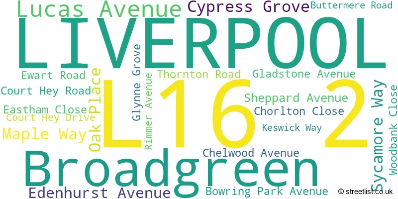
The largest settlements in the L16 2 postal code are LIVERPOOL and Broadgreen.
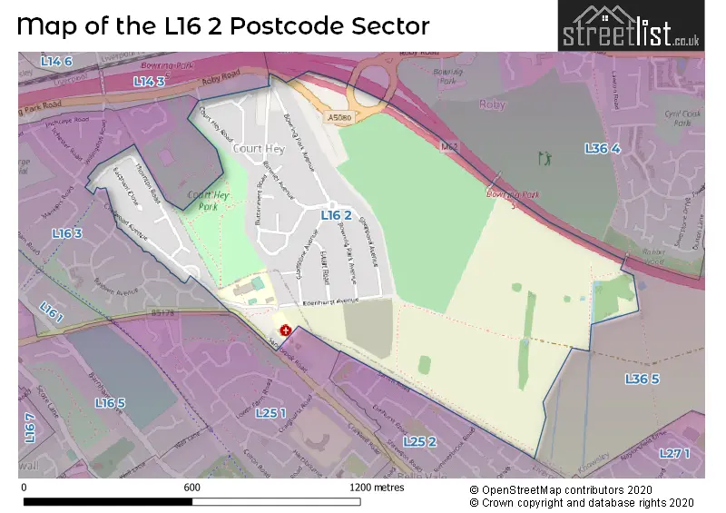
The L16 2 Postcode shares a border with L14 3 (LIVERPOOL, Broadgreen, Bowring Park), L16 3 (LIVERPOOL), L25 1 (LIVERPOOL, Childwall), L25 2 (LIVERPOOL, Belle Vale), L36 4 (LIVERPOOL, Huyton) and L36 5 (LIVERPOOL, Huyton).
The sector is within the post town of LIVERPOOL.
L16 2 is a postcode sector within the L1 postcode district which is within the L Liverpool postcode area.
The Royal Mail delivery office for the L16 2 postal sector is the Liverpool 1-3.
The area of the L16 2 postcode sector is 0.51 square miles which is 1.31 square kilometres or 323.91 square acres.

Map of the L16 2 Postcode Sector
Explore the L16 2 postcode sector by using our free interactive map.
| L | 1 | 6 | - | 2 | X | X |
| L | 1 | 6 | Space | 2 | Letter | Letter |
Official List of Streets
LIVERPOOL (20 Streets)
Broadgreen (1 Streets)
Unofficial Streets or Alternative Spellings
Weather Forecast for L16 2
Press Button to Show Forecast for National Wildflower Centre Liverpool
| Time Period | Icon | Description | Temperature | Rain Probability | Wind |
|---|---|---|---|---|---|
| 06:00 to 09:00 | Cloudy | 10.0°C (feels like 6.0°C) | 5.00% | SE 16 mph | |
| 09:00 to 12:00 | Partly cloudy (day) | 12.0°C (feels like 9.0°C) | 5.00% | SE 18 mph | |
| 12:00 to 15:00 | Cloudy | 15.0°C (feels like 11.0°C) | 9.00% | SSE 18 mph | |
| 15:00 to 18:00 | Cloudy | 15.0°C (feels like 12.0°C) | 15.00% | SSE 16 mph | |
| 18:00 to 21:00 | Light rain shower (day) | 14.0°C (feels like 11.0°C) | 35.00% | SSE 11 mph | |
| 21:00 to 00:00 | Cloudy | 11.0°C (feels like 10.0°C) | 16.00% | SE 9 mph |
Press Button to Show Forecast for National Wildflower Centre Liverpool
| Time Period | Icon | Description | Temperature | Rain Probability | Wind |
|---|---|---|---|---|---|
| 00:00 to 03:00 | Cloudy | 10.0°C (feels like 9.0°C) | 8.00% | SE 7 mph | |
| 03:00 to 06:00 | Cloudy | 9.0°C (feels like 8.0°C) | 4.00% | SE 7 mph | |
| 06:00 to 09:00 | Cloudy | 9.0°C (feels like 7.0°C) | 4.00% | SE 7 mph | |
| 09:00 to 12:00 | Cloudy | 12.0°C (feels like 10.0°C) | 5.00% | ESE 7 mph | |
| 12:00 to 15:00 | Cloudy | 15.0°C (feels like 14.0°C) | 8.00% | SE 7 mph | |
| 15:00 to 18:00 | Cloudy | 16.0°C (feels like 14.0°C) | 13.00% | ENE 7 mph | |
| 18:00 to 21:00 | Cloudy | 15.0°C (feels like 14.0°C) | 12.00% | NNE 7 mph | |
| 21:00 to 00:00 | Cloudy | 13.0°C (feels like 12.0°C) | 11.00% | NNW 7 mph |
Press Button to Show Forecast for National Wildflower Centre Liverpool
| Time Period | Icon | Description | Temperature | Rain Probability | Wind |
|---|---|---|---|---|---|
| 00:00 to 03:00 | Cloudy | 12.0°C (feels like 10.0°C) | 11.00% | N 7 mph | |
| 03:00 to 06:00 | Cloudy | 11.0°C (feels like 10.0°C) | 9.00% | NNW 7 mph | |
| 06:00 to 09:00 | Cloudy | 11.0°C (feels like 10.0°C) | 7.00% | NNW 7 mph | |
| 09:00 to 12:00 | Cloudy | 13.0°C (feels like 12.0°C) | 8.00% | N 9 mph | |
| 12:00 to 15:00 | Sunny day | 16.0°C (feels like 14.0°C) | 5.00% | N 9 mph | |
| 15:00 to 18:00 | Sunny day | 18.0°C (feels like 15.0°C) | 3.00% | N 11 mph | |
| 18:00 to 21:00 | Sunny day | 17.0°C (feels like 14.0°C) | 4.00% | N 11 mph | |
| 21:00 to 00:00 | Clear night | 14.0°C (feels like 12.0°C) | 3.00% | NNE 9 mph |
Schools and Places of Education Within the L16 2 Postcode Sector
St Paschal Baylon Catholic Primary School
Voluntary aided school
Chelwood Avenue, Liverpool, Merseyside, L16 2LN
Head: Mr Edward Flood
Ofsted Rating: Good
Inspection: 2023-05-17 (349 days ago)
Website: Visit St Paschal Baylon Catholic Primary School Website
Phone: 01517220464
Number of Pupils: 413
House Prices in the L16 2 Postcode Sector
| Type of Property | 2018 Average | 2018 Sales | 2017 Average | 2017 Sales | 2016 Average | 2016 Sales | 2015 Average | 2015 Sales |
|---|---|---|---|---|---|---|---|---|
| Detached | £218,333 | 3 | £198,500 | 2 | £165,000 | 1 | £179,000 | 1 |
| Semi-Detached | £200,234 | 19 | £198,886 | 18 | £181,213 | 16 | £167,714 | 21 |
| Terraced | £174,050 | 10 | £147,167 | 9 | £172,750 | 2 | £149,304 | 13 |
| Flats | £78,000 | 1 | £0 | 0 | £70,000 | 1 | £0 | 0 |
Important Postcodes L16 2 in the Postcode Sector
L16 2LN is the postcode for St. Paschal Baylon Primary School, Chelwood Avenue
| The L16 2 Sector is within these Local Authorities |
|
|---|---|
| The L16 2 Sector is within these Counties |
|
| The L16 2 Sector is within these Water Company Areas |
|