The LS12 6 postcode sector is within the county of West Yorkshire.
Did you know? According to the 2021 Census, the LS12 6 postcode sector is home to a bustling 2,304 residents!
Given that each sector allows for 400 unique postcode combinations. Letters C, I, K, M, O and V are not allowed in the last two letters of a postcode. With 111 postcodes already in use, this leaves 289 units available.
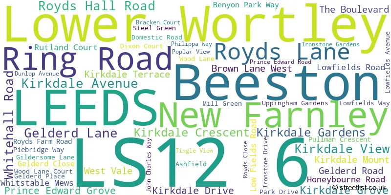
The largest settlement in the LS12 6 postal code is LEEDS followed by Lower Wortley, and New Farnley.
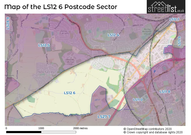
The LS12 6 Postcode shares a border with LS11 9 (LEEDS), LS12 5 (LEEDS, Farnley, New Farnley), LS12 4 (LEEDS, Lower Wortley), LS12 1 (LEEDS, Armley), LS11 0 (LEEDS) and LS27 7 (Morley).
The sector is within the post town of LEEDS.
LS12 6 is a postcode sector within the LS1 postcode district which is within the LS Leeds postcode area.
The Royal Mail delivery office for the LS12 6 postal sector is the Leeds City Delivery Office.
The area of the LS12 6 postcode sector is 1.81 square miles which is 4.68 square kilometres or 1,155.33 square acres.
The LS12 6 postcode sector is crossed by the M621 motorway.

Map of the LS12 6 Postcode Sector
Explore the LS12 6 postcode sector by using our free interactive map.
| L | S | 1 | 2 | - | 6 | X | X |
| L | S | 1 | 2 | Space | 6 | Letter | Letter |
Official List of Streets
LEEDS (46 Streets)
Lower Wortley (2 Streets)
Beeston (2 Streets)
Unofficial Streets or Alternative Spellings
LEEDS
BROWN AVENUE BROWN PLACE BROWN ROAD COACH ROAD COPLEY HILL COPLEY HILL WAY WALSH LANE WOLLEY AVENUE WORTLEY LANE BEESTON INTERCHANGE CARLTON COURT EDWARD WAY ELLAND ROAD INTERCHANGE INGRAM DISTRIBUTOR LATCHMORE ROAD LOW FIELDS AVENUE LOW FIELDS WAY PAVILION BUSINESS PARK RING ROAD BEESTON RING ROAD LOW WORTLEY RINGWAYS ROUNDABOUT THE TRISTRAM CENTRE UNITED BUSINESS PARK WORTLEY SUBWAYLower Wortley
BRANCH ROADMorley
BROOK RISE GILDERSOME LANE WISE CRESCENTDrighlington
WHITEHALL ROADSchools and Places of Education Within the LS12 6 Postcode Sector
The Elland Academy
Free schools alternative provision
Gelderd Road, Leeds, West Yorkshire, LS12 6DQ
Head: Mr Edward Staton
Ofsted Rating: Good
Inspection: 2023-07-04 (324 days ago)
Website: Visit The Elland Academy Website
Phone: 01132127010
Number of Pupils: 2
House Prices in the LS12 6 Postcode Sector
| Type of Property | 2018 Average | 2018 Sales | 2017 Average | 2017 Sales | 2016 Average | 2016 Sales | 2015 Average | 2015 Sales |
|---|---|---|---|---|---|---|---|---|
| Detached | £299,525 | 17 | £284,496 | 12 | £282,623 | 8 | £250,082 | 6 |
| Semi-Detached | £192,458 | 37 | £181,130 | 41 | £173,414 | 42 | £138,410 | 17 |
| Terraced | £187,277 | 9 | £196,413 | 14 | £189,359 | 26 | £203,818 | 11 |
| Flats | £116,660 | 21 | £98,752 | 18 | £109,690 | 13 | £96,027 | 3 |
Important Postcodes LS12 6 in the Postcode Sector
LS12 6AB is the postcode for Thebigword Group, Link up House, Ring Road
LS12 6DD is the postcode for Environment Agency, Olympia House, Gelderd Lane
LS12 6DQ is the postcode for The Elland Academy, Gelderd House
LS12 6LL is the postcode for The Big Word, Unit 4, Royds Close
| The LS12 6 Sector is within these Local Authorities |
|
|---|---|
| The LS12 6 Sector is within these Counties |
|
| The LS12 6 Sector is within these Water Company Areas |
|