The M41 5 postcode sector is within the county of Greater Manchester.
Did you know? According to the 2021 Census, the M41 5 postcode sector is home to a bustling 6,591 residents!
Given that each sector allows for 400 unique postcode combinations. Letters C, I, K, M, O and V are not allowed in the last two letters of a postcode. With 170 postcodes already in use, this leaves 230 units available.
The M41 5 postal code covers the settlement of Urmston.
The M41 5 Postcode shares a border with M41 9 (Urmston), M41 6 (Urmston), M41 7 (Urmston), M41 0 (Urmston) and M41 8 (Urmston).
The sector is within the post town of MANCHESTER.
M41 5 is a postcode sector within the M41 postcode district which is within the M Manchester postcode area.
The Royal Mail delivery office for the M41 5 postal sector is the Urmston Delivery Office.
The area of the M41 5 postcode sector is 0.69 square miles which is 1.80 square kilometres or 444.72 square acres.


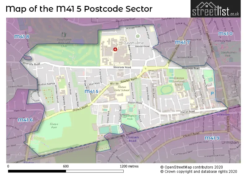
Map of the M41 5 Postcode Sector
Explore the M41 5 postcode sector by using our free interactive map.
| M | 4 | 1 | - | 5 | X | X |
| M | 4 | 1 | Space | 5 | Letter | Letter |
Official List of Streets
Urmston (86 Streets)
Unofficial Streets or Alternative Spellings
Weather Forecast for M41 5
Press Button to Show Forecast for Urmston
| Time Period | Icon | Description | Temperature | Rain Probability | Wind |
|---|---|---|---|---|---|
| 12:00 to 15:00 | Cloudy | 9.0°C (feels like 7.0°C) | 6.00% | E 9 mph | |
| 15:00 to 18:00 | Cloudy | 9.0°C (feels like 7.0°C) | 8.00% | ESE 9 mph | |
| 18:00 to 21:00 | Cloudy | 8.0°C (feels like 6.0°C) | 49.00% | E 9 mph | |
| 21:00 to 00:00 | Cloudy | 7.0°C (feels like 5.0°C) | 7.00% | ENE 7 mph |
Press Button to Show Forecast for Urmston
| Time Period | Icon | Description | Temperature | Rain Probability | Wind |
|---|---|---|---|---|---|
| 00:00 to 03:00 | Cloudy | 6.0°C (feels like 4.0°C) | 4.00% | ENE 7 mph | |
| 03:00 to 06:00 | Partly cloudy (night) | 5.0°C (feels like 3.0°C) | 2.00% | NE 7 mph | |
| 06:00 to 09:00 | Partly cloudy (day) | 5.0°C (feels like 3.0°C) | 2.00% | NE 7 mph | |
| 09:00 to 12:00 | Cloudy | 8.0°C (feels like 6.0°C) | 5.00% | ENE 9 mph | |
| 12:00 to 15:00 | Overcast | 10.0°C (feels like 8.0°C) | 13.00% | ENE 9 mph | |
| 15:00 to 18:00 | Cloudy | 10.0°C (feels like 8.0°C) | 16.00% | ENE 9 mph | |
| 18:00 to 21:00 | Overcast | 9.0°C (feels like 7.0°C) | 10.00% | ENE 9 mph | |
| 21:00 to 00:00 | Cloudy | 8.0°C (feels like 5.0°C) | 5.00% | NE 7 mph |
Press Button to Show Forecast for Urmston
| Time Period | Icon | Description | Temperature | Rain Probability | Wind |
|---|---|---|---|---|---|
| 00:00 to 03:00 | Cloudy | 6.0°C (feels like 4.0°C) | 4.00% | NE 7 mph | |
| 03:00 to 06:00 | Cloudy | 6.0°C (feels like 3.0°C) | 6.00% | NNE 7 mph | |
| 06:00 to 09:00 | Cloudy | 6.0°C (feels like 4.0°C) | 12.00% | N 7 mph | |
| 09:00 to 12:00 | Cloudy | 8.0°C (feels like 5.0°C) | 15.00% | NNW 7 mph | |
| 12:00 to 15:00 | Light rain | 10.0°C (feels like 7.0°C) | 44.00% | NW 9 mph | |
| 15:00 to 18:00 | Cloudy | 11.0°C (feels like 8.0°C) | 10.00% | WNW 11 mph | |
| 18:00 to 21:00 | Partly cloudy (day) | 10.0°C (feels like 8.0°C) | 4.00% | W 9 mph | |
| 21:00 to 00:00 | Clear night | 8.0°C (feels like 6.0°C) | 1.00% | WSW 7 mph |
Press Button to Show Forecast for Urmston
| Time Period | Icon | Description | Temperature | Rain Probability | Wind |
|---|---|---|---|---|---|
| 00:00 to 03:00 | Partly cloudy (night) | 6.0°C (feels like 4.0°C) | 1.00% | SSW 7 mph | |
| 03:00 to 06:00 | Partly cloudy (night) | 5.0°C (feels like 3.0°C) | 2.00% | SSE 7 mph | |
| 06:00 to 09:00 | Cloudy | 6.0°C (feels like 3.0°C) | 5.00% | SSE 7 mph | |
| 09:00 to 12:00 | Partly cloudy (day) | 10.0°C (feels like 8.0°C) | 2.00% | S 11 mph | |
| 12:00 to 15:00 | Cloudy | 13.0°C (feels like 10.0°C) | 7.00% | S 13 mph | |
| 15:00 to 18:00 | Cloudy | 14.0°C (feels like 11.0°C) | 10.00% | S 13 mph | |
| 18:00 to 21:00 | Partly cloudy (day) | 13.0°C (feels like 11.0°C) | 6.00% | SSE 11 mph | |
| 21:00 to 00:00 | Clear night | 11.0°C (feels like 9.0°C) | 3.00% | SSE 9 mph |
Press Button to Show Forecast for Urmston
| Time Period | Icon | Description | Temperature | Rain Probability | Wind |
|---|---|---|---|---|---|
| 00:00 to 03:00 | Partly cloudy (night) | 9.0°C (feels like 7.0°C) | 4.00% | SE 9 mph | |
| 03:00 to 06:00 | Partly cloudy (night) | 8.0°C (feels like 6.0°C) | 3.00% | SE 9 mph | |
| 06:00 to 09:00 | Sunny day | 9.0°C (feels like 7.0°C) | 3.00% | ESE 9 mph | |
| 09:00 to 12:00 | Partly cloudy (day) | 13.0°C (feels like 10.0°C) | 4.00% | ESE 11 mph | |
| 12:00 to 15:00 | Partly cloudy (day) | 15.0°C (feels like 12.0°C) | 7.00% | SE 13 mph | |
| 15:00 to 18:00 | Partly cloudy (day) | 16.0°C (feels like 13.0°C) | 10.00% | SE 11 mph | |
| 18:00 to 21:00 | Partly cloudy (day) | 15.0°C (feels like 13.0°C) | 7.00% | ESE 9 mph | |
| 21:00 to 00:00 | Cloudy | 13.0°C (feels like 11.0°C) | 7.00% | ESE 9 mph |
Schools and Places of Education Within the M41 5 Postcode Sector
English Martyrs' RC Primary School
Voluntary aided school
Wycliffe Road, Manchester, , M41 5AH
Head: Mrs Alison McGlade
Ofsted Rating: Good
Inspection: 2023-02-23 (428 days ago)
Website: Visit English Martyrs' RC Primary School Website
Phone: 01617487257
Number of Pupils: 232
Flixton Girls School
Academy converter
Flixton Road, Manchester, , M41 5DR
Head: Mrs Dorothy Trussell
Ofsted Rating: Good
Inspection: 2023-11-29 (149 days ago)
Website: Visit Flixton Girls School Website
Phone: 01619600160
Number of Pupils: 927
Flixton Primary School
Community school
Delamere Road, Manchester, , M41 5QL
Head: Mr Jason Redmond
Ofsted Rating: Good
Inspection: 2021-06-17 (1044 days ago)
Website: Visit Flixton Primary School Website
Phone: 01617485141
Number of Pupils: 450
St Mary's CofE Primary School
Voluntary aided school
Cornhill Rd, Manchester, , M41 5TJ
Head: Mrs Alison Daniel
Ofsted Rating: Good
Inspection: 2021-11-11 (897 days ago)
Website: Visit St Mary's CofE Primary School Website
Phone: 01619122728
Number of Pupils: 194
Urmston Grammar Academy
Academy converter
Newton Road, Manchester, , M41 5UG
Head: Mrs Riffat Wall
Ofsted Rating: Good
Inspection: 2022-05-25 (702 days ago)
Website: Visit Urmston Grammar Academy Website
Phone: 01617482875
Number of Pupils: 1100
Urmston Primary School
Community school
Wycliffe Road, Manchester, , M41 5AH
Head: Mr Simon Parker
Ofsted Rating: Good
Inspection: 2023-05-26 (336 days ago)
Website: Visit Urmston Primary School Website
Phone: 01617484362
Number of Pupils: 503
House Prices in the M41 5 Postcode Sector
| Type of Property | 2018 Average | 2018 Sales | 2017 Average | 2017 Sales | 2016 Average | 2016 Sales | 2015 Average | 2015 Sales |
|---|---|---|---|---|---|---|---|---|
| Detached | £388,968 | 17 | £373,548 | 21 | £340,154 | 29 | £361,812 | 12 |
| Semi-Detached | £304,383 | 36 | £271,059 | 55 | £262,349 | 56 | £231,439 | 49 |
| Terraced | £241,082 | 22 | £240,870 | 36 | £236,925 | 31 | £196,771 | 33 |
| Flats | £182,028 | 51 | £169,580 | 32 | £118,708 | 13 | £113,235 | 17 |
Important Postcodes M41 5 in the Postcode Sector
M41 5AH is the postcode for English Martyrs RC Primary School, Wycliffe Road, Urmston, Urmston Infant School, Wycliffe Road, and English Martyrs RC School, Wycliffe Road
M41 5AJ is the postcode for Urmston Junior School, Hereford Grove
M41 5DL is the postcode for SHAWE VIEW RESIDENTIAL CARE HOME, 10-12 SHAWE ROAD, FLIXTON, and Shawe View Hostel, 10-12 Shawe Road
M41 5DR is the postcode for Flixton Girls School, Flixton Road, ART BLOCK, Flixton Girls School, Flixton Road, Flixton Girls School, Flixton Road, Urmston, DINING HALL BUILDING, Flixton Girls School, Flixton Road, and 6TH FORM BUILDING, Flixton Girls School, Flixton Road
M41 5GW is the postcode for Trafford Medical Education Service, 350 Flixton Road
M41 5QL is the postcode for Flixton Primary School, Junior Department, Delamere Road, FLIXTON PRIMARY SCHOOL, Flixton Junior School, Delamere Road, and Flixton Junior School, Delamere Road
M41 5RR is the postcode for Move URMSTON, URMSTON LEISURE CENTRE, BOWFELL ROAD, and Urmston Leisure Centre, Bowfell Road
M41 5SA is the postcode for Flixton Infant School, Mardale Avenue, Flixton Primary School, Infant Department, Mardale Avenue, and FLIXTON PRIMARY SCHOOL, Flixton Infant School, Mardale Avenue
M41 5SL is the postcode for PATHOLOGY LABORATORY, MANCHESTER UNIVERSITY NHS FOUNDATION TRUST, TRAFFORD GENERAL HOSPITAL, Manchester University NHS Foundation Trust, Trafford General Hospital, Moorside Road, PATHOLOGY LABORATORY, Manchester University NHS Foundation Trust, Trafford General Hospital, Moorside Road, BEREAVEMENT CENTRE, Manchester University NHS Foundation Trust, Trafford General Hospital, Moorside Road, MOORSIDE UNIT, Trafford General Hospital, Moorside Road, GREENWAY, Manchester University NHS Foundation Trust, Trafford General Hospital, Moorside Road, Greater Manchester West Mental Health NHS Foundation Trust, Trafford Hospital Site, MACMILLAN UNIT, Manchester University NHS Foundation Trust, Trafford General Hospital, Moorside Road, and EDUCATION CENTRE & NURSES HOME, Manchester University NHS Foundation Trust, Trafford General Hospital, Moorside Road
M41 5SZ is the postcode for Cornhill Clinic, 59 Cornhill Road
M41 5TJ is the postcode for St. Mary's C.E. (Aided) Primary School, Cornhill Road, and St Mary's CofE Primary School, Cornhill Road, Davyhulme
M41 5TQ is the postcode for PARK HOUSE, 59, Bowers Avenue, Urmston
M41 5UG is the postcode for Urmston Grammar School, Newton Road, and URMSTON GRAMMAR SCHOOL, NEWTON ROAD, URMSTON
| The M41 5 Sector is within these Local Authorities |
|
|---|---|
| The M41 5 Sector is within these Counties |
|
| The M41 5 Sector is within these Water Company Areas |
|