The M8 0 postcode sector is within the county of Greater Manchester.
Did you know? According to the 2021 Census, the M8 0 postcode sector is home to a bustling 11,194 residents!
Given that each sector allows for 400 unique postcode combinations. Letters C, I, K, M, O and V are not allowed in the last two letters of a postcode. With 200 postcodes already in use, this leaves 200 units available.
The M8 0 postal code covers the settlement of MANCHESTER.
The M8 0 Postcode shares a border with M8 5 (MANCHESTER, Crumpsall), M8 9 (MANCHESTER), M9 5 (MANCHESTER, Harpurhey), M8 8 (MANCHESTER) and M40 7 (MANCHESTER).
The sector is within the post town of MANCHESTER.
M8 0 is a postcode sector within the M8 postcode district which is within the M Manchester postcode area.
The Royal Mail delivery office for the M8 0 postal sector is the Manchester North Delivery Office.
The area of the M8 0 postcode sector is 0.51 square miles which is 1.33 square kilometres or 329.42 square acres.
Waterways within the M8 0 postcode sector include the River Irk.

Map of the M8 0 Postcode Sector
Explore the M8 0 postcode sector by using our free interactive map.
| M | 8 | - | 0 | X | X |
| M | 8 | Space | 0 | Letter | Letter |
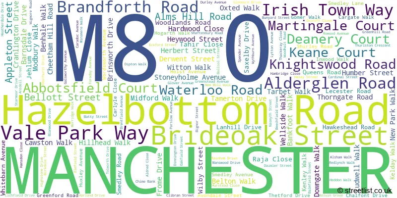
Official List of Streets
MANCHESTER (131 Streets)
Unofficial Streets or Alternative Spellings
MANCHESTER
ABERCARN CLOSE CHEETWOOD ROAD CRESCENT ROAD DARESBURY STREET ELIZABETH STREET ESMOND ROAD LARCH GARDENS LEVENHURST ROAD MOORDOWN CLOSE PENROSE CLOSE SCHOOLSIDE CLOSE SMEDLEY STREET ALDERFORD DRIVE ALSHAW WALK AMWELL STREET BROADOAK COURT GRANSDEN DRIVE HODDESDON STREET IRKDALE STREET MAGNOLIA DRIVE SMEATON STREET TURLEY STREETWeather Forecast for M8 0
Press Button to Show Forecast for Higher Broughton
| Time Period | Icon | Description | Temperature | Rain Probability | Wind |
|---|---|---|---|---|---|
| 18:00 to 21:00 | Cloudy | 22.0°C (feels like 22.0°C) | 3.00% | ESE 4 mph | |
| 21:00 to 00:00 | Partly cloudy (night) | 19.0°C (feels like 18.0°C) | 1.00% | ESE 4 mph |
Press Button to Show Forecast for Higher Broughton
| Time Period | Icon | Description | Temperature | Rain Probability | Wind |
|---|---|---|---|---|---|
| 00:00 to 03:00 | Cloudy | 17.0°C (feels like 16.0°C) | 3.00% | ESE 4 mph | |
| 03:00 to 06:00 | Cloudy | 16.0°C (feels like 16.0°C) | 4.00% | ESE 4 mph | |
| 06:00 to 09:00 | Cloudy | 16.0°C (feels like 16.0°C) | 3.00% | ESE 4 mph | |
| 09:00 to 12:00 | Partly cloudy (day) | 19.0°C (feels like 18.0°C) | 1.00% | SSE 4 mph | |
| 12:00 to 15:00 | Cloudy | 22.0°C (feels like 20.0°C) | 3.00% | SSE 9 mph | |
| 15:00 to 18:00 | Cloudy | 23.0°C (feels like 21.0°C) | 4.00% | SSE 9 mph | |
| 18:00 to 21:00 | Cloudy | 21.0°C (feels like 20.0°C) | 4.00% | SE 9 mph | |
| 21:00 to 00:00 | Cloudy | 18.0°C (feels like 17.0°C) | 4.00% | ESE 9 mph |
Press Button to Show Forecast for Higher Broughton
| Time Period | Icon | Description | Temperature | Rain Probability | Wind |
|---|---|---|---|---|---|
| 00:00 to 03:00 | Cloudy | 16.0°C (feels like 15.0°C) | 4.00% | ESE 7 mph | |
| 03:00 to 06:00 | Cloudy | 14.0°C (feels like 13.0°C) | 4.00% | E 7 mph | |
| 06:00 to 09:00 | Cloudy | 15.0°C (feels like 14.0°C) | 3.00% | E 7 mph | |
| 09:00 to 12:00 | Cloudy | 18.0°C (feels like 17.0°C) | 3.00% | ESE 7 mph | |
| 12:00 to 15:00 | Cloudy | 21.0°C (feels like 19.0°C) | 9.00% | SE 9 mph | |
| 15:00 to 18:00 | Thunder | 21.0°C (feels like 19.0°C) | 60.00% | SSE 11 mph | |
| 18:00 to 21:00 | Heavy rain shower (day) | 18.0°C (feels like 17.0°C) | 60.00% | S 7 mph | |
| 21:00 to 00:00 | Light rain shower (night) | 16.0°C (feels like 16.0°C) | 38.00% | SSE 7 mph |
Press Button to Show Forecast for Higher Broughton
| Time Period | Icon | Description | Temperature | Rain Probability | Wind |
|---|---|---|---|---|---|
| 00:00 to 03:00 | Cloudy | 15.0°C (feels like 15.0°C) | 12.00% | SSE 4 mph | |
| 03:00 to 06:00 | Partly cloudy (night) | 14.0°C (feels like 13.0°C) | 10.00% | SSE 4 mph | |
| 06:00 to 09:00 | Cloudy | 14.0°C (feels like 13.0°C) | 12.00% | SSE 7 mph | |
| 09:00 to 12:00 | Cloudy | 15.0°C (feels like 14.0°C) | 17.00% | SSE 9 mph | |
| 12:00 to 15:00 | Light rain shower (day) | 17.0°C (feels like 15.0°C) | 41.00% | SSE 11 mph | |
| 15:00 to 18:00 | Heavy rain | 17.0°C (feels like 14.0°C) | 78.00% | SSE 11 mph | |
| 18:00 to 21:00 | Heavy rain | 15.0°C (feels like 14.0°C) | 83.00% | SSE 11 mph | |
| 21:00 to 00:00 | Heavy rain | 14.0°C (feels like 12.0°C) | 76.00% | SSE 9 mph |
Press Button to Show Forecast for Higher Broughton
| Time Period | Icon | Description | Temperature | Rain Probability | Wind |
|---|---|---|---|---|---|
| 00:00 to 03:00 | Light rain | 13.0°C (feels like 11.0°C) | 52.00% | SE 9 mph | |
| 03:00 to 06:00 | Cloudy | 12.0°C (feels like 10.0°C) | 16.00% | SE 9 mph | |
| 06:00 to 09:00 | Cloudy | 12.0°C (feels like 10.0°C) | 8.00% | SE 9 mph | |
| 09:00 to 12:00 | Light rain shower (day) | 14.0°C (feels like 12.0°C) | 35.00% | SSE 11 mph | |
| 12:00 to 15:00 | Light rain shower (day) | 16.0°C (feels like 13.0°C) | 40.00% | SSE 13 mph | |
| 15:00 to 18:00 | Light rain shower (day) | 16.0°C (feels like 13.0°C) | 40.00% | SSE 13 mph | |
| 18:00 to 21:00 | Light rain shower (day) | 15.0°C (feels like 13.0°C) | 37.00% | S 11 mph | |
| 21:00 to 00:00 | Light rain shower (night) | 13.0°C (feels like 11.0°C) | 30.00% | SSE 9 mph |

House Prices in the M8 0 Postcode Sector
| Type of Property | 2018 Average | 2018 Sales | 2017 Average | 2017 Sales | 2016 Average | 2016 Sales | 2015 Average | 2015 Sales |
|---|---|---|---|---|---|---|---|---|
| Detached | £152,500 | 2 | £125,650 | 3 | £104,950 | 1 | £188,333 | 3 |
| Semi-Detached | £155,042 | 12 | £129,836 | 19 | £115,575 | 20 | £118,460 | 15 |
| Terraced | £121,622 | 37 | £93,510 | 41 | £100,698 | 30 | £82,784 | 41 |
| Flats | £104,795 | 19 | £87,364 | 22 | £74,864 | 11 | £68,586 | 14 |
Important Postcodes M8 0 in the Postcode Sector
M8 0AD is the postcode for Northwards Housing, Unit 11, Vale Park Way
M8 0NE is the postcode for Manchester City Council, Woodville Resource Centre, Shirley Road
M8 0SP is the postcode for St. Chads RC Primary School, Balmfield Street, and MAIN SCHOOL BUILDING, St. Chads RC Primary School, Balmfield Street
| The M8 0 Sector is within these Local Authorities |
|
|---|---|
| The M8 0 Sector is within these Counties |
|
| The M8 0 Sector is within these Water Company Areas |
|