The PO36 0 postcode sector is within the county of Isle of Wight.
Did you know? According to the 2021 Census, the PO36 0 postcode sector is home to a bustling 4,564 residents!
Given that each sector allows for 400 unique postcode combinations. Letters C, I, K, M, O and V are not allowed in the last two letters of a postcode. With 165 postcodes already in use, this leaves 235 units available.
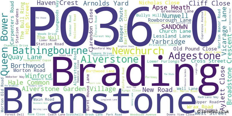
The largest settlement in the PO36 0 postal code is Brading followed by Apse Heath, and Newchurch.
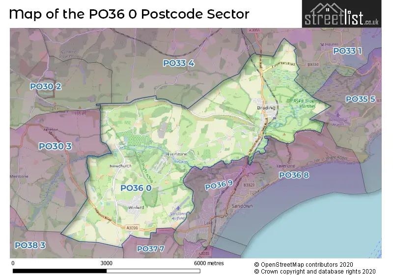
The PO36 0 Postcode shares a border with PO33 1 (RYDE, St. Helens, Oakfield), PO37 7 (SHANKLIN), PO30 2 (NEWPORT, Binfield, Barton), PO30 3 (NEWPORT, Shorwell, Arreton), PO33 4 (Wootton Bridge, RYDE, Havenstreet), PO35 5 (BEMBRIDGE), PO36 8 (SANDOWN), PO36 9 (SANDOWN) and PO38 3 (Wroxall, Godshill, Rookley).
The sector is within the post town of SANDOWN.
PO36 0 is a postcode sector within the PO3 postcode district which is within the PO Portsmouth postcode area.
The Royal Mail delivery office for the PO36 0 postal sector is the unknown.
The area of the PO36 0 postcode sector is 9.41 square miles which is 24.37 square kilometres or 6,022.46 square acres.
Waterways within the PO36 0 postcode sector include the River Yar.

Map of the PO36 0 Postcode Sector
Explore the PO36 0 postcode sector by using our free interactive map.
| P | O | 3 | 6 | - | 0 | X | X |
| P | O | 3 | 6 | Space | 0 | Letter | Letter |
Official List of Streets
Apse Heath (10 Streets)
Brading (40 Streets)
Newchurch (18 Streets)
Bathingbourne (2 Streets)
Borthwood (1 Streets)
Branstone (3 Streets)
Winford (6 Streets)
Alverstone Garden Village (5 Streets)
Adgestone (3 Streets)
SANDOWN (1 Streets)
Unofficial Streets or Alternative Spellings
Brading
LOWER ADGESTONE ROADSANDOWN
YAVERLAND ROADBEMBRIDGE
SANDOWN ROADRYDE
ASHEY ROADSHANKLIN
APSE MANOR ROADWhiteley Bank
CANTEEN ROADHavenstreet
ROWLANDS LANEHale Common
MACKETTS LANESchools and Places of Education Within the PO36 0 Postcode Sector
Brading Church of England Controlled Primary School
Voluntary controlled school
West Street, Sandown, Isle of Wight, PO36 0DS
Head: Mrs Beverley Gilbert
Ofsted Rating: Good
Inspection: 2020-02-11 (1563 days ago)
Website: Visit Brading Church of England Controlled Primary School Website
Phone: 01983407217
Number of Pupils: 195
Newchurch Primary School
Community school
School Lane, Sandown, Isle of Wight, PO36 0NL
Head: Miss Kirsty Howarth
Ofsted Rating: Good
Inspection: 2018-11-01 (2030 days ago)
Website: Visit Newchurch Primary School Website
Phone: 01983865210
Number of Pupils: 212
House Prices in the PO36 0 Postcode Sector
| Type of Property | 2018 Average | 2018 Sales | 2017 Average | 2017 Sales | 2016 Average | 2016 Sales | 2015 Average | 2015 Sales |
|---|---|---|---|---|---|---|---|---|
| Detached | £311,278 | 50 | £309,120 | 54 | £285,875 | 45 | £263,182 | 67 |
| Semi-Detached | £227,131 | 18 | £224,972 | 21 | £198,220 | 20 | £212,846 | 13 |
| Terraced | £165,000 | 5 | £153,333 | 15 | £159,684 | 19 | £159,389 | 9 |
| Flats | £123,550 | 10 | £87,975 | 9 | £94,333 | 9 | £91,938 | 8 |
Important Postcodes PO36 0 in the Postcode Sector
PO36 0DS is the postcode for Brading C of E Primary School, West Street, Brading
PO36 0NL is the postcode for Newchurch Primary School, School Lane, Newchurch, and Newchurch Cp School, School Lane
| The PO36 0 Sector is within these Local Authorities |
|
|---|---|
| The PO36 0 Sector is within these Counties |
|
| The PO36 0 Sector is within these Water Company Areas |
|