The RH18 5 postcode sector stands on the East Sussex and West Sussex border.
Did you know? According to the 2021 Census, the RH18 5 postcode sector is home to a bustling 4,476 residents!
Given that each sector allows for 400 unique postcode combinations. Letters C, I, K, M, O and V are not allowed in the last two letters of a postcode. With 143 postcodes already in use, this leaves 257 units available.
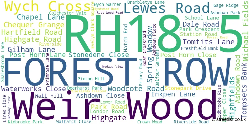
The largest settlement in the RH18 5 postal code is FOREST ROW followed by Wych Cross, and Weir Wood.
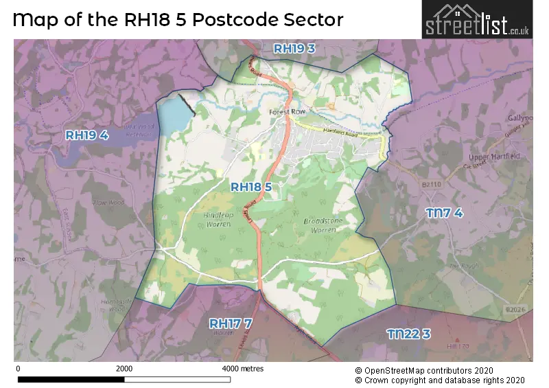
The RH18 5 Postcode shares a border with RH19 3 (EAST GRINSTEAD, Ashurst Wood, Hammerwood), TN22 3 (Nutley, Five Ash Down, Sheffield Park), RH17 7 (Horsted Keynes, Scaynes Hill, HAYWARDS HEATH), RH19 4 (EAST GRINSTEAD, Sharpthorne, West Hoathly) and TN7 4 (HARTFIELD, Withyham, Upper Hartfield).
The sector is within the post town of FOREST ROW.
RH18 5 is a postcode sector within the RH18 postcode district which is within the RH Redhill postcode area.
The Royal Mail delivery office for the RH18 5 postal sector is the East Grinstead Delivery Office.
The area of the RH18 5 postcode sector is 7.47 square miles which is 19.35 square kilometres or 4,782.39 square acres.

Map of the RH18 5 Postcode Sector
Explore the RH18 5 postcode sector by using our free interactive map.
| R | H | 1 | 8 | - | 5 | X | X |
| R | H | 1 | 8 | Space | 5 | Letter | Letter |
Official List of Streets
FOREST ROW (53 Streets)
Wych Cross (1 Streets)
Unofficial Streets or Alternative Spellings
FOREST ROW
RYST WOOD ROAD WALL HILLEAST GRINSTEAD
LEGSHEATH LANE LEWES ROADAshurst Wood
WALL HILL ROADChelwood Gate
LEWES ROADSharpthorne
PLAWHATCH LANEWeather Forecast for RH18 5
Press Button to Show Forecast for Standen
| Time Period | Icon | Description | Temperature | Rain Probability | Wind |
|---|---|---|---|---|---|
| 03:00 to 06:00 | Heavy rain | 10.0°C (feels like 8.0°C) | 81.00% | SSE 9 mph | |
| 06:00 to 09:00 | Overcast | 9.0°C (feels like 8.0°C) | 23.00% | S 7 mph | |
| 09:00 to 12:00 | Thunder | 11.0°C (feels like 9.0°C) | 66.00% | WSW 9 mph | |
| 12:00 to 15:00 | Light rain | 8.0°C (feels like 4.0°C) | 54.00% | W 16 mph | |
| 15:00 to 18:00 | Cloudy | 9.0°C (feels like 6.0°C) | 45.00% | W 11 mph | |
| 18:00 to 21:00 | Cloudy | 9.0°C (feels like 7.0°C) | 9.00% | SW 9 mph | |
| 21:00 to 00:00 | Partly cloudy (night) | 7.0°C (feels like 6.0°C) | 1.00% | S 7 mph |
Press Button to Show Forecast for Standen
| Time Period | Icon | Description | Temperature | Rain Probability | Wind |
|---|---|---|---|---|---|
| 00:00 to 03:00 | Clear night | 6.0°C (feels like 4.0°C) | 0.00% | SSW 7 mph | |
| 03:00 to 06:00 | Clear night | 5.0°C (feels like 3.0°C) | 3.00% | SSW 4 mph | |
| 06:00 to 09:00 | Sunny day | 8.0°C (feels like 6.0°C) | 0.00% | S 7 mph | |
| 09:00 to 12:00 | Cloudy | 11.0°C (feels like 9.0°C) | 5.00% | SSW 11 mph | |
| 12:00 to 15:00 | Sunny day | 13.0°C (feels like 10.0°C) | 1.00% | SSW 13 mph | |
| 15:00 to 18:00 | Sunny day | 13.0°C (feels like 11.0°C) | 2.00% | SSW 11 mph | |
| 18:00 to 21:00 | Sunny day | 12.0°C (feels like 11.0°C) | 1.00% | S 7 mph | |
| 21:00 to 00:00 | Clear night | 8.0°C (feels like 7.0°C) | 1.00% | SE 7 mph |
Press Button to Show Forecast for Standen
| Time Period | Icon | Description | Temperature | Rain Probability | Wind |
|---|---|---|---|---|---|
| 00:00 to 03:00 | Clear night | 8.0°C (feels like 6.0°C) | 1.00% | ESE 7 mph | |
| 03:00 to 06:00 | Partly cloudy (night) | 8.0°C (feels like 6.0°C) | 1.00% | SE 7 mph | |
| 06:00 to 09:00 | Partly cloudy (day) | 9.0°C (feels like 8.0°C) | 2.00% | SE 7 mph | |
| 09:00 to 12:00 | Cloudy | 14.0°C (feels like 12.0°C) | 12.00% | SSE 9 mph | |
| 12:00 to 15:00 | Light rain shower (day) | 14.0°C (feels like 12.0°C) | 31.00% | SSE 11 mph | |
| 15:00 to 18:00 | Light rain | 14.0°C (feels like 13.0°C) | 45.00% | SSE 9 mph | |
| 18:00 to 21:00 | Cloudy | 14.0°C (feels like 13.0°C) | 12.00% | SE 7 mph | |
| 21:00 to 00:00 | Cloudy | 11.0°C (feels like 10.0°C) | 14.00% | ESE 4 mph |
Press Button to Show Forecast for Standen
| Time Period | Icon | Description | Temperature | Rain Probability | Wind |
|---|---|---|---|---|---|
| 00:00 to 03:00 | Cloudy | 10.0°C (feels like 9.0°C) | 14.00% | ESE 4 mph | |
| 03:00 to 06:00 | Cloudy | 9.0°C (feels like 8.0°C) | 11.00% | E 4 mph | |
| 06:00 to 09:00 | Fog | 10.0°C (feels like 9.0°C) | 21.00% | ENE 4 mph | |
| 09:00 to 12:00 | Cloudy | 14.0°C (feels like 14.0°C) | 12.00% | ESE 4 mph | |
| 12:00 to 15:00 | Cloudy | 17.0°C (feels like 16.0°C) | 15.00% | E 7 mph | |
| 15:00 to 18:00 | Light rain shower (day) | 16.0°C (feels like 15.0°C) | 34.00% | SE 7 mph | |
| 18:00 to 21:00 | Cloudy | 15.0°C (feels like 14.0°C) | 14.00% | SSE 4 mph | |
| 21:00 to 00:00 | Cloudy | 13.0°C (feels like 12.0°C) | 17.00% | S 4 mph |
Schools and Places of Education Within the RH18 5 Postcode Sector
Forest Row Church of England Primary School
Voluntary controlled school
Forest Row CE Primary School, Forest Row, East Sussex, RH18 5EB
Head: Miss Laura Drury
Ofsted Rating: Good
Inspection: 2018-10-10 (2027 days ago)
Website: Visit Forest Row Church of England Primary School Website
Phone: 01342823380
Number of Pupils: 162
Michael Hall School
Other independent school
Kidbrooke Park, Forest Row, East Sussex, RH18 5JA
Head: Principal Sarah Stokes
Ofsted Rating: Requires improvement
Inspection: 2022-10-13 (563 days ago)
Website: Visit Michael Hall School Website
Phone: 01342822275
Number of Pupils: 421
House Prices in the RH18 5 Postcode Sector
| Type of Property | 2018 Average | 2018 Sales | 2017 Average | 2017 Sales | 2016 Average | 2016 Sales | 2015 Average | 2015 Sales |
|---|---|---|---|---|---|---|---|---|
| Detached | £758,131 | 21 | £750,043 | 22 | £752,640 | 34 | £635,387 | 31 |
| Semi-Detached | £409,786 | 7 | £409,615 | 13 | £402,930 | 15 | £325,920 | 13 |
| Terraced | £354,188 | 16 | £393,493 | 7 | £352,727 | 11 | £403,542 | 21 |
| Flats | £279,438 | 8 | £272,656 | 16 | £233,118 | 17 | £223,400 | 15 |
Important Postcodes RH18 5 in the Postcode Sector
RH18 5AQ is the postcode for Ashdown Forest Health Centre, Lewes Road
RH18 5DW is the postcode for East Sussex Fire & Rescue Service, Fire Station, Station Road
RH18 5DZ is the postcode for Forest Row Parish Council, The Community Centre, Hartfield Road, Forest Row School, School Road, and Forest Row School, School Road, Hartfield Road
| The RH18 5 Sector is within these Local Authorities |
|
|---|---|
| The RH18 5 Sector is within these Counties |
|
| The RH18 5 Sector is within these Water Company Areas |
|