S13 8UD is a postal code used within the United Kingdom for delivering mail.
Postcodes are made up of two parts. The part before the space (S13) is called the outward code. The part after the space (8UD) is called the inward code. The letters C, I, K, M, O and V are not allowed in the inward code. In addition to the inward and outward code, the postcode can be broken up into four parts:
- Postal Area. In our case S which means Sheffield.
- Postal District. In our case S13.
- Postal Sector. In our case S13 8.
- Postcode Unit. The last two letters. In our case UD.
The regional mail center for the post area S is the Yorkshire Distribution Centre, which is located at Silkstone House, Express Way, Wakefield Europort, NORMANTON, WF6 2XX.
The final port of call for any post addressed to the S13 8UD postcode is the local delivery office (DO) which is SHEFFIELD SEPDO. Here the post will be sorted ready for delivery.
The properties in the S13 8UD postcode have the street address of Sundown Road
Did you know? According to the 2021 Census, the S13 8UD postcode is home to a bustling 55 residents!
It is situated within the post town of SHEFFIELD within the old postal county of Yorkshire.
S13 8UD is within the city of Sheffield.
The S13 8UD postcode area is composed of 100% residential properties, 0% commercial properties, and 0% public properties.
According to our data. Most dwellings in S13 8UD are houses. Of these houses, most are semi-detached.
Most properties in S13 8UD are owned by the occupiers with the rest being newly built and awaiting an owner.

Interactive Mapping Showing UPRNs within the S13 8UD Postcode Boundaries
Use the search box to search for other postcodes or places.
| Property Type | Percentage |
|---|---|
| Residential | 100% |
| Commercial | 0% |
| Public | 0% |
Telephone Area Code for S13 8UD
The telephone area code for S13 8UD is 0114 Sheffield.
Map Coordinates for S13 8UD
| Latitude | 53.3681827597 |
|---|---|
| Longitude | -1.38841590299 |
Weather Forecast for S13 8UD
Sun 5th May
Press Button to Show Forecast for Richmond (South Yorkshire)
| Time Period | Icon | Description | Temperature | Rain Probability | Wind |
|---|---|---|---|---|---|
| 18:00 to 21:00 | Cloudy | 17.0°C (feels like 16.0°C) | 4.00% | S 4 mph | |
| 21:00 to 00:00 | Cloudy | 15.0°C (feels like 14.0°C) | 4.00% | NE 4 mph |
Mon 6th May
Press Button to Show Forecast for Richmond (South Yorkshire)
| Time Period | Icon | Description | Temperature | Rain Probability | Wind |
|---|---|---|---|---|---|
| 00:00 to 03:00 | Cloudy | 13.0°C (feels like 13.0°C) | 4.00% | W 4 mph | |
| 03:00 to 06:00 | Cloudy | 12.0°C (feels like 12.0°C) | 6.00% | NNW 2 mph | |
| 06:00 to 09:00 | Cloudy | 12.0°C (feels like 12.0°C) | 4.00% | NNW 2 mph | |
| 09:00 to 12:00 | Partly cloudy (day) | 14.0°C (feels like 14.0°C) | 2.00% | NNE 4 mph | |
| 12:00 to 15:00 | Cloudy | 17.0°C (feels like 16.0°C) | 6.00% | NNE 4 mph | |
| 15:00 to 18:00 | Heavy rain | 17.0°C (feels like 16.0°C) | 78.00% | N 4 mph | |
| 18:00 to 21:00 | Cloudy | 16.0°C (feels like 15.0°C) | 56.00% | N 4 mph | |
| 21:00 to 00:00 | Cloudy | 14.0°C (feels like 13.0°C) | 9.00% | N 4 mph |
Tue 7th May
Press Button to Show Forecast for Richmond (South Yorkshire)
| Time Period | Icon | Description | Temperature | Rain Probability | Wind |
|---|---|---|---|---|---|
| 00:00 to 03:00 | Cloudy | 12.0°C (feels like 11.0°C) | 14.00% | N 4 mph | |
| 03:00 to 06:00 | Overcast | 11.0°C (feels like 10.0°C) | 10.00% | N 4 mph | |
| 06:00 to 09:00 | Light rain | 11.0°C (feels like 9.0°C) | 51.00% | NNW 7 mph | |
| 09:00 to 12:00 | Overcast | 12.0°C (feels like 11.0°C) | 12.00% | N 7 mph | |
| 12:00 to 15:00 | Overcast | 14.0°C (feels like 13.0°C) | 11.00% | N 7 mph | |
| 15:00 to 18:00 | Cloudy | 15.0°C (feels like 14.0°C) | 8.00% | N 9 mph | |
| 18:00 to 21:00 | Cloudy | 14.0°C (feels like 13.0°C) | 7.00% | NNE 7 mph | |
| 21:00 to 00:00 | Cloudy | 12.0°C (feels like 11.0°C) | 5.00% | NE 7 mph |
Wed 8th May
Press Button to Show Forecast for Richmond (South Yorkshire)
| Time Period | Icon | Description | Temperature | Rain Probability | Wind |
|---|---|---|---|---|---|
| 00:00 to 03:00 | Cloudy | 10.0°C (feels like 9.0°C) | 6.00% | NE 4 mph | |
| 03:00 to 06:00 | Overcast | 9.0°C (feels like 8.0°C) | 8.00% | NE 4 mph | |
| 06:00 to 09:00 | Overcast | 9.0°C (feels like 9.0°C) | 8.00% | E 2 mph | |
| 09:00 to 12:00 | Cloudy | 11.0°C (feels like 11.0°C) | 4.00% | SE 4 mph | |
| 12:00 to 15:00 | Cloudy | 15.0°C (feels like 14.0°C) | 3.00% | SSE 4 mph | |
| 15:00 to 18:00 | Cloudy | 17.0°C (feels like 16.0°C) | 5.00% | S 4 mph | |
| 18:00 to 21:00 | Cloudy | 17.0°C (feels like 16.0°C) | 5.00% | S 4 mph | |
| 21:00 to 00:00 | Cloudy | 14.0°C (feels like 13.0°C) | 4.00% | SSW 7 mph |
Thu 9th May
Press Button to Show Forecast for Richmond (South Yorkshire)
| Time Period | Icon | Description | Temperature | Rain Probability | Wind |
|---|---|---|---|---|---|
| 00:00 to 03:00 | Cloudy | 12.0°C (feels like 12.0°C) | 3.00% | SSW 4 mph | |
| 03:00 to 06:00 | Cloudy | 11.0°C (feels like 10.0°C) | 3.00% | SSW 4 mph | |
| 06:00 to 09:00 | Partly cloudy (day) | 12.0°C (feels like 11.0°C) | 1.00% | SW 4 mph | |
| 09:00 to 12:00 | Cloudy | 15.0°C (feels like 15.0°C) | 4.00% | SW 4 mph | |
| 12:00 to 15:00 | Cloudy | 18.0°C (feels like 17.0°C) | 5.00% | SW 7 mph | |
| 15:00 to 18:00 | Cloudy | 20.0°C (feels like 18.0°C) | 4.00% | WSW 7 mph | |
| 18:00 to 21:00 | Cloudy | 19.0°C (feels like 18.0°C) | 4.00% | WSW 4 mph | |
| 21:00 to 00:00 | Cloudy | 16.0°C (feels like 15.0°C) | 5.00% | WSW 4 mph |
What are the Broadband Speeds like in the S13 8UD Postcode?
Download Speeds For S13 8UD

| Average Mbps | 55.200 |
|---|---|
| Median Mbps | 50.400 |
| Maximum Mbps | 159.870 |
S13 8UD has an average download speed of 55.2 Megabits per second (Mbps).
1,533 other postcode units have the same broadband speed.
33% of postcodes (389,081) have slower broadband speeds.
67% of postcodes (794,027) have faster broadband speeds.
Upload Speeds For S13 8UD

| Average Mbps | 15.100 |
|---|---|
| Median Mbps | 15.600 |
| Maximum Mbps | 30.000 |
S13 8UD has an average upload speed of 15.1 Megabits per second (Mbps).
11,961 other postcode units have the same upload speed.
66% of postcodes (781,303) have slower upload speeds.
33% of postcodes (391,377) have faster upload speeds.
Schools within a five minute drive of S13 8UD Postcode
England Primary Schools
Aston Fence Junior and Infant School
Address: Aston Fence Junior and Infant School, 237 Sheffield Road, Woodhouse Mill, Sheffield, South Yorkshire, S13 9ZD
Distance: 2.08 miles
Contact: 01142692688
Waverley Junior Academy
Address: Waverley Junior Academy, Waverley Walk, Rotherham, S60 8DD
Distance: 1.37 miles
Contact: 01143570150
Catcliffe Primary School
Address: Catcliffe Primary School, Rotherham Road, Catcliffe, Rotherham, South Yorkshire, S60 5SW
Distance: 2.10 miles
Contact: 01709828598
Catcliffe Primary School
Address: Catcliffe Primary School, Rotherham Road, Catcliffe, Rotherham, South Yorkshire, S60 5SW
Distance: 2.10 miles
Contact:
Brunswick Community Primary School
Address: Brunswick Community Primary School, Station Road, Woodhouse, Sheffield, South Yorkshire, S13 7RB
Distance: 1.23 miles
Contact: 01142695315
Ballifield Primary School
Address: Ballifield Primary School, Handsworth Grange Road, Sheffield, South Yorkshire, S13 9HH
Distance: 0.45 miles
Contact: 01142697557
Woodhouse West Primary School
Address: Woodhouse West Primary School, Coisley Hill, Sheffield, South Yorkshire, S13 7BP
Distance: 0.84 miles
Contact:
St Joseph's Primary School
Address: St Joseph's Primary School, St Joseph's Road, Handsworth, Sheffield, South Yorkshire, S13 9AT
Distance: 0.29 miles
Contact: 01142692773
Athelstan Primary School
Address: Athelstan Primary School, Richmond Park Way, Sheffield, South Yorkshire, S13 8HH
Distance: 0.53 miles
Contact: 01142692301
Stradbroke Primary School
Address: Stradbroke Primary School, Richmond Road, Sheffield, South Yorkshire, S13 8LT
Distance: 0.66 miles
Contact: 01142399320
Woodthorpe Primary School
Address: Woodthorpe Primary School, Lewis Road, Sheffield, South Yorkshire, S13 8DA
Distance: 1.13 miles
Contact:
High Hazels Junior School
Address: High Hazels Junior School, Fisher Lane, Darnall, Sheffield, South Yorkshire, S9 4RP
Distance: 1.73 miles
Contact: 01142442189
High Hazels Nursery Infant Academy
Address: High Hazels Nursery Infant Academy, Fisher Lane, Darnall, Sheffield, South Yorkshire, S9 4RP
Distance: 1.73 miles
Contact: 01142442189
Intake Primary School
Address: Intake Primary School, Mansfield Road, Intake, Sheffield, South Yorkshire, S12 2AR
Distance: 1.37 miles
Contact: 01142399824
Acres Hill Community Primary School
Address: Acres Hill Community Primary School, Mather Road, Littledale, Sheffield, South Yorkshire, S9 4GQ
Distance: 1.41 miles
Contact: 01142441512
Acres Hill Community Primary School
Address: Acres Hill Community Primary School, Mather Road, Littledale, Sheffield, South Yorkshire, S9 4GQ
Distance: 1.41 miles
Contact:
St Theresa's Catholic Primary School
Address: St Theresa's Catholic Primary School, Prince of Wales Road, Sheffield, South Yorkshire, S2 1EY
Distance: 1.33 miles
Contact: 01142397251
Pipworth Community Primary School
Address: Pipworth Community Primary School, Pipworth Road, Sheffield, South Yorkshire, S2 1AA
Distance: 1.21 miles
Contact: 01142391078
Gleadless Primary School
Address: Gleadless Primary School, Hollinsend Road, Sheffield, South Yorkshire, S12 2EJ
Distance: 1.75 miles
Contact: 01142399705
Prince Edward Primary School
Address: Prince Edward Primary School, Queen Mary Road, Sheffield, South Yorkshire, S2 1EE
Distance: 1.68 miles
Contact: 01142281900
England Secondary Schools
Handsworth Grange Community Sports College
Address: Handsworth Grange Community Sports College, Handsworth Grange Road, Handsworth, Sheffield, South Yorkshire, S13 9HJ
Distance: 0.63 miles
Contact: 01142694801
Outwood Academy City
Address: Outwood Academy City, Stradbroke Road, Sheffield, South Yorkshire, S13 8SS
Distance: 0.65 miles
Contact: 01142358120
Nearest Dentists
Dentists near S13 8UD
269 HANDSWORTH ROAD (DENTAL PRACTICE)
Address: 269 HANDSWORTH ROAD, HANDSWORTH, SHEFFIELD, SOUTH YORKSHIRE, S13 9BN
Distance: 0.35 miles
Contact: :
ORGREAVE DENTAL SURGERY
Address: 25 ORGREAVE LANE, SHEFFIELD, SOUTH YORKSHIRE, S13 9NE
Distance: 0.54 miles
Contact: :
RICHMOND DENTAL CARE
Address: 427-429 RICHMOND ROAD, SHEFFIELD, SOUTH YORKSHIRE, S13 8LU
Distance: 0.81 miles
Contact: :
CHAPEL STREET (DENTAL SURGERY)
Address: 15 CHAPEL STREET, SHEFFIELD, SOUTH YORKSHIRE, S13 7JL
Distance: 0.90 miles
Contact: :
MANOR DENTAL PRACTICE
Address: 1A MOTEHALL ROAD, SHEFFIELD, SOUTH YORKSHIRE, S2 1RA
Distance: 1.34 miles
Contact: :
DENTAL SURGERY
Address: 188 MANSFIELD ROAD, SHEFFIELD, SOUTH YORKSHIRE, S12 2AQ
Distance: 1.44 miles
Contact: :
Nearest Chemists
Pharmacies near S13 8UD
ALLIED PHARMACY HANDSWORTH ROAD
Address: 292-294 HANDSWORTH ROAD, HANDSWORTH, SHEFFIELD, S13 9BX
Distance: 0.32 miles
Contact: tel: 01142 692461
ASDA PHARMACY
Address: ASDA STORES LTD, HANDSWORTH ROAD, HANDSWORTH, SHEFFIELD, SOUTH YORKSHIRE, S13 9LR
Distance: 0.62 miles
Contact: tel: 0114 2635010
MEDIFAST DELIVERY PHARMACY
Address: SUITE 3, KHEPERA BUSINESS CENTRE, 9 ORGREAVE ROAD, SHEFFIELD, SOUTH YORKSHIRE, S13 9LQ
Distance: 0.78 miles
Contact: tel: 01143 080500
WELL
Address: 439 RICHMOND ROAD, RICHMOND, SHEFFIELD, SHEFFIELD, SOUTH YORKSHIRE, S13 8LU
Distance: 0.81 miles
Contact: tel: 01142 397260
ALLIED PHARMACY - SKELTON LANE
Address: 3 SKELTON LANE, WOODHOUSE, SHEFFIELD, S13 7LY
Distance: 0.99 miles
Contact: tel: 01142 695189
WOODHOUSE PHARMACY
Address: 1 MARKET SQUARE, WOODHOUSE, SHEFFIELD, S13 7JX
Distance: 1.01 miles
Contact: tel: 01142 692136
Nearest Opticians
Opticians near S13 8UD
4684 SHEFFIELD
Address: ASDA STORES LTD, HANDSWORTH ROAD, HANDSWORTH, SHEFFIELD, SOUTH YORKSHIRE, S13 9LR
Distance: 0.62 miles
Contact: :
ROBERT HUGHES EYECARE (WOODHOUSE)
Address: 38 CHAPEL STREET, WOODHOUSE, SHEFFIELD, SOUTH YORKSHIRE, S13 7JN
Distance: 0.86 miles
Contact: :
EYECARE OPTICAL
Address: 197-199 MAIN ROAD, SHEFFIELD, S9 5HP
Distance: 1.57 miles
Contact: :
SPECSAVERS (CATCLIFFE)
Address: CATCLIFFE RETAIL PARK, POPLAR WAY, CATCLIFFE, ROTHERHAM, SOUTH YORKSHIRE, S60 5TR
Distance: 1.58 miles
Contact: :
MARTYN KEMP OPTICIANS (MANOR TOP)
Address: 926-928 CITY ROAD, SHEFFIELD, SOUTH YORKSHIRE, S2 1GQ
Distance: 1.78 miles
Contact: :
COSTCO OPTICAL
Address: UNIT 8, PARKWAY BUSINESS PARK, PARKWAY DRIVE, SHEFFIELD, SOUTH YORKSHIRE, S9 4WU
Distance: 1.81 miles
Contact: :
Nearest GP Surgeries
Doctors near S13 8UD
HANDSWORTH MEDICAL PRACTICE
Address: 432 HANDSWORTH ROAD, HANDSWORTH, SHEFFIELD, SOUTH YORKSHIRE, S13 9BZ
Distance: 0.32 miles
Contact: tel: 0114 2697505
FITZALAN SURGERY
Address: 1 FITZALAN ROAD, SHEFFIELD, SOUTH YORKSHIRE, S13 9AW
Distance: 0.34 miles
Contact: :
RICHMOND MEDICAL CENTRE
Address: 462 RICHMOND ROAD, SHEFFIELD, SOUTH YORKSHIRE, S13 8NA
Distance: 0.97 miles
Contact: tel: 01142 394411
WOODHOUSE HEALTH CENTRE, SHEFFIELD - COVID LOCAL VACCINATION SERVICE 2
Address: 5-9 SKELTON LANE, WOODHOUSE, SHEFFIELD, S13 7LY
Distance: 0.99 miles
Contact: :
WOODHOUSE MEDICAL CENTRE
Address: 5-7 SKELTON LANE, WOODHOUSE, SHEFFIELD, SOUTH YORKSHIRE, S13 7LY
Distance: 0.99 miles
Contact: tel: 0114 2293090
WHITE HOUSE SURGERY
Address: 1 FAIRFAX RISE, SHEFFIELD, SOUTH YORKSHIRE, S2 1SL
Distance: 1.34 miles
Contact: tel: 0114 2245878
Transport Links near S13 8UD
Train Stations
Nearest stations for postcode: S13 8UD
- Darnall
Darnall station, Station Road, Darnall, South Yorkshire, S9 4JUDistance: 2.03 milesDriving Time: 4.06 minutes - Woodhouse
Woodhouse station, Station Road, Woodhouse, South Yorkshire, S13 7RFDistance: 2.44 milesDriving Time: 4.57 minutes - Sheffield
Sheffield station, Sheaf Street, Sheffield, South Yorkshire, S1 2BPDistance: 4.24 milesDriving Time: 6.83 minutes - Meadowhall
Meadowhall station, Meadowhall Road, Meadowhall, South Yorkshire, S9 1JQDistance: 4.98 milesDriving Time: 8.72 minutes - Rotherham Central
Rotherham Central station, Central Road, Rotherham, South Yorkshire, S60 1QHDistance: 6.60 milesDriving Time: 9.72 minutes
Distances represent the quickest route by car.
Motorway Junctions near S13 8UD
Train Stations
Motorway Junctions near S13 8UD
Distances represent the quickest route by car.
Who are my Elected Representatives in the S13 8UD Postcode?
| Westminster Constituency | Sheffield South East Boro Const |
|---|---|
| Member or Parliament | 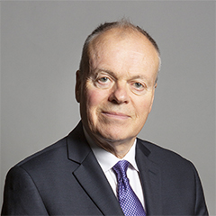 |
| Contact Details | Contact Mr Clive Betts |
| Political Party | Labour |
What Council is the S13 8UD Postcode in?
The Council for this Postcode is Sheffield District Council, who are a Unitary authority. This means that they are responsible for providing education, libraries and maintaining highways as well as normal council duties such as council tax, rubbish collection, housing, environmental health and planning.
You can visit the website for Sheffield District at the following link Sheffield District.How much is the Council Tax?
Sheffield District Council is responsible for collecting council tax. This will vary depending on which council tax band the property falls within. You can check the council tax band at the gov.uk website.
Once you know the council tax band you can view how much Sheffield District charge for that band by visiting the The Council Tax section of their website.
Planning Applications
When moving house to a new post code it is worth checking out what will be built in the neighbourhood.
Few people want to live next door to a building site, have their garden overlooked or have the views from their property ruined.
Visit the local planning department and search for planning applications in this postcode granted within the last three years or still awaiting a decision. This will give an indication of what could still be built.
Where can I find out where the nearest Library to the S13 8UD Postcode is?
Libraries are the responsibility of Sheffield council
Visit the link for more information. Please note that some councils outsource library services to private companies and community groups ran by volunteers.
Libraries and ArchivesHouse Sales in S13 8UD
| Year | High | Low | Average | Sales |
|---|---|---|---|---|
| 2010 | £100,050 | £100,050 | £100,050 | 1 |
| 2013 | £102,000 | £102,000 | £102,000 | 1 |
| 2014 | £122,500 | £122,500 | £122,500 | 1 |
| 2019 | £205 | £175,000 | £136,735 | 3 |
| 2020 | £185,050 | £185,050 | £185,050 | 1 |
| 2022 | £235,000 | £235,000 | £235,000 | 2 |
Contains HM Land Registry data © Crown copyright and database right 2024. This data is licensed under the Open Government Licence v3.0.
Postcodes near the S13 8UD Postcode
What Popular Supermarkets are near the S13 8UD Postcode?
| Supermarket | Distance | Directions |
|---|---|---|
| Aldi, Handsworth Road, Handsworth, SHEFFIELD, S13 9BS | 0.77 miles | Directions from S13 8UD to Aldi |
| Asda, Handsworth Road, Handsworth, SHEFFIELD, S13 9LR | 1.00 miles | Directions from S13 8UD to Asda |
| Morrisons, Poplar Way, Catcliffe, ROTHERHAM, S60 5TR | 2.64 miles | Directions from S13 8UD to Morrisons |
| Asda, City Road, SHEFFIELD, S12 2AB | 2.72 miles | Directions from S13 8UD to Asda |
| Aldi, Drake House Crescent, Waterthorpe, SHEFFIELD, S20 7HT | 3.23 miles | Directions from S13 8UD to Aldi |
What Popular Restaurants are near the S13 8UD Postcode?
| Burger King | Distance | Directions |
|---|---|---|
| Sheffield Parkway Retail Park, Sheffield, S2 5AU | 2.44 miles | Directions from S13 8UD to Sheffield Parkway Retail Park |
| Valley Centertainment, Sheffield, S9 2EP | 2.51 miles | Directions from S13 8UD to Valley Centertainment |
| Sheffield Station, Sheaf Street, Sheffield, S1 2BQ | 3.14 miles | Directions from S13 8UD to Sheffield Station, Sheaf Street |
| Retail World, Stadium Way, Parkgate, Rotherham, S60 1TG | 5.47 miles | Directions from S13 8UD to Retail World, Stadium Way, Parkgate |
| Mcdonald's | Distance | Directions |
|---|---|---|
| McDonald's, Handsworth Road, Handsworth, SHEFFIELD, S13 9BS | 0.48 miles | Directions from S13 8UD to McDonald's, Handsworth Road, Handsworth, SHEFFIELD, S13 9BS |
| McDonald's, Coleford Road, SHEFFIELD, S9 5PA | 1.82 miles | Directions from S13 8UD to McDonald's, Coleford Road, SHEFFIELD, S9 5PA |
| McDonald's, Drake House Way, Waterthorpe, SHEFFIELD, S20 7JJ | 2.08 miles | Directions from S13 8UD to McDonald's, Drake House Way, Waterthorpe, SHEFFIELD, S20 7JJ |
| McDonald's, Lower Mall Level, Crystal Peaks, SHEFFIELD, S20 7PJ | 2.39 miles | Directions from S13 8UD to McDonald's, Lower Mall Level, Crystal Peaks, SHEFFIELD, S20 7PJ |
| Restaurant | Distance | Directions |
|---|---|---|
| KFC, City Road, SHEFFIELD, S2 1GJ | 1.95 miles | Directions from S13 8UD to KFC Sheffield - City Road |
| KFC, Drake House Way, Waterthorpe, SHEFFIELD, S20 7JJ | 2.08 miles | Directions from S13 8UD to KFC Sheffield - Drake Retail Park |
| KFC, Broughton Lane, SHEFFIELD, S9 2DD | 2.68 miles | Directions from S13 8UD to KFC Sheffield Arena - Broughton Lane |
| KFC, Haymarket, SHEFFIELD, S1 2AW | 3.31 miles | Directions from S13 8UD to KFC Sheffield - Haymarket |
| KFC, The Oasis, Meadowhall Centre, SHEFFIELD, S9 1EP | 3.32 miles | Directions from S13 8UD to KFC Sheffield - Meadowhall Shopping Centre |