
Map of the Postcode District
Explore the postcode district by using our interactive map.
Circles represent recorded crime; the larger the circle, the higher the crime rates.
Your support helps keep this site running!
If you enjoy using this website, consider buying me a coffee to help cover hosting costs.
The postcode district located in the S Sheffield postal area , S65 has a population of 35,178 residents according to the 2021 England and Wales Census.
The area of the district is 10.29 square miles (26.66 square kilometers or 6,587.96 acres).
Where is the S65 District?
To give you an idea where the district is located we have created the following table showing nearby towns.
Nearest Towns to S65
| Town | Distance (miles) | Direction |
|---|---|---|
| Rawmarsh | 2.29 | WNW |
| Mexborough | 3.39 | N |
| Conisbrough | 3.75 | NE |
| Maltby | 4.18 | ESE |
| Wath upon Dearne | 4.44 | NNW |
| Bolton upon Dearne | 5.14 | N |
| Goldthorpe | 6.15 | N |
| Dinnington | 6.38 | SSE |
| Wombwell | 6.76 | NW |
| Thurnscoe | 6.86 | N |
| Tickhill | 7.77 | E |
| Sheffield | 8.34 | WSW |
| Doncaster | 8.63 | NE |
| Worsbrough | 9.26 | NW |
| Bentley | 9.32 | NE |
| Adwick le Street | 9.86 | NNE |
| South Kirkby | 10.32 | N |
| South Elmsall | 10.32 | N |
| Barnsley | 10.73 | NW |
The post town for this district is ROTHERHAM.
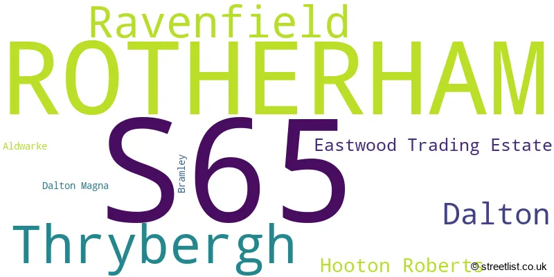
Postcode Information for District S65 (Total Geographical Postcodes: 937)
| Location | Post Town | Sector | Number of Postcodes |
|---|---|---|---|
| ROTHERHAM | ROTHERHAM | S65 2 | 244 |
| ROTHERHAM | ROTHERHAM | S65 3 | 200 |
| ROTHERHAM | ROTHERHAM | S65 1 | 157 |
| Ravenfield | ROTHERHAM | S65 4 | 150 |
| Thrybergh | ROTHERHAM | S65 4 | 122 |
| Dalton | ROTHERHAM | S65 3 | 27 |
| Dalton | ROTHERHAM | S65 4 | 15 |
| Eastwood Trading Estate | ROTHERHAM | S65 1 | 10 |
| Hooton Roberts | ROTHERHAM | S65 4 | 9 |
| Aldwarke | ROTHERHAM | S65 3 | 1 |
| Dalton Magna | ROTHERHAM | S65 3 | 1 |
| Bramley | ROTHERHAM | S65 4 | 1 |
Retail and Shopping in S65
In the S65 postcode district in South Yorkshire, the primary settlement is Rotherham. There are also other significant settlements in this district including Eastwood Trading Estate, Aldwarke, Dalton, Dalton Magna, Bramley, Hooton Roberts, Ravenfield, and Thrybergh. The most significant post town in this district is Rotherham.
When it comes to local government, postal geography often disregards political borders. However, this district intersects the following councils: the district mostly encompasses the Rotherham District (B) area with a total of 821 postal codes.
The largest settlement in the S65 postal code is ROTHERHAM followed by Thrybergh, and Ravenfield.
The S65 Postcode shares a border with S60 (ROTHERHAM, Brinsworth, Whiston), S62 (Rawmarsh, Parkgate, Wentworth), DN12 (Conisbrough, Edlington, Denaby Main), S64 (MEXBOROUGH, Swinton, Kilnhurst) and S66 (Maltby, Wickersley, Bramley).


Schools in the Sector
RNN Group
Phase: 16 plus
Address: Town Centre Campus , Eastwood Lane , Rotherham
Postcode: S65 1EG
Headteacher: Mr John Connolly (Principal/Chief Executive)
Ofsted Rating: Good
Coleridge Primary
Phase: Primary
Address: Coleridge Road , Eastwood , Rotherham
Postcode: S65 1LW
Headteacher: Mr Ian Tankard (Head of School)
Ofsted Rating: Outstanding
St Ann's Junior and Infant School
Phase: Primary
Address: St Leonard's Road , Eastwood , Rotherham
Postcode: S65 1PD
Headteacher: Headteacher L Rowan S Blagden (Headteacher)
Ofsted Rating: Requires improvement
St Ann's Primary School
Phase: Primary
Address: St Leonard's Road , Eastwood , Rotherham
Postcode: S65 1PD
Headteacher: Mr Lee Rowan (Headteacher)
Ofsted Rating: Good
ROTHERHAM OPPORTUNITIES COLLEGE
Phase: Not applicable
Address: My Place , Rotherham , St Ann's Road , Rotherham
Postcode: S65 1PH
Headteacher: Dr Perdita Mousley ()
Ofsted Rating: Requires improvement
Eastwood Village Primary School
Phase: Primary
Address: Eldon Road , Eastwood Village , Rotherham
Postcode: S65 1RD
Headteacher: Ms Kirsty Beresford (Headteacher)
Ofsted Rating: Good
East Dene Primary
Phase: Primary
Address: Doncaster Road , East Dene , Rotherham
Postcode: S65 2DF
Headteacher: Mr Ian Tankard ()
Ofsted Rating: Good
Herringthorpe Junior School
Phase: Primary
Address: Chatterton Drive , Rotherham
Postcode: S65 2JW
Headteacher: Mrs Jane K Fearnley (Headteacher)
Ofsted Rating: Outstanding
Herringthorpe Infant School
Phase: Primary
Address: Chatterton Drive , Herringthorpe , Rotherham
Postcode: S65 2JW
Headteacher: Mrs Nicola Kitchen (Headteacher)
Ofsted Rating: Outstanding
Arnold Nursery School and Children's Centre
Phase: Nursery
Address: The Arnold Centre, Goldsmith Road , Rotherham
Postcode: S65 2LY
Headteacher: Mrs Lynsey Hadfield (Acting Head of Centre)
Ofsted Rating: Outstanding
St Mary's Catholic Primary School
Phase: Primary
Address: Herringthorpe Valley Road , Rotherham
Postcode: S65 2NU
Headteacher: Mrs Anna Osborne (Headteacher)
Ofsted Rating: Good
Badsley Primary School
Phase: Primary
Address: Badsley Moor Lane , Rotherham
Postcode: S65 2QS
Headteacher: Mr Mark Windle (Headteacher)
Ofsted Rating: Good
Clifton Community School
Phase: Secondary
Address: Middle Lane , Rotherham
Postcode: S65 2SN
Headteacher: Mr David Hudson (Executive Headteacher)
Ofsted Rating: Special Measures
Clifton Community School
Phase: Secondary
Address: Middle Lane , Rotherham
Postcode: S65 2SN
Headteacher: Mrs Anna Leng ()
Ofsted Rating: Good
St Bernard's Catholic High School, Specialist School for the Arts and Applied Learning
Phase: Secondary
Address: Herringthorpe Valley Road , Rotherham
Postcode: S65 3BE
Headteacher: Mr David Butler (Headteacher)
Ofsted Rating: Outstanding
Listerdale Junior Academy
Phase: Primary
Address: Beech Avenue , Brecks , Rotherham
Postcode: S65 3HN
Headteacher: Ms Cathryn Keeton (Headteacher)
Ofsted Rating: Good
High Greave Junior School
Phase: Primary
Address: High Greave Road , Rotherham
Postcode: S65 3LZ
Headteacher: Mr Matt Freeston (Headteacher)
Ofsted Rating: Good
High Greave Infant School
Phase: Primary
Address: High Greave Road , East Herringthorpe , Rotherham
Postcode: S65 3LZ
Headteacher: Mr Matt Freeston (Executive Head Teacher)
Ofsted Rating: Good
High Greave Junior School
Phase: Primary
Address: High Greave Road , Rotherham
Postcode: S65 3LZ
Headteacher: Miss Claire Cawthorne (Headteacher)
Ofsted Rating: Good
High Greave Infant School
Phase: Primary
Address: High Greave Road , East Herringthorpe , Rotherham
Postcode: S65 3LZ
Headteacher: Mrs Rachel Taylor (Executive Head Teacher)
Ofsted Rating: Requires improvement
Trinity Croft CofE Primary Academy
Phase: Primary
Address: Dalton Lane , Dalton Parva , Rotherham
Postcode: S65 3QJ
Headteacher: Mrs Amy Gurner (Head of School)
Ofsted Rating: Good
St Gerard's Catholic Primary School
Phase: Primary
Address: Park Nook Doncaster Road , Thrybergh , Rotherham
Postcode: S65 4AE
Headteacher: Mrs Bernadette Baxter (Headteacher)
Ofsted Rating: Good
Thrybergh Academy and Sports College
Phase: All-through
Address: Arran Hill , Thrybergh , Rotherham
Postcode: S65 4BJ
Headteacher: Mr David Burnham (Principal)
Ofsted Rating: Special Measures
Thrybergh Fullerton CofE VA Primary School
Phase: Primary
Address: Church View , Thrybergh , Rotherham
Postcode: S65 4BL
Headteacher: Mr M Wheeler (Headteacher)
Ofsted Rating: Outstanding
Thrybergh Academy
Phase: Secondary
Address: Park Lane , Thrybergh , Rotherham
Postcode: S65 4BP
Headteacher: Mr David Burnham ()
Ofsted Rating: Requires improvement
Thrybergh Primary School
Phase: Primary
Address: Oldgate Lane , Thrybergh , Rotherham
Postcode: S65 4JG
Headteacher: Mrs Robyn Parry-McDermott ()
Ofsted Rating: Good
Ravenfield Primary Academy
Phase: Primary
Address: Moor Lane North , Ravenfield , Rotherham
Postcode: S65 4LZ
Headteacher: Miss Leanne Jepson (Principal)
Ofsted Rating: Good
Stations in the Sector
No stations found in this postcode district.
Accessable Motorway Junctions
M1 J33
Average Driving Time from within the district: 6.14
Average Driving Distance: 3.97
Number of Postcodes that can access the Motorway Junction: 805
M18 J1
Average Driving Time from within the district: 6.46
Average Driving Distance: 3.84
Number of Postcodes that can access the Motorway Junction: 809
M1 J34
Average Driving Time from within the district: 7.90
Average Driving Distance: 5.09
Number of Postcodes that can access the Motorway Junction: 746
M1 J31
Average Driving Time from within the district: 9.22
Average Driving Distance: 7.65
Number of Postcodes that can access the Motorway Junction: 303
M18 J2
Average Driving Time from within the district: 9.39
Average Driving Distance: 7.45
Number of Postcodes that can access the Motorway Junction: 27
M1 J35
Average Driving Time from within the district: 9.48
Average Driving Distance: 5.43
Number of Postcodes that can access the Motorway Junction: 433
A1(M) J35
Average Driving Time from within the district: 9.52
Average Driving Distance: 7.53
Number of Postcodes that can access the Motorway Junction: 63
A1(M) J36
Average Driving Time from within the district: 9.62
Average Driving Distance: 6.25
Number of Postcodes that can access the Motorway Junction: 57
A1(M) J37
Average Driving Time from within the district: 10.51
Average Driving Distance: 8.06
Number of Postcodes that can access the Motorway Junction: 2
A1(M) J34
Average Driving Time from within the district: 13.08
Average Driving Distance: 7.85
Number of Postcodes that can access the Motorway Junction: 1
Weather Forecast for Wickersley
| Time Period | Icon | Description | Temperature | Rain Probability | Wind |
|---|---|---|---|---|---|
| 12:00 to 15:00 | Partly cloudy (day) | 13.0°C (feels like 11.0°C) | 1.00% | W 11 mph | |
| 15:00 to 18:00 | Sunny day | 13.0°C (feels like 12.0°C) | 1.00% | W 9 mph | |
| 18:00 to 21:00 | Clear night | 11.0°C (feels like 10.0°C) | 0.00% | SW 4 mph | |
| 21:00 to 00:00 | Clear night | 10.0°C (feels like 8.0°C) | 0.00% | SSW 7 mph |
| Time Period | Icon | Description | Temperature | Rain Probability | Wind |
|---|---|---|---|---|---|
| 00:00 to 03:00 | Clear night | 9.0°C (feels like 7.0°C) | 0.00% | SSW 7 mph | |
| 03:00 to 06:00 | Clear night | 9.0°C (feels like 7.0°C) | 0.00% | SSW 9 mph | |
| 06:00 to 09:00 | Partly cloudy (night) | 9.0°C (feels like 7.0°C) | 0.00% | SSW 9 mph | |
| 09:00 to 12:00 | Cloudy | 9.0°C (feels like 7.0°C) | 3.00% | SSW 9 mph | |
| 12:00 to 15:00 | Cloudy | 12.0°C (feels like 10.0°C) | 3.00% | SSW 11 mph | |
| 15:00 to 18:00 | Partly cloudy (day) | 13.0°C (feels like 11.0°C) | 2.00% | SSW 11 mph | |
| 18:00 to 21:00 | Partly cloudy (night) | 12.0°C (feels like 10.0°C) | 1.00% | S 9 mph | |
| 21:00 to 00:00 | Partly cloudy (night) | 11.0°C (feels like 9.0°C) | 1.00% | S 11 mph |
| Time Period | Icon | Description | Temperature | Rain Probability | Wind |
|---|---|---|---|---|---|
| 00:00 to 03:00 | Partly cloudy (night) | 10.0°C (feels like 8.0°C) | 2.00% | S 11 mph | |
| 03:00 to 06:00 | Cloudy | 10.0°C (feels like 7.0°C) | 5.00% | S 11 mph | |
| 06:00 to 09:00 | Partly cloudy (night) | 9.0°C (feels like 7.0°C) | 3.00% | SSE 11 mph | |
| 09:00 to 12:00 | Cloudy | 10.0°C (feels like 7.0°C) | 6.00% | SSE 13 mph | |
| 12:00 to 15:00 | Overcast | 13.0°C (feels like 10.0°C) | 8.00% | S 16 mph | |
| 15:00 to 18:00 | Cloudy | 14.0°C (feels like 12.0°C) | 5.00% | SSE 13 mph | |
| 18:00 to 21:00 | Cloudy | 13.0°C (feels like 11.0°C) | 6.00% | SSE 11 mph | |
| 21:00 to 00:00 | Overcast | 13.0°C (feels like 10.0°C) | 15.00% | SSE 11 mph |
| Time Period | Icon | Description | Temperature | Rain Probability | Wind |
|---|---|---|---|---|---|
| 00:00 to 03:00 | Light rain | 12.0°C (feels like 10.0°C) | 53.00% | S 11 mph | |
| 03:00 to 06:00 | Light rain | 12.0°C (feels like 10.0°C) | 48.00% | S 11 mph | |
| 06:00 to 09:00 | Partly cloudy (night) | 11.0°C (feels like 9.0°C) | 14.00% | SSW 11 mph | |
| 09:00 to 12:00 | Cloudy | 11.0°C (feels like 9.0°C) | 10.00% | SSW 11 mph | |
| 12:00 to 15:00 | Partly cloudy (day) | 12.0°C (feels like 10.0°C) | 13.00% | SSW 11 mph | |
| 15:00 to 18:00 | Partly cloudy (day) | 12.0°C (feels like 10.0°C) | 11.00% | SSW 11 mph | |
| 18:00 to 21:00 | Clear night | 10.0°C (feels like 7.0°C) | 8.00% | SSW 9 mph | |
| 21:00 to 00:00 | Partly cloudy (night) | 9.0°C (feels like 6.0°C) | 5.00% | SSW 9 mph |
| Time Period | Icon | Description | Temperature | Rain Probability | Wind |
|---|---|---|---|---|---|
| 00:00 to 03:00 | Partly cloudy (night) | 8.0°C (feels like 6.0°C) | 3.00% | SSW 9 mph | |
| 03:00 to 06:00 | Cloudy | 8.0°C (feels like 5.0°C) | 9.00% | SSW 11 mph | |
| 06:00 to 09:00 | Partly cloudy (night) | 8.0°C (feels like 5.0°C) | 6.00% | SSW 11 mph | |
| 09:00 to 12:00 | Cloudy | 9.0°C (feels like 7.0°C) | 10.00% | SW 11 mph | |
| 12:00 to 15:00 | Cloudy | 11.0°C (feels like 9.0°C) | 12.00% | SW 13 mph | |
| 15:00 to 18:00 | Cloudy | 12.0°C (feels like 9.0°C) | 31.00% | SW 11 mph | |
| 18:00 to 21:00 | Cloudy | 11.0°C (feels like 8.0°C) | 10.00% | WSW 11 mph | |
| 21:00 to 00:00 | Clear night | 10.0°C (feels like 8.0°C) | 4.00% | WSW 9 mph |
| Postal Sector | Delivery Office |
|---|---|
| S65 1 | Rotherham Delivery Office |
| S65 2 | Rotherham Delivery Office |
| S65 3 | Rotherham Delivery Office |
| S65 4 | Rotherham Delivery Office |
| S | 6 | 5 | - | X | X | X |
| S | 6 | 5 | Space | Numeric | Letter | Letter |
Street List for the S65 District
Current Monthly Rental Prices
| # Bedrooms | Min Price | Max Price | Avg Price |
|---|---|---|---|
| £750 | £750 | £750 | |
| 1 | £520 | £520 | £520 |
| 2 | £589 | £675 | £632 |
| 3 | £900 | £1,100 | £1,000 |
Current House Prices
| # Bedrooms | Min Price | Max Price | Avg Price |
|---|---|---|---|
| £210,000 | £950,000 | £580,000 | |
| 1 | £60,000 | £65,000 | £61,250 |
| 2 | £57,000 | £230,000 | £117,348 |
| 3 | £60,000 | £455,000 | £204,608 |
| 4 | £135,000 | £650,000 | £404,588 |
| 5 | £200,000 | £850,000 | £459,494 |
| 6 | £250,000 | £250,000 | £250,000 |
Estate Agents
| Logo | Name | Brand Name | Address | Contact Number |
|---|---|---|---|---|
 | Rotherham | Merryweathers | Ship Hill Rotherham S60 2HG | 01709 912085 |
 | Rotherham | William H. Brown | 32 Mansfield Road, Rotherham, S60 2DR | 01709 212549 |
 | Poppy Fields | Redrow | Moor Lane South, Ravenfield, Rotherham, S65 4QQ | 01749 608554 |
 | Rotherham | Bartons | 51 - 53 Moorgate Street Rotherham S60 2EY | 01709 212542 |
 | Rotherham | Lincoln Ralph | London House Clifford Lister Business Centre Bawtry Road Wickersley Rotherham S66 2BL | 01709 212513 |
Yearly House Price Averages for the District
| Type of Property | 2018 Average | 2018 Sales | 2017 Average | 2017 Sales | 2016 Average | 2016 Sales | 2015 Average | 2015 Sales |
|---|---|---|---|---|---|---|---|---|
| Detached | £236,685 | 40 | £224,125 | 54 | £232,499 | 45 | £212,043 | 38 |
| Semi-Detached | £118,734 | 164 | £113,297 | 193 | £113,936 | 182 | £114,959 | 155 |
| Terraced | £80,074 | 121 | £71,511 | 113 | £77,378 | 99 | £74,402 | 107 |
| Flats | £64,703 | 17 | £51,152 | 26 | £52,555 | 65 | £57,250 | 24 |