The S7 1 postcode sector is within the county of South Yorkshire.
Did you know? According to the 2021 Census, the S7 1 postcode sector is home to a bustling 9,521 residents!
Given that each sector allows for 400 unique postcode combinations. Letters C, I, K, M, O and V are not allowed in the last two letters of a postcode. With 156 postcodes already in use, this leaves 244 units available.
The S7 1 postal code covers the settlement of SHEFFIELD.
The S7 1 Postcode shares a border with S2 4 (SHEFFIELD), S7 2 (SHEFFIELD), S11 8 (SHEFFIELD), S8 0 (SHEFFIELD) and S11 9 (SHEFFIELD).
The sector is within the post town of SHEFFIELD.
S7 1 is a postcode sector within the S7 postcode district which is within the S Sheffield postcode area.
The Royal Mail delivery office for the S7 1 postal sector is the Sheffield Scale Payment Delivery Office.
The area of the S7 1 postcode sector is 0.43 square miles which is 1.11 square kilometres or 275.05 square acres.

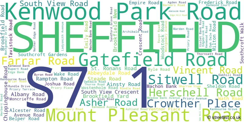
Map of the S7 1 Postcode Sector
Explore the S7 1 postcode sector by using our free interactive map.
| S | 7 | - | 1 | X | X |
| S | 7 | Space | 1 | Letter | Letter |
Official List of Streets
SHEFFIELD (84 Streets)
Unofficial Streets or Alternative Spellings
SHEFFIELD
AIZLEWOOD ROAD ARCHER LANE BATT STREET BRINCLIFFE EDGE ROAD BROADFIELD ROAD CHERRY TREE ROAD FIELDHEAD ROAD HALE STREET KINGFIELD ROAD LEYBURN ROAD OAKDALE ROAD OSBORNE ROAD PSALTER LANE SELLERS STREET SHARROW LANE STAVELEY ROAD UNION ROAD WITNEY STREET WOLSELEY ROAD BANK CLOSE BEDALE ROAD EMPIRE ROAD ROUNDABOUT FOUNTSIDE HORNER ROAD LUCKNOW COURT MILLER ROAD PRIMROSE WALK RIVER SHEAF WALK SITWELL PLACE SMEATON STREET WARD PLACEWeather Forecast for S7 1
Press Button to Show Forecast for Nether Edge
| Time Period | Icon | Description | Temperature | Rain Probability | Wind |
|---|---|---|---|---|---|
| 03:00 to 06:00 | Clear night | 2.0°C (feels like 0.0°C) | 1.00% | N 4 mph | |
| 06:00 to 09:00 | Sunny day | 2.0°C (feels like 0.0°C) | 1.00% | N 4 mph | |
| 09:00 to 12:00 | Cloudy | 6.0°C (feels like 4.0°C) | 4.00% | NE 7 mph | |
| 12:00 to 15:00 | Overcast | 8.0°C (feels like 7.0°C) | 9.00% | ENE 4 mph | |
| 15:00 to 18:00 | Cloudy | 9.0°C (feels like 8.0°C) | 7.00% | ENE 4 mph | |
| 18:00 to 21:00 | Cloudy | 8.0°C (feels like 6.0°C) | 10.00% | ENE 7 mph | |
| 21:00 to 00:00 | Cloudy | 5.0°C (feels like 3.0°C) | 8.00% | ENE 4 mph |
Press Button to Show Forecast for Nether Edge
| Time Period | Icon | Description | Temperature | Rain Probability | Wind |
|---|---|---|---|---|---|
| 00:00 to 03:00 | Cloudy | 4.0°C (feels like 2.0°C) | 8.00% | NE 4 mph | |
| 03:00 to 06:00 | Cloudy | 3.0°C (feels like 1.0°C) | 11.00% | NE 4 mph | |
| 06:00 to 09:00 | Partly cloudy (day) | 4.0°C (feels like 1.0°C) | 8.00% | NE 7 mph | |
| 09:00 to 12:00 | Cloudy | 7.0°C (feels like 4.0°C) | 11.00% | ENE 9 mph | |
| 12:00 to 15:00 | Cloudy | 9.0°C (feels like 6.0°C) | 19.00% | ENE 9 mph | |
| 15:00 to 18:00 | Cloudy | 10.0°C (feels like 7.0°C) | 18.00% | ENE 11 mph | |
| 18:00 to 21:00 | Cloudy | 9.0°C (feels like 6.0°C) | 20.00% | ENE 11 mph | |
| 21:00 to 00:00 | Cloudy | 7.0°C (feels like 4.0°C) | 17.00% | NE 11 mph |
Press Button to Show Forecast for Nether Edge
| Time Period | Icon | Description | Temperature | Rain Probability | Wind |
|---|---|---|---|---|---|
| 00:00 to 03:00 | Light rain | 6.0°C (feels like 3.0°C) | 50.00% | NE 11 mph | |
| 03:00 to 06:00 | Light rain | 6.0°C (feels like 3.0°C) | 50.00% | NNE 13 mph | |
| 06:00 to 09:00 | Heavy rain | 6.0°C (feels like 3.0°C) | 77.00% | NNE 13 mph | |
| 09:00 to 12:00 | Light rain | 8.0°C (feels like 4.0°C) | 57.00% | NNE 13 mph | |
| 12:00 to 15:00 | Light rain shower (day) | 9.0°C (feels like 6.0°C) | 46.00% | NNE 13 mph | |
| 15:00 to 18:00 | Overcast | 10.0°C (feels like 7.0°C) | 25.00% | NE 11 mph | |
| 18:00 to 21:00 | Overcast | 9.0°C (feels like 7.0°C) | 21.00% | N 9 mph | |
| 21:00 to 00:00 | Partly cloudy (night) | 7.0°C (feels like 6.0°C) | 9.00% | S 7 mph |
Schools and Places of Education Within the S7 1 Postcode Sector
Brantwood Specialist School
Other independent special school
1 Kenwood Bank, Sheffield, South Yorkshire, S7 1NU
Head: Mr Alan Harrison
Ofsted Rating: Good
Inspection: 2022-06-09 (687 days ago)
Website: Visit Brantwood Specialist School Website
Phone: 01142589062
Number of Pupils: 50
Sharrow Nursery, Infant and Junior School
Foundation school
Sitwell Road, Sheffield, South Yorkshire, S7 1BE
Head: Ms Evelyn Abram
Ofsted Rating: Good
Inspection: 2019-02-06 (1906 days ago)
Website: Visit Sharrow Nursery, Infant and Junior School Website
Phone: 01142551704
Number of Pupils: 518

House Prices in the S7 1 Postcode Sector
| Type of Property | 2018 Average | 2018 Sales | 2017 Average | 2017 Sales | 2016 Average | 2016 Sales | 2015 Average | 2015 Sales |
|---|---|---|---|---|---|---|---|---|
| Detached | £471,853 | 17 | £357,825 | 22 | £374,534 | 20 | £343,779 | 20 |
| Semi-Detached | £302,771 | 31 | £281,882 | 28 | £338,102 | 28 | £306,257 | 23 |
| Terraced | £203,700 | 76 | £187,281 | 66 | £169,949 | 77 | £165,621 | 81 |
| Flats | £139,510 | 20 | £128,688 | 25 | £120,051 | 25 | £116,512 | 34 |
Important Postcodes S7 1 in the Postcode Sector
S7 1BE is the postcode for PAC - BUILDING C BLOCK 04, Sharrow School, Sitwell Road, SHARROW SCHOOL, SITWELL ROAD, SHEFFIELD, and Sharrow School, Sitwell Road
S7 1DB is the postcode for Sharrow Community Forum, South View Road
S7 1HQ is the postcode for 9 Moncrieffe Road
S7 1RB is the postcode for Abbeydale Primary School, Glen Road, ABBEYDALE RD BUILDING B BLOCK 02, Nether Edge Primary School, Glen Road, Nether Edge Primary School, Glen Road, and GLEN RD BUILDING A BLOCK 01, Nether Edge Primary School, Glen Road
| The S7 1 Sector is within these Local Authorities |
|
|---|---|
| The S7 1 Sector is within these Counties |
|
| The S7 1 Sector is within these Water Company Areas |
|