The S80 3 postcode sector lies where the three counties of Derbyshire, Nottinghamshire, and South Yorkshire meet.
Did you know? According to the 2021 Census, the S80 3 postcode sector is home to a bustling 4,974 residents!
Given that each sector allows for 400 unique postcode combinations. Letters C, I, K, M, O and V are not allowed in the last two letters of a postcode. With 191 postcodes already in use, this leaves 209 units available.
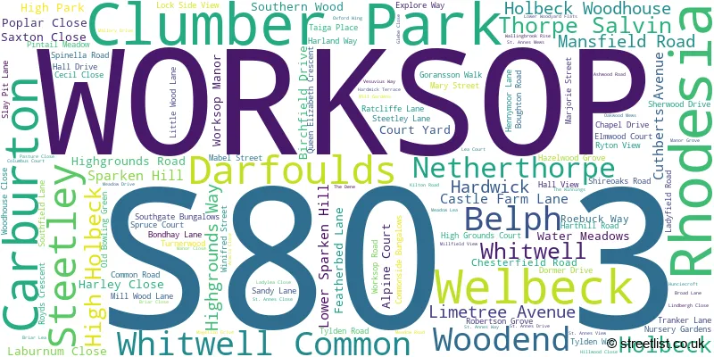
The largest settlement in the S80 3 postal code is WORKSOP followed by Rhodesia, and Welbeck.
The S80 3 Postcode shares a border with NG20 9 (Langwith, Meden Vale, Langwith Junction), S43 4 (Clowne, Barlborough), S80 1 (WORKSOP), S80 2 (WORKSOP), S80 4 (Creswell, Whitwell, Hodthorpe), S81 7 (WORKSOP), DN22 8 (Ranskill, Elkesley, Sutton), NG22 9 (New Ollerton, Ollerton, Boughton), S26 6 (Kiveton Park, Kiveton Park Station), S26 7 (Harthill), S81 0 (WORKSOP, Carlton Forest, Hodsock) and S81 8 (Shireoaks, Gateford, Blyth).
The sector is within the post town of WORKSOP.
S80 3 is a postcode sector within the S8 postcode district which is within the S Sheffield postcode area.
The Royal Mail delivery office for the S80 3 postal sector is the unknown.
The area of the S80 3 postcode sector is 30.66 square miles which is 79.41 square kilometres or 19,622.21 square acres.
Waterways within the S80 3 postcode sector include the River Poulter, Chesterfield Canal, Millwood Brook, River Ryton.

Map of the S80 3 Postcode Sector
Explore the S80 3 postcode sector by using our free interactive map.
| S | 8 | 0 | - | 3 | X | X |
| S | 8 | 0 | Space | 3 | Letter | Letter |
Official List of Streets
WORKSOP (55 Streets)
Whitwell Common (3 Streets)
Rhodesia (32 Streets)
Darfoulds (3 Streets)
Thorpe Salvin (7 Streets)
Clumber Park (2 Streets)
Steetley (2 Streets)
Hardwick (1 Streets)
Whitwell (2 Streets)
Holbeck (1 Streets)
Welbeck (3 Streets)
Belph (1 Streets)
Unofficial Streets or Alternative Spellings
Ranby
BLYTH ROADClumber Park
LIMETREE AVENUEWORKSOP
ALMOND GROVE DEVONSHIRE STREET NETHERTON ROAD NEWCASTLE AVENUE SPARKEN CLOSE SPRING WALK STUBBING LANE WINDMILL LANEHodthorpe
BROAD LANEWhitwell
DOLES LANE HIGH STREET OLD HALL LANE WORKSOP ROADBelph
MILLASH LANECreswell
CRAGS ROADShireoaks
SHIREOAKS ROAD SPRING LANEHarthill
PACKMAN LANEBarlborough
WALLS LANE WORKSOP ROADClowne
GAPSICK LANECuckney
CRESWELL ROAD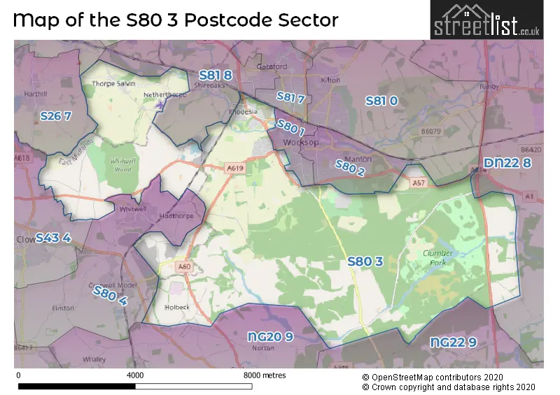
House Prices in the S80 3 Postcode Sector
| Type of Property | 2018 Average | 2018 Sales | 2017 Average | 2017 Sales | 2016 Average | 2016 Sales | 2015 Average | 2015 Sales |
|---|---|---|---|---|---|---|---|---|
| Detached | £266,731 | 39 | £260,700 | 43 | £261,368 | 44 | £244,226 | 37 |
| Semi-Detached | £164,781 | 16 | £150,144 | 17 | £153,731 | 29 | £116,006 | 29 |
| Terraced | £95,921 | 7 | £94,125 | 4 | £90,438 | 8 | £111,864 | 11 |
| Flats | £156,750 | 2 | £74,500 | 1 | £68,490 | 5 | £63,000 | 1 |
| The S80 3 Sector is within these Local Authorities |
|
|---|---|
| The S80 3 Sector is within these Counties |
|
| The S80 3 Sector is within these Water Company Areas |
|
Tourist Attractions within the S80 3 Postcode Area
We found 1 visitor attractions within the S8 postcode area
| Clumber Park |
|---|
| Country Parks |
| Country Park |
| View Clumber Park on Google Maps |