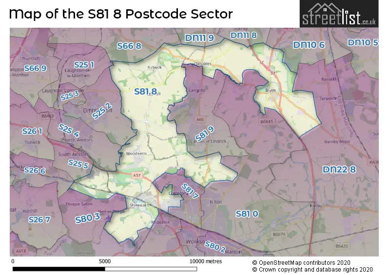
The S81 8 postcode sector lies where the three counties of Derbyshire, Nottinghamshire, and South Yorkshire meet.
Did you know? According to the 2021 Census, the S81 8 postcode sector is home to a bustling 8,204 residents!
Given that each sector allows for 400 unique postcode combinations. Letters C, I, K, M, O and V are not allowed in the last two letters of a postcode. With 277 postcodes already in use, this leaves 123 units available.
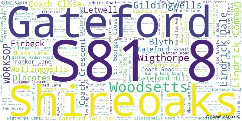
The largest settlement in the S81 8 postal code is Shireoaks followed by Gateford, and Blyth.
The S81 8 Postcode shares a border with S81 7 (WORKSOP), S25 1 (Laughton), S25 4 (North Anston), S25 5 (South Anston), DN22 8 (Ranskill, Elkesley, Sutton), DN11 9 (Tickhill, Wadworth, Loversall), S66 8 (Maltby, Hellaby, Hooton Levitt), S25 2 (Dinnington), S26 6 (Kiveton Park, Kiveton Park Station), S80 3 (WORKSOP, Rhodesia, Welbeck), S81 0 (WORKSOP, Carlton Forest, Hodsock), S81 9 (Carlton-in-Lindrick, Langold, Costhorpe), DN10 6 (Bawtry, Misson, Austerfield) and DN11 8 (Harworth, Bircotes, Styrrup).
The sector is within the post town of WORKSOP.
S81 8 is a postcode sector within the S8 postcode district which is within the S Sheffield postcode area.
The Royal Mail delivery office for the S81 8 postal sector is the Sheffield Scale Payment Delivery Office.
The area of the S81 8 postcode sector is 20.15 square miles which is 52.18 square kilometres or 12,893.12 square acres.
The S81 8 postcode sector is crossed by the A1 Major A road.
The S81 8 postcode sector is crossed by the A1M Major A road.
Waterways within the S81 8 postcode sector include the Chesterfield Canal, Anston Brook, River Ryton.

Map of the S81 8 Postcode Sector
Explore the S81 8 postcode sector by using our free interactive map.
| S | 8 | 1 | - | 8 | X | X |
| S | 8 | 1 | Space | 8 | Letter | Letter |
Official List of Streets
Woodsetts (28 Streets)
Shireoaks (46 Streets)
Gateford (56 Streets)
Blyth (37 Streets)
Letwell (5 Streets)
Firbeck (11 Streets)
Oldcotes (7 Streets)
Gildingwells (4 Streets)
WORKSOP (4 Streets)
Lindrick Common (1 Streets)
Wallingwells (1 Streets)
Wigthorpe (1 Streets)
Unofficial Streets or Alternative Spellings
Ranby
BLYTH ROADTorworth
BAULK LANE ANSTON BRIDLEWAY NO.18 ASHES PARK AVENUE BARFORD COURT BERNE SQUARE BLYTH INTERCHANGE BLYTH SERVICES BRIBER HILL CARRLON VIEW COMMON LANE DONCASTER BY-PASS DUMB HALL LANE FIRST LANE FLAT LANE GILDING WELLS ROAD GLENHILL DRIVE GRAVES MOOR LANE HAVEN HILL KID LANE KINGS WOOD LANE LADY FIELD ROAD LEWIS WAY LINDRICK DALE LIQUORICE LANE LONG BRECKS LANE MONK BRIDGE MOOR LANE NORNAY CLOSE NORTH FARM PARK DRIVE RED QUARRY LANE SALT HILL ROAD SCRATTA LANE THE MEWS THORNBURY HILL LANE THORPE LANE TINKER LANE TINKERS HILL WHITEWATER LANE WYNLEA DRIVERanskill
BLYTH ROADBarnby Moor
RETFORD ROADWORKSOP
BLYTH ROAD CLAYLANDS AVENUE GATEFORD RISECarlton-in-Lindrick
DONCASTER ROAD HIGH ROAD ROTHERHAM BAULKRhodesia
TRANKER LANESteetley
STEETLEY LANEDinnington
LODGE LANE SWINSTON HILL ROADLaughton
EAST FIELD LANEAnston
WOODSETTS ROADSouth Anston
WORKSOP ROADHarworth
BLYTH ROADSchools and Places of Education Within the S81 8 Postcode Sector
St Luke's CofE (Aided) Primary School
Voluntary aided school
Brancliffe Lane, Worksop, Nottinghamshire, S81 8PW
Head: Mrs Jeanette Dunn
Ofsted Rating: Good
Inspection: 2023-06-28 (330 days ago)
Website: Visit St Luke's CofE (Aided) Primary School Website
Phone: 01909475821
Number of Pupils: 172
The Primary School of St Mary and St Martin
Voluntary aided school
Retford Road, Worksop, Nottinghamshire, S81 8ER
Head: Mrs Sarah Preston
Ofsted Rating: Good
Inspection: 2019-12-10 (1626 days ago)
Website: Visit The Primary School of St Mary and St Martin Website
Phone: 01909591218
Number of Pupils: 140
Woodsetts Primary School
Academy converter
Wellfield Crescent, Worksop, Nottinghamshire, S81 8SB
Head: Mr Matthew Revill
Ofsted Rating: Good
Inspection: 2021-09-15 (981 days ago)
Website: Visit Woodsetts Primary School Website
Phone: 01909550758
Number of Pupils: 212
House Prices in the S81 8 Postcode Sector
| Type of Property | 2018 Average | 2018 Sales | 2017 Average | 2017 Sales | 2016 Average | 2016 Sales | 2015 Average | 2015 Sales |
|---|---|---|---|---|---|---|---|---|
| Detached | £277,906 | 83 | £253,453 | 92 | £210,997 | 75 | £241,535 | 81 |
| Semi-Detached | £173,037 | 27 | £177,237 | 39 | £151,766 | 38 | £163,540 | 25 |
| Terraced | £145,500 | 19 | £154,289 | 19 | £164,369 | 18 | £124,092 | 19 |
| Flats | £0 | 0 | £0 | 0 | £228,250 | 2 | £72,500 | 1 |
Important Postcodes S81 8 in the Postcode Sector
S81 8AD is the postcode for Unit 8,Shireoaks Network Centre, Shireoaks Triangle, and UNIT 7, North Nottinghamshire College, Unit 7-8, Coach Crescent
S81 8ER is the postcode for The Primary School of St. Mary's & St. Martin, 40 Retford Road, and The Primary School of St. Mary's & St. Martin, 40 Retford Road, Blyth
S81 8PW is the postcode for St. Lukes C of E School, Brancliffe Lane, Shireoaks, and St. Lukes C of E School, Brancliffe Lane
S81 8SB is the postcode for Woodsetts Primary School, Wellfield Crescent, Woodsetts, and Woodsetts Primary School, 7 Wellfield Crescent
| The S81 8 Sector is within these Local Authorities |
|
|---|---|
| The S81 8 Sector is within these Counties |
|
| The S81 8 Sector is within these Water Company Areas |
|