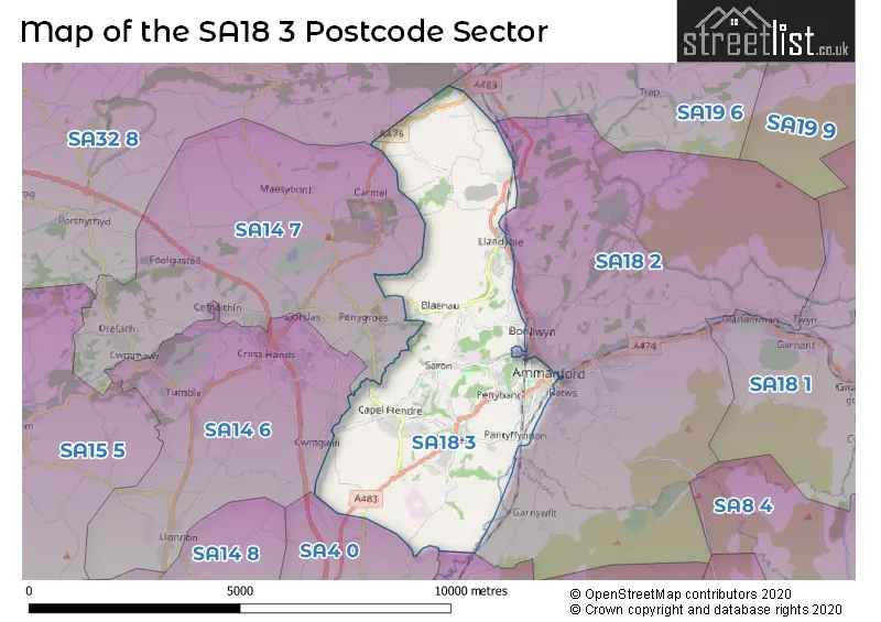
The SA18 3 postcode sector stands on the Dyfed and West Glamorgan border.
Did you know? According to the 2021 Census, the SA18 3 postcode sector is home to a bustling 10,937 residents!
Given that each sector allows for 400 unique postcode combinations. Letters C, I, K, M, O and V are not allowed in the last two letters of a postcode. With 263 postcodes already in use, this leaves 137 units available.
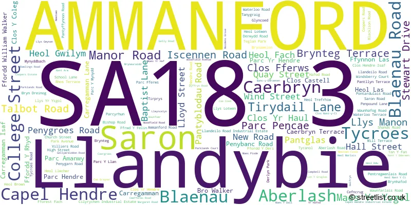
The largest settlement in the SA18 3 postal code is AMMANFORD followed by LLANDYBIE, and TYCROES.
The SA18 3 Postcode shares a border with SA14 6 (CROSS HANDS, TUMBLE, UPPER TUMBLE), SA14 7 (PENYGROES, GORSLAS, CEFNEITHIN), SA18 2 (AMMANFORD, GLANAMAN, BETWS), SA19 6 (LLANDEILO, FFAIRFACH, TRAP), SA4 0 (HENDY, FFOREST, PONTARDDULAIS), SA4 8 (PONTARDDULAIS, GROVESEND) and SA32 8 (LLANARTHNE, DRYSLWYN, PORTHYRHYD).
The sector is within the post town of AMMANFORD.
SA18 3 is a postcode sector within the SA18 postcode district which is within the SA Swansea postcode area.
The Royal Mail delivery office for the SA18 3 postal sector is the Ammanford Delivery Office.
The area of the SA18 3 postcode sector is 13.10 square miles which is 33.92 square kilometres or 8,381.78 square acres.

Map of the SA18 3 Postcode Sector
Explore the SA18 3 postcode sector by using our free interactive map.
| S | A | 1 | 8 | - | 3 | X | X |
| S | A | 1 | 8 | Space | 3 | Letter | Letter |
Official List of Streets
AMMANFORD (70 Streets)
Llandybie (29 Streets)
Tycroes (15 Streets)
Capel Hendre (12 Streets)
Saron (7 Streets)
Caerbryn (3 Streets)
Aberlash (1 Streets)
Unofficial Streets or Alternative Spellings
AMMANFORD
FOUNDRY ROAD HIGH STREET MARGARET STREET STATION ROAD THE ARCADE AMMAN VALLEY CYCLEWAY BANC Y DDRAENEN BRYN-TEG TERRACE BRYNDERI BRYNDERWEN ROAD CAECOED CAER BRYN ROAD CAER GROES CARREGAMAN CARREGAMAN ISAF CLOSFFERWS COOPERS CWRT STANLLYD DERLIN PARK DYFFRYN BRIDGE FFORESTFACH FFRWD-Y-FELIN GELLI LANE GELLI ROAD GELLIWRIDDON HEOL CAE YSGUBOR HEOL ELIZABETH WYNNE HEOL FAWR HEOL HAFOD HEOL PEN-Y-BANC HEOL PENYGARN HEOL TOM HANDEL HEOL TYCROES HEOL Y HENDRE LLWYN CELYN LLYS TIRNANT LLYS Y NANT LON-Y-GRUGLAS LOTWEN ROAD MAES-Y-DAIL MAES-YR-HAF MEMORIAL AVENUE NANT-Y-CI ROAD PANT Y BOBLEN PARC DERLYN PARC TEGLAN PARC YR HUN PARK MILL ROAD PEN-Y-BANC ROAD PONTARDDULAIS ROAD RUE GUY MOQUET SCHOOL PATH TANYFAN TIR-Y-DAIL LANE TREFRHIW ROAD WALLASEY ROADGwyn Fryn Estate
RHODFA FRANKLlandybie
DERWYDD ROAD KINGS ROADSaron
CLOS NANT-Y-CIPenygroes
WATERLOO ROADPontarddulais
EBENEZER ROADCross Hands
BLACK LION ROADWeather Forecast for SA18 3
Press Button to Show Forecast for Ammanford
| Time Period | Icon | Description | Temperature | Rain Probability | Wind |
|---|---|---|---|---|---|
| 00:00 to 03:00 | Cloudy | 13.0°C (feels like 13.0°C) | 4.00% | NNE 4 mph | |
| 03:00 to 06:00 | Partly cloudy (night) | 12.0°C (feels like 11.0°C) | 0.00% | NNE 4 mph | |
| 06:00 to 09:00 | Cloudy | 13.0°C (feels like 13.0°C) | 3.00% | NE 2 mph | |
| 09:00 to 12:00 | Partly cloudy (day) | 18.0°C (feels like 17.0°C) | 0.00% | SSE 7 mph | |
| 12:00 to 15:00 | Partly cloudy (day) | 20.0°C (feels like 18.0°C) | 0.00% | SSE 9 mph | |
| 15:00 to 18:00 | Sunny day | 20.0°C (feels like 19.0°C) | 0.00% | SSE 9 mph | |
| 18:00 to 21:00 | Sunny day | 19.0°C (feels like 18.0°C) | 0.00% | S 4 mph | |
| 21:00 to 00:00 | Clear night | 14.0°C (feels like 14.0°C) | 0.00% | SSW 2 mph |
Press Button to Show Forecast for Ammanford
| Time Period | Icon | Description | Temperature | Rain Probability | Wind |
|---|---|---|---|---|---|
| 00:00 to 03:00 | Partly cloudy (night) | 13.0°C (feels like 12.0°C) | 0.00% | ENE 2 mph | |
| 03:00 to 06:00 | Clear night | 12.0°C (feels like 11.0°C) | 0.00% | ENE 4 mph | |
| 06:00 to 09:00 | Sunny day | 14.0°C (feels like 12.0°C) | 0.00% | ENE 7 mph | |
| 09:00 to 12:00 | Sunny day | 17.0°C (feels like 15.0°C) | 0.00% | ESE 11 mph | |
| 12:00 to 15:00 | Sunny day | 18.0°C (feels like 16.0°C) | 0.00% | SE 11 mph | |
| 15:00 to 18:00 | Partly cloudy (day) | 19.0°C (feels like 17.0°C) | 1.00% | SE 11 mph | |
| 18:00 to 21:00 | Sunny day | 18.0°C (feels like 17.0°C) | 1.00% | SE 9 mph | |
| 21:00 to 00:00 | Clear night | 15.0°C (feels like 14.0°C) | 0.00% | SE 7 mph |
Press Button to Show Forecast for Ammanford
| Time Period | Icon | Description | Temperature | Rain Probability | Wind |
|---|---|---|---|---|---|
| 00:00 to 03:00 | Partly cloudy (night) | 14.0°C (feels like 13.0°C) | 1.00% | ESE 7 mph | |
| 03:00 to 06:00 | Partly cloudy (night) | 14.0°C (feels like 12.0°C) | 1.00% | E 9 mph | |
| 06:00 to 09:00 | Cloudy | 14.0°C (feels like 13.0°C) | 4.00% | E 9 mph | |
| 09:00 to 12:00 | Cloudy | 16.0°C (feels like 15.0°C) | 6.00% | SE 9 mph | |
| 12:00 to 15:00 | Cloudy | 17.0°C (feels like 16.0°C) | 12.00% | S 9 mph | |
| 15:00 to 18:00 | Mist | 17.0°C (feels like 15.0°C) | 24.00% | SSW 9 mph | |
| 18:00 to 21:00 | Drizzle | 15.0°C (feels like 14.0°C) | 34.00% | SW 9 mph | |
| 21:00 to 00:00 | Cloudy | 14.0°C (feels like 13.0°C) | 18.00% | SSW 7 mph |
Press Button to Show Forecast for Ammanford
| Time Period | Icon | Description | Temperature | Rain Probability | Wind |
|---|---|---|---|---|---|
| 00:00 to 03:00 | Cloudy | 13.0°C (feels like 12.0°C) | 20.00% | SSW 7 mph | |
| 03:00 to 06:00 | Cloudy | 13.0°C (feels like 12.0°C) | 21.00% | S 7 mph | |
| 06:00 to 09:00 | Light rain | 13.0°C (feels like 11.0°C) | 53.00% | S 9 mph | |
| 09:00 to 12:00 | Light rain | 13.0°C (feels like 11.0°C) | 52.00% | S 11 mph | |
| 12:00 to 15:00 | Light rain shower (day) | 14.0°C (feels like 12.0°C) | 43.00% | SSW 13 mph | |
| 15:00 to 18:00 | Light rain shower (day) | 14.0°C (feels like 12.0°C) | 41.00% | SSW 13 mph | |
| 18:00 to 21:00 | Light rain shower (day) | 14.0°C (feels like 12.0°C) | 37.00% | SSW 11 mph | |
| 21:00 to 00:00 | Light rain shower (night) | 12.0°C (feels like 11.0°C) | 35.00% | S 9 mph |
House Prices in the SA18 3 Postcode Sector
| Type of Property | 2018 Average | 2018 Sales | 2017 Average | 2017 Sales | 2016 Average | 2016 Sales | 2015 Average | 2015 Sales |
|---|---|---|---|---|---|---|---|---|
| Detached | £199,760 | 67 | £192,236 | 78 | £174,086 | 93 | £177,162 | 78 |
| Semi-Detached | £111,684 | 101 | £117,835 | 77 | £108,948 | 74 | £104,550 | 59 |
| Terraced | £108,057 | 38 | £106,649 | 32 | £104,110 | 20 | £93,357 | 23 |
| Flats | £104,843 | 1 | £50,000 | 1 | £0 | 0 | £0 | 0 |
Important Postcodes SA18 3 in the Postcode Sector
SA18 3AP is the postcode for Ammanford Social Activity Centre, Manor Road, and Indoor Bowls Centre, Manor Road
SA18 3AS is the postcode for Swn y Gwynt Day Hospital, Tirydail Lane
SA18 3BE is the postcode for Carmarthenshire County Council Town Hall, Iscennen Road
SA18 3BQ is the postcode for Blaenau Cp School, Pantyblodau, Blaenau
SA18 3DN is the postcode for Carmarthenshire County Council, Ammanford Library, 3 Wind Street
SA18 3HB is the postcode for Parcyrhun Cp School, Villiers Road
SA18 3JB is the postcode for Llandybie CP School, Llandeilo Road, and Llandbybie School, Llandeilo Road, Llandybie
SA18 3LH is the postcode for Saron Cp School, Saron Road, Saron
SA18 3QD is the postcode for Tycroes Cp School, Pontardulais Road, Tycroes
SA18 3TA is the postcode for AGANTO 2, Coleg Sir Gar, Ammanford Campus, Dyffryn Road, BLOCK B, Coleg Sir Gar, Ammanford Campus, Dyffryn Road, AGANTO 1, Coleg Sir Gar, Ammanford Campus, Dyffryn Road, and Coleg Sir Gar, Ammanford Campus, Dyffryn Road
SA18 3YS is the postcode for Glanmarlaishome, Maes Piode
| The SA18 3 Sector is within these Local Authorities |
|
|---|---|
| The SA18 3 Sector is within these Counties |
|
| The SA18 3 Sector is within these Water Company Areas |
|