The SA33 6 postcode sector is within the county of Dyfed.
Did you know? According to the 2021 Census, the SA33 6 postcode sector is home to a bustling 3,634 residents!
Given that each sector allows for 400 unique postcode combinations. Letters C, I, K, M, O and V are not allowed in the last two letters of a postcode. With 215 postcodes already in use, this leaves 185 units available.
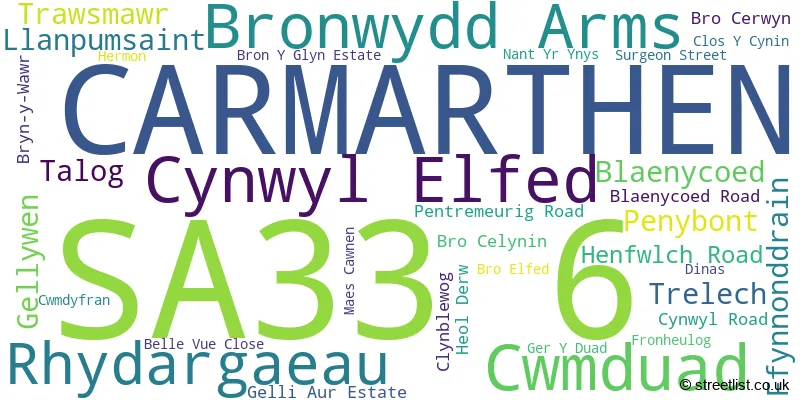
The largest settlement in the SA33 6 postal code is CYNWYL ELFED followed by BRONWYDD, and LLANPUMSAINT.
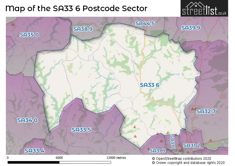
The SA33 6 Postcode shares a border with SA31 1 (CARMARTHEN), SA34 0 (WHITLAND, LLANBOIDY, HEBRON), SA35 0 (TEGRYN, LLANFYRNACH, CILRHEDYN), SA44 4 (LLANDYSUL, TALGARREG, RHYDOWEN), SA31 2 (LLANGUNNOR, CARMARTHEN, ABERGWILI), SA31 3 (CARMARTHEN, JOHNSTOWN, LLANLLWCH), SA32 7 (NANTGAREDIG, PENIEL, LLANFYNYDD), SA33 5 (LLANGAIN, LLANSTEFFAN, MEIDRIM), SA38 9 (NEWCASTLE EMLYN, ADPAR, CENARTH), SA39 9 (PENCADER, MAESYCRUGIAU, LLANFIHANGEL-AR-ARTH) and SA44 5 (VELINDRE, RHYDLEWIS, SARON).
The sector is within the post town of CARMARTHEN.
SA33 6 is a postcode sector within the SA33 postcode district which is within the SA Swansea postcode area.
The Royal Mail delivery office for the SA33 6 postal sector is the Carmarthen Delivery Office.
The area of the SA33 6 postcode sector is 68.83 square miles which is 178.28 square kilometres or 44,054.05 square acres.

Map of the SA33 6 Postcode Sector
Explore the SA33 6 postcode sector by using our free interactive map.
| S | A | 3 | 3 | - | 6 | X | X |
| S | A | 3 | 3 | Space | 6 | Letter | Letter |
Official List of Streets
Cwmduad (1 Streets)
CARMARTHEN (4 Streets)
Cynwyl Elfed (7 Streets)
Bronwydd Arms (3 Streets)
Llanpumsaint (2 Streets)
Unofficial Streets or Alternative Spellings
Weather Forecast for SA33 6
Press Button to Show Forecast for Esgair
| Time Period | Icon | Description | Temperature | Rain Probability | Wind |
|---|---|---|---|---|---|
| 06:00 to 09:00 | Cloudy | 4.0°C (feels like 2.0°C) | 8.00% | ENE 4 mph | |
| 09:00 to 12:00 | Cloudy | 8.0°C (feels like 6.0°C) | 8.00% | ESE 7 mph | |
| 12:00 to 15:00 | Light rain | 9.0°C (feels like 7.0°C) | 51.00% | SE 4 mph | |
| 15:00 to 18:00 | Cloudy | 9.0°C (feels like 8.0°C) | 13.00% | ESE 4 mph | |
| 18:00 to 21:00 | Cloudy | 9.0°C (feels like 7.0°C) | 12.00% | NE 7 mph | |
| 21:00 to 00:00 | Cloudy | 6.0°C (feels like 4.0°C) | 12.00% | NE 7 mph |
Press Button to Show Forecast for Esgair
| Time Period | Icon | Description | Temperature | Rain Probability | Wind |
|---|---|---|---|---|---|
| 00:00 to 03:00 | Cloudy | 5.0°C (feels like 2.0°C) | 12.00% | ENE 7 mph | |
| 03:00 to 06:00 | Cloudy | 4.0°C (feels like 1.0°C) | 11.00% | ENE 7 mph | |
| 06:00 to 09:00 | Cloudy | 4.0°C (feels like 1.0°C) | 9.00% | ENE 7 mph | |
| 09:00 to 12:00 | Cloudy | 8.0°C (feels like 6.0°C) | 8.00% | ENE 9 mph | |
| 12:00 to 15:00 | Overcast | 10.0°C (feels like 8.0°C) | 13.00% | ENE 9 mph | |
| 15:00 to 18:00 | Overcast | 10.0°C (feels like 8.0°C) | 18.00% | NE 9 mph | |
| 18:00 to 21:00 | Cloudy | 9.0°C (feels like 7.0°C) | 12.00% | NNE 9 mph | |
| 21:00 to 00:00 | Cloudy | 7.0°C (feels like 4.0°C) | 14.00% | NNE 9 mph |
Press Button to Show Forecast for Esgair
| Time Period | Icon | Description | Temperature | Rain Probability | Wind |
|---|---|---|---|---|---|
| 00:00 to 03:00 | Overcast | 6.0°C (feels like 3.0°C) | 19.00% | NNE 9 mph | |
| 03:00 to 06:00 | Cloudy | 5.0°C (feels like 2.0°C) | 18.00% | N 11 mph | |
| 06:00 to 09:00 | Cloudy | 6.0°C (feels like 3.0°C) | 14.00% | N 11 mph | |
| 09:00 to 12:00 | Cloudy | 8.0°C (feels like 5.0°C) | 19.00% | N 13 mph | |
| 12:00 to 15:00 | Partly cloudy (day) | 10.0°C (feels like 7.0°C) | 18.00% | NNW 13 mph | |
| 15:00 to 18:00 | Partly cloudy (day) | 10.0°C (feels like 7.0°C) | 32.00% | NNW 13 mph | |
| 18:00 to 21:00 | Sunny day | 9.0°C (feels like 7.0°C) | 8.00% | NW 9 mph | |
| 21:00 to 00:00 | Clear night | 5.0°C (feels like 3.0°C) | 4.00% | WNW 7 mph |
House Prices in the SA33 6 Postcode Sector
| Type of Property | 2018 Average | 2018 Sales | 2017 Average | 2017 Sales | 2016 Average | 2016 Sales | 2015 Average | 2015 Sales |
|---|---|---|---|---|---|---|---|---|
| Detached | £207,958 | 37 | £243,471 | 34 | £231,963 | 28 | £224,978 | 37 |
| Semi-Detached | £132,975 | 2 | £125,563 | 8 | £117,000 | 3 | £123,250 | 2 |
| Terraced | £85,500 | 4 | £51,750 | 1 | £119,167 | 3 | £111,667 | 3 |
| Flats | £0 | 0 | £0 | 0 | £0 | 0 | £0 | 0 |
Important Postcodes SA33 6 in the Postcode Sector
SA33 6BY is the postcode for Llanpumsaint Cp School, U5552 From, Llanpumsaint
SA33 6RU is the postcode for Hafodwenog Cp School, Trelech To Bryniwan, Trelech
SA33 6TR is the postcode for Cynwyl Elfed CP School, Cynwyl Elfed
| The SA33 6 Sector is within these Local Authorities |
|
|---|---|
| The SA33 6 Sector is within these Counties |
|
| The SA33 6 Sector is within these Water Company Areas |
|
Tourist Attractions within the SA33 6 Postcode Area
We found 1 visitor attractions within the SA33 postcode area
| Gwili Steam Railway |
|---|
| View Gwili Steam Railway on Google Maps |