The SR2 8 postcode sector is within the county of Tyne & Wear.
Did you know? According to the 2021 Census, the SR2 8 postcode sector is home to a bustling 5,906 residents!
Given that each sector allows for 400 unique postcode combinations. Letters C, I, K, M, O and V are not allowed in the last two letters of a postcode. With 165 postcodes already in use, this leaves 235 units available.
The largest settlements in the SR2 8 postal code are SUNDERLAND and Hendon.
The SR2 8 Postcode shares a border with SR1 2 (SUNDERLAND), SR2 7 (SUNDERLAND), SR2 9 (SUNDERLAND, Leechmere Industrial Estate) and SR1 1 (SUNDERLAND).
The sector is within the post town of SUNDERLAND.
SR2 8 is a postcode sector within the SR2 postcode district which is within the SR Sunderland postcode area.
The Royal Mail delivery office for the SR2 8 postal sector is the Sunderland Delivery Office.
The area of the SR2 8 postcode sector is 0.66 square miles which is 1.71 square kilometres or 422.49 square acres.

Map of the SR2 8 Postcode Sector
Explore the SR2 8 postcode sector by using our free interactive map.
| S | R | 2 | - | 8 | X | X |
| S | R | 2 | Space | 8 | Letter | Letter |
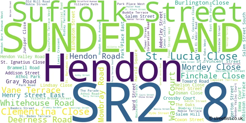
Official List of Streets
SUNDERLAND (91 Streets)
Unofficial Streets or Alternative Spellings
SUNDERLAND
BURDON ROAD RAGLAN AVENUE RAINFORD AVENUEWeather Forecast for SR2 8
Press Button to Show Forecast for Sunderland
| Time Period | Icon | Description | Temperature | Rain Probability | Wind |
|---|---|---|---|---|---|
| 03:00 to 06:00 | Partly cloudy (night) | 5.0°C (feels like 4.0°C) | 2.00% | NE 4 mph | |
| 06:00 to 09:00 | Partly cloudy (day) | 5.0°C (feels like 4.0°C) | 2.00% | NNE 4 mph | |
| 09:00 to 12:00 | Cloudy | 8.0°C (feels like 6.0°C) | 8.00% | ENE 7 mph | |
| 12:00 to 15:00 | Partly cloudy (day) | 8.0°C (feels like 6.0°C) | 6.00% | ENE 9 mph | |
| 15:00 to 18:00 | Cloudy | 8.0°C (feels like 6.0°C) | 9.00% | ENE 9 mph | |
| 18:00 to 21:00 | Partly cloudy (day) | 8.0°C (feels like 5.0°C) | 8.00% | ENE 9 mph | |
| 21:00 to 00:00 | Cloudy | 7.0°C (feels like 5.0°C) | 8.00% | ENE 9 mph |
Press Button to Show Forecast for Sunderland
| Time Period | Icon | Description | Temperature | Rain Probability | Wind |
|---|---|---|---|---|---|
| 00:00 to 03:00 | Cloudy | 7.0°C (feels like 4.0°C) | 6.00% | NE 9 mph | |
| 03:00 to 06:00 | Cloudy | 7.0°C (feels like 4.0°C) | 6.00% | NNE 11 mph | |
| 06:00 to 09:00 | Cloudy | 7.0°C (feels like 3.0°C) | 16.00% | N 13 mph | |
| 09:00 to 12:00 | Light rain | 7.0°C (feels like 3.0°C) | 50.00% | N 16 mph | |
| 12:00 to 15:00 | Light rain | 8.0°C (feels like 4.0°C) | 50.00% | NNW 13 mph | |
| 15:00 to 18:00 | Light rain | 8.0°C (feels like 5.0°C) | 45.00% | NNW 13 mph | |
| 18:00 to 21:00 | Sunny day | 9.0°C (feels like 7.0°C) | 8.00% | NW 7 mph | |
| 21:00 to 00:00 | Partly cloudy (night) | 8.0°C (feels like 5.0°C) | 3.00% | SW 9 mph |
Press Button to Show Forecast for Sunderland
| Time Period | Icon | Description | Temperature | Rain Probability | Wind |
|---|---|---|---|---|---|
| 00:00 to 03:00 | Clear night | 6.0°C (feels like 4.0°C) | 1.00% | SW 9 mph | |
| 03:00 to 06:00 | Clear night | 6.0°C (feels like 3.0°C) | 0.00% | SSW 9 mph | |
| 06:00 to 09:00 | Sunny day | 6.0°C (feels like 3.0°C) | 1.00% | S 11 mph | |
| 09:00 to 12:00 | Partly cloudy (day) | 10.0°C (feels like 8.0°C) | 1.00% | S 13 mph | |
| 12:00 to 15:00 | Cloudy | 13.0°C (feels like 10.0°C) | 6.00% | S 13 mph | |
| 15:00 to 18:00 | Cloudy | 13.0°C (feels like 11.0°C) | 6.00% | SSE 13 mph | |
| 18:00 to 21:00 | Cloudy | 13.0°C (feels like 10.0°C) | 5.00% | SSE 13 mph | |
| 21:00 to 00:00 | Clear night | 10.0°C (feels like 7.0°C) | 2.00% | SE 13 mph |
Press Button to Show Forecast for Sunderland
| Time Period | Icon | Description | Temperature | Rain Probability | Wind |
|---|---|---|---|---|---|
| 00:00 to 03:00 | Partly cloudy (night) | 9.0°C (feels like 6.0°C) | 1.00% | SSE 13 mph | |
| 03:00 to 06:00 | Clear night | 8.0°C (feels like 5.0°C) | 1.00% | SE 11 mph | |
| 06:00 to 09:00 | Partly cloudy (day) | 8.0°C (feels like 6.0°C) | 2.00% | SE 11 mph | |
| 09:00 to 12:00 | Partly cloudy (day) | 11.0°C (feels like 8.0°C) | 5.00% | ESE 11 mph | |
| 12:00 to 15:00 | Cloudy | 12.0°C (feels like 9.0°C) | 12.00% | E 11 mph | |
| 15:00 to 18:00 | Cloudy | 11.0°C (feels like 9.0°C) | 14.00% | E 11 mph | |
| 18:00 to 21:00 | Cloudy | 11.0°C (feels like 8.0°C) | 12.00% | E 11 mph | |
| 21:00 to 00:00 | Overcast | 10.0°C (feels like 8.0°C) | 12.00% | E 9 mph |
Schools and Places of Education Within the SR2 8 Postcode Sector
Grangetown Primary School
Community school
Spelter Works Road, Sunderland, Tyne and Wear, SR2 8PX
Head: Mr Les McAnaney
Ofsted Rating: Good
Inspection: 2022-11-16 (528 days ago)
Website: Visit Grangetown Primary School Website
Phone: 01918149820
Number of Pupils: 308
Valley Road Academy
Academy converter
Corporation Road, Sunderland, Tyne and Wear, SR2 8PL
Head: Mrs Rebekah Bowman
Ofsted Rating: Good
Inspection: 2022-10-19 (556 days ago)
Website: Visit Valley Road Academy Website
Phone: 01915002999
Number of Pupils: 386

House Prices in the SR2 8 Postcode Sector
| Type of Property | 2018 Average | 2018 Sales | 2017 Average | 2017 Sales | 2016 Average | 2016 Sales | 2015 Average | 2015 Sales |
|---|---|---|---|---|---|---|---|---|
| Detached | £0 | 0 | £425,000 | 1 | £0 | 0 | £0 | 0 |
| Semi-Detached | £120,300 | 5 | £133,100 | 5 | £141,350 | 4 | £93,786 | 7 |
| Terraced | £70,097 | 60 | £64,783 | 67 | £67,310 | 44 | £64,277 | 71 |
| Flats | £73,466 | 19 | £70,600 | 11 | £65,958 | 12 | £68,545 | 11 |
Important Postcodes SR2 8 in the Postcode Sector
SR2 8AD is the postcode for Deerness Medical Centre, Suffolk Street
SR2 8AX is the postcode for Villette Surgery, Suffolk Street
SR2 8JG is the postcode for Ashburne Medical Centre, 74-75 Toward Road
SR2 8JS is the postcode for Villette Lodge, 1 Edith Street
SR2 8PD is the postcode for Raich Carter Sports Centre, Commercial Road, Hendon, THE RAICH CARTER SPORTS CENTRE, COMMERCIAL ROAD, SUNDERLAND, and The Raich Carter Sports Centre, Commercial Road
SR2 8PL is the postcode for Valley Road Community Primary School, Corporation Road, and Valley Road Academy, Corporation Road
SR2 8PX is the postcode for GRANGETOWN PRIMARY SCHOOL, SPELTER WORKS ROAD, SUNDERLAND, and Grangetown Primary School, Spelter Works Road
SR2 8QR is the postcode for City of Sunderland, Jack Crawford House, Commercial Road, Hendon, HIGHWAYS, JACK CRAWFORD HOUSE, COMMERCIAL ROAD, City of Sunderland, Jack Crawford House, Commercial Road, JACK CRAWFORD HOUSE, COMMERCIAL ROAD, and HIGHWAYS BUILDING, City of Sunderland, Jack Crawford House, Commercial Road
| The SR2 8 Sector is within these Local Authorities |
|
|---|---|
| The SR2 8 Sector is within these Counties |
|
| The SR2 8 Sector is within these Water Company Areas |
|