The SY14 postcode district is a postal district located in the SY Shrewsbury postcode area with a population of 7,046 residents according to the 2021 England and Wales Census.
The area of the SY14 postcode district is 45.03 square miles which is 116.62 square kilometres or 28,816.33 acres.
Currently, the SY14 district has about 340 postcode units spread across 2 geographic postcode sectors.
Given that each sector allows for 400 unique postcode combinations, the district has a capacity of 800 postcodes. With 340 postcodes already in use, this leaves 460 units available.
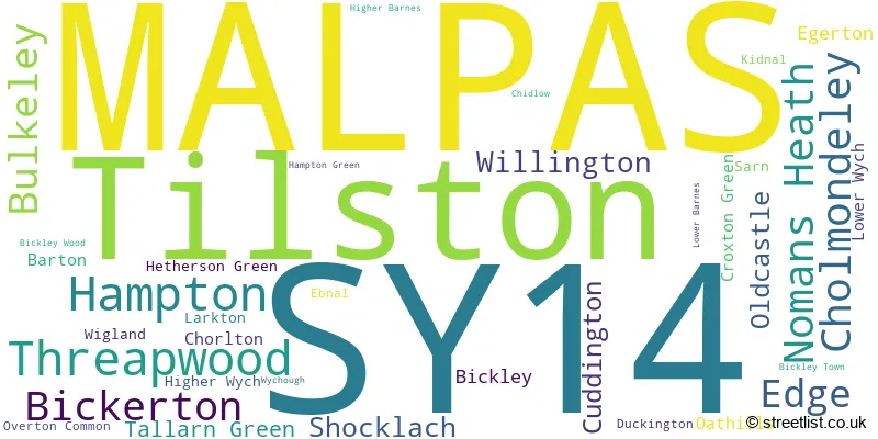
The largest settlement in the SY14 postal code is MALPAS followed by Tilston, and Threapwood.
The SY14 Postcode shares a border with CW5 (NANTWICH, Willaston, Stapeley), CW6 (TARPORLEY, Kelsall, Bunbury), SY13 (WHITCHURCH, Prees, Whixall), LL13 (WREXHAM, WREXHAM INDUSTRIAL ESTATE, PENLEY) and CH3 (CHESTER, Tattenhall, Vicars Cross).
In the SY14 postcode district, the primary settlement is Malpas, located in the county of Cheshire, England. The most significant post town in this district is Malpas, which has the highest number of postcodes. Other notable settlements in this district include Barton, Chidlow, Chorlton, Cuddington, Edge, Kidnal, Oldcastle, Overton Common, Shocklach, Tallarn Green, Threapwood, Tilston, Wigland, Willington, and Wychough, all located in Cheshire county. Additionally, there are settlements in the county of Clwyd, including Higher Barnes, Higher Wych, Lower Barnes, Lower Wych, Sarn, and Threapwood.
For the district SY14, we have data on 2 postcode sectors. Here's a breakdown: The sector SY14 7, covers Tilston and Malpas and Threapwood in Cheshire. The sector SY14 8, covers Malpas and Hampton in Cheshire.

Map of the SY14 Postcode District
Explore the SY14 postcode district by using our free interactive map.

When it comes to local government, postal geography often disregards political borders. However, for a breakdown in the SY14 District: the district mostly encompasses the Cheshire West and Chester (B) (265 postcodes), followed by the Cheshire East (B) area (49 postcodes), and finally, the Wrecsam - Wrexham area (29 postcodes).
Recent House Sales in SY14
| Date | Price | Address |
|---|---|---|
| 20/10/2023 | £525,000 | Chester Road, Malpas, SY14 8HT |
| 04/10/2023 | £565,000 | Wrexham Road, Malpas, SY14 7EJ |
| 29/09/2023 | £531,000 | Little Green, Shocklach, Malpas, SY14 7BS |
| 25/08/2023 | £227,500 | St Oswalds Close, Malpas, SY14 8QT |
| 22/08/2023 | £175,000 | Sarn, Malpas, SY14 7LN |
| 18/08/2023 | £550,000 | Tilston, Malpas, SY14 7DR |
| 10/08/2023 | £395,000 | Oldcastle Lane, Threapwood, Malpas, SY14 7AY |
| 09/08/2023 | £165,000 | Rose Villas, Malpas, SY14 8QH |
| 31/07/2023 | £270,000 | Bullcroft Close, Shocklach, Malpas, SY14 7BU |
| 28/07/2023 | £407,500 | Witney Lane, Edge, Malpas, SY14 8JJ |
Weather Forecast for SY14
Press Button to Show Forecast for Malpas
| Time Period | Icon | Description | Temperature | Rain Probability | Wind |
|---|---|---|---|---|---|
| 15:00 to 18:00 | Cloudy | 10.0°C (feels like 7.0°C) | 5.00% | NW 13 mph | |
| 18:00 to 21:00 | Partly cloudy (day) | 10.0°C (feels like 7.0°C) | 4.00% | W 11 mph | |
| 21:00 to 00:00 | Partly cloudy (night) | 7.0°C (feels like 4.0°C) | 1.00% | SSW 11 mph |
Press Button to Show Forecast for Malpas
| Time Period | Icon | Description | Temperature | Rain Probability | Wind |
|---|---|---|---|---|---|
| 00:00 to 03:00 | Cloudy | 7.0°C (feels like 3.0°C) | 5.00% | S 13 mph | |
| 03:00 to 06:00 | Cloudy | 7.0°C (feels like 4.0°C) | 34.00% | S 11 mph | |
| 06:00 to 09:00 | Cloudy | 8.0°C (feels like 4.0°C) | 8.00% | S 13 mph | |
| 09:00 to 12:00 | Cloudy | 11.0°C (feels like 7.0°C) | 14.00% | S 20 mph | |
| 12:00 to 15:00 | Light rain | 12.0°C (feels like 8.0°C) | 50.00% | S 20 mph | |
| 15:00 to 18:00 | Heavy rain | 12.0°C (feels like 8.0°C) | 77.00% | S 20 mph | |
| 18:00 to 21:00 | Heavy rain | 11.0°C (feels like 8.0°C) | 76.00% | S 16 mph | |
| 21:00 to 00:00 | Cloudy | 10.0°C (feels like 7.0°C) | 42.00% | S 16 mph |
Press Button to Show Forecast for Malpas
| Time Period | Icon | Description | Temperature | Rain Probability | Wind |
|---|---|---|---|---|---|
| 00:00 to 03:00 | Cloudy | 10.0°C (feels like 7.0°C) | 14.00% | SSE 16 mph | |
| 03:00 to 06:00 | Cloudy | 9.0°C (feels like 6.0°C) | 5.00% | SSE 16 mph | |
| 06:00 to 09:00 | Cloudy | 9.0°C (feels like 5.0°C) | 6.00% | SE 16 mph | |
| 09:00 to 12:00 | Cloudy | 11.0°C (feels like 8.0°C) | 7.00% | SSE 18 mph | |
| 12:00 to 15:00 | Cloudy | 14.0°C (feels like 10.0°C) | 12.00% | SSE 18 mph | |
| 15:00 to 18:00 | Cloudy | 13.0°C (feels like 11.0°C) | 19.00% | S 13 mph | |
| 18:00 to 21:00 | Light rain shower (day) | 12.0°C (feels like 10.0°C) | 40.00% | S 9 mph | |
| 21:00 to 00:00 | Cloudy | 10.0°C (feels like 9.0°C) | 18.00% | SSE 7 mph |
Press Button to Show Forecast for Malpas
| Time Period | Icon | Description | Temperature | Rain Probability | Wind |
|---|---|---|---|---|---|
| 00:00 to 03:00 | Cloudy | 9.0°C (feels like 7.0°C) | 9.00% | SSE 4 mph | |
| 03:00 to 06:00 | Cloudy | 8.0°C (feels like 6.0°C) | 7.00% | SSE 4 mph | |
| 06:00 to 09:00 | Cloudy | 8.0°C (feels like 6.0°C) | 6.00% | SSE 4 mph | |
| 09:00 to 12:00 | Cloudy | 11.0°C (feels like 10.0°C) | 5.00% | SSE 4 mph | |
| 12:00 to 15:00 | Cloudy | 14.0°C (feels like 13.0°C) | 10.00% | SSE 7 mph | |
| 15:00 to 18:00 | Cloudy | 15.0°C (feels like 14.0°C) | 14.00% | ESE 4 mph | |
| 18:00 to 21:00 | Cloudy | 14.0°C (feels like 13.0°C) | 13.00% | NNE 4 mph | |
| 21:00 to 00:00 | Cloudy | 11.0°C (feels like 10.0°C) | 10.00% | NNW 4 mph |
Press Button to Show Forecast for Malpas
| Time Period | Icon | Description | Temperature | Rain Probability | Wind |
|---|---|---|---|---|---|
| 00:00 to 03:00 | Cloudy | 10.0°C (feels like 9.0°C) | 15.00% | NNW 7 mph | |
| 03:00 to 06:00 | Cloudy | 9.0°C (feels like 8.0°C) | 14.00% | NNW 7 mph | |
| 06:00 to 09:00 | Cloudy | 10.0°C (feels like 9.0°C) | 10.00% | NNW 7 mph | |
| 09:00 to 12:00 | Cloudy | 13.0°C (feels like 11.0°C) | 10.00% | NNW 7 mph | |
| 12:00 to 15:00 | Cloudy | 15.0°C (feels like 14.0°C) | 9.00% | NNW 9 mph | |
| 15:00 to 18:00 | Cloudy | 17.0°C (feels like 15.0°C) | 7.00% | N 11 mph | |
| 18:00 to 21:00 | Partly cloudy (day) | 15.0°C (feels like 13.0°C) | 5.00% | N 9 mph | |
| 21:00 to 00:00 | Clear night | 11.0°C (feels like 10.0°C) | 3.00% | N 7 mph |
Where is the SY14 Postcode District?
The data shows that the SY14 postcode district is located in the town of Malpas. Malpas is situated in close proximity to several nearby towns: Whitchurch is located to the South East, Chester to the North West, Ellesmere to the South West, Nantwich to the East, Wrexham to the West, and Tarporley to the North East. Additionally, the distance between Malpas and the center of London is approximately 154.02 miles.
The district is within the post town of MALPAS.
The sector has postcodes within the nations of England, Wales.
The SY14 Postcode District is covers the following regions.
- Cheshire West and Chester - Cheshire - North West (England)
- Flintshire and Wrexham - East Wales - Wales
- Shropshire CC - Shropshire and Staffordshire - West Midlands (England)
- Cheshire East - Cheshire - North West (England)
| Postcode Sector | Delivery Office |
|---|---|
| SY14 7 | Whitchurch (sy) Delivery Office |
| SY14 8 | Whitchurch (sy) Delivery Office |
| S | Y | 1 | 4 | - | X | X | X |
| S | Y | 1 | 4 | Space | Numeric | Letter | Letter |
Current Monthly Rental Prices
| # Bedrooms | Min Price | Max Price | Avg Price |
|---|---|---|---|
| 2 | £1,100 | £1,100 | £1,100 |
| 3 | £1,300 | £1,300 | £1,300 |
| 4 | £1,395 | £2,100 | £1,797 |
| 5 | £3,500 | £3,500 | £3,500 |
Current House Prices
| # Bedrooms | Min Price | Max Price | Avg Price |
|---|---|---|---|
| £100,000 | £700,000 | £294,000 | |
| 2 | £290,000 | £525,000 | £368,417 |
| 3 | £235,000 | £665,000 | £357,558 |
| 4 | £285,000 | £1,125,000 | £570,320 |
| 5 | £465,000 | £1,250,000 | £752,688 |
| 6 | £650,000 | £1,000,000 | £825,000 |
| 7 | £1,750,000 | £3,000,000 | £2,625,000 |
| 8 | £2,500,000 | £2,500,000 | £2,500,000 |
Estate Agents who Operate in the SY14 District
| Logo | Name | Brand Name | Address | Contact Number | Total Properties |
|---|---|---|---|---|---|
 | Tarporley | Cheshire Lamont | The Chestnut Pavilion Chestnut Terrace High Street Tarporley CW6 0UW | 01829 700793 | 15 |
 | Whitchurch | Barbers | 34 High Street, Whitchurch, SY13 1BB | 01948 800373 | 10 |
 | Tarporley | Gascoigne Halman | 62 High Street, Tarporley, CW6 0AG | 01829 708163 | 6 |
 | Whitchurch | AJ Reid Estate Agents | 23 Green End Whitchurch Shropshire SY13 1AD | 01948 804966 | 5 |
 | Chester | Strutt & Parker | Park House, 37 Lower Bridge Street Chester CH1 1RS | 01244 565092 | 4 |
| Type of Property | 2018 Average | 2018 Sales | 2017 Average | 2017 Sales | 2016 Average | 2016 Sales | 2015 Average | 2015 Sales |
|---|---|---|---|---|---|---|---|---|
| Detached | £369,624 | 64 | £379,731 | 80 | £411,771 | 86 | £399,383 | 82 |
| Semi-Detached | £204,452 | 37 | £235,008 | 30 | £216,212 | 33 | £193,820 | 28 |
| Terraced | £233,047 | 16 | £254,935 | 24 | £253,412 | 20 | £165,902 | 21 |
| Flats | £0 | 0 | £0 | 0 | £0 | 0 | £0 | 0 |