TF6 6BP is a postal code used within the United Kingdom for delivering mail.
Postcodes are made up of two parts. The part before the space (TF6) is called the outward code. The part after the space (6BP) is called the inward code. The letters C, I, K, M, O and V are not allowed in the inward code. In addition to the inward and outward code, the postcode can be broken up into four parts:
- Postal Area. In our case TF which means Telford.
- Postal District. In our case TF6.
- Postal Sector. In our case TF6 6.
- Postcode Unit. The last two letters. In our case BP.
The regional mail center for the post area TF is the National Distribution Centre, which is located at Danes Way, NORTHAMPTON, NN6 7DD.
The final port of call for any post addressed to the TF6 6BP postcode is the local delivery office (DO) which is WELLINGTON (TF) DO. Here the post will be sorted ready for delivery.
The properties in the TF6 6BP postcode have the street address of Roden Lane
Did you know? According to the 2021 Census, the TF6 6BP postcode is home to a bustling 21 residents!
It is situated within the post town of TELFORD within the old postal county of Shropshire.
TF6 6BP is within the village of Roden.
The TF6 6BP postcode area is composed of 57.14% residential properties, 42.86% commercial properties, and 0% public properties.
According to our data. Most dwellings in TF6 6BP are houses. Of these houses, most are semi-detached.
Most properties in TF6 6BP are owned by the occupiers with the rest being unknown tenure.
None Domestic Buildings in TF6 6BP fall under these categories: Shops and Hospitals And Homes.
Shops include Roden Nurseries, Roden Lane.
Hospitals And Homes include Dogs Trust, Roden Lane.

Interactive Mapping Showing UPRNs within the TF6 6BP Postcode Boundaries
Use the search box to search for other postcodes or places.
TF6 6BP: Points of Interest
THE POTTING SHED CAFE RODEN
THE POTTING SHED CAFE RODEN is an establishment offering meals and refreshments located at Roden Nurseries Roden Lane, Roden, Telford, Shropshire, TF6 6BP.
| Property Type | Percentage |
|---|---|
| Residential | 57.14% |
| Commercial | 42.86% |
| Public | 0% |
Map Coordinates for TF6 6BP
| Latitude | 52.7438535257 |
|---|---|
| Longitude | -2.64350624698 |
Weather Forecast for TF6 6BP
Fri 10th May
Press Button to Show Forecast for Shawbury
| Time Period | Icon | Description | Temperature | Rain Probability | Wind |
|---|---|---|---|---|---|
| 21:00 to 00:00 | Partly cloudy (night) | 17.0°C (feels like 17.0°C) | 0.00% | SSE 4 mph |
Sat 11th May
Press Button to Show Forecast for Shawbury
| Time Period | Icon | Description | Temperature | Rain Probability | Wind |
|---|---|---|---|---|---|
| 00:00 to 03:00 | Cloudy | 15.0°C (feels like 15.0°C) | 3.00% | ESE 4 mph | |
| 03:00 to 06:00 | Cloudy | 14.0°C (feels like 13.0°C) | 3.00% | ESE 4 mph | |
| 06:00 to 09:00 | Partly cloudy (day) | 14.0°C (feels like 14.0°C) | 0.00% | ESE 4 mph | |
| 09:00 to 12:00 | Cloudy | 18.0°C (feels like 18.0°C) | 3.00% | SE 7 mph | |
| 12:00 to 15:00 | Cloudy | 20.0°C (feels like 19.0°C) | 3.00% | SE 9 mph | |
| 15:00 to 18:00 | Cloudy | 22.0°C (feels like 20.0°C) | 4.00% | SSE 9 mph | |
| 18:00 to 21:00 | Cloudy | 21.0°C (feels like 21.0°C) | 3.00% | SSE 7 mph | |
| 21:00 to 00:00 | Cloudy | 17.0°C (feels like 17.0°C) | 4.00% | ESE 7 mph |
Sun 12th May
Press Button to Show Forecast for Shawbury
| Time Period | Icon | Description | Temperature | Rain Probability | Wind |
|---|---|---|---|---|---|
| 00:00 to 03:00 | Cloudy | 16.0°C (feels like 15.0°C) | 4.00% | ESE 7 mph | |
| 03:00 to 06:00 | Cloudy | 13.0°C (feels like 12.0°C) | 3.00% | ESE 7 mph | |
| 06:00 to 09:00 | Cloudy | 13.0°C (feels like 13.0°C) | 4.00% | ESE 7 mph | |
| 09:00 to 12:00 | Cloudy | 17.0°C (feels like 16.0°C) | 5.00% | ESE 7 mph | |
| 12:00 to 15:00 | Cloudy | 20.0°C (feels like 19.0°C) | 12.00% | SE 11 mph | |
| 15:00 to 18:00 | Light rain shower (day) | 20.0°C (feels like 18.0°C) | 37.00% | S 11 mph | |
| 18:00 to 21:00 | Heavy rain shower (day) | 19.0°C (feels like 18.0°C) | 56.00% | S 9 mph | |
| 21:00 to 00:00 | Cloudy | 16.0°C (feels like 15.0°C) | 12.00% | S 7 mph |
Mon 13th May
Press Button to Show Forecast for Shawbury
| Time Period | Icon | Description | Temperature | Rain Probability | Wind |
|---|---|---|---|---|---|
| 00:00 to 03:00 | Cloudy | 14.0°C (feels like 14.0°C) | 11.00% | S 4 mph | |
| 03:00 to 06:00 | Cloudy | 13.0°C (feels like 12.0°C) | 10.00% | SSW 7 mph | |
| 06:00 to 09:00 | Cloudy | 13.0°C (feels like 12.0°C) | 9.00% | S 9 mph | |
| 09:00 to 12:00 | Cloudy | 15.0°C (feels like 13.0°C) | 18.00% | SSE 11 mph | |
| 12:00 to 15:00 | Light rain | 16.0°C (feels like 14.0°C) | 54.00% | SSE 13 mph | |
| 15:00 to 18:00 | Heavy rain | 16.0°C (feels like 14.0°C) | 79.00% | SSE 16 mph | |
| 18:00 to 21:00 | Heavy rain | 15.0°C (feels like 13.0°C) | 77.00% | SSE 13 mph | |
| 21:00 to 00:00 | Heavy rain | 13.0°C (feels like 12.0°C) | 75.00% | SE 9 mph |
Tue 14th May
Press Button to Show Forecast for Shawbury
| Time Period | Icon | Description | Temperature | Rain Probability | Wind |
|---|---|---|---|---|---|
| 00:00 to 03:00 | Cloudy | 13.0°C (feels like 11.0°C) | 21.00% | SSE 9 mph | |
| 03:00 to 06:00 | Cloudy | 11.0°C (feels like 10.0°C) | 12.00% | SSE 9 mph | |
| 06:00 to 09:00 | Cloudy | 11.0°C (feels like 9.0°C) | 9.00% | SSE 11 mph | |
| 09:00 to 12:00 | Cloudy | 13.0°C (feels like 11.0°C) | 19.00% | S 13 mph | |
| 12:00 to 15:00 | Light rain shower (day) | 15.0°C (feels like 12.0°C) | 39.00% | SSE 16 mph | |
| 15:00 to 18:00 | Light rain shower (day) | 16.0°C (feels like 13.0°C) | 39.00% | S 16 mph | |
| 18:00 to 21:00 | Light rain shower (day) | 14.0°C (feels like 12.0°C) | 35.00% | S 13 mph | |
| 21:00 to 00:00 | Partly cloudy (night) | 12.0°C (feels like 11.0°C) | 6.00% | S 9 mph |
What are the Broadband Speeds like in the TF6 6BP Postcode?
Download Speeds For TF6 6BP

| Average Mbps | 21.500 |
|---|---|
| Median Mbps | 23.200 |
| Maximum Mbps | 31.050 |
TF6 6BP has an average download speed of 21.5 Megabits per second (Mbps).
429 other postcode units have the same broadband speed.
4% of postcodes (45,599) have slower broadband speeds.
96% of postcodes (1,138,613) have faster broadband speeds.
Upload Speeds For TF6 6BP
| Average Mbps | 6.600 |
|---|---|
| Median Mbps | 6.500 |
| Maximum Mbps | 10.000 |
TF6 6BP has an average upload speed of 6.6 Megabits per second (Mbps).
3,501 other postcode units have the same upload speed.
10% of postcodes (123,464) have slower upload speeds.
89% of postcodes (1,057,676) have faster upload speeds.
Schools within a five minute drive of TF6 6BP Postcode
England Primary Schools
High Ercall Primary School
Address: High Ercall Primary School, Church Road, High Ercall, Telford, Shropshire, TF6 6AF
Distance: 1.76 miles
Contact: 01952387570
Nearest Dentists
Dentists near TF6 6BP
SHAWBURY DENTAL CENTRE
Address: SHAWBURY, SHREWSBURY, SHROPSHIRE, SY4 4DZ
Distance: 3.42 miles
Contact: :
AMBLESIDE DENTAL PRACTICE
Address: 1 AMBLESIDE, SHREWSBURY, SHROPSHIRE, SY1 4ET
Distance: 3.62 miles
Contact: :
ORACLE DENTAL LIMITED
Address: 10 LONGBOW CLOSE, SHREWSBURY, SHROPSHIRE, SY1 3GZ
Distance: 3.74 miles
Contact: :
DENTAL SURGERY
Address: 73 WHITCHURCH ROAD, SHREWSBURY, SHROPSHIRE, SY1 4EE
Distance: 3.78 miles
Contact: :
ESTHETIQUE DENTAL LIMITED
Address: UNIT 11-12 THE STABLES, SANSAW BUSINESS PARK, HADNALL, SHREWSBURY, SHROPSHIRE, SY4 4AS
Distance: 4.33 miles
Contact: :
DENTAL SURGERY
Address: 54 MONKMOOR ROAD, SHREWSBURY, SHROPSHIRE, SY2 5AU
Distance: 4.51 miles
Contact: :
Nearest Chemists
Pharmacies near TF6 6BP
TESCO PHARMACY
Address: WHITCHURCH ROAD, SHREWSBURY, SHROPSHIRE, SY1 4HA
Distance: 3.43 miles
Contact: tel: 01743 845400
ROWLANDS PHARMACY
Address: SEVERN FIELDS HEALTH CTR, SUNDORNE ROAD, SHREWSBURY, SHROPSHIRE, SY1 4RQ
Distance: 3.45 miles
Contact: tel: 01743 462929
CONWAY PHARMACY
Address: 238 MONKMOOR ROAD, SHREWSBURY, SHROPSHIRE, SY2 5SR
Distance: 3.80 miles
Contact: tel: 01743 352352
WELL
Address: 101 MOUNT PLEASANT ROAD, SHREWSBURY, SHROPSHIRE, SY1 3EL
Distance: 4.27 miles
Contact: tel: 01743 344277
ROWLANDS PHARMACY
Address: MARDEN MEDICAL PRACTICE, 25 SUTTON ROAD, SHREWSBURY, SHROPSHIRE, SY2 6DL
Distance: 4.83 miles
Contact: tel: 01743 369446
ASDA PHARMACY
Address: OLD POTTS WAY, SHREWSBURY, SHROPSHIRE, SY3 7ET
Distance: 4.93 miles
Contact: tel: 01743 359795
Nearest Opticians
Opticians near TF6 6BP
VISION EXPRESS AT TESCO (SHREWSBURY)
Address: CATTLE MARKET, BATTLEFIELD ROAD, SHREWSBURY, SHROPSHIRE, SY1 4AB
Distance: 3.23 miles
Contact: :
VISION EXPRESS (SHREWSBURY TESCOS)
Address: WHITCHURCH ROAD, SHREWSBURY, SHROPSHIRE, SY1 4HA
Distance: 3.43 miles
Contact: :
COMMUNITY HEALTH & EYECARE LTD (SUNDORNE ROAD)
Address: SUNDORNE ROAD, SHREWSBURY, SY1 4RQ
Distance: 3.45 miles
Contact: :
EATON EYELAND OPTICAL
Address: 105A MOUNT PLEASANT ROAD, SHREWSBURY, SHROPSHIRE, SY1 3EL
Distance: 4.27 miles
Contact: :
JOHN BIDDLE OPTICIANS LTD - SHREWSBURY
Address: 23 CASTLE STREET, SHREWSBURY, SHROPSHIRE, SY1 2AZ
Distance: 5.07 miles
Contact: :
HAYWOOD & WARDS OPTICIANS
Address: 11 ST. MARYS PLACE, SHREWSBURY, SHROPSHIRE, SY1 1DZ
Distance: 5.14 miles
Contact: :
Nearest GP Surgeries
Doctors near TF6 6BP
HIGH ERCALL
Address: THE SURGERY, 73 TALBOT ROAD, HIGH ERCALL, SHROPSHIRE, TF6 6LY
Distance: 1.68 miles
Contact: tel: 01952 770224
SHAWBURY MEDICAL PRACTICE
Address: POYNTON ROAD, SHAWBURY, SHREWSBURY, SHROPSHIRE, SY4 4JS
Distance: 2.74 miles
Contact: tel: 01939 250237
SEVERN FIELDS MEDICAL PRACTICE
Address: SEVERN FIELDS HTH VILLAGE, SUNDORNE ROAD, SHREWSBURY, SHROPSHIRE, SY1 4RQ
Distance: 3.45 miles
Contact: tel: 01743 281950
ELLERDINE
Address: THE VILLAGE HALL, ELLERDINE, TELFORD, SHROPSHIRE, TF6 6QT
Distance: 4.38 miles
Contact: tel: 01630 685230
BELVIDERE MEDICAL PRACT.
Address: 23 BELVIDERE ROAD, SHREWSBURY, SHROPSHIRE, SY2 5LS
Distance: 4.41 miles
Contact: tel: 01743 363640
SHAWBIRCH MEDICAL CENTRE
Address: BRANDON AVENUE, ADMASTON, TELFORD, TF5 0DU
Distance: 4.73 miles
Contact: tel: 01952 641555
Transport Links near TF6 6BP
Train Stations
Nearest stations for postcode: TF6 6BP
- Shrewsbury
Shrewsbury station, Castle Foregate, Shrewsbury, Shropshire, SY1 2DQDistance: 5.53 milesDriving Time: 9.30 minutes - Wellington (Shropshire)
Wellington station, Station Road, Wellington, Shropshire, TF1 1BYDistance: 8.87 milesDriving Time: 13.65 minutes - Yorton
Yorton station, Station Road, Yorton, Shropshire, SY4 3EPDistance: 9.92 milesDriving Time: 13.96 minutes - Oakengates
Oakengates station, Station Road, Telford, Shropshire, TF2 6DHDistance: 11.71 milesDriving Time: 17.89 minutes - Wem
Wem station, Aston Road, Wem, Shropshire, SY4 5AZDistance: 13.49 milesDriving Time: 18.51 minutes
Distances represent the quickest route by car.
Motorway Junctions near TF6 6BP
Train Stations
Motorway Junctions near TF6 6BP
Distances represent the quickest route by car.
Who are my Elected Representatives in the TF6 6BP Postcode?
| Westminster Constituency | The Wrekin Co Const |
|---|---|
| Member or Parliament | 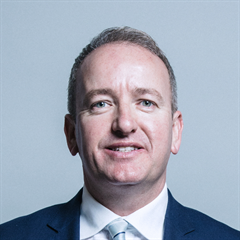 |
| Contact Details | Contact Mark Pritchard |
| Political Party | Conservative |
What Council is the TF6 6BP Postcode in?
The Council for this Postcode is Telford and Wrekin Council, who are a Unitary authority. This means that they are responsible for providing education, libraries and maintaining highways as well as normal council duties such as council tax, rubbish collection, housing, environmental health and planning.
You can visit the website for Telford and Wrekin at the following link Telford and Wrekin.How much is the Council Tax?
Telford and Wrekin Council is responsible for collecting council tax. This will vary depending on which council tax band the property falls within. You can check the council tax band at the gov.uk website.
Once you know the council tax band you can view how much Telford and Wrekin charge for that band by visiting the The Council Tax section of their website.
Planning Applications
When moving house to a new post code it is worth checking out what will be built in the neighbourhood.
Few people want to live next door to a building site, have their garden overlooked or have the views from their property ruined.
Visit the local planning department and search for planning applications in this postcode granted within the last three years or still awaiting a decision. This will give an indication of what could still be built.
Where can I find out where the nearest Library to the TF6 6BP Postcode is?
Libraries are the responsibility of Telford and Wrekin council
Visit the link for more information. Please note that some councils outsource library services to private companies and community groups ran by volunteers.
Introduction - Library catalogue - Telford & Wrekin CouncilHouse Sales in TF6 6BP
| Year | High | Low | Average | Sales |
|---|---|---|---|---|
| 2013 | £115,000 | £115,000 | £115,000 | 1 |
| 2015 | £201,500 | £201,500 | £201,500 | 1 |
| 2017 | £280,000 | £280,000 | £280,000 | 1 |
Contains HM Land Registry data © Crown copyright and database right 2024. This data is licensed under the Open Government Licence v3.0.
Postcodes near the TF6 6BP Postcode
What Popular Supermarkets are near the TF6 6BP Postcode?
| Supermarket | Distance | Directions |
|---|---|---|
| Aldi, Arlington Way, SHREWSBURY, SY1 4PR | 5.05 miles | Directions from TF6 6BP to Aldi |
| Iceland, Brixton Way, SHREWSBURY, SY1 3AZ | 5.85 miles | Directions from TF6 6BP to Iceland |
| Morrisons, Whitchurch Road, SHREWSBURY, SY1 4DL | 6.42 miles | Directions from TF6 6BP to Morrisons |
| Asda, Old Potts Way, SHREWSBURY, SY3 7ET | 7.92 miles | Directions from TF6 6BP to Asda |
| Aldi, Maxfield Drive, SHREWSBURY, SY2 6QZ | 8.98 miles | Directions from TF6 6BP to Aldi |
What Popular Restaurants are near the TF6 6BP Postcode?
| Burger King | Distance | Directions |
|---|---|---|
| Robert Jones Way, Battlefield, Shrewsbury, SY4 3EQ | 3.04 miles | Directions from TF6 6BP to Robert Jones Way |
| Bayston Hill, Shrewsbury, SY3 0DA | 6.53 miles | Directions from TF6 6BP to Bayston Hill |
| Hadley Park Services, Telford, TF1 6QJ | 7.21 miles | Directions from TF6 6BP to Hadley Park Services |
| Burger King, Unit A, Rampart Way, Telford, TF3 4NA | 9.30 miles | Directions from TF6 6BP to Burger King, Unit A, Rampart Way |
| Mcdonald's | Distance | Directions |
|---|---|---|
| McDonald's, Battlefield Road, SHREWSBURY, SY1 4AQ | 3.15 miles | Directions from TF6 6BP to McDonald's, Battlefield Road, SHREWSBURY, SY1 4AQ |
| McDonald's, Meole Brace Retail Park, Hereford Road, SHREWSBURY, SY3 9NB | 5.89 miles | Directions from TF6 6BP to McDonald's, Meole Brace Retail Park, Hereford Road, SHREWSBURY, SY3 9NB |
| McDonald's, Wrekin Retail Park, Arleston, TELFORD, TF1 2DE | 7.27 miles | Directions from TF6 6BP to McDonald's, Wrekin Retail Park, Arleston, TELFORD, TF1 2DE |
| McDonald's, School Road, Donnington, TELFORD, TF2 8HH | 8.85 miles | Directions from TF6 6BP to McDonald's, School Road, Donnington, TELFORD, TF2 8HH |
| Restaurant | Distance | Directions |
|---|---|---|
| KFC, Battlefield Road, SHREWSBURY, SY1 4AB | 3.23 miles | Directions from TF6 6BP to KFC Shrewsbury - Arlington Way |
| KFC, Barker Street, SHREWSBURY, SY1 1QJ | 5.35 miles | Directions from TF6 6BP to KFC Shrewsbury - Barker Street |
| KFC, Wrekin Retail Park, Arleston, TELFORD, TF1 2DE | 7.27 miles | Directions from TF6 6BP to KFC Telford - Wrekin Retail Park |
| KFC, Trench Lock, TELFORD, TF1 6SZ | 7.59 miles | Directions from TF6 6BP to KFC Telford - Trench Lock |
| KFC, Forgegate, Town Centre, TELFORD, TF3 4NA | 9.24 miles | Directions from TF6 6BP to KFC Telford - Rampart Way |