Postcode district

TF6 Postcode District

TF6 is the Postcode District for High Ercall, Telford Shropshire

The TF6 postcode district is located in the TF Telford postal area, TF6 has a population of 5,788 residents according to the 2021 England and Wales Census..

The area of the district is 52.41 square miles (135.73 square kilometres or 33,539.87 acres).

A wide range of spatial data has been analysed to present this overview of TF6. If you would like anything added, please contact us.

Sectors 2
Streets indexed 119
Geographical postcodes 297
Councils crossed 2

Map of TF6

Explore the postcode district using the interactive map.

Larger circles indicate higher recorded crime totals.

On this page

District overview

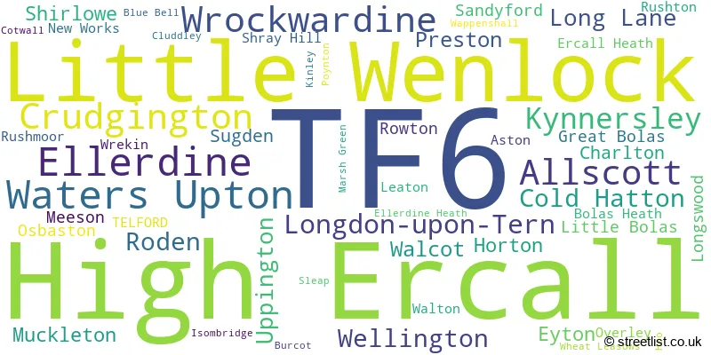
The primary settlement in the TF6 postcode district is Allscott, located in Telford, Shropshire. Other significant settlements in the district include Aston, Blue Bell, Burcot, Charlton, Cluddley, Leaton, Little Wenlock, New Works, Overley, Rushmoor, Rushton, Uppington, Walcot, Wellington, Wrekin, and Wrockwardine. The TF6 postcode district is part of Telford, which is in the county of Shropshire, England. The most significant postal town in the district is Telford.

There are 2 postcode sectors within the district. Here's a breakdown:
The sector TF6 5, covers Little Wenlock and Wrockwardine and Allscott in Shropshire.
The sector TF6 6, covers High Ercall in Shropshire.

The post town for this district is TELFORD.

When it comes to local government, postal geography often disregards political borders. However, this district intersects the following councils: the district mostly encompasses the Telford and Wrekin (B) (274 postal codes), and finally, the Shropshire area (24 postal codes).

Nearest towns

To help place the district geographically, here are nearby towns and their approximate direction from the district centre.

Town Distance (miles) Direction
Telford 6.16 SE
Newport 7.75 ENE
Shrewsbury 8.58 WSW
Broseley 9.06 SSE
Much Wenlock 9.78 S
Wem 10.85 NW
Market Drayton 11.96 NNE
Bridgnorth 15.01 SSE
Eccleshall 15.26 NE
Whitchurch 16.99 NNW
Church Stretton 17.37 SW
Ellesmere 18.44 NW
Penkridge 18.59 E
Stafford 19.01 ENE
Madeley 20.43 NNE
Stone 20.62 NE
Wolverhampton 20.69 ESE
Cannock 22.17 E
Oswestry 22.65 WNW
Sedgley 22.69 SE

Postcode information

Total geographical postcodes: 297

Location Post Town Sector Number of postcodes
High Ercall TELFORD TF6 6 23
Little Wenlock TELFORD TF6 5 19
Waters Upton TELFORD TF6 6 17
Ellerdine TELFORD TF6 6 13
Wrockwardine TELFORD TF6 5 13
Crudgington TELFORD TF6 6 11
Longdon-upon-Tern TELFORD TF6 6 9
Allscott TELFORD TF6 5 9
High Ercall TELFORD TF6 6 8
Cold Hatton TELFORD TF6 6 7
Ellerdine TELFORD TF6 6 6
Kynnersley TELFORD TF6 6 6
Long Lane TELFORD TF6 6 6
Horton TELFORD TF6 6 5
Preston TELFORD TF6 6 5
Roden TELFORD TF6 6 5
Uppington TELFORD TF6 5 5
Kynnersley TELFORD TF6 6 4
Crudgington TELFORD TF6 6 4
Shirlowe TELFORD TF6 6 4
Sugden TELFORD TF6 6 4
Wellington TELFORD TF6 5 4
Roden TELFORD TF6 6 3
Allscott TELFORD TF6 5 3
Meeson TELFORD TF6 6 3
Wellington TELFORD TF6 5 3
Eyton TELFORD TF6 6 3
Walcot TELFORD TF6 5 3
Muckleton TELFORD TF6 6 3
Charlton TELFORD TF6 5 3
Cold Hatton TELFORD TF6 6 3
Sandyford TELFORD TF6 6 3
Little Wenlock TELFORD TF6 5 3
Longswood TELFORD TF6 6 3
Eyton TELFORD TF6 6 2
Rushton TELFORD TF6 5 2
Bolas Heath TELFORD TF6 6 2
New Works TELFORD TF6 5 2
Little Bolas TELFORD TF6 6 2
Wrockwardine TELFORD TF6 5 2
Great Bolas TELFORD TF6 6 2
Overley TELFORD TF6 5 2
Waters Upton TELFORD TF6 6 2
Rushmoor TELFORD TF6 5 2
Rowton TELFORD TF6 6 2
Osbaston TELFORD TF6 6 2
Muckleton TELFORD TF6 6 2
Walton TELFORD TF6 6 2
Allscott TELFORD TF6 5 2
Uppington TELFORD TF6 5 2
Leaton TELFORD TF6 5 2
Aston TELFORD TF6 5 2
Great Bolas TELFORD TF6 6 1
Walcot TELFORD TF6 6 1
Isombridge TELFORD TF6 6 1
Ercall Heath TELFORD TF6 6 1
Little Bolas TELFORD TF6 6 1
Sleap TELFORD TF6 6 1
Burcot TELFORD TF6 5 1
Ellerdine Heath TELFORD TF6 6 1
Cold Hatton TELFORD TF6 6 1
Osbaston TELFORD TF6 6 1
TELFORD TELFORD TF6 6 1
Rowton TELFORD TF6 6 1
Ercall Heath TELFORD TF6 6 1
Wheat Leasows TELFORD TF6 6 1
Blue Bell TELFORD TF6 5 1
Cotwall TELFORD TF6 6 1
Charlton TELFORD TF6 5 1
Walcot TELFORD TF6 5 1
Poynton TELFORD TF6 6 1
TELFORD TELFORD TF6 6 1
Wappenshall TELFORD TF6 6 1
Kinley TELFORD TF6 6 1
Preston TELFORD TF6 6 1
Hoo TELFORD TF6 6 1
Marsh Green TELFORD TF6 6 1
Cluddley TELFORD TF6 5 1
Preston TELFORD TF6 6 1
Wrekin TELFORD TF6 5 1
Long Lane TELFORD TF6 6 1
Wrekin TELFORD TF6 5 1
Shray Hill TELFORD TF6 6 1
Wellington TELFORD TF6 5 1
Shirlowe TELFORD TF6 6 1
High Ercall TELFORD TF6 6 1

Street list for TF6

ALDESCOTE WAY

ALLSCOTT, Telford, Shropshire

Local Road
USRN: 45227362

ASTON LANE

Minor road

ASTON, Telford, Shropshire

Minor Road
USRN: 45226389

BLUEBELL LANE

Minor road

CHARLTON, Telford, Shropshire

Minor Road
USRN: 45210146

BOLAS ROAD

Minor road

ERCALL HEATH, Telford, Shropshire

Minor Road
USRN: 45200155

BUILDWAS BANK A4169

A-road

Telford, Shropshire

A Road
USRN: 45210371

BUILDWAS LANE

LITTLE WENLOCK, Telford, Shropshire

Local Access Road
USRN: 45200260

CATHEDRAL CLOSE

CRUDGINGTON, Telford, Shropshire

Local Road
USRN: 45227484

CATSBRITCH LANE

Minor road

WATERS UPTON, Telford, Shropshire

Minor Road
USRN: 45210358

CHURCH HILL

Minor road

NEW WORKS, Telford, Shropshire

Minor Road
USRN: 45210402

CHURCH LANE

Minor road

LITTLE WENLOCK, Telford, Shropshire

Minor Road
USRN: 45200387

CHURCH ROAD

HIGH ERCALL, Telford, Shropshire

Local Road
USRN: 45200393

CHURN CLOSE

CRUDGINGTON, Telford, Shropshire

Local Road
USRN: 45227384

CITY ROAD

Minor road

ELLERDINE, Telford, Shropshire

Minor Road
USRN: 45200414

CLEE RISE

LITTLE WENLOCK, Telford, Shropshire

Local Road
USRN: 45210410

CLEVELAND AVENUE

HIGH ERCALL, Telford, Shropshire

Local Road
USRN: 45200421

CLIFF CRESCENT

Minor road

ELLERDINE, Telford, Shropshire

Minor Road
USRN: 45224490

CLUDDLEY LANE

CLUDDLEY, Telford, Shropshire

Local Road
USRN: 45210412

COALBROOKDALE ROAD

Minor road

LITTLE WENLOCK, Telford, Shropshire

Minor Road
USRN: 45210468

COALMOOR LANE

LITTLE WENLOCK, Telford, Shropshire

Local Road
USRN: 45200434

COALMOOR ROAD

Minor road

LITTLE WORTH, Telford, Shropshire

Minor Road
USRN: 45210399

COALMOOR ROAD

Minor road

LITTLE WENLOCK, Telford, Shropshire

Minor Road
USRN: 45224569

COPPICE DRIVE

HIGH ERCALL, Telford, Shropshire

Local Road
USRN: 45200461

COTWALL LANE B5062

B-road

HIGH ERCALL, Telford, Shropshire

B Road
USRN: 45220004

COTWALL ROAD B5063

B-road

LONGDON ON TERN, Telford, Shropshire

B Road
USRN: 45200476

COTWALL ROAD B5063

B-road

SHIRLOWE, Telford, Shropshire

B Road
USRN: 45224856

COTWALL ROAD B5063

B-road

HIGH ERCALL, Telford, Shropshire

B Road
USRN: 45200475

CRABTREE LANE

Minor road

HIGH ERCALL, Telford, Shropshire

Minor Road
USRN: 45200482

CROFTERS VIEW

LITTLE WENLOCK, Telford, Shropshire

Local Road
USRN: 45200489

CROSSFIELDS

HIGH ERCALL, Telford, Shropshire

Local Road
USRN: 45200492

CRUDGINGTON MOOR ROAD

Minor road

CRUDGINGTON, Telford, Shropshire

Minor Road
USRN: 45210389

CRUGETONE WAY

CRUDGINGTON, Telford, Shropshire

Local Road
USRN: 45227383

DAVIDS BANK

Minor road

WROCKWARDINE, Telford, Shropshire

Minor Road
USRN: 45210475

DOG IN THE LANE

Minor road

LITTLE WENLOCK, Telford, Shropshire

Minor Road
USRN: 45200547

DRUMMERY LANE

Minor road

WROCKWARDINE, Telford, Shropshire

Minor Road
USRN: 45200564

DUKES DRIVE

KYNNERSLEY, Telford, Shropshire

Local Road
USRN: 45224587

EARLS WAY

HIGH ERCALL, Telford, Shropshire

Local Road
USRN: 45227213

ERCALL LANE

Minor road

WELLINGTON, Telford, Shropshire

Minor Road
USRN: 45200611

FARRIERS COURT

ELLERDINE, Telford, Shropshire

Local Road
USRN: 45225399

GOLF LINKS LANE

WELLINGTON, Telford, Shropshire

Local Road
USRN: 45200707

GREEN LANE

ELLERDINE, Telford, Shropshire

Local Road
USRN: 45201932

GREENHURST LANE

ELLERDINE, Telford, Shropshire

Restricted Local Access Road
USRN: 28200273

HAZLES ROAD

Minor road

Shawbury, Shropshire

Minor Road
USRN: 28200758

HEATH LANE

Minor road

ELLERDINE, Telford, Shropshire

Minor Road
USRN: 45210079

HIGH POINT

LITTLE WENLOCK, Telford, Shropshire

Local Road
USRN: 45200861

HOLYHEAD ROAD B5061

B-road

WELLINGTON, Telford, Shropshire

B Road
USRN: 45200909

HOME FARM

PRESTON UPON THE WEALD MOORS, Telford, Shropshire

Restricted Local Access Road
USRN: 45227358

HONEYCOPE

ALLSCOTT, Telford, Shropshire

Local Road
USRN: 45227374

HORTON LANE

Minor road

HORTON, Telford, Shropshire

Minor Road
USRN: 45210765

HORTONWOOD 45

HORTONWOOD, Telford, Shropshire

Restricted Local Access Road
USRN: 45200933

HORTONWOOD 60

Minor road

HORTONWOOD, Telford, Shropshire

Minor Road
USRN: 45202196

ISOMBRIDGE LANE

Minor road

LONGDON ON TERN, Telford, Shropshire

Minor Road
USRN: 45202245

KYNNERSLEY DRIVE

Minor road

LILLESHALL, Newport, Shropshire

Minor Road
USRN: 45201887

LEAHAYS WAY

ALLSCOTT, Telford, Shropshire


USRN: 45227473

LEIGHTON LANE

Minor road

LITTLE WENLOCK, Telford, Shropshire

Minor Road
USRN: 45210368

LLANHAVEN CLOSE

RODEN, Telford, Shropshire


USRN: 45227534

LONG LANE

Minor road

Telford, Shropshire

Minor Road
USRN: 45210091

MALT HOUSE BANK

Minor road

LITTLE WENLOCK, Telford, Shropshire

Minor Road
USRN: 45201130

MARLBROOK WAY

RODEN, Telford, Shropshire

Local Road
USRN: 45201159

MEADOW DRIVE

WALCOT, Telford, Shropshire

Local Road
USRN: 45201182

MIDDLE LANE

Minor road

COLD HATTON HEATH, Telford, Shropshire

Minor Road
USRN: 45201206

MILLERS ROW

LONGDON ON TERN, Telford, Shropshire

Restricted Local Access Road
USRN: 45201601

MORLAIS WAY

CRUDGINGTON, Telford, Shropshire


USRN: 45227483

MUCKLETON LANE

Minor road

HIGH ERCALL, Telford, Shropshire

Minor Road
USRN: 45210407

NEW WORKS LANE

Minor road

NEW WORKS, Telford, Shropshire

Minor Road
USRN: 45201280

NURSERY GARDENS

RODEN, Telford, Shropshire

Local Road
USRN: 45227396

OLD DAIRY LANE

CRUDGINGTON, Telford, Shropshire

Local Road
USRN: 45227385

OLD RECTORY FIELDS

WATERS UPTON, Telford, Shropshire

Local Access Road
USRN: 45225266

ORCHARD CLOSE

WATERS UPTON, Telford, Shropshire

Local Road
USRN: 45201331

ORCHARD CLOSE

LITTLE WENLOCK, Telford, Shropshire

Local Road
USRN: 45201330

PARISH ROOM CROFT

WATERS UPTON, Telford, Shropshire

Restricted Local Access Road
USRN: 45226387

PARK LANE

HIGH ERCALL, Telford, Shropshire

Local Road
USRN: 45201357

PENMARSH LANE

HIGH ERCALL, Telford, Shropshire

Restricted Local Access Road
USRN: 45200992

PINFOLD CROFT

WATERS UPTON, Telford, Shropshire

Local Road
USRN: 45210408

PLEATON LANE

ALLSCOTT, Telford, Shropshire


USRN: 45227487

POYNTON ROAD

Minor road

RODEN, Telford, Shropshire

Minor Road
USRN: 45224972

RIDGWAY

HIGH ERCALL, Telford, Shropshire

Local Road
USRN: 45210595

RIVER LANE

Minor road

WATERS UPTON, Telford, Shropshire

Minor Road
USRN: 45210359

RODEN LANE B5062

B-road

RODEN, Telford, Shropshire

B Road
USRN: 45201518

RODINGTON ROAD

Minor road

Telford, Shropshire

Minor Road
USRN: 45227315

RUSHMOOR LANE

Minor road

BRATTON, Telford, Shropshire

Minor Road
USRN: 45201543

RUSHMOOR LANE

Minor road

ALLSCOTT, Telford, Shropshire

Minor Road
USRN: 45224630

SANDYFORD LANE

Minor road

SANDYFORD, Telford, Shropshire

Minor Road
USRN: 45210594

SHIRLOWE LANE

Minor road

HIGH ERCALL, Telford, Shropshire

Minor Road
USRN: 45201608

SHOP LANE

Minor road

COLD HATTON, Telford, Shropshire

Minor Road
USRN: 45201609

SHOP LANE

HIGH ERCALL, Telford, Shropshire

Local Road
USRN: 45201607

SHREWSBURY ROAD B5062

B-road

HIGH ERCALL, Telford, Shropshire

B Road
USRN: 45201611

SILVER HILL

Minor road

HIGH ERCALL, Telford, Shropshire

Minor Road
USRN: 45201618

SLEAPFORD

LONG LANE, Telford, Shropshire

Local Road
USRN: 45200787

SPOUT LANE

Minor road

LITTLE WENLOCK, Telford, Shropshire

Minor Road
USRN: 45201669

STARLING DRIVE

ALLSCOTT, Telford, Shropshire


USRN: 45227475

STARS LANE

Minor road

COLD HATTON, Telford, Shropshire

Minor Road
USRN: 45210357

STATION ROAD

Minor road

WROCKWARDINE, Telford, Shropshire

Minor Road
USRN: 45224580

STEVENTON WAY

ALLSCOTT, Telford, Shropshire


USRN: 45227477

SUGAR BEET AVENUE

ALLSCOTT, Telford, Shropshire

Local Road
USRN: 45227372

SYTCH LANE

Minor road

WATERS UPTON, Telford, Shropshire

Minor Road
USRN: 45210134

TALBOT FIELDS

HIGH ERCALL, Telford, Shropshire

Local Road
USRN: 45201832

TERN LANE

Minor road

LONGDON ON TERN, Telford, Shropshire

Minor Road
USRN: 45210092

TERNLEY ORCHARDS

ALLSCOTT, Telford, Shropshire

Local Road
USRN: 45227363

THE ALLEY

LITTLE WENLOCK, Telford, Shropshire

Local Road
USRN: 45201855

THE AVENUE

Minor road

WROCKWARDINE, Telford, Shropshire

Minor Road
USRN: 45225186

THE AVENUE

SUGDEN, Telford, Shropshire

Restricted Local Access Road
USRN: 45224602

THE CLAYFIELDS

ALLSCOTT, Telford, Shropshire

Local Road
USRN: 45227391

THE GLEBELANDS

HIGH ERCALL, Telford, Shropshire

Local Road
USRN: 45201883

THE MEADOWS

GREAT BOLAS, Telford, Shropshire

Local Road
USRN: 45210365

THE STACKYARD

WATERS UPTON, Telford, Shropshire

Local Access Road
USRN: 45227125

THE TERRILL

WATERS UPTON, Telford, Shropshire

Restricted Local Access Road
USRN: 45202427

TOP CROFT

ALLSCOTT, Telford, Shropshire


USRN: 45227474

TWINEY LANE

ELLERDINE, Telford, Shropshire

Local Road
USRN: 45200870

UPTON STONES

WATERS UPTON, Telford, Shropshire

Local Road
USRN: 45224317

VESEY COURT

WELLINGTON, Telford, Shropshire

Local Road
USRN: 45224888

WALTON AVENUE B5063

B-road

HIGH ERCALL, Telford, Shropshire

B Road
USRN: 45202019

WAPPENSHALL ROAD

Minor road

PRESTON UPON THE WEALD MOORS, Telford, Shropshire

Minor Road
USRN: 45210141

WAPPENSHALL ROAD

Minor road

WAPPENSHALL, Telford, Shropshire

Minor Road
USRN: 45227047

WELLINGTON ROAD

Minor road

LITTLE WENLOCK, Telford, Shropshire

Minor Road
USRN: 45220236

WILLOW TERN

CRUDGINGTON, Telford, Shropshire

Local Road
USRN: 45227485

WITCHWELL LANE

LITTLE WENLOCK, Telford, Shropshire

Local Road
USRN: 45202109

WREKIN COURSE

Minor road

WELLINGTON, Telford, Shropshire

Minor Road
USRN: 45210367

WREKIN COURSE

Minor road

WELLINGTON, Telford, Shropshire

Minor Road
USRN: 34701230

WREKIN VIEW

Minor road

WROCKWARDINE, Telford, Shropshire

Minor Road
USRN: 45210478

Crime overview

Top streets by recorded crime

Most common crime types

Crime type Count
Violence and sexual offences 259
Other theft 56
Criminal damage and arson 45
Burglary 45
Public order 27
Drugs 25
Vehicle crime 22
Other crime 16
Possession of weapons 6
Theft from the person 1
Bicycle theft 1

Schools in the district

Overley Hall School

Phase: Not applicable

Address: Wellington , Telford
Postcode: TF6 5HE

Headteacher: Mrs Beverley Doran (Headteacher)

Ofsted rating: Good

High Ercall Primary School

Phase: Primary

Address: Church Road , High Ercall , Telford
Postcode: TF6 6AF

Headteacher: Mrs Sarah Roberts (Headteacher)

Ofsted rating: Good

St Lawrence Church of England Voluntary Controlled Primary School

Phase: Primary

Address: Preston-upon-the-Wealdmoors , Telford
Postcode: TF6 6DH

Headteacher: Mrs Rebecca Nash (Headteacher)

Ofsted rating: Good

Crudgington Primary School

Phase: Primary

Address: School Lane , Crudgington , Telford
Postcode: TF6 6JF

Headteacher: Mr Adam Ames (Headteacher)

Ofsted rating: Good

Crudgington Primary School

Phase: Primary

Address: School Lane , Crudgington , Telford
Postcode: TF6 6JF

Headteacher: Mrs Hannah Gharu (Headteacher)

Ofsted rating: Good

The Retreat

Phase: Not applicable

Address: Ercall Heath , Telford , Shopshire
Postcode: Tf6 6pn

Headteacher: Mr Sam Thomas

Ofsted rating: Good

Healthcare services

No dentists found in this district.

Data accessed from NHS Digital and updated monthly.

# Name Address Type Contact
1 High Ercall THE SURGERY, 73 TALBOT ROAD, HIGH ERCALL, SHROPSHIRE, TF6 6LY BRANCH SURGERY
Call 01952 770224
2 Ellerdine THE VILLAGE HALL, ELLERDINE, TELFORD, SHROPSHIRE, TF6 6QT BRANCH SURGERY
Call 01630 685230

Data accessed from NHS Digital and updated monthly.

No chemists found in this district.

Data accessed from NHS Digital and updated monthly.

No opticians found in this district.

Data accessed from NHS Digital and updated monthly.

Property and housing

Yearly house price averages for the district

Type of property 2025 average 2025 sales 2024 average 2024 sales 2023 average 2023 sales 2022 average 2022 sales
Detached £472,432 54 £402,101 81 £407,923 70 £424,485 97
Semi-detached £267,059 58 £266,556 81 £250,358 56 £231,310 93
Terraced £288,250 8 £249,467 15 £300,400 16 £227,550 41
Flats £377,000 1 £73,500 2 £107,500 1 £200,500 4

Transport and connectivity

Stations in the district

No stations found in this postcode district.

Accessible motorway junctions

M54 J6

Average Driving Time from within the district: 9.53

Average Driving Distance: 6.20

Number of Postcodes that can access the Motorway Junction: 290

M54 J7

Average Driving Time from within the district: 9.54

Average Driving Distance: 5.73

Number of Postcodes that can access the Motorway Junction: 290

M54 J5

Average Driving Time from within the district: 11.22

Average Driving Distance: 7.88

Number of Postcodes that can access the Motorway Junction: 290

M54 J4

Average Driving Time from within the district: 12.66

Average Driving Distance: 9.41

Number of Postcodes that can access the Motorway Junction: 290

M54 J3

Average Driving Time from within the district: 17.68

Average Driving Distance: 14.50

Number of Postcodes that can access the Motorway Junction: 290


Royal Mail delivery and sorting offices

Delivery offices serving this district
Postal sector Delivery office
TF6 5 Wellington (tf) Delivery Office
TF6 6 Wellington (tf) Delivery Office

Postcode format

How this district code is structured
T F 6 - X X X
T F 6 Space Numeric Letter Letter

Administrative and boundary notes

The largest settlement in the TF6 postal code is High Ercall followed by Allscott, and Waters Upton.

The TF6 Postcode shares a border with TF1 (Wellington, Hadley, Leegomery), TF2 (Donnington, Priorslee, St. Georges), TF8 (Ironbridge, Coalbrookdale, Jackfield), TF4 (Dawley, TELFORD, Lawley Village), TF5 (TELFORD, Admaston, Bratton), SY5 (Minsterley, Pontesbury, Dorrington), TF9 (MARKET DRAYTON, Loggerheads, Hinstock) and SY4 (Wem, Baschurch, Shawbury).

Maps and visuals

Map of the TF6 postcode
District map
A word cloud for the TF6 postcode
Word cloud showing place names in the district
Map of the TF6 district
Additional district map

Weather

Weather Forecast for Winterbourne

Powered by Met Office DataPoint under the Open Government Licence.

© streetlist.co.uk 2026
Contains public sector information licensed under the Open Government Licence v2.0.
© Crown copyright and database rights 2026
© OpenStreetMap contributors 2026