The TF1 postcode district is a postal district located in the TF Telford postcode area with a population of 42,708 residents according to the 2021 England and Wales Census.
The area of the TF1 postcode district is 7.64 square miles which is 19.79 square kilometres or 4,889.52 acres.
Currently, the TF1 district has about 1074 postcode units spread across 13 geographic postcode sectors.
Given that each sector allows for 400 unique postcode combinations, the district has a capacity of 5,200 postcodes. With 1074 postcodes already in use, this leaves 4126 units available.
The largest settlement in the TF1 postal code is Wellington followed by Hadley, and Leegomery.
The TF1 Postcode shares a border with TF2 (Donnington, Priorslee, St. Georges), TF3 (TELFORD, Stirchley, The Rock), TF6 (High Ercall, Allscott, Waters Upton) and TF5 (TELFORD, Admaston, Bratton).
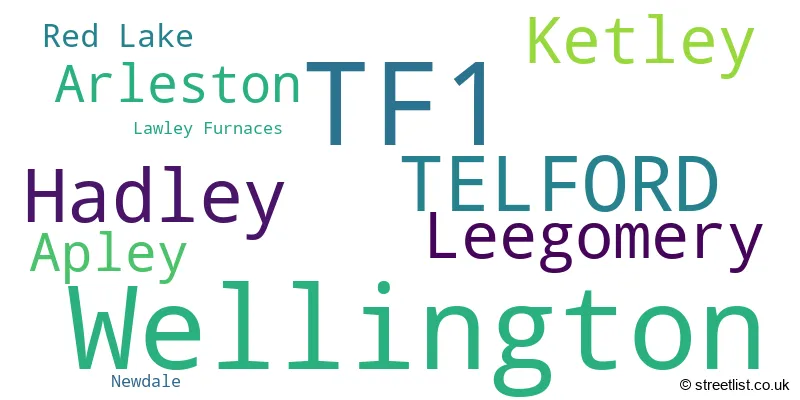
The primary settlement in the TF1 postcode district is Telford, which is located in Shropshire, England. Other significant settlements in the district include Wellington, Arleston, Hadley, Ketley, Lawley Furnaces, and Newdale. The most significant Postal Town in the district is Telford.
For the district TF1, we have data on 7 postcode sectors. Here's a breakdown: The sector TF1 1, covers Wellington in Shropshire. The sector TF1 2, covers Wellington and Arleston in Shropshire. The sector TF1 3, covers Wellington and Telford in Shropshire. The sector TF1 5, covers Ketley and Hadley in Shropshire. The sector TF1 6, covers Leegomery and Apley and Hadley in Shropshire. The sector TF1 7, covers Telford in Shropshire. The sector TF1 9 is non-geographic. It's often designated for PO Boxes, large organisations, or special services.

Map of the TF1 Postcode District
Explore the TF1 postcode district by using our free interactive map.

When it comes to local government, postal geography often disregards political borders. However, for a breakdown in the TF1 District: the district mostly encompasses the Telford and Wrekin (B) area with a total of 1099 postcodes.
Recent House Sales in TF12
| Date | Price | Address |
|---|---|---|
| 04/10/2023 | £150,000 | High Street, Broseley, TF12 5EZ |
| 22/09/2023 | £300,000 | The Mines, Benthall, Broseley, TF12 5QY |
| 23/08/2023 | £99,000 | High Street, Broseley, TF12 5ET |
| 10/08/2023 | £290,000 | King Street, Broseley Wood, Broseley, TF12 5PR |
| 28/07/2023 | £191,000 | Cherrybrook Drive, Broseley, TF12 5SH |
| 28/07/2023 | £180,000 | Bridgnorth Road, Broseley, TF12 5DS |
| 27/07/2023 | £235,000 | The Bentlands, Benthall, Broseley, TF12 5RP |
| 14/07/2023 | £475,000 | Quarry Road, Broseley Wood, Broseley, TF12 5QF |
| 12/07/2023 | £200,000 | Barber Street, Broseley, TF12 5NR |
| 12/07/2023 | £247,500 | Amies Meadow, Broseley, TF12 5FE |
Weather Forecast for TF1
Press Button to Show Forecast for Telford
| Time Period | Icon | Description | Temperature | Rain Probability | Wind |
|---|---|---|---|---|---|
| 12:00 to 15:00 | Overcast | 8.0°C (feels like 5.0°C) | 23.00% | ENE 11 mph | |
| 15:00 to 18:00 | Light rain | 8.0°C (feels like 5.0°C) | 47.00% | NE 9 mph | |
| 18:00 to 21:00 | Overcast | 8.0°C (feels like 5.0°C) | 13.00% | NE 9 mph | |
| 21:00 to 00:00 | Cloudy | 6.0°C (feels like 3.0°C) | 10.00% | NE 9 mph |
Press Button to Show Forecast for Telford
| Time Period | Icon | Description | Temperature | Rain Probability | Wind |
|---|---|---|---|---|---|
| 00:00 to 03:00 | Cloudy | 5.0°C (feels like 2.0°C) | 8.00% | NNE 9 mph | |
| 03:00 to 06:00 | Cloudy | 5.0°C (feels like 1.0°C) | 48.00% | N 9 mph | |
| 06:00 to 09:00 | Light rain | 4.0°C (feels like 1.0°C) | 54.00% | NNW 11 mph | |
| 09:00 to 12:00 | Heavy rain | 6.0°C (feels like 3.0°C) | 72.00% | NNW 11 mph | |
| 12:00 to 15:00 | Overcast | 9.0°C (feels like 6.0°C) | 17.00% | NW 11 mph | |
| 15:00 to 18:00 | Cloudy | 10.0°C (feels like 8.0°C) | 11.00% | NW 9 mph | |
| 18:00 to 21:00 | Sunny day | 10.0°C (feels like 8.0°C) | 3.00% | WNW 9 mph | |
| 21:00 to 00:00 | Clear night | 5.0°C (feels like 3.0°C) | 1.00% | SW 7 mph |
Press Button to Show Forecast for Telford
| Time Period | Icon | Description | Temperature | Rain Probability | Wind |
|---|---|---|---|---|---|
| 00:00 to 03:00 | Clear night | 4.0°C (feels like 2.0°C) | 1.00% | SSW 7 mph | |
| 03:00 to 06:00 | Clear night | 4.0°C (feels like 1.0°C) | 1.00% | S 7 mph | |
| 06:00 to 09:00 | Sunny day | 5.0°C (feels like 2.0°C) | 1.00% | S 9 mph | |
| 09:00 to 12:00 | Partly cloudy (day) | 10.0°C (feels like 7.0°C) | 2.00% | S 13 mph | |
| 12:00 to 15:00 | Cloudy | 12.0°C (feels like 9.0°C) | 5.00% | S 16 mph | |
| 15:00 to 18:00 | Cloudy | 13.0°C (feels like 10.0°C) | 12.00% | S 13 mph | |
| 18:00 to 21:00 | Partly cloudy (day) | 12.0°C (feels like 9.0°C) | 3.00% | S 11 mph | |
| 21:00 to 00:00 | Clear night | 9.0°C (feels like 7.0°C) | 2.00% | SSE 11 mph |
Press Button to Show Forecast for Telford
| Time Period | Icon | Description | Temperature | Rain Probability | Wind |
|---|---|---|---|---|---|
| 00:00 to 03:00 | Clear night | 8.0°C (feels like 5.0°C) | 3.00% | SE 9 mph | |
| 03:00 to 06:00 | Partly cloudy (night) | 7.0°C (feels like 5.0°C) | 2.00% | SE 9 mph | |
| 06:00 to 09:00 | Sunny day | 8.0°C (feels like 5.0°C) | 3.00% | ESE 9 mph | |
| 09:00 to 12:00 | Sunny day | 11.0°C (feels like 9.0°C) | 4.00% | SE 11 mph | |
| 12:00 to 15:00 | Partly cloudy (day) | 14.0°C (feels like 11.0°C) | 11.00% | SE 13 mph | |
| 15:00 to 18:00 | Light rain shower (day) | 15.0°C (feels like 12.0°C) | 34.00% | SE 11 mph | |
| 18:00 to 21:00 | Cloudy | 14.0°C (feels like 12.0°C) | 13.00% | SE 9 mph | |
| 21:00 to 00:00 | Partly cloudy (night) | 11.0°C (feels like 9.0°C) | 4.00% | ESE 7 mph |
Where is the TF1 Postcode District?
The postcode district TF1 is located in Telford. Telford is surrounded by several nearby towns, including Shifnal to the east, Broseley to the south, Newport to the northeast, Shrewsbury to the west, Market Drayton to the north, and Wolverhampton to the southeast. The distance between Telford and London is approximately 130.39 miles.
The district is within the post town of TELFORD.
The sector has postcodes within the nation of England.
The TF1 Postcode District is in the Telford and Wrekin region of Shropshire and Staffordshire within the West Midlands (England).
Postcode Sectors within the TF1 District
| Postcode Sector | Delivery Office |
|---|---|
| TF1 1 | Wellington (tf) Delivery Office |
| TF1 2 | Wellington (tf) Delivery Office |
| TF1 3 | Wellington (tf) Delivery Office |
| TF1 5 | Wellington (tf) Delivery Office |
| TF1 6 | Wellington (tf) Delivery Office |
| TF1 7 | Wellington (tf) Delivery Office |
| T | F | 1 | - | X | X | X |
| T | F | 1 | Space | Numeric | Letter | Letter |
Tourist Attractions within the Postcode Area
We found 1 visitor attractions within the TF1 postcode area
| Sunnycroft |
|---|
| Historic Properties |
| Historic House / House and Garden / Palace |
| View Sunnycroft on Google Maps |
Current Monthly Rental Prices
| # Bedrooms | Min Price | Max Price | Avg Price |
|---|---|---|---|
| 1 | £575 | £625 | £598 |
| 2 | £700 | £750 | £725 |
| 3 | £795 | £1,350 | £1,123 |
| 4 | £1,300 | £1,300 | £1,300 |
| 10 | £350 | £350 | £350 |
Current House Prices
| # Bedrooms | Min Price | Max Price | Avg Price |
|---|---|---|---|
| £70,000 | £5,700,000 | £1,767,500 | |
| 1 | £60,000 | £160,000 | £98,650 |
| 2 | £70,000 | £425,000 | £168,659 |
| 3 | £60,000 | £450,000 | £228,818 |
| 4 | £180,000 | £795,000 | £374,647 |
| 5 | £375,000 | £795,000 | £504,639 |
| 6 | £160,000 | £525,000 | £342,500 |
Estate Agents who Operate in the TF1 District
| Logo | Name | Brand Name | Address | Contact Number | Total Properties |
|---|---|---|---|---|---|
 | Telford | Mannleys Sales & Lettings | 23A Market Street, Wellington, Telford, TF1 1DT | 01952 456785 | 46 |
 | Telford | D B Roberts & Partners | 56 Southwater Town Centre Telford TF3 4DE | 01952 458201 | 37 |
 | Wellington | Coleman Estates | 25 Church Street, Wellington, Telford, TF1 1DG | 01952 458187 | 27 |
 | Wellington | Barbers | 1 Church Street, Wellington, Telford, TF1 1DD | 01952 458145 | 16 |
 | Telford | Harwood The Estate Agents | 44 ? 46 Market Street Wellington Telford Shropshire TF1 1DT | 01952 984232 | 16 |
| Type of Property | 2018 Average | 2018 Sales | 2017 Average | 2017 Sales | 2016 Average | 2016 Sales | 2015 Average | 2015 Sales |
|---|---|---|---|---|---|---|---|---|
| Detached | £249,290 | 222 | £235,118 | 242 | £223,078 | 258 | £214,268 | 262 |
| Semi-Detached | £149,126 | 250 | £139,916 | 270 | £140,877 | 327 | £131,369 | 263 |
| Terraced | £128,624 | 121 | £133,958 | 173 | £129,651 | 196 | £124,816 | 190 |
| Flats | £95,989 | 52 | £102,533 | 49 | £100,850 | 63 | £94,117 | 47 |