The TN20 postcode district is a postal district located in the TN Tonbridge postcode area with a population of 3,760 residents according to the 2021 England and Wales Census.
The area of the TN20 postcode district is 15.22 square miles which is 39.41 square kilometres or 9,737.91 acres.
Currently, the TN20 district has about 177 postcode units spread across 1 geographic postcode sectors.
Given that each sector allows for 400 unique postcode combinations, the district has a capacity of 400 postcodes. With 177 postcodes already in use, this leaves 223 units available.
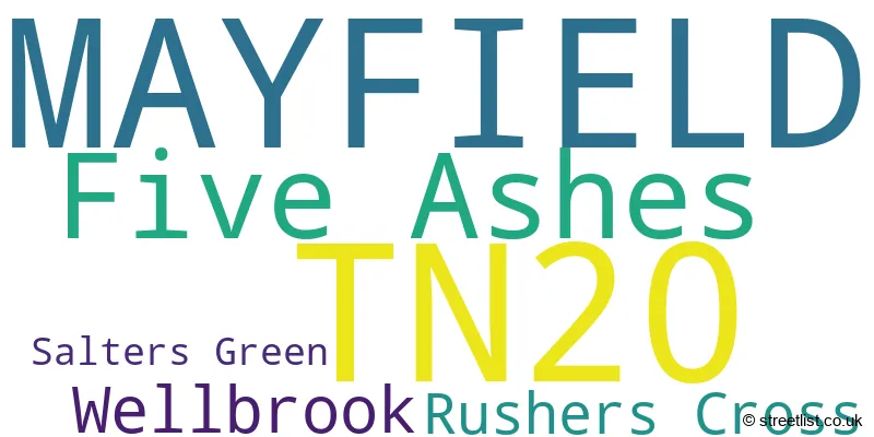
The largest settlement in the TN20 postal code is MAYFIELD followed by Five Ashes, and Wellbrook.
The TN20 Postcode shares a border with TN5 (WADHURST, Ticehurst, Flimwell), TN6 (CROWBOROUGH, Rotherfield, Mark Cross), TN19 (Burwash, Hurst Green, ETCHINGHAM) and TN21 (HEATHFIELD, Horam, Cross In Hand).
In the TN20 postcode district, the primary settlement is Mayfield, which is located in the county of East Sussex in England. The most significant post town in this district is Mayfield. There are also other settlements within the TN20 postcode district, including Five Ashes, Rushers Cross, Salters Green, and Wellbrook. However, these settlements represent a smaller proportion of the district and are therefore not mentioned in this concise description.
For the district TN20, we have data on 1 postcode sectors. Here's a breakdown: The sector TN20 6, covers Mayfield and Five Ashes in East Sussex.
TN20 Postcode Sectors

Map of the TN20 Postcode District
Explore the TN20 postcode district by using our free interactive map.

When it comes to local government, postal geography often disregards political borders. However, for a breakdown in the TN20 District: the district mostly encompasses the Wealden District area with a total of 177 postcodes.
Recent House Sales in TN20
| Date | Price | Address |
|---|---|---|
| 13/10/2023 | £610,000 | Criers Lane, Five Ashes, Mayfield, TN20 6LE |
| 22/09/2023 | £670,000 | Fletching Street, Mayfield, TN20 6TD |
| 30/08/2023 | £675,000 | The Warren, Mayfield, TN20 6UB |
| 25/08/2023 | £490,000 | Fletching Street, Mayfield, TN20 6TB |
| 18/08/2023 | £305,000 | West Street, Mayfield, TN20 6DR |
| 10/08/2023 | £378,000 | Five Ashes, Mayfield, TN20 6HY |
| 01/08/2023 | £350,000 | Ferndale Cottages, Five Ashes, Mayfield, TN20 6HY |
| 21/07/2023 | £1,425,000 | Rushers Cross, Mayfield, TN20 6PX |
| 14/07/2023 | £365,000 | Heathfield Road, Five Ashes, Mayfield, TN20 6JJ |
| 19/06/2023 | £482,000 | Station Road, Mayfield, TN20 6BL |
Where is the TN20 Postcode District?
The postcode district TN20 is located in Mayfield, which is a town in East Sussex. Mayfield is situated near several other towns, including Heathfield to the South (approximately 3.96 miles away), Wadhurst to the North East (approximately 4.34 miles away), Crowborough to the North West (approximately 4.68 miles away), Etchingham to the East (approximately 7.16 miles away), Uckfield to the South West (approximately 7.54 miles away), and Tunbridge Wells to the North (approximately 8.28 miles away). Additionally, Mayfield is approximately 38.01 miles away from the center of London.
The district is within the post town of MAYFIELD.
The sector has postcodes within the nation of England.
The TN20 Postcode District is covers the following regions.
- East Sussex CC - Surrey, East and West Sussex - South East (England)
- West Kent - Kent - South East (England)
Weather Forecast for TN20
Press Button to Show Forecast for Heathfield
| Time Period | Icon | Description | Temperature | Rain Probability | Wind |
|---|---|---|---|---|---|
| 06:00 to 09:00 | Cloudy | 14.0°C (feels like 13.0°C) | 4.00% | E 7 mph | |
| 09:00 to 12:00 | Partly cloudy (day) | 19.0°C (feels like 18.0°C) | 1.00% | ESE 7 mph | |
| 12:00 to 15:00 | Partly cloudy (day) | 22.0°C (feels like 20.0°C) | 0.00% | SE 9 mph | |
| 15:00 to 18:00 | Partly cloudy (day) | 22.0°C (feels like 21.0°C) | 1.00% | SE 7 mph | |
| 18:00 to 21:00 | Cloudy | 20.0°C (feels like 19.0°C) | 4.00% | SSE 7 mph | |
| 21:00 to 00:00 | Cloudy | 15.0°C (feels like 14.0°C) | 4.00% | SSW 7 mph |
Press Button to Show Forecast for Heathfield
| Time Period | Icon | Description | Temperature | Rain Probability | Wind |
|---|---|---|---|---|---|
| 00:00 to 03:00 | Partly cloudy (night) | 13.0°C (feels like 11.0°C) | 3.00% | SW 9 mph | |
| 03:00 to 06:00 | Cloudy | 11.0°C (feels like 9.0°C) | 7.00% | SW 9 mph | |
| 06:00 to 09:00 | Cloudy | 11.0°C (feels like 9.0°C) | 10.00% | SW 9 mph | |
| 09:00 to 12:00 | Cloudy | 14.0°C (feels like 12.0°C) | 4.00% | SSW 11 mph | |
| 12:00 to 15:00 | Cloudy | 15.0°C (feels like 13.0°C) | 4.00% | S 11 mph | |
| 15:00 to 18:00 | Partly cloudy (day) | 16.0°C (feels like 14.0°C) | 2.00% | S 11 mph | |
| 18:00 to 21:00 | Cloudy | 16.0°C (feels like 14.0°C) | 10.00% | SE 9 mph | |
| 21:00 to 00:00 | Cloudy | 14.0°C (feels like 12.0°C) | 21.00% | ESE 11 mph |
Press Button to Show Forecast for Heathfield
| Time Period | Icon | Description | Temperature | Rain Probability | Wind |
|---|---|---|---|---|---|
| 00:00 to 03:00 | Cloudy | 14.0°C (feels like 12.0°C) | 21.00% | SE 11 mph | |
| 03:00 to 06:00 | Light rain | 13.0°C (feels like 11.0°C) | 56.00% | SE 9 mph | |
| 06:00 to 09:00 | Heavy rain | 13.0°C (feels like 11.0°C) | 83.00% | SE 11 mph | |
| 09:00 to 12:00 | Heavy rain | 13.0°C (feels like 11.0°C) | 85.00% | SSE 11 mph | |
| 12:00 to 15:00 | Heavy rain | 14.0°C (feels like 12.0°C) | 82.00% | S 11 mph | |
| 15:00 to 18:00 | Light rain | 14.0°C (feels like 12.0°C) | 51.00% | S 11 mph | |
| 18:00 to 21:00 | Cloudy | 14.0°C (feels like 12.0°C) | 12.00% | SE 9 mph | |
| 21:00 to 00:00 | Cloudy | 12.0°C (feels like 10.0°C) | 9.00% | SE 11 mph |
Press Button to Show Forecast for Heathfield
| Time Period | Icon | Description | Temperature | Rain Probability | Wind |
|---|---|---|---|---|---|
| 00:00 to 03:00 | Cloudy | 12.0°C (feels like 10.0°C) | 9.00% | SE 11 mph | |
| 03:00 to 06:00 | Clear night | 11.0°C (feels like 9.0°C) | 5.00% | SSE 9 mph | |
| 06:00 to 09:00 | Partly cloudy (day) | 11.0°C (feels like 10.0°C) | 9.00% | SSE 9 mph | |
| 09:00 to 12:00 | Partly cloudy (day) | 14.0°C (feels like 12.0°C) | 9.00% | SSE 9 mph | |
| 12:00 to 15:00 | Partly cloudy (day) | 15.0°C (feels like 13.0°C) | 6.00% | SSE 11 mph | |
| 15:00 to 18:00 | Partly cloudy (day) | 16.0°C (feels like 14.0°C) | 4.00% | S 9 mph | |
| 18:00 to 21:00 | Sunny day | 15.0°C (feels like 14.0°C) | 2.00% | SSE 7 mph | |
| 21:00 to 00:00 | Clear night | 11.0°C (feels like 9.0°C) | 1.00% | ESE 7 mph |
Press Button to Show Forecast for Heathfield
| Time Period | Icon | Description | Temperature | Rain Probability | Wind |
|---|---|---|---|---|---|
| 00:00 to 03:00 | Clear night | 10.0°C (feels like 8.0°C) | 1.00% | ESE 7 mph | |
| 03:00 to 06:00 | Clear night | 9.0°C (feels like 7.0°C) | 4.00% | ESE 7 mph | |
| 06:00 to 09:00 | Sunny day | 11.0°C (feels like 10.0°C) | 4.00% | ESE 7 mph | |
| 09:00 to 12:00 | Partly cloudy (day) | 15.0°C (feels like 14.0°C) | 6.00% | SSE 7 mph | |
| 12:00 to 15:00 | Light rain shower (day) | 16.0°C (feels like 15.0°C) | 33.00% | S 7 mph | |
| 15:00 to 18:00 | Sunny day | 17.0°C (feels like 16.0°C) | 10.00% | S 7 mph | |
| 18:00 to 21:00 | Partly cloudy (day) | 16.0°C (feels like 15.0°C) | 10.00% | SW 7 mph | |
| 21:00 to 00:00 | Clear night | 11.0°C (feels like 10.0°C) | 4.00% | SW 7 mph |
Postcode Sectors within the TN20 District
| Postcode Sector | Delivery Office |
|---|---|
| TN20 6 | Tunbridge Wells Delivery Office |
| T | N | 2 | 0 | - | X | X | X |
| T | N | 2 | 0 | Space | Numeric | Letter | Letter |
Current Monthly Rental Prices
| # Bedrooms | Min Price | Max Price | Avg Price |
|---|---|---|---|
| 2 | £2,250 | £2,250 | £2,250 |
| 4 | £2,100 | £2,100 | £2,100 |
| 7 | £4,450 | £4,450 | £4,450 |
Current House Prices
| # Bedrooms | Min Price | Max Price | Avg Price |
|---|---|---|---|
| £195,000 | £195,000 | £195,000 | |
| 2 | £415,000 | £760,000 | £560,000 |
| 3 | £425,000 | £925,000 | £635,000 |
| 4 | £550,000 | £1,995,000 | £990,000 |
| 5 | £725,000 | £4,650,000 | £1,946,429 |
| 6 | £1,100,000 | £1,600,000 | £1,353,125 |
| 8 | £3,250,000 | £3,250,000 | £3,250,000 |
| 9 | £1,750,000 | £1,750,000 | £1,750,000 |
Estate Agents who Operate in the TN20 District
| Logo | Name | Brand Name | Address | Contact Number | Total Properties |
|---|---|---|---|---|---|
 | Mayfield | Burnetts | 3 Church View House, High Street, Mayfield, TN20 6AB | 01435 518061 | 12 |
 | Tunbridge Wells | Savills | 53 High Street, Tunbridge Wells, TN1 1XU | 01892 362215 | 5 |
 | Cowbeech | Neville & Neville Estate Agents | Forge Meadow Hammer Lane, Cowbeech, BN27 4JL | 01323 679845 | 5 |
 | Tunbridge Wells | Knight Frank | 47 High Street Tunbridge Wells TN1 1XL | 01892 362238 | 4 |
 | Tunbridge Wells | Batcheller Monkhouse | 1 London Road, Tunbridge Wells, TN1 1DH | 01892 362131 | 4 |
Yearly House Price Averages for the TN20 Postcode District
| Type of Property | 2018 Average | 2018 Sales | 2017 Average | 2017 Sales | 2016 Average | 2016 Sales | 2015 Average | 2015 Sales |
|---|---|---|---|---|---|---|---|---|
| Detached | £754,077 | 29 | £620,191 | 27 | £711,147 | 37 | £637,717 | 30 |
| Semi-Detached | £455,542 | 12 | £421,999 | 9 | £485,556 | 9 | £415,000 | 9 |
| Terraced | £359,550 | 10 | £341,333 | 6 | £372,950 | 11 | £313,543 | 14 |
| Flats | £410,000 | 3 | £248,417 | 6 | £345,833 | 9 | £329,950 | 10 |