The TN25 7 postcode sector is within the county of Kent.
Did you know? According to the 2021 Census, the TN25 7 postcode sector is home to a bustling 5,107 residents!
Given that each sector allows for 400 unique postcode combinations. Letters C, I, K, M, O and V are not allowed in the last two letters of a postcode. With 150 postcodes already in use, this leaves 250 units available.
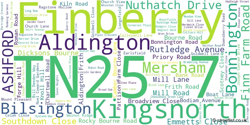
The largest settlement in the TN25 7 postal code is Aldington followed by Kingsnorth, and Finberry.
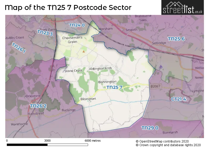
The TN25 7 Postcode shares a border with TN25 6 (Sellindge, Smeeth, Mersham), TN26 1 (Shadoxhurst, Hothfield, Great Chart), TN26 2 (Hamstreet, Ruckinge, Appledore), CT21 4 (HYTHE, Lympne, Saltwood), TN23 3 (Kingsnorth, ASHFORD, Great Chart), TN24 0 (Willesborough, ASHFORD, Sevington) and TN29 0 (Dymchurch, St. Marys Bay, Burmarsh).
The sector is within the post town of ASHFORD.
TN25 7 is a postcode sector within the TN25 postcode district which is within the TN Tonbridge postcode area.
The Royal Mail delivery office for the TN25 7 postal sector is the Ashford (tn) Delivery Office.
The area of the TN25 7 postcode sector is 14.71 square miles which is 38.10 square kilometres or 9,415.75 square acres.
The TN25 7 postcode sector is crossed by the A2070 Major A road.
Waterways within the TN25 7 postcode sector include the East Stour, Royal Military Canal.

Map of the TN25 7 Postcode Sector
Explore the TN25 7 postcode sector by using our free interactive map.
| T | N | 2 | 5 | - | 7 | X | X |
| T | N | 2 | 5 | Space | 7 | Letter | Letter |
Official List of Streets
Aldington (33 Streets)
Finberry (27 Streets)
Kingsnorth (33 Streets)
Mersham (8 Streets)
Bilsington (3 Streets)
Bonnington (1 Streets)
Unofficial Streets or Alternative Spellings
Mersham
FLOOD STREETKingsnorth
BLUEBELL ROAD AE370 AE377 AE382 AE390 BODIUM AVENUE CAMBER BOURNE ROAD CHERRY ORCHARD LANE FINN FARM DRIVE GIGGERS GREEN ROAD NEW ROAD HILL NEWCHURCH ROAD PIPIN CRESENT ROWLING STREET STONE CROSS ROAD SWANTON LANE TAR POT LANE THE STREET WILLS LANERuckinge
BRISLEY LANEWest Hythe
LOWER WALL ROADWeather Forecast for TN25 7
Press Button to Show Forecast for Newchurch
| Time Period | Icon | Description | Temperature | Rain Probability | Wind |
|---|---|---|---|---|---|
| 03:00 to 06:00 | Overcast | 6.0°C (feels like 3.0°C) | 44.00% | NE 7 mph | |
| 06:00 to 09:00 | Overcast | 6.0°C (feels like 4.0°C) | 11.00% | NE 7 mph | |
| 09:00 to 12:00 | Cloudy | 8.0°C (feels like 6.0°C) | 11.00% | ENE 9 mph | |
| 12:00 to 15:00 | Cloudy | 9.0°C (feels like 7.0°C) | 12.00% | E 9 mph | |
| 15:00 to 18:00 | Cloudy | 9.0°C (feels like 7.0°C) | 10.00% | E 9 mph | |
| 18:00 to 21:00 | Cloudy | 8.0°C (feels like 6.0°C) | 11.00% | ENE 9 mph | |
| 21:00 to 00:00 | Cloudy | 7.0°C (feels like 5.0°C) | 13.00% | ENE 9 mph |
Press Button to Show Forecast for Newchurch
| Time Period | Icon | Description | Temperature | Rain Probability | Wind |
|---|---|---|---|---|---|
| 00:00 to 03:00 | Overcast | 7.0°C (feels like 5.0°C) | 20.00% | ENE 7 mph | |
| 03:00 to 06:00 | Overcast | 8.0°C (feels like 6.0°C) | 21.00% | ENE 7 mph | |
| 06:00 to 09:00 | Overcast | 9.0°C (feels like 7.0°C) | 20.00% | E 9 mph | |
| 09:00 to 12:00 | Cloudy | 11.0°C (feels like 8.0°C) | 14.00% | ESE 11 mph | |
| 12:00 to 15:00 | Cloudy | 12.0°C (feels like 10.0°C) | 12.00% | E 11 mph | |
| 15:00 to 18:00 | Cloudy | 12.0°C (feels like 9.0°C) | 17.00% | ENE 11 mph | |
| 18:00 to 21:00 | Cloudy | 11.0°C (feels like 8.0°C) | 18.00% | ENE 11 mph | |
| 21:00 to 00:00 | Light rain | 11.0°C (feels like 8.0°C) | 50.00% | E 11 mph |
Press Button to Show Forecast for Newchurch
| Time Period | Icon | Description | Temperature | Rain Probability | Wind |
|---|---|---|---|---|---|
| 00:00 to 03:00 | Heavy rain | 11.0°C (feels like 9.0°C) | 75.00% | ESE 11 mph | |
| 03:00 to 06:00 | Light rain shower (night) | 11.0°C (feels like 8.0°C) | 40.00% | SSE 13 mph | |
| 06:00 to 09:00 | Light rain shower (day) | 11.0°C (feels like 8.0°C) | 36.00% | SSE 13 mph | |
| 09:00 to 12:00 | Cloudy | 12.0°C (feels like 9.0°C) | 18.00% | S 18 mph | |
| 12:00 to 15:00 | Light rain shower (day) | 12.0°C (feels like 9.0°C) | 37.00% | SSW 20 mph | |
| 15:00 to 18:00 | Light rain shower (day) | 14.0°C (feels like 10.0°C) | 34.00% | SSW 16 mph | |
| 18:00 to 21:00 | Partly cloudy (day) | 12.0°C (feels like 9.0°C) | 11.00% | SSW 13 mph | |
| 21:00 to 00:00 | Cloudy | 10.0°C (feels like 8.0°C) | 9.00% | SW 11 mph |
Schools and Places of Education Within the TN25 7 Postcode Sector
Aldington Primary School
Foundation school
Roman Road, Ashford, Kent, TN25 7EE
Head: Mr Ben Dawson.
Ofsted Rating: Good
Inspection: 2018-06-26 (2131 days ago)
Website: Visit Aldington Primary School Website
Phone: 01233720247
Number of Pupils: 191
Finberry Primary School
Academy sponsor led
Avocet Way, Ashford, Kent, TN25 7GS
Head: Headteacher Stella Scharinger
Ofsted Rating: Good
Inspection: 2018-09-27 (2038 days ago)
Website: Visit Finberry Primary School Website
Phone: 01233622686
Number of Pupils: 334
House Prices in the TN25 7 Postcode Sector
| Type of Property | 2018 Average | 2018 Sales | 2017 Average | 2017 Sales | 2016 Average | 2016 Sales | 2015 Average | 2015 Sales |
|---|---|---|---|---|---|---|---|---|
| Detached | £454,174 | 72 | £446,380 | 79 | £357,258 | 97 | £354,367 | 64 |
| Semi-Detached | £317,144 | 45 | £280,694 | 36 | £259,279 | 56 | £239,314 | 62 |
| Terraced | £269,438 | 46 | £262,763 | 38 | £249,954 | 67 | £230,728 | 34 |
| Flats | £210,250 | 11 | £180,984 | 25 | £185,635 | 10 | £153,300 | 24 |
Important Postcodes TN25 7 in the Postcode Sector
TN25 7DS is the postcode for Aldington Eco Centre, Goldwell Lane, Aldington
TN25 7EE is the postcode for ALDINGTON PRIMARY SCHOOL, ROMAN ROAD, ALDINGTON, and Aldington Cp School, Roman Road
TN25 7GS is the postcode for Finberry Primary School, Avocet Way, Sevington, and Finberry Primary School, Avocet Way
| The TN25 7 Sector is within these Local Authorities |
|
|---|---|
| The TN25 7 Sector is within these Counties |
|
| The TN25 7 Sector is within these Water Company Areas |
|