UB3 5FE is a postal code used within the United Kingdom for delivering mail.
Postcodes are made up of two parts. The part before the space (UB3) is called the outward code. The part after the space (5FE) is called the inward code. The letters C, I, K, M, O and V are not allowed in the inward code. In addition to the inward and outward code, the postcode can be broken up into four parts:
- Postal Area. In our case TW which means Twickenham.
- Postal District. In our case UB3.
- Postal Sector. In our case TW6 2.
- Postcode Unit. The last two letters. In our case FE.
The regional mail center for the post area TW is the Princess Royal Distribution Centre, which is located at Blackmore Drive, North Circular, LONDON , NW10 7RH.
The final port of call for any post addressed to the UB3 5FE postcode is the local delivery office (DO) which is . Here the post will be sorted ready for delivery.
The properties in the UB3 5FE postcode have the street address of Nobel Drive
Did you know? According to the 2021 Census, the UB3 5FE postcode is home to a bustling 63 residents!
It is situated within the post town of HAYES within the old postal county of Middlesex.
UB3 5FE is within Harlington.
The UB3 5FE postcode area is composed of 100% residential properties, 0% commercial properties, and 0% public properties.
According to our data. Most dwellings in UB3 5FE are flats. Of these flats, most are detached.
Most properties in UB3 5FE are unknown tenure with the rest being unknown tenure.

Interactive Mapping Showing UPRNs within the UB3 5FE Postcode Boundaries
Use the search box to search for other postcodes or places.
Map of the UB3 5FE Postcode

| Property Type | Percentage |
|---|---|
| Residential | 100% |
| Commercial | 0% |
| Public | 0% |
Telephone Area Code for UB3 5FE
The telephone area code for UB3 5FE is 020 London.
Map Coordinates for UB3 5FE
| Latitude | 51.4810529348 |
|---|---|
| Longitude | -0.429984988381 |
What are the Broadband Speeds like in the UB3 5FE Postcode?
Download Speeds For UB3 5FE

| Average Mbps | 91.000 |
|---|---|
| Median Mbps | 80.000 |
| Maximum Mbps | 160.000 |
UB3 5FE has an average download speed of 91 Megabits per second (Mbps).
753 other postcode units have the same broadband speed.
61% of postcodes (728,002) have slower broadband speeds.
38% of postcodes (455,886) have faster broadband speeds.
Upload Speeds For UB3 5FE

| Average Mbps | 19.000 |
|---|---|
| Median Mbps | 20.000 |
| Maximum Mbps | 30.000 |
UB3 5FE has an average upload speed of 19 Megabits per second (Mbps).
3,231 other postcode units have the same upload speed.
91% of postcodes (1,080,334) have slower upload speeds.
9% of postcodes (101,076) have faster upload speeds.
Schools within a five minute drive of UB3 5FE Postcode
England Primary Schools
Beavers Community Primary School
Address: Beavers Community Primary School, Arundel Road, Hounslow, TW4 6HR
Distance: 1.45 miles
Contact: 02085709347
Cranford Primary School
Address: Cranford Primary School, Berkeley Avenue, Cranford, Hounslow, TW4 6LB
Distance: 0.87 miles
Contact: 02087590305
Cranford Park Academy
Address: Cranford Park Academy, Phelps Way, Harlington, Hayes, UB3 4LQ
Distance: 1.09 miles
Contact: 02085733453
William Byrd Primary Academy
Address: William Byrd Primary Academy, Victoria Lane, Harlington, Hayes, Middlesex, UB3 5EW
Distance: 0.72 miles
Contact: 01895462394
William Byrd School
Address: William Byrd School, Victoria Lane, Harlington, Hayes, Middlesex, UB3 5EW
Distance: 0.72 miles
Contact:
Heathrow Primary School
Address: Heathrow Primary School, Harmondsworth Lane, Sipson, West Drayton, UB7 0JQ
Distance: 1.40 miles
Contact: 02087591628
England Secondary Schools
Cranford Community College
Address: Cranford Community College, High Street, Cranford, Hounslow, Middlesex, TW5 9PD
Distance: 1.11 miles
Contact: 02088972001
Harlington School
Address: Harlington School, Pinkwell Lane, Harlington, Hayes, UB3 1PB
Distance: 1.14 miles
Contact: 02085691610
Nearest Dentists
Dentists near UB3 5FE
VILLAGE DENTAL PRACTICE
Address: 159 HIGH STREET, HARLINGTON, HAYES, MIDDLESEX, UB3 5DA
Distance: 0.67 miles
Contact: :
DENTAL SURGERY
Address: 734A BATH ROAD, HOUNSLOW, MIDDLESEX, TW5 9TY
Distance: 0.78 miles
Contact: :
CLARADENT DENTAL CARE
Address: 766 BATH ROAD, HOUNSLOW, MIDDLESEX, TW5 9TY
Distance: 0.78 miles
Contact: :
DENTAL SURGERY
Address: 59 BERKELEY AVENUE, HOUNSLOW, MIDDLESEX, TW4 6LE
Distance: 0.84 miles
Contact: :
EVODENTAL
Address: 2 HEATHROW BOULEVARD, 284 BATH ROAD, SIPSON, WEST DRAYTON, UB7 0DQ
Distance: 1.40 miles
Contact: :
HAYES DENTAL PRACTICE
Address: 115-117 STATION ROAD, HAYES, UB3 4BX
Distance: 1.61 miles
Contact: :
Nearest Chemists
Pharmacies near UB3 5FE
THE VILLAGE PHARMACY
Address: 218-220 HIGH STREET, HARLINGTON, HAYES, MIDDLESEX, UB3 5DS
Distance: 0.52 miles
Contact: tel: 020 87599658
DUNN CHEMISTS
Address: 740 BATH ROAD, CRANFORD, HOUNSLOW, MIDDLESEX, TW5 9TY
Distance: 0.78 miles
Contact: :
MEDICS PHARMACY
Address: 11 DAWLEY ROAD, HAYES, MIDDLESEX, UB3 1LS
Distance: 1.16 miles
Contact: tel: 020 85731799
HOBBS PHARMACY
Address: MEADOWS CENTRE FOR HEALTH, CHINCHILLA DRIVE, HOUNSLOW, MIDDLESEX, TW4 7NR
Distance: 1.37 miles
Contact: tel: 02033 931118
KASMANI PHARMACY
Address: 6 NORTHFIELD PARADE, STATION ROAD, HAYES, MIDDLESEX, UB3 4JA
Distance: 1.40 miles
Contact: tel: 02085 730679
BOOTS
Address: AIRSIDE, TERMINAL THREE, LONDON HEATHROW AIRPORT, HOUNSLOW, MIDDLESEX, TW6 1QG
Distance: 1.41 miles
Contact: tel: 020 88971817
Nearest Opticians
Opticians near UB3 5FE
CRANFORD OPTICIANS
Address: 742 BATH ROAD, CRANFORD, HOUNSLOW, MIDDLESEX, TW5 9TY
Distance: 0.78 miles
Contact: :
COSTCO WHOLESALE UK LTD - WESTERN INTERNATIONAL PARK
Address: COSTCO WHOLESALE, WESTERN INTERNATIONAL MARKET, HAYES ROAD, SOUTHALL, MIDDLESEX, UB2 5XJ
Distance: 1.41 miles
Contact: :
ASDA OPTICIANS (HAYES)
Address: UNIT 3 WESTLANDS ESTATE, HAYES, MIDDLESEX, UB3 4AZ
Distance: 1.41 miles
Contact: :
HAYES BULLS BRIDGE EXTRA
Address: HAYES ROAD, SOUTHALL, MIDDLESEX, UB2 5LN
Distance: 1.63 miles
Contact: :
TESCO OPTICIANS (HAYES)
Address: BULLS BRIDGE IND EST, HAYES ROAD, SOUTHALL, MIDDLESEX, UB2 5LN
Distance: 1.63 miles
Contact: :
BOOTS OPTICIANS (HAYES MIDDLESEX)
Address: 49 STATION ROAD, HAYES, MIDDLESEX, UB3 4BE
Distance: 1.77 miles
Contact: :
Nearest GP Surgeries
Doctors near UB3 5FE
GLENDALE MEDICAL CENTRE
Address: 155 HIGH STREET, HARLINGTON, HAYES, MIDDLESEX, UB3 5DA
Distance: 0.67 miles
Contact: tel: 020 88978288
CRANFORD MEDICAL CENTRE
Address: 24 HIGH STREET, CRANFORD, HOUNSLOW, MIDDLESEX, TW5 9RG
Distance: 0.76 miles
Contact: tel: 020 85648696
SANDHU P J S
Address: 48 BERKELEY AVENUE, CRANFORD, MIDDLESEX, TW4 6LA
Distance: 0.82 miles
Contact: tel: 02088979106
HEATHROW MEDICAL CENTRE
Address: ST. PETERS WAY, HARLINGTON, HAYES, UB3 5AB
Distance: 0.84 miles
Contact: tel: 020 87541555
SHAKESPEARE HEALTH CENTRE
Address: ELERS ROAD CLINIC, ELERS ROAD, HAYES, MIDDLESEX, UB3 1NY
Distance: 1.24 miles
Contact: tel: 020 37943119
NORTH HYDE PRACTICE - COVID LOCAL VACCINATION SERVICE
Address: 167 NORTH HYDE ROAD, HAYES, UB3 4NS
Distance: 1.35 miles
Contact: :
Motorway Junctions near UB3 5FE
Train Stations
Motorway Junctions near UB3 5FE
Distances represent the quickest route by car.
Who are my Elected Representatives in the UB3 5FE Postcode?
| Westminster Constituency | Hayes and Harlington Boro Const |
|---|---|
| Member or Parliament | 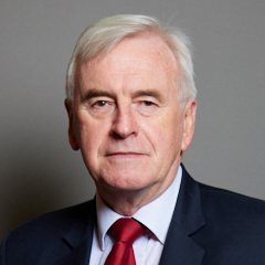 |
| Contact Details | Contact John McDonnell |
| Political Party | Labour |
What Council is the UB3 5FE Postcode in?
The Local Council for this Postcode is Hillingdon London Boro Council and the County Council is Greater London Authority Council.
Greater London Authority Council is responsible for providing education, libraries and maintaining highways.
Hillingdon London Boro Council is responsible for duties such as council tax, rubbish collection, housing, environmental health and planning.
You can visit the website for Hillingdon London Boro at the following link Hillingdon London Boro.How much is the Council Tax?
Hillingdon London Boro Council is responsible for collecting council tax. This will vary depending on which council tax band the property falls within. You can check the council tax band at the gov.uk website.
Once you know the council tax band you can view how much Hillingdon London Boro charge for that band by visiting the The Council Tax section of their website.
Where can I find out where the nearest Library to the UB3 5FE Postcode is?
Libraries are the responsibility of Hillingdon council
Visit the link for more information. Please note that some councils outsource library services to private companies and community groups ran by volunteers.
Libraries - Hillingdon CouncilPostcodes near the UB3 5FE Postcode
What Popular Supermarkets are near the UB3 5FE Postcode?
| Supermarket | Distance | Directions |
|---|---|---|
| Asda, Millington Road, HAYES, UB3 4AZ | 2.33 miles | Directions from UB3 5FE to Asda |
| Tesco, Faggs Road, FELTHAM, TW14 0LH | 2.51 miles | Directions from UB3 5FE to Tesco |
| Iceland, Station Road, HAYES, UB3 4DX | 2.90 miles | Directions from UB3 5FE to Iceland |
| Iceland, Bath Road, HOUNSLOW, TW4 7DN | 3.14 miles | Directions from UB3 5FE to Iceland |
| Iceland, The Centre, FELTHAM, TW13 4BH | 4.08 miles | Directions from UB3 5FE to Iceland |
What Popular Restaurants are near the UB3 5FE Postcode?
| Burger King | Distance | Directions |
|---|---|---|
| Heston Service Area, Hounslow, TW5 9NA | 1.53 miles | Directions from UB3 5FE to Heston Service Area |
| Heston Service Area, Hounslow, TW5 9NB | 1.54 miles | Directions from UB3 5FE to Heston Service Area |
| Unit G, Feltham Leisure Park, Feltham, TW13 7EQ | 2.81 miles | Directions from UB3 5FE to Unit G, Feltham Leisure Park |
| Unit A3,5, Treaty Shopping Centre, Hounslow, TW3 1ES | 2.97 miles | Directions from UB3 5FE to Unit A3,5, Treaty Shopping Centre |
| Mcdonald's | Distance | Directions |
|---|---|---|
| McDonald's, Mondial Way, Harlington, HAYES, UB3 5AR | 0.59 miles | Directions from UB3 5FE to McDonald's, Mondial Way, Harlington, HAYES, UB3 5AR |
| McDonald's, Bath Road, HOUNSLOW, TW5 9UW | 1.46 miles | Directions from UB3 5FE to McDonald's, Bath Road, HOUNSLOW, TW5 9UW |
| McDonald's, Station Road, HAYES, UB3 4DA | 1.83 miles | Directions from UB3 5FE to McDonald's, Station Road, HAYES, UB3 4DA |
| McDonald's, Bath Road, WEST DRAYTON, UB7 0EA | 2.19 miles | Directions from UB3 5FE to McDonald's, Bath Road, WEST DRAYTON, UB7 0EA |
| Restaurant | Distance | Directions |
|---|---|---|
| KFC, Bath Road, Heathrow, HOUNSLOW, TW6 2AA | 0.49 miles | Directions from UB3 5FE to KFC Heathrow - Bath Road |
| KFC, Cavendish Parade, Bath Road, HOUNSLOW, TW4 7DJ | 2.00 miles | Directions from UB3 5FE to KFC Hounslow - Cavendish Parade |
| KFC, Uxbridge Road, HAYES, UB4 0RY | 2.77 miles | Directions from UB3 5FE to KFC Hayes End - Uxbridge Road |
| KFC, High Street, Yiewsley, WEST DRAYTON, UB7 7DS | 2.83 miles | Directions from UB3 5FE to KFC Yiewsley - High Street |
| KFC, Rochester Parade, High Street, FELTHAM, TW13 4DX | 2.86 miles | Directions from UB3 5FE to KFC Feltham - Rochester Parade |