UB7 9DL is a postal code used within the United Kingdom for delivering mail.
Postcodes are made up of two parts. The part before the space (UB7) is called the outward code. The part after the space (9DL) is called the inward code. The letters C, I, K, M, O and V are not allowed in the inward code. In addition to the inward and outward code, the postcode can be broken up into four parts:
- Postal Area. In our case TW which means Twickenham.
- Postal District. In our case UB7.
- Postal Sector. In our case TW6 2.
- Postcode Unit. The last two letters. In our case DL.
The regional mail center for the post area TW is the Princess Royal Distribution Centre, which is located at Blackmore Drive, North Circular, LONDON , NW10 7RH.
The final port of call for any post addressed to the UB7 9DL postcode is the local delivery office (DO) which is . Here the post will be sorted ready for delivery.
The properties in the UB7 9DL postcode have the street address of Sipson Road
It is situated within the post town of WEST DRAYTON within the old postal county of Middlesex.
UB7 9DL is within West Drayton.
According to our data UB7 9DL is a commercial postcode.
The UB7 9DL postcode area is composed of 0% residential properties, 28.57% commercial properties, and 71.43% public properties.
None Domestic Buildings in UB7 9DL fall under these categories: Day Centre.
Day Centre include Modular Classrooms Cherry Lane Primary School Cherry Lane Primary School, and New Classroom Block Cherry Lane Primary School, Sipson Road.

Interactive Mapping Showing UPRNs within the UB7 9DL Postcode Boundaries
Use the search box to search for other postcodes or places.
Map of the UB7 9DL Postcode

| Property Type | Percentage |
|---|---|
| Residential | 0% |
| Commercial | 28.57% |
| Public | 71.43% |
Telephone Area Code for UB7 9DL
The telephone area code for UB7 9DL is 01895 Uxbridge.
Map Coordinates for UB7 9DL
| Latitude | 51.4971626891 |
|---|---|
| Longitude | -0.460866416024 |
Schools within a five minute drive of UB7 9DL Postcode
England Primary Schools
Pinkwell Primary School
Address: Pinkwell Primary School, Pinkwell Lane, Hayes, Middlesex, UB3 1PG
Distance: 0.92 miles
Contact: 02085732199
Heathrow Primary School
Address: Heathrow Primary School, Harmondsworth Lane, Sipson, West Drayton, UB7 0JQ
Distance: 0.51 miles
Contact: 02087591628
Cherry Lane Primary School
Address: Cherry Lane Primary School, Sipson Road, West Drayton, UB7 9DL
Distance: 0.00 miles
Contact: 01895444480
Rabbsfarm Primary School
Address: Rabbsfarm Primary School, Gordon Road, West Drayton, UB7 8AH
Distance: 1.45 miles
Contact: 01895444971
St Matthew's CofE Primary School
Address: St Matthew's CofE Primary School, High Street, Yiewsley, West Drayton, UB7 7QJ
Distance: 1.21 miles
Contact: 01895442724
St Matthew's CofE Primary School
Address: St Matthew's CofE Primary School, High Street, Yiewsley, West Drayton, UB7 7QJ
Distance: 1.21 miles
Contact:
Laurel Lane Primary School
Address: Laurel Lane Primary School, Laurel Lane, West Drayton, Middlesex, UB7 7TX
Distance: 0.49 miles
Contact: 01895462360
West Drayton Primary School
Address: West Drayton Primary School, Kingston Lane, West Drayton, Middlesex, UB7 9EA
Distance: 0.61 miles
Contact:
Colham Manor Primary School
Address: Colham Manor Primary School, Violet Avenue, Hillingdon, Uxbridge, UB8 3PT
Distance: 1.79 miles
Contact: 01895442879
Harmondsworth Primary School
Address: Harmondsworth Primary School, School Road, Harmondsworth, West Drayton, UB7 0AU
Distance: 1.11 miles
Contact: 02087591718
St Martin's Church of England Primary School
Address: St Martin's Church of England Primary School, Rowan Road, West Drayton, Middlesex, UB7 7UF
Distance: 0.55 miles
Contact: 01895462350
St Catherine Catholic Primary School
Address: St Catherine Catholic Primary School, Money Lane, West Drayton, UB7 7NX
Distance: 0.90 miles
Contact: 01895442839
England Secondary Schools
Stockley Academy
Address: Stockley Academy, Park View Road, Yiewsley, Hillingdon, UB8 3GA
Distance: 1.50 miles
Contact:
Harlington School
Address: Harlington School, Pinkwell Lane, Harlington, Hayes, UB3 1PB
Distance: 1.05 miles
Contact: 02085691610
Nearest Dentists
Dentists near UB7 9DL
EVODENTAL
Address: 2 HEATHROW BOULEVARD, 284 BATH ROAD, SIPSON, WEST DRAYTON, UB7 0DQ
Distance: 0.97 miles
Contact: :
I.D.H. LTD
Address: 11 STATION ROAD, WEST DRAYTON, MIDDLESEX, UB7 7BT
Distance: 0.99 miles
Contact: :
FEELGOOD DENTAL
Address: 2 PROVIDENCE ROAD, YIEWSLEY, WEST DRAYTON, UB7 8HJ
Distance: 1.04 miles
Contact: :
VILLAGE DENTAL PRACTICE
Address: 159 HIGH STREET, HARLINGTON, HAYES, MIDDLESEX, UB3 5DA
Distance: 1.23 miles
Contact: :
COLNBROOK BY PASS
Address: HARMONDSWORTH, WEST DRAYTON, UB7 0HB
Distance: 1.38 miles
Contact: :
HAYES DENTAL PRACTICE
Address: 115-117 STATION ROAD, HAYES, UB3 4BX
Distance: 1.80 miles
Contact: :
Nearest Chemists
Pharmacies near UB7 9DL
ORCHARD PHARMACY
Address: 6 LAUREL LANE, WEST DRAYTON, MIDDLESEX, UB7 7TU
Distance: 0.50 miles
Contact: tel: 01895 444103
CAREWELL CHEMIST
Address: 10 MULBERRY PARADE, WEST DRAYTON, MIDDLESEX, UB7 9AE
Distance: 0.53 miles
Contact: tel: 01895 443329
WINCHESTER PHARMACY
Address: 64 SWAN ROAD, WEST DRAYTON, MIDDLESEX, UB7 7JZ
Distance: 0.86 miles
Contact: :
BOOTS
Address: 14-16 STATION ROAD, WEST DRAYTON, MIDDLESEX, UB7 7BY
Distance: 1.00 miles
Contact: tel: 01895 442589
YIEWSLEY PHARMACY
Address: 28 HIGH STREET, YIEWSLEY, WEST DRAYTON, MIDDLESEX, UB7 7DP
Distance: 1.13 miles
Contact: tel: 01895 442545
PHILLIPS PHARMACY
Address: 84 HIGH STREET, YIEWSLEY, WEST DRAYTON, MIDDLESEX, UB7 7DS
Distance: 1.17 miles
Contact: tel: 01895 443695
Nearest Opticians
Opticians near UB7 9DL
HARROLD OPTICIANS (WEST DRAYTON)
Address: 69 STATION ROAD, WEST DRAYTON, MIDDLESEX, UB7 7LR
Distance: 0.89 miles
Contact: :
SPECSAVERS (WEST DRAYTON)
Address: 40 HIGH STREET, YIEWSLEY, WEST DRAYTON, MIDDLESEX, UB7 7DS
Distance: 1.17 miles
Contact: :
MANSONS EYECARE
Address: 166 HIGH STREET, YIEWSLEY, WEST DRAYTON, MIDDLESEX, UB7 7BE
Distance: 1.34 miles
Contact: :
TESCOS OPTICIANS (WEST DRAYTON)
Address: TESCO STORES LTD, CHANTRY CLOSE, YIEWSLEY, WEST DRAYTON, MIDDLESEX, UB7 7FP
Distance: 1.46 miles
Contact: :
ASDA OPTICIANS (HAYES)
Address: UNIT 3 WESTLANDS ESTATE, HAYES, MIDDLESEX, UB3 4AZ
Distance: 1.49 miles
Contact: :
YIEWSLEY
Address: HIGH STREET, YIEWSLEY, WEST DRAYTON, MIDDLESEX, UB7 7GN
Distance: 1.53 miles
Contact: :
Nearest GP Surgeries
Doctors near UB7 9DL
THE MEDICAL CENTRE
Address: 6 THE GREEN, WEST DRAYTON, MIDDLESEX, UB7 7PJ
Distance: 0.82 miles
Contact: tel: 01895 442026
SHAKESPEARE HEALTH CENTRE
Address: ELERS ROAD CLINIC, ELERS ROAD, HAYES, MIDDLESEX, UB3 1NY
Distance: 1.03 miles
Contact: tel: 020 37943119
YIEWSLEY FAMILY PRACTICE
Address: HIGH STREET, YIEWSLEY, WEST DRAYTON, MIDDLESEX, UB7 7DP
Distance: 1.13 miles
Contact: tel: 01895 435377
THE HIGH STREET PRACTICE
Address: YIEWSLEY HEALTH CENTRE, 20 HIGH STREET, YIEWSLEY, WEST DRAYTON, MIDDLESEX, UB7 7DP
Distance: 1.13 miles
Contact: tel: 01895 422292
HEATHROW MEDICAL CENTRE
Address: ST. PETERS WAY, HARLINGTON, HAYES, UB3 5AB
Distance: 1.19 miles
Contact: tel: 020 87541555
GLENDALE MEDICAL CENTRE
Address: 155 HIGH STREET, HARLINGTON, HAYES, MIDDLESEX, UB3 5DA
Distance: 1.23 miles
Contact: tel: 020 88978288
Motorway Junctions near UB7 9DL
Train Stations
Motorway Junctions near UB7 9DL
Distances represent the quickest route by car.
Who are my Elected Representatives in the UB7 9DL Postcode?
| Westminster Constituency | Hayes and Harlington Boro Const |
|---|---|
| Member or Parliament | 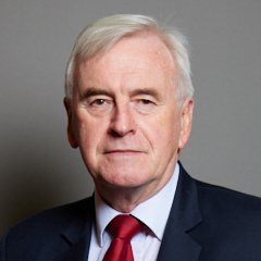 |
| Contact Details | Contact John McDonnell |
| Political Party | Labour |
What Council is the UB7 9DL Postcode in?
The Local Council for this Postcode is Hillingdon London Boro Council and the County Council is Greater London Authority Council.
Greater London Authority Council is responsible for providing education, libraries and maintaining highways.
Hillingdon London Boro Council is responsible for duties such as council tax, rubbish collection, housing, environmental health and planning.
You can visit the website for Hillingdon London Boro at the following link Hillingdon London Boro.How much is the Council Tax?
Hillingdon London Boro Council is responsible for collecting council tax. This will vary depending on which council tax band the property falls within. You can check the council tax band at the gov.uk website.
Once you know the council tax band you can view how much Hillingdon London Boro charge for that band by visiting the The Council Tax section of their website.
Where can I find out where the nearest Library to the UB7 9DL Postcode is?
Libraries are the responsibility of Hillingdon council
Visit the link for more information. Please note that some councils outsource library services to private companies and community groups ran by volunteers.
Libraries - Hillingdon CouncilPostcodes near the UB7 9DL Postcode
What Popular Supermarkets are near the UB7 9DL Postcode?
| Supermarket | Distance | Directions |
|---|---|---|
| Morrisons, High Street, Yiewsley, WEST DRAYTON, UB7 7QQ | 1.85 miles | Directions from UB7 9DL to Morrisons |
| Iceland, High Street, Yiewsley, WEST DRAYTON, UB7 7FB | 1.93 miles | Directions from UB7 9DL to Iceland |
| Aldi, High Street, Yiewsley, WEST DRAYTON, UB7 7QN | 2.13 miles | Directions from UB7 9DL to Aldi |
| Asda, Millington Road, HAYES, UB3 4AZ | 2.31 miles | Directions from UB7 9DL to Asda |
| Tesco, Chantry Close, Yiewsley, WEST DRAYTON, UB7 7FP | 2.34 miles | Directions from UB7 9DL to Tesco |
What Popular Restaurants are near the UB7 9DL Postcode?
| Burger King | Distance | Directions |
|---|---|---|
| Heston Service Area, Hounslow, TW5 9NA | 2.84 miles | Directions from UB7 9DL to Heston Service Area |
| Heston Service Area, Hounslow, TW5 9NB | 2.84 miles | Directions from UB7 9DL to Heston Service Area |
| 25 Chequers Square, Uxbridge, UB8 1LN | 3.50 miles | Directions from UB7 9DL to 25 Chequers Square |
| Glencoe Road, Yeading, Yeading, UB4 9SN | 3.62 miles | Directions from UB7 9DL to Glencoe Road, Yeading |
| Mcdonald's | Distance | Directions |
|---|---|---|
| McDonald's, Mondial Way, Harlington, HAYES, UB3 5AR | 1.29 miles | Directions from UB7 9DL to McDonald's, Mondial Way, Harlington, HAYES, UB3 5AR |
| McDonald's, Bath Road, WEST DRAYTON, UB7 0EA | 1.35 miles | Directions from UB7 9DL to McDonald's, Bath Road, WEST DRAYTON, UB7 0EA |
| McDonald's, Station Road, HAYES, UB3 4DA | 1.90 miles | Directions from UB7 9DL to McDonald's, Station Road, HAYES, UB3 4DA |
| McDonald's, Lombardy Retail Park, Coldharbour Lane, HAYES, UB3 3EX | 2.73 miles | Directions from UB7 9DL to McDonald's, Lombardy Retail Park, Coldharbour Lane, HAYES, UB3 3EX |
| Restaurant | Distance | Directions |
|---|---|---|
| KFC, High Street, Yiewsley, WEST DRAYTON, UB7 7DS | 1.17 miles | Directions from UB7 9DL to KFC Yiewsley - High Street |
| KFC, Bath Road, Heathrow, HOUNSLOW, TW6 2AA | 2.14 miles | Directions from UB7 9DL to KFC Heathrow - Bath Road |
| KFC, Whiteleys Parade, Uxbridge Road, Hillingdon, UXBRIDGE, UB10 0PD | 2.33 miles | Directions from UB7 9DL to KFC Hillingdon - Whiteleys Parade |
| KFC, Uxbridge Road, HAYES, UB4 0RY | 2.59 miles | Directions from UB7 9DL to KFC Hayes End - Uxbridge Road |
| KFC, Cavendish Parade, Bath Road, HOUNSLOW, TW4 7DJ | 3.66 miles | Directions from UB7 9DL to KFC Hounslow - Cavendish Parade |