The W12 8 postcode sector is within the county of Greater London.
Did you know? According to the 2021 Census, the W12 8 postcode sector is home to a bustling 9,275 residents!
Given that each sector allows for 400 unique postcode combinations. Letters C, I, K, M, O and V are not allowed in the last two letters of a postcode. With 146 postcodes already in use, this leaves 254 units available.
The W12 8 postal code covers the settlement of LONDON .
The W12 8 Postcode shares a border with W6 0 (LONDON , CHISWICK ), W6 7 (LONDON ), W11 4 (LONDON ), W12 7 (LONDON , WHITE CITY ESTATE ), W14 0 (LONDON ), W14 8 (LONDON ), W12 0 (LONDON ) and W12 9 (LONDON ).
The sector is within the post town of LONDON.
W12 8 is a postcode sector within the W12 postcode district which is within the W West London postcode area.
The Royal Mail delivery office for the W12 8 postal sector is the Shepherds Bush Sdelivery Office.
The area of the W12 8 postcode sector is 0.27 square miles which is 0.69 square kilometres or 169.81 square acres.

Map of the W12 8 Postcode Sector
Explore the W12 8 postcode sector by using our free interactive map.
| W | 1 | 2 | - | 8 | X | X |
| W | 1 | 2 | Space | 8 | Letter | Letter |
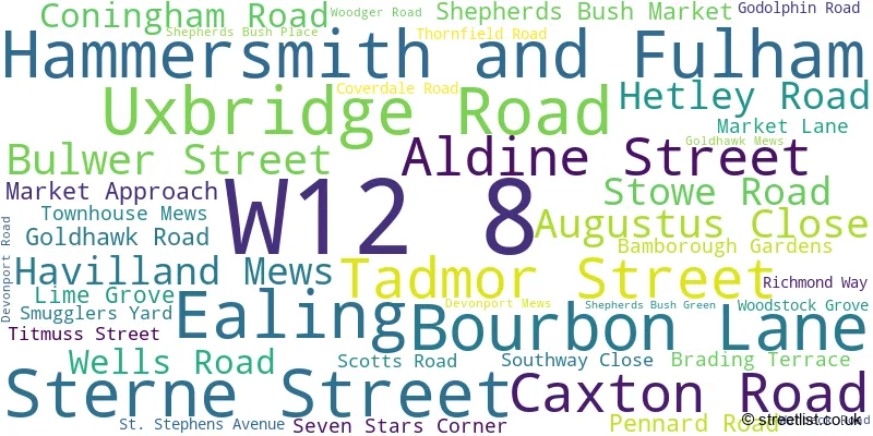
Official List of Streets
Hammersmith and Fulham (39 Streets)
Unofficial Streets or Alternative Spellings
Hammersmith and Fulham
ARIEL WAY ASHCHURCH PARK VILLAS BRACKENBURY ROAD CHARECROFT WAY ELGIN AVENUE FINDON ROAD FRITHVILLE GARDENS GOODWIN ROAD HAMMERSMITH GROVE LOFTUS ROAD PADDENSWICK ROAD QUEENSDALE CRESCENT RICHFORD STREET ROCKLEY ROAD SHEPHERDS BUSH ROAD STANLAKE ROAD SYCAMORE GARDENS TUNIS ROAD VINERY WAY WINGATE ROAD WOOD LANEKensington and Chelsea
KINGSDALE GARDENSWeather Forecast for W12 8
Press Button to Show Forecast for Qpr F.C.
| Time Period | Icon | Description | Temperature | Rain Probability | Wind |
|---|---|---|---|---|---|
| 09:00 to 12:00 | Partly cloudy (day) | 13.0°C (feels like 12.0°C) | 5.00% | SSW 7 mph | |
| 12:00 to 15:00 | Partly cloudy (day) | 16.0°C (feels like 14.0°C) | 9.00% | SSW 9 mph | |
| 15:00 to 18:00 | Cloudy | 16.0°C (feels like 15.0°C) | 12.00% | S 7 mph | |
| 18:00 to 21:00 | Cloudy | 15.0°C (feels like 14.0°C) | 14.00% | SSE 7 mph | |
| 21:00 to 00:00 | Cloudy | 12.0°C (feels like 11.0°C) | 12.00% | SSE 7 mph |
Press Button to Show Forecast for Qpr F.C.
| Time Period | Icon | Description | Temperature | Rain Probability | Wind |
|---|---|---|---|---|---|
| 00:00 to 03:00 | Cloudy | 10.0°C (feels like 9.0°C) | 12.00% | SSE 4 mph | |
| 03:00 to 06:00 | Overcast | 9.0°C (feels like 8.0°C) | 12.00% | SSE 4 mph | |
| 06:00 to 09:00 | Cloudy | 10.0°C (feels like 9.0°C) | 12.00% | SSE 7 mph | |
| 09:00 to 12:00 | Cloudy | 14.0°C (feels like 13.0°C) | 13.00% | S 7 mph | |
| 12:00 to 15:00 | Cloudy | 16.0°C (feels like 15.0°C) | 13.00% | W 7 mph | |
| 15:00 to 18:00 | Cloudy | 16.0°C (feels like 14.0°C) | 16.00% | SSW 7 mph | |
| 18:00 to 21:00 | Cloudy | 15.0°C (feels like 14.0°C) | 11.00% | SW 7 mph | |
| 21:00 to 00:00 | Cloudy | 13.0°C (feels like 12.0°C) | 11.00% | SW 4 mph |
Schools and Places of Education Within the W12 8 Postcode Sector
London Vocational Ballet School
Other independent school
58 Bulwer Street, London, , W12 8AR
Head: Directors Gavin McCaig
Ofsted Rating: Good
Inspection: 2023-06-29 (310 days ago)
Website: Visit London Vocational Ballet School Website
Phone: 02087460412
Number of Pupils: 45
Miles Coverdale Primary School
Community school
Coverdale Road, London, , W12 8JJ
Head: Mrs Taranum Baig
Ofsted Rating: Outstanding
Inspection: 2013-03-01 (4082 days ago)
Website: Visit Miles Coverdale Primary School Website
Phone: 02087435847
Number of Pupils: 217
St Stephen's CofE Primary School
Voluntary aided school
Uxbridge Road, London, , W12 8LH
Head: Mr Michael Schumm
Ofsted Rating: Outstanding
Inspection: 2023-11-08 (178 days ago)
Website: Visit St Stephen's CofE Primary School Website
Phone: 02087434483
Number of Pupils: 439

House Prices in the W12 8 Postcode Sector
| Type of Property | 2018 Average | 2018 Sales | 2017 Average | 2017 Sales | 2016 Average | 2016 Sales | 2015 Average | 2015 Sales |
|---|---|---|---|---|---|---|---|---|
| Detached | £0 | 0 | £2,137,500 | 2 | £2,525,000 | 1 | £0 | 0 |
| Semi-Detached | £1,135,000 | 2 | £1,925,000 | 1 | £0 | 0 | £2,271,900 | 2 |
| Terraced | £1,466,542 | 12 | £1,297,500 | 18 | £1,227,855 | 21 | £1,242,389 | 18 |
| Flats | £469,126 | 70 | £514,461 | 77 | £573,865 | 113 | £510,595 | 88 |
Important Postcodes W12 8 in the Postcode Sector
W12 8EA is the postcode for BLOCK A-C, LONDON COLLEGE OF FASHION, 34-46 LIME GROVE, BLOCK A - C, 40, Lime Grove, 40, Lime Grove, BLOCK D, 40, Lime Grove, and BLOCK D, LONDON COLLEGE OF FASHION, 34-46 LIME GROVE
W12 8JJ is the postcode for Miles Coverdale Primary School, Coverdale Road
W12 8LH is the postcode for NURSERY BUILDING, St. Stephens C of E Primary School, Uxbridge Road, UPPER SCHOOL BUILDING, St. Stephens C of E Primary School, Uxbridge Road, and St. Stephens C of E Primary School, Uxbridge Road
| The W12 8 Sector is within these Local Authorities |
|
|---|---|
| The W12 8 Sector is within these Counties |
|
| The W12 8 Sector is within these Water Company Areas |
|