The WF4 postcode district is a postal district located in the WF Wakefield postcode area with a population of 44,564 residents according to the 2021 England and Wales Census.
The area of the WF4 postcode district is 35.47 square miles which is 91.88 square kilometres or 22,703.85 acres.
Currently, the WF4 district has about 1259 postcode units spread across 6 geographic postcode sectors.
Given that each sector allows for 400 unique postcode combinations, the district has a capacity of 2,400 postcodes. With 1259 postcodes already in use, this leaves 1141 units available.
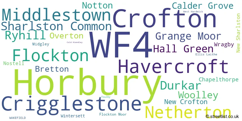
The largest settlement in the WF4 postal code is Horbury followed by Crofton, and Crigglestone.
The WF4 Postcode shares a border with S75 (BARNSLEY, Darton, Dodworth), HD8 (Kirkburton, Skelmanthorpe, Lepton), WF12 (DEWSBURY, Earlsheaton, Thornhill Lees), WF2 (WAKEFIELD, Wrenthorpe, Walton), WF1 (WAKEFIELD, Outwood), WF5 (OSSETT), WF6 (NORMANTON, Normanton Industrial Estate, Altofts), WF7 (Featherstone, Ackworth, Streethouse), WF9 (South Elmsall, Hemsworth, South Kirkby), S71 (BARNSLEY, Royston, Carlton) and S72 (Cudworth, Grimethorpe, Shafton).
In the WF4 postcode district, the primary settlement is Wakefield, which is located in the county of West Yorkshire. The most significant Postal Town in this district is also Wakefield. Other significant settlements within WF4 include Crofton, Foulby, New Crofton, New Sharlston, Nostell, Sharlston Common, West Hardwick, and Wragby.
For the district WF4, we have data on 6 postcode sectors. Here's a breakdown: The sector WF4 1, covers Crofton and Sharlston Common in West Yorkshire. The sector WF4 2, covers Havercroft and Ryhill and Woolley and Notton in West Yorkshire. The sector WF4 3, covers Crigglestone and Durkar and Hall Green and Calder Grove in West Yorkshire. The sector WF4 4, covers Middlestown and Flockton and Netherton and Grange Moor in West Yorkshire. The sector WF4 5, covers Horbury in West Yorkshire. The sector WF4 6, covers Horbury in West Yorkshire.

Map of the WF4 Postcode District
Explore the WF4 postcode district by using our free interactive map.

When it comes to local government, postal geography often disregards political borders. However, for a breakdown in the WF4 District: the district mostly encompasses the Wakefield District (B) (1166 postcodes), and finally, the Kirklees District (B) area (97 postcodes).
Recent House Sales in WF4
| Date | Price | Address |
|---|---|---|
| 25/10/2023 | £256,000 | Green Lane Close, Overton, Wakefield, WF4 4SE |
| 20/10/2023 | £131,000 | The Shutt, Horbury, Wakefield, WF4 5AY |
| 06/10/2023 | £400,000 | Applehaigh Lane, Notton, Wakefield, WF4 2NA |
| 06/10/2023 | £315,000 | High Ash Close, Notton, Wakefield, WF4 2PF |
| 28/09/2023 | £265,000 | Green Acres, Durkar, Wakefield, WF4 3BG |
| 25/09/2023 | £150,000 | Mulberry Place, Ryhill, Wakefield, WF4 2BD |
| 21/09/2023 | £400,000 | George Lane, Notton, Wakefield, WF4 2ND |
| 19/09/2023 | £205,000 | Woodmoor Rise, Crigglestone, Wakefield, WF4 3NT |
| 15/09/2023 | £159,250 | Brunswick, Ryhill, Wakefield, WF4 2DG |
| 11/09/2023 | £74,900 | Hillcrest, Havercroft, Wakefield, WF4 2EW |
Weather Forecast for WF4
Press Button to Show Forecast for Horbury
| Time Period | Icon | Description | Temperature | Rain Probability | Wind |
|---|---|---|---|---|---|
| 12:00 to 15:00 | Cloudy | 8.0°C (feels like 6.0°C) | 8.00% | NE 7 mph | |
| 15:00 to 18:00 | Cloudy | 9.0°C (feels like 7.0°C) | 10.00% | E 7 mph | |
| 18:00 to 21:00 | Cloudy | 7.0°C (feels like 5.0°C) | 10.00% | E 9 mph | |
| 21:00 to 00:00 | Cloudy | 6.0°C (feels like 4.0°C) | 7.00% | E 7 mph |
Press Button to Show Forecast for Horbury
| Time Period | Icon | Description | Temperature | Rain Probability | Wind |
|---|---|---|---|---|---|
| 00:00 to 03:00 | Partly cloudy (night) | 5.0°C (feels like 3.0°C) | 1.00% | ENE 4 mph | |
| 03:00 to 06:00 | Cloudy | 4.0°C (feels like 2.0°C) | 4.00% | NE 4 mph | |
| 06:00 to 09:00 | Cloudy | 4.0°C (feels like 2.0°C) | 6.00% | NNE 4 mph | |
| 09:00 to 12:00 | Cloudy | 7.0°C (feels like 5.0°C) | 11.00% | NE 9 mph | |
| 12:00 to 15:00 | Overcast | 8.0°C (feels like 6.0°C) | 21.00% | ENE 9 mph | |
| 15:00 to 18:00 | Overcast | 9.0°C (feels like 7.0°C) | 18.00% | ENE 9 mph | |
| 18:00 to 21:00 | Cloudy | 8.0°C (feels like 6.0°C) | 12.00% | ENE 9 mph | |
| 21:00 to 00:00 | Cloudy | 7.0°C (feels like 4.0°C) | 7.00% | NE 7 mph |
Press Button to Show Forecast for Horbury
| Time Period | Icon | Description | Temperature | Rain Probability | Wind |
|---|---|---|---|---|---|
| 00:00 to 03:00 | Cloudy | 6.0°C (feels like 3.0°C) | 7.00% | NNE 7 mph | |
| 03:00 to 06:00 | Cloudy | 5.0°C (feels like 2.0°C) | 12.00% | N 9 mph | |
| 06:00 to 09:00 | Light rain | 6.0°C (feels like 2.0°C) | 53.00% | N 11 mph | |
| 09:00 to 12:00 | Light rain | 7.0°C (feels like 4.0°C) | 54.00% | N 11 mph | |
| 12:00 to 15:00 | Light rain | 8.0°C (feels like 5.0°C) | 52.00% | NW 9 mph | |
| 15:00 to 18:00 | Cloudy | 10.0°C (feels like 8.0°C) | 16.00% | WNW 9 mph | |
| 18:00 to 21:00 | Cloudy | 10.0°C (feels like 8.0°C) | 9.00% | W 9 mph | |
| 21:00 to 00:00 | Clear night | 8.0°C (feels like 6.0°C) | 2.00% | WSW 7 mph |
Press Button to Show Forecast for Horbury
| Time Period | Icon | Description | Temperature | Rain Probability | Wind |
|---|---|---|---|---|---|
| 00:00 to 03:00 | Clear night | 7.0°C (feels like 4.0°C) | 1.00% | SW 7 mph | |
| 03:00 to 06:00 | Clear night | 5.0°C (feels like 3.0°C) | 1.00% | SSW 7 mph | |
| 06:00 to 09:00 | Sunny day | 6.0°C (feels like 4.0°C) | 1.00% | S 7 mph | |
| 09:00 to 12:00 | Partly cloudy (day) | 11.0°C (feels like 9.0°C) | 1.00% | S 11 mph | |
| 12:00 to 15:00 | Cloudy | 14.0°C (feels like 11.0°C) | 5.00% | S 13 mph | |
| 15:00 to 18:00 | Cloudy | 14.0°C (feels like 12.0°C) | 7.00% | S 13 mph | |
| 18:00 to 21:00 | Partly cloudy (day) | 14.0°C (feels like 11.0°C) | 3.00% | SSE 11 mph | |
| 21:00 to 00:00 | Partly cloudy (night) | 11.0°C (feels like 9.0°C) | 1.00% | SSE 9 mph |
Press Button to Show Forecast for Horbury
| Time Period | Icon | Description | Temperature | Rain Probability | Wind |
|---|---|---|---|---|---|
| 00:00 to 03:00 | Clear night | 9.0°C (feels like 7.0°C) | 2.00% | SE 7 mph | |
| 03:00 to 06:00 | Partly cloudy (night) | 7.0°C (feels like 6.0°C) | 2.00% | ESE 7 mph | |
| 06:00 to 09:00 | Partly cloudy (day) | 8.0°C (feels like 6.0°C) | 4.00% | ESE 7 mph | |
| 09:00 to 12:00 | Partly cloudy (day) | 11.0°C (feels like 9.0°C) | 5.00% | ESE 9 mph | |
| 12:00 to 15:00 | Partly cloudy (day) | 15.0°C (feels like 13.0°C) | 7.00% | ESE 11 mph | |
| 15:00 to 18:00 | Partly cloudy (day) | 16.0°C (feels like 13.0°C) | 9.00% | ESE 11 mph | |
| 18:00 to 21:00 | Partly cloudy (day) | 14.0°C (feels like 13.0°C) | 12.00% | E 9 mph | |
| 21:00 to 00:00 | Cloudy | 12.0°C (feels like 11.0°C) | 10.00% | E 7 mph |
Where is the WF4 Postcode District?
The postcode district WF4 is located in Wakefield, which is a district town. It is closely situated to several nearby towns. To the North West, there is Ossett, which is approximately 4.1 miles away. To the North East, there is Normanton, which is approximately 5.8 miles away. To the South, there is Barnsley, which is approximately 6.5 miles away. To the East, there is Pontefract, which is approximately 8.1 miles away. To the West, there is Mirfield, which is approximately 9 miles away. Additionally, the postcode district WF4 is located at a distance of 158.3 miles from the center of London.
The district is within the post town of WAKEFIELD.
The sector has postcodes within the nation of England.
The WF4 Postcode District is covers the following regions.
- Wakefield - West Yorkshire - Yorkshire and The Humber
- Calderdale and Kirklees - West Yorkshire - Yorkshire and The Humber
| Postcode Sector | Delivery Office |
|---|---|
| WF4 1 | Crofton Scale Payment Delivery Office |
| WF4 1 | Sharlston Common Scale Payment Delivery Office |
| WF4 2 | Ryhill Scale Payment Delivery Office |
| WF4 2 | Notton Scale Payment Delivery Office |
| WF4 2 | Wakefield Delivery Office |
| WF4 3 | Wakefield Delivery Office |
| WF4 4 | Wakefield Delivery Office |
| WF4 5 | Wakefield Delivery Office |
| WF4 6 | Wakefield Delivery Office |
| WF4 3 | Caldergrove Scale Payment Delivery Office |
| WF4 3 | Crigglestone Scale Payment Delivery Office |
| WF4 4 | Flockton Scale Payment Delivery Office |
| WF4 4 | Middlestown Scale Payment Delivery Office |
| W | F | 4 | - | X | X | X |
| W | F | 4 | Space | Numeric | Letter | Letter |
Tourist Attractions within the Postcode Area
We found 3 visitor attractions within the WF4 postcode area
| Yorkshire Sculpture Park |
|---|
| Museums & Art Galleries |
| Museum and / or Art Gallery |
| View Yorkshire Sculpture Park on Google Maps |
| Anglers Country Park |
| Country Parks |
| Country Park |
| View Anglers Country Park on Google Maps |
| Nostell Priory & Parkland |
| Historic Properties |
| Historic House / House and Garden / Palace |
| View Nostell Priory & Parkland on Google Maps |
Current Monthly Rental Prices
| # Bedrooms | Min Price | Max Price | Avg Price |
|---|---|---|---|
| 1 | £795 | £795 | £795 |
| 2 | £650 | £1,100 | £777 |
| 3 | £895 | £995 | £935 |
| 4 | £1,795 | £1,895 | £1,845 |
Current House Prices
| # Bedrooms | Min Price | Max Price | Avg Price |
|---|---|---|---|
| £155,000 | £380,000 | £267,500 | |
| 1 | £100,000 | £100,000 | £100,000 |
| 2 | £85,000 | £315,000 | £186,616 |
| 3 | £60,000 | £950,000 | £257,375 |
| 4 | £90,000 | £2,000,000 | £479,627 |
| 5 | £275,000 | £1,625,000 | £652,379 |
| 6 | £575,000 | £2,500,000 | £1,073,333 |
| 7 | £1,300,000 | £1,300,000 | £1,300,000 |
Estate Agents who Operate in the WF4 District
| Logo | Name | Brand Name | Address | Contact Number | Total Properties |
|---|---|---|---|---|---|
 | Wakefield | Richard Kendall | 66 Northgate, Wakefield, West Yorkshire, WF1 3AP | 01924 793995 | 37 |
 | Wakefield | William H. Brown | 2 Wood Street, Wakefield, WF1 2ED | 01924 908264 | 35 |
 | Ossett | Richard Kendall | Unit 2 Wellgate, Ossett, WF5 8NS | 01924 908217 | 31 |
 | Horbury | Richard Kendall | 4 Cluntergate, Horbury, WF4 5AG | 01924 907007 | 20 |
 | Wakefield | Manning Stainton | 62-64 Northgate Wakefield WF1 3AP | 01924 669581 | 17 |
- Briestfield
- Calder Grove
- Chapelthorpe
- Cold Hiendley
- Coxley
- Crigglestone
- Crofton
- Cross Roads
- Dewsbury
- Durkar
- Flockton Green
- Flockton
- Foulby
- Grange Moor
- Haigh
- Hall Green
- Havercroft
- High Ackworth
- Horbury
- Linfit
- Middlestown
- Midgley
- Netherton
- New Sharlston
- Notton
- Ossett
- Overton
- Royston
- Ryhill
- Sharlston
- Wakefield
- West Bretton
- West Hardwick
- Wintersett
- Woolley
- Wragby
| Type of Property | 2018 Average | 2018 Sales | 2017 Average | 2017 Sales | 2016 Average | 2016 Sales | 2015 Average | 2015 Sales |
|---|---|---|---|---|---|---|---|---|
| Detached | £288,170 | 262 | £279,512 | 254 | £260,249 | 306 | £288,680 | 250 |
| Semi-Detached | £156,618 | 285 | £144,120 | 321 | £139,483 | 295 | £140,236 | 281 |
| Terraced | £128,992 | 210 | £117,101 | 214 | £121,116 | 207 | £118,032 | 185 |
| Flats | £122,081 | 30 | £110,017 | 41 | £120,733 | 19 | £86,566 | 15 |