The YO42 postcode district is a postal district located in the YO York postcode area with a population of 16,271 residents according to the 2021 England and Wales Census.
The area of the YO42 postcode district is 93.87 square miles which is 243.12 square kilometres or 60,077.01 acres.
Currently, the YO42 district has about 667 postcode units spread across 3 geographic postcode sectors.
Given that each sector allows for 400 unique postcode combinations, the district has a capacity of 1,200 postcodes. With 667 postcodes already in use, this leaves 533 units available.
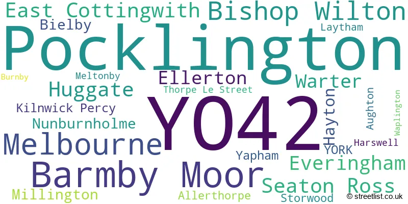
The largest settlement in the YO42 postal code is Pocklington followed by Melbourne, and Barmby Moor.
The YO42 Postcode shares a border with YO43 (Market Weighton, Holme-on-Spalding-Moor, North Newbald), YO8 (SELBY, Thorpe Willoughby, Brayton), YO19 (Dunnington, Riccall, Fulford), YO25 (DRIFFIELD, Skipsea, Nafferton) and YO41 (Stamford Bridge, Wilberfoss, Elvington).
The primary settlement in the YO42 postcode district is Pocklington, located in the East Riding of Yorkshire in England. The most significant Postal Town in this district is York. Other significant settlements in this district include Bishop Wilton, Burnby, Hayton, Huggate, Kilnwick Percy, Meltonby, Millington, Nunburnholme, Warter, and Yapham.
For the district YO42, we have data on 4 postcode sectors. Here's a breakdown: The sector YO42 1, covers Pocklington and Bishop Wilton and Huggate and Warter in East Riding of Yorkshire. The sector YO42 2, covers Pocklington in East Riding of Yorkshire. The sector YO42 4, covers Barmby Moor and Melbourne in East Riding of Yorkshire. The sector YO42 9 is non-geographic. It's often designated for PO Boxes, large organisations, or special services.

Map of the YO42 Postcode District
Explore the YO42 postcode district by using our free interactive map.

When it comes to local government, postal geography often disregards political borders. However, for a breakdown in the YO42 District: the district mostly encompasses the East Riding of Yorkshire area with a total of 706 postcodes.
Recent House Sales in YO42
| Date | Price | Address |
|---|---|---|
| 29/09/2023 | £389,000 | Yapham Mill, Pocklington, York, YO42 1PB |
| 29/09/2023 | £285,000 | Allerthorpe, York, YO42 4RW |
| 25/09/2023 | £285,000 | Allerthorpe, York, YO42 4RW |
| 18/09/2023 | £418,203 | Everingham, York, YO42 4JF |
| 15/09/2023 | £351,500 | Burns Close, Pocklington, York, YO42 2XX |
| 08/09/2023 | £455,000 | Barmby Road, Pocklington, York, YO42 2DW |
| 08/09/2023 | £240,000 | Overend Avenue, Pocklington, York, YO42 2FS |
| 06/09/2023 | £260,000 | Southfield Road, Pocklington, York, YO42 2XE |
| 29/08/2023 | £375,000 | Broadmanor, Pocklington, York, YO42 2GA |
| 24/08/2023 | £235,000 | Beech Court, Pocklington, York, YO42 2NE |
Weather Forecast for YO42
Press Button to Show Forecast for Pocklington
| Time Period | Icon | Description | Temperature | Rain Probability | Wind |
|---|---|---|---|---|---|
| 09:00 to 12:00 | Cloudy | 8.0°C (feels like 6.0°C) | 11.00% | ENE 9 mph | |
| 12:00 to 15:00 | Overcast | 9.0°C (feels like 7.0°C) | 14.00% | ENE 11 mph | |
| 15:00 to 18:00 | Cloudy | 9.0°C (feels like 6.0°C) | 9.00% | ENE 11 mph | |
| 18:00 to 21:00 | Cloudy | 8.0°C (feels like 5.0°C) | 8.00% | ENE 9 mph | |
| 21:00 to 00:00 | Cloudy | 6.0°C (feels like 3.0°C) | 5.00% | NE 7 mph |
Press Button to Show Forecast for Pocklington
| Time Period | Icon | Description | Temperature | Rain Probability | Wind |
|---|---|---|---|---|---|
| 00:00 to 03:00 | Cloudy | 5.0°C (feels like 3.0°C) | 7.00% | NNE 7 mph | |
| 03:00 to 06:00 | Cloudy | 6.0°C (feels like 3.0°C) | 17.00% | NNE 9 mph | |
| 06:00 to 09:00 | Light rain | 6.0°C (feels like 3.0°C) | 55.00% | N 11 mph | |
| 09:00 to 12:00 | Heavy rain | 7.0°C (feels like 4.0°C) | 78.00% | N 13 mph | |
| 12:00 to 15:00 | Heavy rain | 8.0°C (feels like 4.0°C) | 74.00% | NW 13 mph | |
| 15:00 to 18:00 | Light rain | 9.0°C (feels like 6.0°C) | 49.00% | NW 11 mph | |
| 18:00 to 21:00 | Cloudy | 9.0°C (feels like 7.0°C) | 10.00% | W 7 mph | |
| 21:00 to 00:00 | Clear night | 6.0°C (feels like 4.0°C) | 2.00% | SW 7 mph |
Press Button to Show Forecast for Pocklington
| Time Period | Icon | Description | Temperature | Rain Probability | Wind |
|---|---|---|---|---|---|
| 00:00 to 03:00 | Clear night | 5.0°C (feels like 2.0°C) | 2.00% | SSW 7 mph | |
| 03:00 to 06:00 | Clear night | 4.0°C (feels like 1.0°C) | 1.00% | S 7 mph | |
| 06:00 to 09:00 | Sunny day | 5.0°C (feels like 2.0°C) | 1.00% | S 7 mph | |
| 09:00 to 12:00 | Sunny day | 10.0°C (feels like 8.0°C) | 1.00% | S 11 mph | |
| 12:00 to 15:00 | Partly cloudy (day) | 13.0°C (feels like 10.0°C) | 2.00% | S 13 mph | |
| 15:00 to 18:00 | Cloudy | 14.0°C (feels like 11.0°C) | 6.00% | S 13 mph | |
| 18:00 to 21:00 | Partly cloudy (day) | 13.0°C (feels like 10.0°C) | 2.00% | SSE 11 mph | |
| 21:00 to 00:00 | Partly cloudy (night) | 10.0°C (feels like 7.0°C) | 1.00% | SE 11 mph |
Press Button to Show Forecast for Pocklington
| Time Period | Icon | Description | Temperature | Rain Probability | Wind |
|---|---|---|---|---|---|
| 00:00 to 03:00 | Clear night | 8.0°C (feels like 6.0°C) | 2.00% | SE 9 mph | |
| 03:00 to 06:00 | Clear night | 7.0°C (feels like 5.0°C) | 2.00% | ESE 9 mph | |
| 06:00 to 09:00 | Sunny day | 8.0°C (feels like 6.0°C) | 4.00% | ESE 9 mph | |
| 09:00 to 12:00 | Sunny day | 13.0°C (feels like 11.0°C) | 5.00% | ESE 11 mph | |
| 12:00 to 15:00 | Partly cloudy (day) | 14.0°C (feels like 12.0°C) | 8.00% | ESE 11 mph | |
| 15:00 to 18:00 | Cloudy | 14.0°C (feels like 12.0°C) | 12.00% | E 11 mph | |
| 18:00 to 21:00 | Cloudy | 12.0°C (feels like 11.0°C) | 9.00% | E 9 mph | |
| 21:00 to 00:00 | Cloudy | 10.0°C (feels like 8.0°C) | 10.00% | E 7 mph |
Where is the YO42 Postcode District?
The postcode district YO42 is located in the town of York. It is close to several nearby towns, including Brough to the South East (distance: 13.92 miles), Selby to the South West (distance: 14.18 miles), Malton to the North (distance: 14.94 miles), Driffield to the North East (distance: 14.97 miles), Beverley to the East (distance: 15.21 miles), and Goole to the South (distance: 15.84 miles). Furthermore, YO42 is approximately 168.91 miles away from the centre of London.
The district is within the post town of YORK.
The sector has postcodes within the nation of England.
The YO42 Postcode District is in the East Riding of Yorkshire region of East Yorkshire and Northern Lincolnshire within the Yorkshire and The Humber.
| Postcode Sector | Delivery Office |
|---|---|
| YO42 1 | Pocklington Delivery Office |
| YO42 2 | Pocklington Delivery Office |
| YO42 4 | Pocklington Delivery Office |
| Y | O | 4 | 2 | - | X | X | X |
| Y | O | 4 | 2 | Space | Numeric | Letter | Letter |
Current Monthly Rental Prices
| # Bedrooms | Min Price | Max Price | Avg Price |
|---|---|---|---|
| 1 | £400 | £610 | £503 |
| 2 | £795 | £2,035 | £1,579 |
| 3 | £650 | £825 | £738 |
| 5 | £2,500 | £3,000 | £2,750 |
Current House Prices
| # Bedrooms | Min Price | Max Price | Avg Price |
|---|---|---|---|
| £50,000 | £950,000 | £302,500 | |
| 1 | £70,000 | £180,000 | £120,800 |
| 2 | £59,995 | £365,000 | £205,305 |
| 3 | £215,000 | £800,000 | £322,690 |
| 4 | £250,000 | £995,000 | £521,062 |
| 5 | £415,000 | £1,395,000 | £674,611 |
| 6 | £699,950 | £1,125,000 | £916,650 |
Estate Agents who Operate in the YO42 District
| Logo | Name | Brand Name | Address | Contact Number | Total Properties |
|---|---|---|---|---|---|
 | Pocklington | Clubleys | 52 Market Place, Pocklington, YO42 2AH | 01759 304040 | 26 |
 | Pocklington | Sweetmove | 54 Market Place, Pocklington, YO42 2AH | 01759 306262 | 24 |
 | Pocklington | R M English Yorkshire Limited | 2 Railway Street Pocklington York Yorkshire, YO42 2QZ | 01759 486194 | 14 |
 | York | R M English York Limited | 13 Walmgate, York, YO1 9TX | 01904 935338 | 13 |
 | Pocklington | Hunters | 77 Market Street, Pocklington, YO42 2AE | 01759 486127 | 10 |
| Type of Property | 2018 Average | 2018 Sales | 2017 Average | 2017 Sales | 2016 Average | 2016 Sales | 2015 Average | 2015 Sales |
|---|---|---|---|---|---|---|---|---|
| Detached | £350,832 | 228 | £330,498 | 197 | £310,759 | 159 | £323,950 | 157 |
| Semi-Detached | £196,580 | 116 | £205,516 | 79 | £196,832 | 83 | £182,436 | 60 |
| Terraced | £167,899 | 60 | £174,411 | 60 | £177,072 | 98 | £175,725 | 89 |
| Flats | £191,028 | 50 | £105,038 | 12 | £85,493 | 15 | £93,163 | 27 |