
Map of the Postcode District
Explore the postcode district by using our interactive map.
Circles represent recorded crime; the larger the circle, the higher the crime rates.
Your support helps keep this site running!
If you enjoy using this website, consider buying me a coffee to help cover hosting costs.
The postcode district located in the YO York postal area , YO60 has a population of 4,578 residents according to the 2021 England and Wales Census.
The area of the district is 57.87 square miles (149.88 square kilometers or 37,037.27 acres).
Where is the YO60 District?
To give you an idea where the district is located we have created the following table showing nearby towns.
Nearest Towns to YO60
| Town | Distance (miles) | Direction |
|---|---|---|
| Malton | 6.32 | ENE |
| Norton-on-Derwent | 6.76 | ENE |
| Haxby | 7.62 | SW |
| York | 10.72 | SW |
| Easingwold | 10.99 | WNW |
| Helmsley | 12.22 | NNW |
| Pocklington | 12.47 | SSE |
| Pickering | 12.56 | NNE |
| Kirkbymoorside | 12.58 | N |
| Market Weighton | 18.73 | SE |
| Boroughbridge | 18.94 | W |
| Thirsk | 19.53 | WNW |
| Tadcaster | 19.56 | SW |
| Driffield | 20.72 | ESE |
| Wetherby | 21.64 | WSW |
| Selby | 21.77 | SSW |
| Knaresborough | 22.47 | WSW |
| Howden | 23.78 | S |
| Ripon | 24.36 | W |
| Scarborough | 25.25 | ENE |
The post town for this district is YORK.
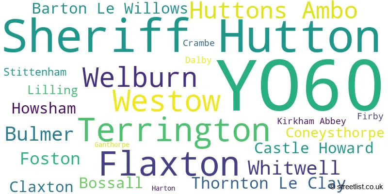
Postcode Information for District YO60 (Total Geographical Postcodes: 264)
| Location | Post Town | Sector | Number of Postcodes |
|---|---|---|---|
| Sheriff Hutton | YORK | YO60 6 | 58 |
| Flaxton | YORK | YO60 7 | 28 |
| Terrington | YORK | YO60 6 | 26 |
| Huttons Ambo | YORK | YO60 7 | 23 |
| Westow | YORK | YO60 7 | 22 |
| Welburn | YORK | YO60 7 | 18 |
| Bulmer | YORK | YO60 7 | 11 |
| Whitwell | YORK | YO60 7 | 11 |
| Foston | YORK | YO60 7 | 8 |
| Thornton Le Clay | YORK | YO60 7 | 7 |
| Bossall | YORK | YO60 7 | 6 |
| Howsham | YORK | YO60 7 | 6 |
| Castle Howard | YORK | YO60 7 | 6 |
| Barton Le Willows | YORK | YO60 7 | 6 |
| Claxton | YORK | YO60 7 | 6 |
| Coneysthorpe | YORK | YO60 7 | 5 |
| Lilling | YORK | YO60 6 | 4 |
| Stittenham | YORK | YO60 7 | 3 |
| Crambe | YORK | YO60 7 | 2 |
| Kirkham Abbey | YORK | YO60 7 | 2 |
| Dalby | YORK | YO60 6 | 2 |
| Firby | YORK | YO60 7 | 2 |
| Ganthorpe | YORK | YO60 6 | 1 |
| Harton | YORK | YO60 7 | 1 |
In the YO60 postcode district in North Yorkshire, the primary settlement is Sheriff Hutton. Other significant settlements include Dalby, Ganthorpe, Lilling, and Terrington. The most significant Postal Town in this district is York.
When it comes to local government, postal geography often disregards political borders. However, this district intersects the following councils: the district mostly encompasses the North Yorkshire area with a total of 256 postal codes.
The largest settlement in the YO60 postal code is Sheriff Hutton followed by Welburn, and Flaxton.
The YO60 Postcode shares a border with YO32 (Haxby, Huntington, Strensall), YO61 (Easingwold, Sutton-on-the-Forest, Huby), YO17 (MALTON, Norton, Rillington), YO41 (Stamford Bridge, Wilberfoss, Elvington) and YO62 (Kirkbymoorside, Helmsley, Nawton).


Schools in the Sector
Terrington Church of England Voluntary Aided Primary School
Phase: Primary
Address: North Back Lane , Terrington , York
Postcode: YO60 6NS
Headteacher: Mrs Sarah Moore (Headteacher)
Ofsted Rating: Good
Sheriff Hutton Primary School
Phase: Primary
Address: West End , Sheriff Hutton , York
Postcode: YO60 6SH
Headteacher: Mrs Beverley Stell (Headteacher)
Ofsted Rating: Good
Welburn Community Primary School
Phase: Primary
Address: Welburn , York
Postcode: YO60 7DX
Headteacher: Ms Helen Thomson (Headteacher)
Ofsted Rating: Good
Foston Church of England Voluntary Controlled Primary School
Phase: Primary
Address: Main Street , Foston , York
Postcode: YO60 7QB
Headteacher: Mrs Sarah Moore (Headteacher)
Ofsted Rating: Good
Stations in the Sector
No stations found in this postcode district.
Accessable Motorway Junctions
A1(M) J44
Average Driving Time from within the district: 25.30
Average Driving Distance: 23.44
Number of Postcodes that can access the Motorway Junction: 11
A1(M) J47
Average Driving Time from within the district: 30.80
Average Driving Distance: 24.16
Number of Postcodes that can access the Motorway Junction: 257
A1(M) J45
Average Driving Time from within the district: 31.85
Average Driving Distance: 29.58
Number of Postcodes that can access the Motorway Junction: 86
A1(M) J46
Average Driving Time from within the district: 33.36
Average Driving Distance: 25.52
Number of Postcodes that can access the Motorway Junction: 257
A1(M) J48
Average Driving Time from within the district: 34.83
Average Driving Distance: 27.38
Number of Postcodes that can access the Motorway Junction: 257
A1(M) J49
Average Driving Time from within the district: 37.09
Average Driving Distance: 28.89
Number of Postcodes that can access the Motorway Junction: 209
A1(M) J50
Average Driving Time from within the district: 37.52
Average Driving Distance: 29.14
Number of Postcodes that can access the Motorway Junction: 110
M62 J37
Average Driving Time from within the district: 45.41
Average Driving Distance: 34.46
Number of Postcodes that can access the Motorway Junction: 33
M62 J38
Average Driving Time from within the district: 47.80
Average Driving Distance: 29.46
Number of Postcodes that can access the Motorway Junction: 65
Weather Forecast for Castle Howard
| Time Period | Icon | Description | Temperature | Rain Probability | Wind |
|---|---|---|---|---|---|
| 12:00 to 15:00 | Partly cloudy (day) | 13.0°C (feels like 12.0°C) | 0.00% | WSW 9 mph | |
| 15:00 to 18:00 | Sunny day | 13.0°C (feels like 12.0°C) | 0.00% | WSW 9 mph | |
| 18:00 to 21:00 | Clear night | 9.0°C (feels like 8.0°C) | 0.00% | WSW 7 mph | |
| 21:00 to 00:00 | Clear night | 7.0°C (feels like 6.0°C) | 0.00% | SSW 4 mph |
| Time Period | Icon | Description | Temperature | Rain Probability | Wind |
|---|---|---|---|---|---|
| 00:00 to 03:00 | Clear night | 7.0°C (feels like 5.0°C) | 0.00% | S 4 mph | |
| 03:00 to 06:00 | Clear night | 7.0°C (feels like 5.0°C) | 0.00% | S 7 mph | |
| 06:00 to 09:00 | Partly cloudy (night) | 7.0°C (feels like 5.0°C) | 1.00% | S 7 mph | |
| 09:00 to 12:00 | Cloudy | 9.0°C (feels like 7.0°C) | 4.00% | SSW 7 mph | |
| 12:00 to 15:00 | Cloudy | 13.0°C (feels like 11.0°C) | 3.00% | SSW 9 mph | |
| 15:00 to 18:00 | Cloudy | 13.0°C (feels like 11.0°C) | 3.00% | SSW 9 mph | |
| 18:00 to 21:00 | Cloudy | 11.0°C (feels like 9.0°C) | 3.00% | S 9 mph | |
| 21:00 to 00:00 | Cloudy | 11.0°C (feels like 8.0°C) | 4.00% | S 11 mph |
| Time Period | Icon | Description | Temperature | Rain Probability | Wind |
|---|---|---|---|---|---|
| 00:00 to 03:00 | Partly cloudy (night) | 10.0°C (feels like 8.0°C) | 2.00% | S 11 mph | |
| 03:00 to 06:00 | Overcast | 10.0°C (feels like 7.0°C) | 8.00% | S 11 mph | |
| 06:00 to 09:00 | Cloudy | 9.0°C (feels like 7.0°C) | 5.00% | SSE 11 mph | |
| 09:00 to 12:00 | Cloudy | 10.0°C (feels like 7.0°C) | 6.00% | SSE 13 mph | |
| 12:00 to 15:00 | Cloudy | 13.0°C (feels like 10.0°C) | 4.00% | S 16 mph | |
| 15:00 to 18:00 | Overcast | 14.0°C (feels like 11.0°C) | 7.00% | S 13 mph | |
| 18:00 to 21:00 | Partly cloudy (night) | 13.0°C (feels like 10.0°C) | 2.00% | SSE 13 mph | |
| 21:00 to 00:00 | Cloudy | 12.0°C (feels like 10.0°C) | 7.00% | SSE 13 mph |
| Time Period | Icon | Description | Temperature | Rain Probability | Wind |
|---|---|---|---|---|---|
| 00:00 to 03:00 | Cloudy | 12.0°C (feels like 10.0°C) | 16.00% | SSE 11 mph | |
| 03:00 to 06:00 | Light rain shower (night) | 12.0°C (feels like 10.0°C) | 40.00% | S 11 mph | |
| 06:00 to 09:00 | Partly cloudy (night) | 11.0°C (feels like 9.0°C) | 13.00% | S 11 mph | |
| 09:00 to 12:00 | Partly cloudy (day) | 12.0°C (feels like 9.0°C) | 7.00% | S 11 mph | |
| 12:00 to 15:00 | Cloudy | 12.0°C (feels like 10.0°C) | 17.00% | SSW 13 mph | |
| 15:00 to 18:00 | Light rain shower (day) | 12.0°C (feels like 10.0°C) | 33.00% | SSW 11 mph | |
| 18:00 to 21:00 | Clear night | 10.0°C (feels like 8.0°C) | 6.00% | SSW 11 mph | |
| 21:00 to 00:00 | Partly cloudy (night) | 9.0°C (feels like 7.0°C) | 5.00% | SSW 9 mph |
| Time Period | Icon | Description | Temperature | Rain Probability | Wind |
|---|---|---|---|---|---|
| 00:00 to 03:00 | Clear night | 8.0°C (feels like 6.0°C) | 4.00% | SSW 9 mph | |
| 03:00 to 06:00 | Partly cloudy (night) | 8.0°C (feels like 5.0°C) | 6.00% | SSW 11 mph | |
| 06:00 to 09:00 | Partly cloudy (night) | 8.0°C (feels like 5.0°C) | 8.00% | SSW 11 mph | |
| 09:00 to 12:00 | Cloudy | 9.0°C (feels like 7.0°C) | 8.00% | SSW 11 mph | |
| 12:00 to 15:00 | Cloudy | 12.0°C (feels like 9.0°C) | 14.00% | SW 13 mph | |
| 15:00 to 18:00 | Cloudy | 12.0°C (feels like 9.0°C) | 33.00% | SW 13 mph | |
| 18:00 to 21:00 | Clear night | 10.0°C (feels like 8.0°C) | 5.00% | SW 11 mph | |
| 21:00 to 00:00 | Clear night | 9.0°C (feels like 7.0°C) | 5.00% | SW 9 mph |
| Postal Sector | Delivery Office |
|---|---|
| YO60 6 | Sheriff Hutton Scale Payment Delivery Office |
| YO60 7 | Sheriff Hutton Scale Payment Delivery Office |
| Y | O | 6 | 0 | - | X | X | X |
| Y | O | 6 | 0 | Space | Numeric | Letter | Letter |
Tourist Attractions
We found 2 visitor attractions.
| Castle Howard |
|---|
| Historic Properties |
| Historic House / House and Garden / Palace |
| View Castle Howard on Google Maps |
| Kirkham Priory |
| Historic Properties |
| Historic Monument / Archaeological Site |
| View Kirkham Priory on Google Maps |
Street List for the YO60 District
Current Monthly Rental Prices
| # Bedrooms | Min Price | Max Price | Avg Price |
|---|---|---|---|
| 3 | £1,400 | £1,400 | £1,400 |
Current House Prices
| # Bedrooms | Min Price | Max Price | Avg Price |
|---|---|---|---|
| £425,000 | £10,000,000 | £3,616,667 | |
| 2 | £57,995 | £1,000,000 | £193,917 |
| 3 | £265,000 | £1,500,000 | £542,495 |
| 4 | £385,000 | £695,000 | £525,450 |
| 5 | £750,000 | £1,200,000 | £975,000 |
| 6 | £995,000 | £3,250,000 | £1,881,667 |
Estate Agents
| Logo | Name | Brand Name | Address | Contact Number |
|---|---|---|---|---|
 | Lytham | Sell My Group | The Old Bakery Green Street, Lytham, Lytham St. Annes, FY8 5LG | 020 3910 6164 |
 | Easingwold | Stephensons | Market Place, Easingwold, YO61 3AB | 01347 666239 |
 | York | Carter Jonas | 82 Micklegate, York, YO1 6LF | 01904 935435 |
 | York | Savills | River House, 17 Museum Street York YO1 7DJ | 01904 935382 |
 | Micklegate | Hudson Moody | 58 Micklegate, York, YO1 6LF | 01904 935955 |
Yearly House Price Averages for the District
| Type of Property | 2018 Average | 2018 Sales | 2017 Average | 2017 Sales | 2016 Average | 2016 Sales | 2015 Average | 2015 Sales |
|---|---|---|---|---|---|---|---|---|
| Detached | £447,221 | 41 | £430,644 | 40 | £380,579 | 31 | £410,326 | 36 |
| Semi-Detached | £264,767 | 18 | £260,559 | 17 | £234,700 | 15 | £293,893 | 24 |
| Terraced | £263,469 | 16 | £210,250 | 11 | £246,730 | 15 | £194,472 | 18 |
| Flats | £310,000 | 1 | £282,750 | 2 | £205,000 | 1 | £270,000 | 1 |