The B12 8 postcode sector is within the county of West Midlands.
Did you know? According to the 2021 Census, the B12 8 postcode sector is home to a bustling 8,668 residents!
Given that each sector allows for 400 unique postcode combinations. Letters C, I, K, M, O and V are not allowed in the last two letters of a postcode. With 165 postcodes already in use, this leaves 235 units available.
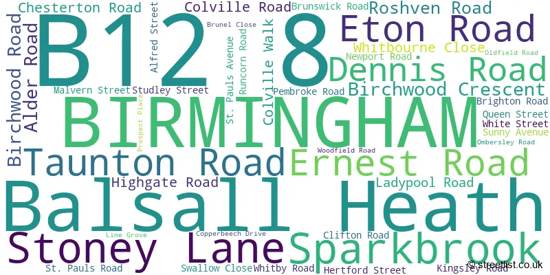
The largest settlement in the B12 8 postal code is BIRMINGHAM followed by Balsall Heath, and Sparkbrook.
The B12 8 Postcode shares a border with B12 0 (BIRMINGHAM, Deritend, Bordesley), B11 1 (BIRMINGHAM, Sparkhill, Sparkbrook), B11 4 (Sparkhill, BIRMINGHAM), B12 9 (BIRMINGHAM, Balsall Heath), B13 8 (BIRMINGHAM, Moseley) and B13 9 (BIRMINGHAM, Moseley, Kings Heath).
The sector is within the post town of BIRMINGHAM.
B12 8 is a postcode sector within the B1 postcode district which is within the B Birmingham postcode area.
The Royal Mail delivery office for the B12 8 postal sector is the unknown.
The area of the B12 8 postcode sector is 0.29 square miles which is 0.74 square kilometres or 183.99 square acres.

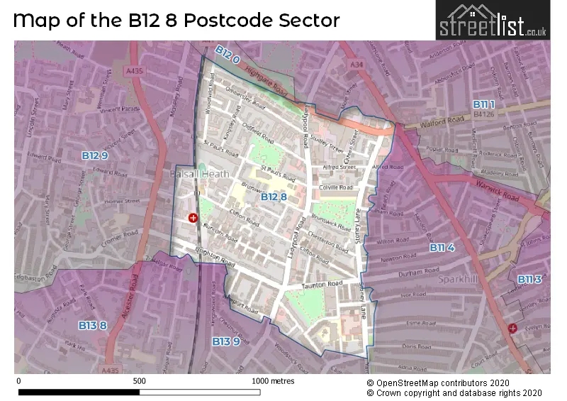
Map of the B12 8 Postcode Sector
Explore the B12 8 postcode sector by using our free interactive map.
| B | 1 | 2 | - | 8 | X | X |
| B | 1 | 2 | Space | 8 | Letter | Letter |
Official List of Streets
BIRMINGHAM (30 Streets)
Sparkbrook (4 Streets)
Balsall Heath (8 Streets)
Unofficial Streets or Alternative Spellings
BIRMINGHAM
ANDERTON PARK ROAD DURHAM ROAD ESME ROAD FENTER CLOSE FULHAM ROAD IVOR ROAD MOLE STREETShirley
YARDLEY WOOD ROADSparkhill
ALFRED ROAD DORIS ROAD NEWTON ROAD WILTON ROAD ALBERT AVENUE ASH AVENUE ASH GROVE BEACH AVENUE BEECH AVENUE BEWDLEY AVENUE BRADGATE PLACE CHESTERTON AVENUE ELM AVENUE FIR AVENUE GROSMONT AVENUE HEREFORD AVENUE HOLLY AVENUE IVY AVENUE KENSINGTON AVENUE LAUREL AVENUE LEAMINGTON ROAD LILAC AVENUE LIME AVENUE MAY AVENUE MELROSE AVENUE MILFORD AVENUE MILTON AVENUE MYRTLE AVENUE NOEL AVENUE OAK AVENUE OAKFIELD AVENUE POPLAR AVENUE SPRINGFIELD AVENUE SYCAMORE AVENUE THE BEECHES THE CRESCENT TRENVILLE AVENUE WOODFIELD CRESCENTMoseley
CHURCH ROAD KINGSWOOD ROADSchools and Places of Education Within the B12 8 Postcode Sector
Anderton Park Primary School
Community school
Dennis Road, Birmingham, West Midlands, B12 8BL
Head: Ms Sarah Hewitt-Clarkson
Ofsted Rating: Good
Inspection: 2023-01-25 (484 days ago)
Website: Visit Anderton Park Primary School Website
Phone: 01214641581
Number of Pupils: 463
Clifton Primary School
Community school
Brunswick Road, Birmingham, West Midlands, B12 8NX
Head: Mrs Nicola Hemming
Ofsted Rating: Good
Inspection: 2019-05-15 (1835 days ago)
Website: Visit Clifton Primary School Website
Phone: 01214642926
Number of Pupils: 848
Nelson Mandela School
Community school
Colville Road, Birmingham, West Midlands, B12 8EH
Head: Ms Amy Lassman
Ofsted Rating: Outstanding
Inspection: 2008-12-10 (5643 days ago)
Website: Visit Nelson Mandela School Website
Phone: 01217723055
Number of Pupils: 453
St Paul's School
Other independent special school
73 Hertford Street, Birmingham, , B12 8NJ
Head: Mrs Sarah Hyde
Ofsted Rating: Good
Inspection: 2021-12-02 (903 days ago)
Website: Visit St Paul's School Website
Phone: 01214642556
Number of Pupils: 45
House Prices in the B12 8 Postcode Sector
| Type of Property | 2018 Average | 2018 Sales | 2017 Average | 2017 Sales | 2016 Average | 2016 Sales | 2015 Average | 2015 Sales |
|---|---|---|---|---|---|---|---|---|
| Detached | £0 | 0 | £172,000 | 1 | £0 | 0 | £0 | 0 |
| Semi-Detached | £229,950 | 1 | £169,333 | 3 | £0 | 0 | £113,000 | 3 |
| Terraced | £124,758 | 33 | £123,302 | 44 | £115,990 | 29 | £109,834 | 35 |
| Flats | £0 | 0 | £0 | 0 | £55,000 | 1 | £0 | 0 |
Important Postcodes B12 8 in the Postcode Sector
B12 8AF is the postcode for Jobcentre Plus, 10 Stoney Lane, Balsall Heath, Jobcentre Plus, 10 Stoney Lane, and Jobcentre Plus, Heynesfield House, 10 Stoney Lane
B12 8BL is the postcode for Anderton Park Junior And Infant School, Dennis Road, and Anderton Park Junior & Infant School, Dennis Road
B12 8EH is the postcode for NELSON MANDELA PRIMARY SCHOOL, COLVILLE ROAD, SPARKBROOK, BIRMINGHAM CITY COUNCIL, Nelson Mandela Junior & Infant School, Colville Road, and Nelson Mandela Junior & Infant School, Colville Road
B12 8LY is the postcode for Clifton Primary School, St. Pauls Road, OCEAN BUILDING, Clifton Primary School, St. Pauls Road, and RAINFOREST BUILDING, Clifton Primary School, St. Pauls Road
B12 8NJ is the postcode for MAIN SCHOOL BUILDING, St. Pauls Community Project Ltd, 73 Hertford Street
B12 8NX is the postcode for UNIVERSE BUILDING, Clifton Primary School, Brunswick Road, RAINFOREST BUILDING, Clifton Primary School, Brunswick Road, and WOODLAND BUILDING, Clifton Primary School, Brunswick Road
B12 8NY is the postcode for Eden Girls Leadership Academy, 55 Brunswick Road
B12 8RQ is the postcode for Runcorn Road Dialysis Unit, 36 Runcorn Road
B12 8SL is the postcode for 165, Clifton Road, Balsall Heath
B12 8SY is the postcode for Bridge Centre, Lime Grove
| The B12 8 Sector is within these Local Authorities |
|
|---|---|
| The B12 8 Sector is within these Counties |
|
| The B12 8 Sector is within these Water Company Areas |
|