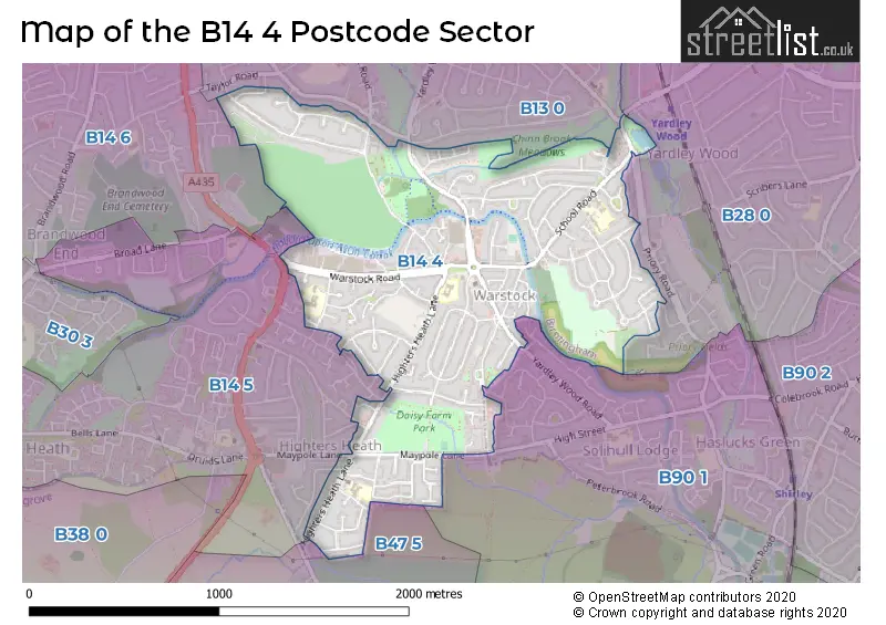
The B14 4 postcode sector stands on the West Midlands and Worcestershire border.
Did you know? According to the 2021 Census, the B14 4 postcode sector is home to a bustling 13,053 residents!
Given that each sector allows for 400 unique postcode combinations. Letters C, I, K, M, O and V are not allowed in the last two letters of a postcode. With 210 postcodes already in use, this leaves 190 units available.
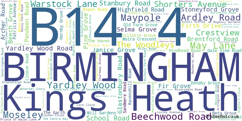
The largest settlement in the B14 4 postal code is BIRMINGHAM followed by Yardley Wood, and Kings Heath.
The B14 4 Postcode shares a border with B13 0 (BIRMINGHAM, Moseley), B14 5 (BIRMINGHAM), B28 0 (BIRMINGHAM, Hall Green), B47 5 (Hollywood), B90 1 (Shirley, Tidbury Green) and B14 6 (BIRMINGHAM, Kings Heath).
The sector is within the post town of BIRMINGHAM.
B14 4 is a postcode sector within the B1 postcode district which is within the B Birmingham postcode area.
The Royal Mail delivery office for the B14 4 postal sector is the unknown.
The area of the B14 4 postcode sector is 1.08 square miles which is 2.80 square kilometres or 691.79 square acres.
Waterways within the B14 4 postcode sector include the River Cole, Stratford-upon-Avon Canal.

Map of the B14 4 Postcode Sector
Explore the B14 4 postcode sector by using our free interactive map.
| B | 1 | 4 | - | 4 | X | X |
| B | 1 | 4 | Space | 4 | Letter | Letter |
Official List of Streets
BIRMINGHAM (92 Streets)
Kings Heath (3 Streets)
Maypole (2 Streets)
Yardley Wood (3 Streets)
Moseley (1 Streets)
Unofficial Streets or Alternative Spellings
Schools and Places of Education Within the B14 4 Postcode Sector
Grendon Primary School
Community school
Grendon Road, Birmingham, West Midlands, B14 4RB
Head: Mrs Helen Ridley
Ofsted Rating: Good
Inspection: 2019-07-11 (1791 days ago)
Website: Visit Grendon Primary School Website
Phone: 01214742460
Number of Pupils: 376
Highters Heath Nursery School
Local authority nursery school
11 School Road, Birmingham, West Midlands, B14 4BH
Head: Ms Elinor Warner
Ofsted Rating: Good
Inspection: 2018-06-12 (2185 days ago)
Website: Visit Highters Heath Nursery School Website
Phone: 01214742356
Number of Pupils: 53
Yardley Wood Community Primary School
Community school
School Road, Birmingham, West Midlands, B14 4ER
Head: Mr Benjamin Turner
Ofsted Rating: Good
Inspection: 2018-05-22 (2206 days ago)
Website: Visit Yardley Wood Community Primary School Website
Phone: 01216752456
Number of Pupils: 448
House Prices in the B14 4 Postcode Sector
| Type of Property | 2018 Average | 2018 Sales | 2017 Average | 2017 Sales | 2016 Average | 2016 Sales | 2015 Average | 2015 Sales |
|---|---|---|---|---|---|---|---|---|
| Detached | £257,917 | 6 | £221,944 | 9 | £230,492 | 6 | £250,000 | 1 |
| Semi-Detached | £189,901 | 70 | £167,605 | 81 | £163,444 | 74 | £144,626 | 85 |
| Terraced | £168,885 | 96 | £163,422 | 88 | £150,152 | 88 | £145,020 | 90 |
| Flats | £116,857 | 28 | £107,965 | 17 | £94,783 | 18 | £93,685 | 10 |
Important Postcodes B14 4 in the Postcode Sector
B14 4AP is the postcode for Birmingham & Solihull NHS Mental Health Trust, 12-14 Warstock Lane
B14 4DU is the postcode for Yardley Wood Health Centre, 401 Highfield Road, and BIRMINGHAM CITY COUNCIL, Yardley Wood Library, Highfield Road
B14 4ER is the postcode for Yardley Wood Community Primary School, School Road, Yardley Wood, Yardley Wood Community Primary School, School Road, and BIRMINGHAM CITY COUNCIL, Yardley Wood Community Primary School, School Road
B14 4HN is the postcode for Christ Church C of E Secondary Academy, Daleview Road, Yardley Wood
B14 4LY is the postcode for Birmingham City Council, Highters Heath Community School, and HIGHTERS HEATH COMMUNITY SCHOOL, HIGHTERS HEATH LANE
B14 4RB is the postcode for GRENDON JUNIOR AND INFANTS SCHOOL, GRENDON ROAD, BIRMINGHAM CITY COUNCIL, Grendon Junior & Infant School, Grendon Road, and Grendon Junior & Infant School, Grendon Road
B14 4TG is the postcode for Hollywood Primary School, Pickenham Road
| The B14 4 Sector is within these Local Authorities |
|
|---|---|
| The B14 4 Sector is within these Counties |
|
| The B14 4 Sector is within these Water Company Areas |
|