The B12 9 postcode sector is within the county of West Midlands.
Did you know? According to the 2021 Census, the B12 9 postcode sector is home to a bustling 8,322 residents!
Given that each sector allows for 400 unique postcode combinations. Letters C, I, K, M, O and V are not allowed in the last two letters of a postcode. With 141 postcodes already in use, this leaves 259 units available.
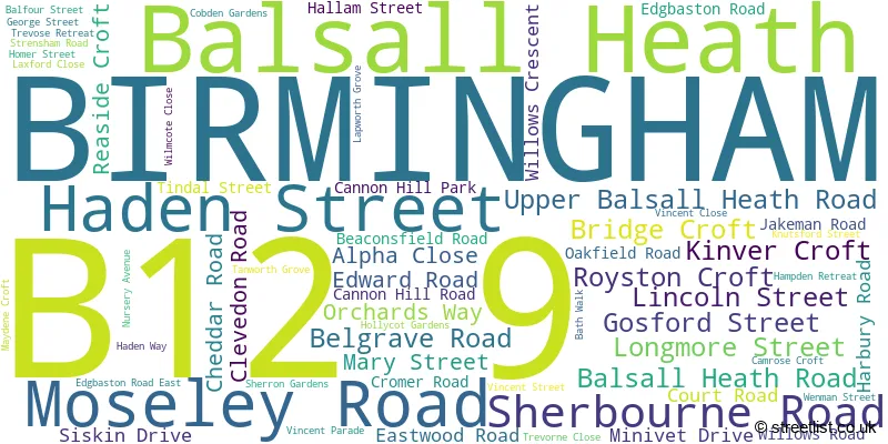
The largest settlements in the B12 9 postal code are BIRMINGHAM and Balsall Heath.
The B12 9 Postcode shares a border with B12 0 (BIRMINGHAM, Deritend, Bordesley), B5 7 (BIRMINGHAM, Edgbaston), B12 8 (BIRMINGHAM, Balsall Heath, Sparkbrook) and B13 8 (BIRMINGHAM, Moseley).
The sector is within the post town of BIRMINGHAM.
B12 9 is a postcode sector within the B12 postcode district which is within the B Birmingham postcode area.
The Royal Mail delivery office for the B12 9 postal sector is the Camp Hill Delivery Office.
The area of the B12 9 postcode sector is 0.44 square miles which is 1.15 square kilometres or 283.93 square acres.
Waterways within the B12 9 postcode sector include the River Rea.

Map of the B12 9 Postcode Sector
Explore the B12 9 postcode sector by using our free interactive map.
| B | 1 | 2 | - | 9 | X | X |
| B | 1 | 2 | Space | 9 | Letter | Letter |
Official List of Streets
BIRMINGHAM (52 Streets)
Balsall Heath (8 Streets)
Unofficial Streets or Alternative Spellings
BIRMINGHAM
ALCESTER ROAD BELGRAVE MIDDLEWAY BRIGHTON ROAD CAROLINE ROAD FRANK STREET HORTON SQUARE OMBERSLEY ROAD PARK HILL RUNCORN ROAD STRENSHAM HILL ARTER STREET BEACONSFIELD CRESCENT CANNON HILL GROVE CANNON HILL PLACE GREGG COURT HADEN CIRCUS HEATH COURT PAGEANT COURT PARK AVENUE RICHMOND AVENUE SHERBOURNE ROAD EAST ST PAULS ROAD STRENSHAM COURTBalsall Heath
CLIFTON ROAD LIME GROVEMoseley
PARK ROAD RUSSELL ROAD TRAFALGAR ROAD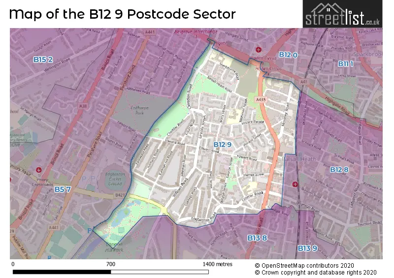
House Prices in the B12 9 Postcode Sector
| Type of Property | 2018 Average | 2018 Sales | 2017 Average | 2017 Sales | 2016 Average | 2016 Sales | 2015 Average | 2015 Sales |
|---|---|---|---|---|---|---|---|---|
| Detached | £0 | 0 | £0 | 0 | £0 | 0 | £0 | 0 |
| Semi-Detached | £261,750 | 4 | £61,200 | 1 | £0 | 0 | £137,500 | 2 |
| Terraced | £183,500 | 16 | £164,902 | 28 | £168,931 | 16 | £174,161 | 23 |
| Flats | £93,200 | 3 | £87,667 | 12 | £84,694 | 9 | £66,908 | 6 |
Important Postcodes B12 9 in the Postcode Sector
B12 9BX is the postcode for Moseley Road Pools, Moseley Road, and Birmingham City Council, Balsall Heath Library, 497 Moseley Road
B12 9ED is the postcode for Percy Shurmer Academy, Longmore Street
B12 9FF is the postcode for Chamberlain Health & Fitness Centre, 1 Belgrave Road, Joseph Chamberlain Sixth Form College, 1 Belgrave Road, Joseph Chamberlain College, 1 Belgrave Road, Joseph Chamberlain Sports Centre, Belgrave Road, and Orchard House, Joseph Chamberlain Sixth Form College, 1 Belgrave Road
B12 9LB is the postcode for Balsall Heath Womens Academy, Cannon Hill Campus
B12 9LP is the postcode for Balsall Heath Health Centre, 43 Edward Road
B12 9LR is the postcode for Police Station, Edward Road
B12 9NX is the postcode for Jakeman Nursery School, Jakeman Road, and EARLY YEARS, Jakeman Nursery School, Jakeman Road
B12 9QH is the postcode for M A C Birmingham, Cannon Hill Park
B12 9QS is the postcode for Tindal Primary School, Tindal Street, and Ark Tindal Primary Academy, Tindal Street
B12 9SR is the postcode for HEATH MOUNT PRIMARY SCHOOL, KNUTSFORD STREET, BIRMINGHAM, and Heath Mount Primary School, Knutsford Street
B12 9ST is the postcode for BIRMINGHAM CITY COUNCIL, Heath Mount Primary School, Mary Street, and Heath Mount Primary School, Mary Street
| The B12 9 Sector is within these Local Authorities |
|
|---|---|
| The B12 9 Sector is within these Counties |
|
| The B12 9 Sector is within these Water Company Areas |
|
Tourist Attractions within the B12 9 Postcode Area
We found 1 visitor attractions within the B12 postcode area
| MAC Birmingham |
|---|
| Other |
| View MAC Birmingham on Google Maps |