The BS15 9 postcode sector is within the county of Gloucestershire.
Did you know? According to the 2021 Census, the BS15 9 postcode sector is home to a bustling 8,278 residents!
Given that each sector allows for 400 unique postcode combinations. Letters C, I, K, M, O and V are not allowed in the last two letters of a postcode. With 171 postcodes already in use, this leaves 229 units available.
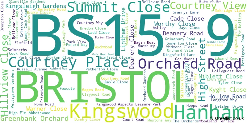
The largest settlement in the BS15 9 postal code is BRISTOL followed by Kingswood, and Hanham.
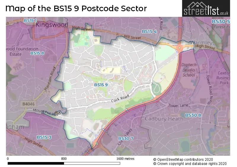
The BS15 9 Postcode shares a border with BS30 8 (BRISTOL, Warmley, Barrs Court), BS15 3 (Hanham, BRISTOL), BS15 4 (BRISTOL, Kingswood, Warmley), BS15 8 (BRISTOL, Kingswood, Hanham) and BS30 7 (Barrs Court, Longwell Green, BRISTOL).
The sector is within the post town of BRISTOL.
BS15 9 is a postcode sector within the BS1 postcode district which is within the BS Bristol postcode area.
The Royal Mail delivery office for the BS15 9 postal sector is the unknown.
The area of the BS15 9 postcode sector is 0.74 square miles which is 1.93 square kilometres or 476.15 square acres.

Map of the BS15 9 Postcode Sector
Explore the BS15 9 postcode sector by using our free interactive map.
| B | S | 1 | 5 | - | 9 | X | X |
| B | S | 1 | 5 | Space | 9 | Letter | Letter |
Official List of Streets
BRISTOL (67 Streets)
Kingswood (23 Streets)
Unofficial Streets or Alternative Spellings
Kingswood
BROOK ROADBRISTOL
LANSDOWN VIEW POTTERSWOOD CLOSE THE HOLLIES WRAXALL ROADHanham
BEACONLEA FAITHFIELDS CLOSE GREENBANK ROAD PREACHERS WALK DEANERY ROAD ROUNDABOUT FUSSELL COURT GREENBANK VIEW LEISURE ROAD ORCHARD CORNER RING ROAD PATH SPRINGLY COURT WRAXALL ROAD ROUNDABOUTWarmley
ROSELAND GARDENSSchools and Places of Education Within the BS15 9 Postcode Sector
Courtney Primary School
Community school
Courtney Road, Bristol, , BS15 9RD
Head: Miss Georgina Scott
Ofsted Rating: Good
Inspection: 2019-05-01 (1849 days ago)
Website: Visit Courtney Primary School Website
Phone: 01454866670
Number of Pupils: 185
The Park Primary School
Community school
Hollow Road, Bristol, , BS15 9TP
Head: Mrs Kathryn Absalom
Ofsted Rating: Good
Inspection: 2023-02-08 (470 days ago)
Website: Visit The Park Primary School Website
Phone: 01454866536
Number of Pupils: 496
House Prices in the BS15 9 Postcode Sector
| Type of Property | 2018 Average | 2018 Sales | 2017 Average | 2017 Sales | 2016 Average | 2016 Sales | 2015 Average | 2015 Sales |
|---|---|---|---|---|---|---|---|---|
| Detached | £350,333 | 9 | £343,316 | 18 | £354,364 | 11 | £302,983 | 18 |
| Semi-Detached | £253,843 | 45 | £260,773 | 46 | £244,915 | 44 | £214,147 | 41 |
| Terraced | £228,329 | 47 | £224,982 | 64 | £211,986 | 59 | £183,951 | 61 |
| Flats | £149,783 | 18 | £170,503 | 20 | £132,404 | 25 | £124,494 | 24 |
Important Postcodes BS15 9 in the Postcode Sector
BS15 9HT is the postcode for Park School, Hollow Road
BS15 9LA is the postcode for Longwell Green Leisure Centre, Kingswood Aspects Leisure Park, and Bowlplex, Kingswood Aspects Leisure Park
BS15 9RD is the postcode for Courtney Primary School, Courtney Road
BS15 9TP is the postcode for Park School, Hollow Road
BS15 9TR is the postcode for South Gloucestershire Council, Civic Centre, High Street
| The BS15 9 Sector is within these Local Authorities |
|
|---|---|
| The BS15 9 Sector is within these Counties |
|
| The BS15 9 Sector is within these Water Company Areas |
|